Old Maps of Vacaville, California for Academic Research
Study the evolution of Vacaville with 40 high-resolution historic maps. Whether you're teaching, researching, or modeling changes in land use, these maps provide essential visual documentation of urban, environmental, and geographic change.
- Analyze long-term change: Track patterns in development, transportation, and natural features.
- Ideal for environmental or urban studies: Support academic projects with primary historical map data.
- Use in the classroom or lab: Educators and researchers rely on these maps to bring historical context to life.
These maps are a powerful tool for teaching, research, and visualizing how Vacaville has changed over the decades.
Vacaville, CA maps
(40)- 1902 Map of Napa
 1902 Napa1902 Print · USGSThe Napa Valley and Carquinez Strait are captured at the turn of the century, showing a landscape defined by maritime military posts and early vineyards. Genealogists and historians can trace the Mare Island Navy Yard, the Insane Asylum, and rail stops at Zinfandel and Rutherford.6 unique versions available
 - 1908 Map of Vacaville
 1908 Vacaville1908 Print · USGSNorthern California's agricultural heartland is captured here at the start of the century, centered on the rail corridors of the Southern Pacific. Genealogists can trace early homesteads and rail stops like Elmira, Maine Prairie, and the Cement Mill.3 unique versions available
 - 1917 Map of Wolfskill
 1917 Wolfskill1917 Print · USGSRail-line settlements in Solano County define this early twentieth-century landscape during the peak of the steam era. Researchers can trace the development of rural hubs along the Southern Pacific tracks, including Allendale, Hartley, and the station at Wolfskill.2 unique versions available
 - 1917 Map of Elmira
 1917 Elmira1917 Print · USGSCentral Solano County is shown at a time of significant rail and industrial development during the early twentieth century. Researchers can trace the Southern Pacific lines through Vacaville and Elmira, or locate the Cement Mill and Gas Well.
 - 1921 Map of Mt. Vaca
 1921 Mt. Vaca1921 Print · USGSFairfield and the surrounding highlands appear at a pivotal moment in the 1920s as early transportation networks began to define the region. Genealogists and historians can trace the early layout of Fairfield and locate remote settlements like Manka and Atlas.
 - 1941 Map of Vacaville
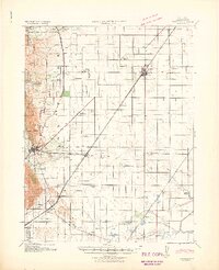 1941 Vacaville1941 Print · USGSSolano County’s fertile ranching and orchard lands are documented in the early 1940s, just before significant regional growth. Local historians can trace family-named school districts like Tremont District School and rural rail stops including Batavia and Cannon.
 - 1942 Map of Mt. Vaca
 1942 Mt. Vaca1942 Print · USGSThe Vaca Mountains and eastern Napa County are captured during the early 1940s, showing a landscape of deep canyons and rising valley towns. Researchers can trace the rail corridors of the Southern Pacific near Fairfield or locate early water works like the Gordon Valley Dam.2 unique versions available
 - 1947 Map of Santa Rosa
 1947 Santa Rosa1947 Print · USGSNorthern California in the late 1940s was a landscape of agricultural valleys and vital rail hubs. Trace the historic routes of the Northwestern Pacific through Healdsburg or explore the mid-century waterfronts of Vallejo and Benicia near Mare Island.
 - 1947 Map of Sacramento, 1948 Print
 1947 Sacramento1948 Print · USGSThe Sacramento Valley meets the high Sierra during a period of post-war expansion. Trace the historic river delta islands like Grand Island or locate early airfield footprints at McClellan Air Force Base and Mather Air Force Base.2 unique versions available
 - 1948 Map of Sacramento, 1951 Print
 1948 Sacramento1951 Print · USGSPost-war Northern California comes alive in this regional survey, capturing the era of expansion between the Central Valley and the High Sierra. Researchers can trace the rail networks of the Central California Traction and Sacramento Northern RR or locate landmarks like the State Capitol and University of California Davis.
 - 1949 Map of Santa Rosa
 1949 Santa Rosa1949 Print · USGSThe North Bay and Wine Country appear here in the late 1940s, when the Northwestern Pacific RR still dominated regional transit. Genealogists and historians can trace old coastal outposts like Anchor Bay Settlement and the early layout of Santa Rosa.2 unique versions available
 - 1951 Map of Mt. Vaca, 1952 Print
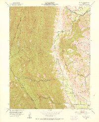 1951 Mt. Vaca1952 Print · USGSSolano County rangelands and the steep ridges of the Vaca Mountains appear here as they were in the early fifties. Local historians and genealogists can trace family holdings like Pioneer Ranch or find the former site of the Rhine School (Abandoned) along Alamo Creek.3 unique versions available
 - 1951 Map of Fairfield North, 1952 Print
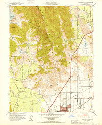 1951 Fairfield North1952 Print · USGSNorthern Solano County in the early fifties shows a landscape of mountain ridges and valley farms. Genealogists and historians can trace old homesteads and landmarks like the Pena House, Mankas Corner, and Suisun School.7 unique versions available
 - 1951 Map of Mt. Vaca, 1959 Print
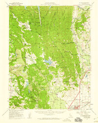 1951 Mt. Vaca1959 Print · USGSNorthern California's agricultural valleys and ridges are captured here in the early fifties. Researchers can trace rural life through landmarks like Peña House, Mankas Corner, and schools such as Gordon Valley School.2 unique versions available
 - 1953 Map of Allendale, 1954 Print
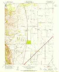 1953 Allendale1954 Print · USGSSolano County agriculture and rail infrastructure are on full display in the early fifties, centered on the Allendale community. Genealogists can locate family-named landmarks and rural institutions like Browns Valley School, Union Chapel, and the village of Hartley.6 unique versions available
 - 1953 Map of Elmira, 1955 Print
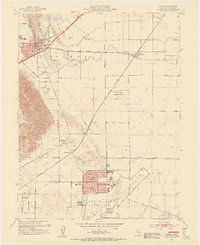 1953 Elmira1955 Print · USGSThe Solano County valley comes alive in the early 1950s as a burgeoning military and transit corridor. Researchers can trace the development of Travis Air Force Base alongside local landmarks like Cooper School and Vacaville Elmira Cemetery.9 unique versions available
 - 1953 Map of Vacaville, 1959 Print
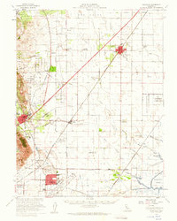 1953 Vacaville1959 Print · USGSSolano County's agricultural heartland is documented here during the mid-fifties as the local rail and military presence expanded. Genealogists and historians can trace numerous rural school sites like Grant Sch and lost rail stops such as Batavia or Dozier.
 - 1956 Map of Sacramento
 1956 Sacramento1956 Print · USGSMid-century California unfolds from the delta to the high Sierra, capturing a landscape of growing valley cities and burgeoning military airbases. Genealogists and historians can trace the rail lines and river towns from Woodland to Lodi, or explore the foothill settlements of Placerville and Jackson.2 unique versions available
 - 1957 Map of Sacramento, 1966 Print
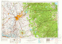 1957 Sacramento1966 Print · USGSIn the mid-twentieth century, the California heartland was a hub of river transport, rail lines, and military airbases. Genealogists and historians can trace the development of Gold Country towns like Angels Camp and Sonora or follow the path of the Southern Pacific RR through the growing suburbs of Sacramento.4 unique versions available
 - 1958 Map of Santa Rosa, 1968 Print
 1958 Santa Rosa1968 Print · USGSThe North Bay and Wine Country are captured in the mid-twentieth century as the region balanced its agricultural roots with a growing military and recreational footprint. Researchers can trace the Northwestern Pacific RR through the Russian River valley or locate landmarks like the Petaluma Adobe Historical Monument and The Geysers Resort.3 unique versions available
 - 1962 Map of Santa Rosa
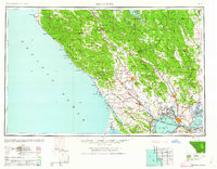 1962 Santa Rosa1962 Print · USGSThe North Bay and Wine Country were entering a period of significant growth in the early sixties, anchored by established rail corridors and coastal maritime commerce. Genealogists and historians can trace the development of Santa Rosa, locate the Mare Island Naval Shipyard, and follow the Northwestern Pacific RR through the Cotati Valley.
 - 1964 Map of Santa Rosa
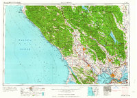 1964 Santa Rosa1964 Print · USGSThe North Bay and Wine Country appear in the mid-fifties during a period of significant military and educational growth. Trace old rail lines like the Northwestern Pacific RR and explore historic sites from Petaluma to the Benicia Arsenal.
 - 1983 Map of Napa
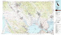 1983 Napa1983 Print · USGSThe North Bay and wine country are captured in the early eighties as suburban growth began to surround traditional agricultural centers. Researchers can trace the rail corridors of the Northwestern Pacific Railroad, the grounds of Mare Island Naval Shipyard, and the reach of the San Andreas Rift Zone.
 - 1993 Map of Lodi, 1994 Print
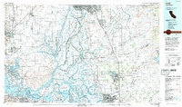 1993 Lodi1994 Print · USGSNorthern California's delta country and the growing Central Valley corridors are captured here in the early nineties. Genealogists and historians can trace the intricate island tracts, old railroad lines like the Sacramento Northern RR, and established local landmarks including the Lodi Memorial Cemetery and University of the Pacific.2 unique versions available
 - 2012 Map of Fairfield North, 2012 Print
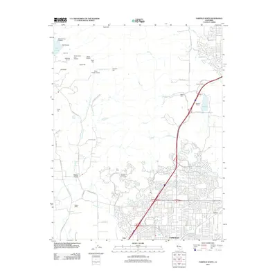 2012 Fairfield North2012 Print · USGSNorthern Solano County comes into focus in this modern era, where the expanding suburbs of Fairfield meet the Vaca Mountain foothills. Researchers can trace local development around Mankas Corner, the Vacaville Airport, and the historic Tolenas settlement.
Showing maps 1-25 of 40
Top cities near Vacaville
- Vallejo historical maps
- Fairfield historical maps
- Davis historical maps
- Suisun City historical maps
- Dixon historical maps
- Winters historical maps
Top neighborhoods of Vacaville
Frequently asked questions
- What are the different types of historical maps available for Vacaville?
- What is the oldest map of Vacaville?
- Where can I purchase historical maps of Vacaville for my home or office?
- Where can I download high-res historical maps of Vacaville?
- Are there historical topographic maps available for Vacaville?
- Is there historical aerial imagery available for Vacaville?
- Where are historical maps of Vacaville sourced from?