1950s Maps of Tehama County, California
Explore 42 historic maps of Tehama County from the 1950s. These maps offer a rare glimpse into what life looked like during the 1950s — showing old roads, neighborhoods, homes, and landmarks that have changed or disappeared over time.
Whether you're researching your family's past, planning a metal detecting trip, or studying how Tehama County's landscape evolved across the 1950s, these high-resolution maps are a powerful tool for exploring the history of this region.
- Focus on a specific era: All maps on this page are from the 1950s, giving you a focused view of this time period.
- See what’s changed: Compare century-old streets, trails, and buildings to today's modern landscape using overlays and satellite layers.
- Research with precision: Use these maps for genealogy, historical research, land use analysis, or educational projects.
- View, download, or print: Maps are fully viewable online in high resolution, and can be downloaded or printed for your own records.
Start exploring Tehama County's history through authentic maps from the 1950s. This is your window into the past.
Tehama County, CA maps
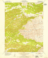
(42)- 1950 Map of Kirkwood
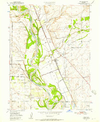
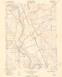
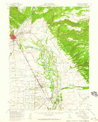
 1950 Kirkwood1950 Print · USGSThe Sacramento Valley at the mid-century shows a landscape of growing irrigation and established rail towns along the Southern Pacific line. Genealogists and local historians can trace family roots through sites like Kirkwood Cem, Lake School, and the Masonic Cem.
 - 1950 Map of Vina, 1957 Print
 1950 Vina1957 Print · USGSUpper Sacramento River life in the mid-fifties centered on the fertile lands of the historic Bosquejo grant. Researchers can trace the river's path past Copeland Bar, locate rural schoolhouses like Moon School, and follow the Southern Pacific tracks through Vina.3 unique versions available
 - 1950 Map of Gerber, 1962 Print
 1950 Gerber1962 Print · USGSMid-century Tehama County is defined by the heavy rail influence of the Southern Pacific and the winding course of the Sacramento River. Genealogists and local historians can trace family-named roads and rural landmarks like the Tehama Cem, El Camino Grange, and the settlement of Gerber.3 unique versions available
 - 1950 Map of Foster Island, 1963 Print
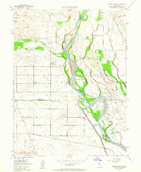 1950 Foster Island1963 Print · USGSThe Sacramento River valley at mid-century shows a landscape of river landings and evolving irrigation systems. Trace the location of former river hubs at Wilson Landing and McIntosh Ldg, or locate family landmarks like McIntosh Sch and Capay Sch.4 unique versions available
 - 1951 Map of Gerber
 1951 Gerber1951 Print · USGSTehama County's agricultural heartland is documented here in the early 1950s, showing the vital rail and river networks of the Sacramento Valley. Genealogists and local historians can trace family properties near Gerber, Tehama, and Proberta, or locate the Tehama Cem and the El Camino Grange.
 - 1951 Map of Vina
 1951 Vina1951 Print · USGSIn the Sacramento Valley during the early fifties, this area shows a complex network of irrigation and rail-river transport. Researchers can trace rural landmarks like the Moon School, the Southern Pacific Railroad line, and Gardiner Ferry Road.2 unique versions available
 - 1951 Map of Foster Island
 1951 Foster Island1951 Print · USGSThe Sacramento River valley in the early fifties is captured here as a landscape of river landings and organized farm blocks. Genealogists can trace family connections through named locations like Mcintosh Sch, Capay, and the historical Wilson Landing.
 - 1951 Map of Corning, 1952 Print
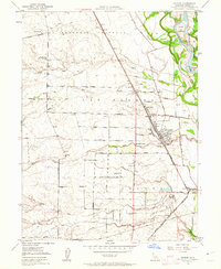
 1951 Corning1952 Print · USGSTehama County agriculture and rail transit defined the Corning area during the early fifties. Genealogists and local historians can trace the foundations of the community through landmarks like Union High Sch, the Independent School, and the Southern Pacific railroad corridor.4 unique versions available
 - 1951 Map of Red Bluff East, 1952 Print
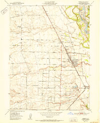
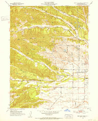
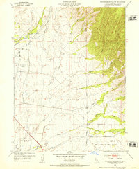
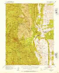
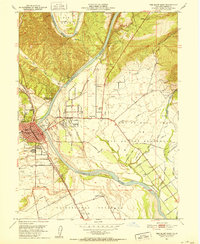 1951 Red Bluff East1952 Print · USGSRed Bluff and the Sacramento River valley are shown in the early fifties as the region's agricultural and transit hubs expanded. Genealogists can trace family footprints at Oak Hill Cem or locate local landmarks like Antelope Sch and Bidwell Airport.5 unique versions available
 - 1951 Map of West of Gerber, 1952 Print
 1951 West of Gerber1952 Print · USGSTehama County's western foothills are captured in the early 1950s, showing a rural landscape shaped by seasonal water and early ranching roads. Trace the locations of family-named landmarks like Boggs and Champlin Road and the site of the Oat Creek Sch (Aban'd).5 unique versions available
 - 1951 Map of Red Bluff West, 1952 Print
 1951 Red Bluff West1952 Print · USGSThe western edge of Tehama County comes into focus in the early fifties as the rural landscape around the county seat began to modernize. Genealogists and local historians can trace schoolhouse sites like Reeds Creek Sch and the grounds of St Marys Cem.4 unique versions available
 - 1951 Map of Chanchelulla Peak, 1953 Print
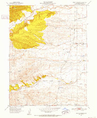
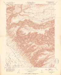
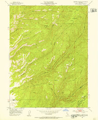
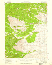
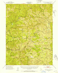 1951 Chanchelulla Peak1953 Print · USGSNorthern California's interior mountains at the midpoint of the century reveal a landscape of isolated forest stations and family ranches. Researchers can locate the Midas Mine and trace early road networks connecting Platina with the Harrison Gulch Ranger Station and Deer Lick Springs.5 unique versions available
 - 1951 Map of Tuscan Springs, 1953 Print
 1951 Tuscan Springs1953 Print · USGSTehama County's rugged volcanic foothills and irrigation networks are frozen in time during the early fifties. Genealogists and local historians can trace the foundations of Dairyville or explore landmarks like Tuscan Springs and Devils Half Acre.4 unique versions available
 - 1951 Map of Corning, 1959 Print
 1951 Corning1959 Print · USGSThe Sacramento Valley in the early fifties shows a region defined by its river landings and expanding rail infrastructure. Researchers can locate family-named schools and vanished river sites such as McIntosh Landing, Kirkwood Cemetery, and Union High School.3 unique versions available
 - 1952 Map of Richardson Springs NW, 1953 Print
 1952 Richardson Springs NW1953 Print · USGSThe ranching and irrigation landscapes of Tehama and Butte Counties are captured here in the early fifties. Researchers can trace rural life through landmarks like Live Oak School, Carter Cemetery, and the U S Auxiliary Airfield.4 unique versions available
 - 1952 Map of Blossom, 1953 Print
 1952 Blossom1953 Print · USGSTehama County's western foothills are captured in the early fifties, showing a rural landscape defined by deep creek forks and pioneer-named routes. Genealogists and historians can trace family-named landmarks like Johnson Road, the Blossom settlement, and the prominent Montgomery Lookout BM 834.5 unique versions available
 - 1952 Map of Campbell Mound, 1953 Print
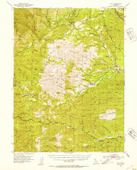
 1952 Campbell Mound1953 Print · USGSTehama and Butte County timberlands are mapped here in the early 1950s, showing a remote landscape of canyons and high ridges. Researchers can locate isolated landmarks like Baccala Cabin, trace the Campbellville Trail, and find the high point of Campbell Mound.5 unique versions available
 - 1952 Map of Los Molinos, 1953 Print
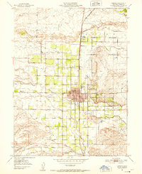
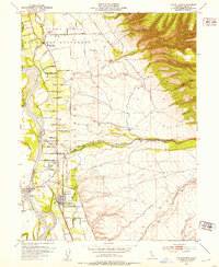 1952 Los Molinos1953 Print · USGSTehama County agriculture and transit flourish during the early fifties as the railroad and river shape local growth. Trace the development of Los Molinos and Tehama near the Southern Pacific line and family landmarks like the Lassen View Union School.4 unique versions available
 - 1952 Map of Red Bank, 1953 Print
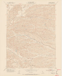
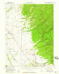
 1952 Red Bank1953 Print · USGSTehama County's ranching landscape is captured here in the early fifties, showing the rural settlement patterns before modern expansion. Genealogists and historians can trace family-named routes and landmarks like Stampfli Road, Elk Flat, and the Grain Tanks near Red Bank.2 unique versions available
 - 1952 Map of Paskenta, 1953 Print
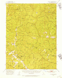
 1952 Paskenta1953 Print · USGSThe foothills of Tehama and Glenn counties come to life in this mid-century survey of the Mendocino National Forest borderlands. Genealogists and local historians can trace family holdings like the Scribner Ranch and Cushman Ranch, or find the old Lowrey Sch.3 unique versions available
 - 1952 Map of Ono, 1954 Print
 1952 Ono1954 Print · USGSShasta and Tehama counties appear in the early fifties as a landscape of remote ranching outposts and deep drainage basins. Genealogists and historians can trace old homesteads and roads through Ono, Gas Point, and the high terrain around Chickabally Mtn.3 unique versions available
 - 1952 Map of Anthony Peak, 1954 Print
 1952 Anthony Peak1954 Print · USGSHigh mountain passes and forest service outposts define this corner of the California Coast Range during the early fifties. Local historians can locate specific mountain camps and former homesteads like Griffin Place, Howell Camp, and the Maxim Cabin (Site).4 unique versions available
 - 1952 Map of Red Bluff, 1959 Print
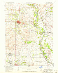
 1952 Red Bluff1959 Print · USGSTehama County in the early fifties shows a bustling valley landscape of river-side grants and railroad towns. Genealogists and local historians can trace family-named sites such as Oak Hill Cem, the Los Molinos Grange, and the Antelope Sch.3 unique versions available
 - 1952 Map of Red Bank, 1959 Print
 1952 Red Bank1959 Print · USGSTehama County in the early fifties shows a landscape of cattle ranches and small rural schools west of the Sacramento River. Genealogists and local researchers can trace family lands near St Marys Cem, Red Bank, and the Reeds Creek School.2 unique versions available
 - 1952 Map of Richardson Springs, 1959 Print
 1952 Richardson Springs1959 Print · USGSNorth of Chico in the early 1950s, the landscape shifts from the flat valley floor near Nord to the steep canyons of the Lassen National Forest. You can trace family ranching history at Stephens Ranch, locate the Old Spanish Corral, or find the secluded Richardson Springs resort area.2 unique versions available
Showing maps 1-25 of 42
Top cities of Tehama County
- Red Bluff historical maps
- Corning historical maps
- Los Molinos historical maps
- Rancho Tehama Reserve historical maps
- Tehama historical maps
- Vina historical maps
See more
Frequently asked questions
- What are the different types of historical maps available for Tehama County?
- What is the oldest map of Tehama County?
- Where can I purchase historical maps of Tehama County for my home or office?
- Where can I download high-res historical maps of Tehama County?
- Are there historical topographic maps available for Tehama County?
- Is there historical aerial imagery available for Tehama County?
- Where are historical maps of Tehama County sourced from?