1960s Maps of Tehama County, California
Explore 28 historic maps of Tehama County from the 1960s. These maps offer a rare glimpse into what life looked like during the 1960s — showing old roads, neighborhoods, homes, and landmarks that have changed or disappeared over time.
Whether you're researching your family's past, planning a metal detecting trip, or studying how Tehama County's landscape evolved across the 1960s, these high-resolution maps are a powerful tool for exploring the history of this region.
- Focus on a specific era: All maps on this page are from the 1960s, giving you a focused view of this time period.
- See what’s changed: Compare century-old streets, trails, and buildings to today's modern landscape using overlays and satellite layers.
- Research with precision: Use these maps for genealogy, historical research, land use analysis, or educational projects.
- View, download, or print: Maps are fully viewable online in high resolution, and can be downloaded or printed for your own records.
Start exploring Tehama County's history through authentic maps from the 1960s. This is your window into the past.
Tehama County, CA maps
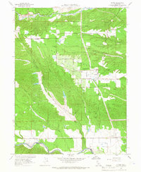
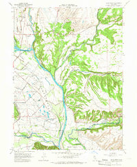
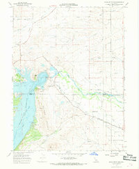
(28)- 1960 Map of Ukiah
 1960 Ukiah1960 Print · USGSNorthern California during the late fifties reveals a landscape of deep timber forests and valley agriculture before modern expansion. Trace the historic rail lines of the California Western RR and the Northwestern Pacific RR through settlements like Fort Bragg and Ukiah.2 unique versions available
 - 1960 Map of Chico
 1960 Chico1960 Print · USGSThe Northern California high country and Sacramento Valley meet in this 1960s-era landscape of mining towns and river settlements. Trace the rail-and-water economy of the gold country through the Empire Mine, Beale Air Force Base, and the Western Pacific Railroad.
 - 1962 Map of Susanville, 1965 Print
 1962 Susanville1965 Print · USGSNortheastern California's high desert and volcanic peaks meet in the early sixties, showing the region's timber and rail hubs in transition. Local historians can trace the Southern Pacific lines through Susanville and Litchfield, or explore the sprawling Sierra Army Depot and Lassen Volcanic National Park.2 unique versions available
 - 1964 Map of Olinda, 1966 Print
 1964 Olinda1966 Print · USGSShasta County's gold-mining legacy and agricultural growth are visible here in the mid-1960s, showing a landscape shaped by both industry and settlement. Genealogists can trace family footprints near Olinda, Cloverdale, and the Happy Valley Sch while mapping the extensive Dredge Tailings along the gulches.4 unique versions available
 - 1965 Map of Dales, 1966 Print
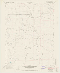
 1965 Dales1966 Print · USGSTehama County's volcanic landscape is captured here in the mid-1960s, showing the intersection of local industry and rugged terrain. Researchers can locate the Trout Farm and Dales settlement, or trace geographic landmarks like Tuscan Buttes and Hog Lake.3 unique versions available
 - 1965 Map of Hooker, 1966 Print
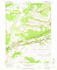
 1965 Hooker1966 Print · USGSThe hills of Northern California between Red Bluff and Redding come into focus during the mid-sixties as the Southern Pacific rail line and Anderson Cottonwood Canal traverse the landscape. Researchers can trace the rural community around the Evergreen Sch and find land features like Solomon Gulch and the Hooker settlement.2 unique versions available
 - 1965 Map of Tuscan Buttes NE, 1966 Print
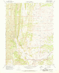
 1965 Tuscan Buttes NE1966 Print · USGSShasta and Tehama counties meet along the rugged canyon of Battle Creek in the mid-1960s. Researchers can trace early hydroelectric systems and family holdings like Coleman Powerhouse, Scharsch Ranch, and the Asbury Pipe Siphon.2 unique versions available
 - 1965 Map of Balls Ferry, 1966 Print
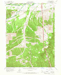
 1965 Balls Ferry1966 Print · USGSNorthern California river country comes to life in this mid-sixties survey of the Sacramento River corridor and its historical crossings. Genealogists and local historians can trace the sites of the Fort Reading Historical Marker, the Parkville Cemetery, and the riverside community at Balls Ferry.3 unique versions available
 - 1965 Map of Mitchell Gulch, 1966 Print
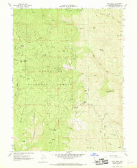
 1965 Mitchell Gulch1966 Print · USGSTehama County's rural landscape at the intersection of the Northern Central Valley and the foothills is documented here in the mid-1960s. Genealogists and local historians can trace family-named sites such as Evergreen Sch, Bowman Sch, and the winding Farquhar Road.3 unique versions available
 - 1965 Map of Cottonwood, 1966 Print
 1965 Cottonwood1966 Print · USGSShasta and Tehama counties appear during a period of agricultural and industrial transition in the mid-sixties. Researchers can trace the Southern Pacific rail line and irrigation networks alongside local landmarks like the Oddfellows Cem and Shasta District Fairgrounds.3 unique versions available
 - 1965 Map of Bend, 1966 Print
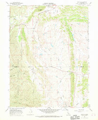
 1965 Bend1966 Print · USGSTehama County's riverfront life is captured here in the mid-sixties, centered on the sweeping curves of the Sacramento River. Researchers can trace local landmarks like Jellys Ferry Bridge, the community of Bend, and the grounds of Jelly Ranch.6 unique versions available
 - 1967 Map of Flournoy, 1968 Print
 1967 Flournoy1968 Print · USGSThe community of Flournoy and the surrounding ranch lands are captured here during the late 1960s, framed by the Thomes Creek watershed. Genealogists and historians can trace the Indian Treaty Boundary and find the site of the Flournoy Sch and the Name Lackee Indian Reservation Monument.2 unique versions available
 - 1967 Map of Henleyville, 1968 Print
 1967 Henleyville1968 Print · USGSThe ranching country of western Tehama County comes into focus in the 1960s, centered on the small settlement of Henleyville. Genealogists and local historians can trace family-named routes such as Chittenden Road and landmarks like Butte Mtn.
 - 1967 Map of Black Butte Dam, 1968 Print
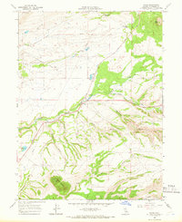
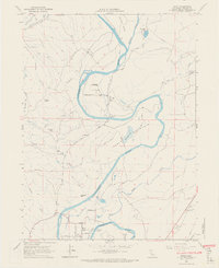
 1967 Black Butte Dam1968 Print · USGSThe Tehama and Glenn county line meets at the newly formed Black Butte Reservoir during the late sixties. Researchers can trace the massive water projects of the era, from the Black Butte Dam to the Lemon Home Colony Canal and the quiet Graves Cem.3 unique versions available
 - 1967 Map of Cold Fork, 1968 Print
 1967 Cold Fork1968 Print · USGSTehama County's high ridges and mountain flats are mapped here in the late sixties, showing a landscape defined by remote homesteads and ranching outposts. Genealogists and historians can trace family sites at Alford Place, the Skinner Mill Place, and a small burial site marked Graves on Oak Flat.3 unique versions available
 - 1967 Map of Sehorn Creek, 1968 Print
 1967 Sehorn Creek1968 Print · USGSThe foothills of the Northern Sacramento Valley meet the newly formed Black Butte Reservoir in the late 1960s. Researchers can trace ancestral locations like the Elmore Cemetery or follow the early paths of Newville Road and Butte Road through the hollows.3 unique versions available
 - 1967 Map of Oxbow Bridge, 1968 Print
 1967 Oxbow Bridge1968 Print · USGSTehama County in the late sixties remained a landscape of remote flats and winding gulches connected by a network of unimproved roads. You can trace the path of South Fork Cottonwood Creek and locate family-named landmarks like Scofield Flat, Table Mtn, and the Oxbow Bridge.2 unique versions available
 - 1967 Map of Lowrey, 1969 Print
 1967 Lowrey1969 Print · USGSThe foothills of Tehama County are captured here in the late sixties, centered on the settlement of Lowrey. Researchers can trace old property lines along the Indian Treaty Boundary or locate family sites at Rouse Gardens and the Lowrey Cem.
 - 1967 Map of Raglin Ridge, 1969 Print
 1967 Raglin Ridge1969 Print · USGSThe high ridges and deep canyons of Tehama County are captured in the late sixties within the Mendocino National Forest. Researchers can trace old homesteads and mountain camps like Hammer Place, Goat Camp, and Mary Ellen Place along the isolated Sunflower Trail.2 unique versions available
 - 1967 Map of Log Spring, 1969 Print
 1967 Log Spring1969 Print · USGSThe high ridges of the Mendocino National Forest are captured here in the late sixties as a network of seasonal camps and trails. Local researchers can trace old mountain outposts like Saturday Camp, find isolated structures such as Bodkin Cabin, and follow the remote Hokey Jeep Trail.
 - 1967 Map of Buck Rock, 1969 Print
 1967 Buck Rock1969 Print · USGSMendocino and Trinity counties meet in this high wilderness during the late sixties, a landscape of remote ridges and deep forest glades. Trace the early routes of the Pacific Crest Road and find isolated backcountry sites like Beaver Glade Station and Hammerhorn Lake.2 unique versions available
 - 1967 Map of Paskenta, 1969 Print
 1967 Paskenta1969 Print · USGSTehama County's rugged eastern foothills are captured here in the late sixties, centered on the settlement of Paskenta and its surrounding ranch lands. Researchers can trace the path of the Old Indian Treaty Boundary or locate family sites like Rouse Gardens and Paskenta Cemetery.2 unique versions available
 - 1967 Map of Riley Ridge, 1970 Print
 1967 Riley Ridge1970 Print · USGSTehama County's high forest interior is captured here in the late sixties, showing a landscape shaped by early mountain homesteads and remote mining operations. Genealogists and hikers can locate family landmarks like Steuben Place, the Kleinsorge Mine, and the Eagle Rock Lookout Tower.2 unique versions available
 - 1967 Map of Newville, 1970 Print
 1967 Newville1970 Print · USGSThe Glenn and Tehama county line area in the late sixties reveals a landscape of isolated ridges and ranching outposts. Researchers can locate the settlement of Newville, trace the Indian Treaty Boundary Road, or find a local Cem near the banks of Thomes Creek.2 unique versions available
 - 1967 Map of Hall Ridge, 1970 Print
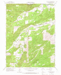
 1967 Hall Ridge1970 Print · USGSThe Tehama and Glenn county line crosses this high-elevation forest landscape during the mid-1960s, revealing a network of remote camps and orchards. Genealogists and historians can trace family-named sites like Davies Orchard and Whitlock Place or locate the Valley View Lookout Tower.
Showing maps 1-25 of 28
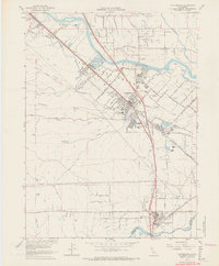
Top cities of Tehama County
- Red Bluff historical maps
- Corning historical maps
- Los Molinos historical maps
- Rancho Tehama Reserve historical maps
- Tehama historical maps
- Vina historical maps
See more
Frequently asked questions
- What are the different types of historical maps available for Tehama County?
- What is the oldest map of Tehama County?
- Where can I purchase historical maps of Tehama County for my home or office?
- Where can I download high-res historical maps of Tehama County?
- Are there historical topographic maps available for Tehama County?
- Is there historical aerial imagery available for Tehama County?
- Where are historical maps of Tehama County sourced from?