2020s Maps of Tehama County, California
Explore 79 historic maps of Tehama County from the 2020s. These maps offer a rare glimpse into what life looked like during the 2020s — showing old roads, neighborhoods, homes, and landmarks that have changed or disappeared over time.
Whether you're researching your family's past, planning a metal detecting trip, or studying how Tehama County's landscape evolved across the 2020s, these high-resolution maps are a powerful tool for exploring the history of this region.
- Focus on a specific era: All maps on this page are from the 2020s, giving you a focused view of this time period.
- See what’s changed: Compare century-old streets, trails, and buildings to today's modern landscape using overlays and satellite layers.
- Research with precision: Use these maps for genealogy, historical research, land use analysis, or educational projects.
- View, download, or print: Maps are fully viewable online in high resolution, and can be downloaded or printed for your own records.
Start exploring Tehama County's history through authentic maps from the 2020s. This is your window into the past.
Tehama County, CA maps
(79)- 2021 Map of Campbell Mound, 2021 Print
 2021 Campbell Mound2021 Print · USGSThe northern Sacramento Valley foothills come alive in the early 2020s, showing a rugged landscape of forest management and volcanic ridges. Trace the heights of Campbell Mound and Sugarloaf Mtn or locate remote sites like Bell Spring.
 - 2021 Map of Mendocino Pass, 2021 Print
 2021 Mendocino Pass2021 Print · USGSThe high ridges of the Northern Coast Ranges meet at the junction of three counties in this recent survey of the backcountry. Researchers can trace remote routes like Paskenta-Mendocino Pass and locate secluded water sources like Seven Troughs Spring.
 - 2021 Map of Cohasset, 2021 Print
 2021 Cohasset2021 Print · USGSRidge-top settlements in the Sierra Nevada foothills flourished along the drainage of Big Chico Cr during the early twenty-first century. Researchers can trace family history at the Cohasset Cem or explore the rugged network of timber and ranch roads along Musty Buck Ridge and Keefer Ridge.
 - 2021 Map of Grays Peak, 2021 Print
 2021 Grays Peak2021 Print · USGSThe high timber country of the Shasta and Tehama border is mapped here in the early twenty-first century. Researchers can trace forest access routes like Forwards Mill Rd and locate natural landmarks such as Grays Peak and the springs of Sugarpine Flat.
 - 2021 Map of Paskenta, 2021 Print
 2021 Paskenta2021 Print · USGSThe eastern foothills of the Coast Ranges meet the floor of the Sacramento Valley in this recent survey of western Tehama County. Researchers can locate the Paskenta Cem, trace the remote reaches of Maupin Flat, and follow old routes like Lowery Rd.
 - 2021 Map of Flournoy, 2021 Print
 2021 Flournoy2021 Print · USGSCovers Tehama County, including Rancho Tehama Reserve, Flournoy, and other nearby areas
 - 2021 Map of Sehorn Creek, 2021 Print
 2021 Sehorn Creek2021 Print · USGSThe foothills of the Sacramento Valley are captured here in recent years, showing where the drainage of Sehorn Creek meets the northern edge of the Central Valley. Researchers can find legacy sites like Elmore Cem and Newville Cem or trace the geography of Black Butte Lake.
 - 2021 Map of Riley Ridge, 2021 Print
 2021 Riley Ridge2021 Print · USGSTehama County's high-country terrain is captured here as it appeared in the early 2020s within the Mendocino National Forest. Researchers can trace old forest routes and identify remote landmarks such as Whiskey Saddle, Government Spring, and Beehive Flat.
 - 2021 Map of Black Butte Dam, 2021 Print
 2021 Black Butte Dam2021 Print · USGSThe foothills of the Sacramento Valley come alive in this modern survey of the Tehama and Glenn county border. Researchers can trace the shoreline of Black Butte Lake or locate family history near Graves Cem and the distinctive peaks of the Orland Buttes.
 - 2021 Map of Shingletown, 2021 Print
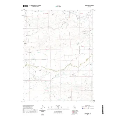 2021 Shingletown2021 Print · USGSCovers Tehama County, including Shingletown, Manton, and other nearby areas
 - 2021 Map of Finley Butte, 2021 Print
 2021 Finley Butte2021 Print · USGSThe foothills of the southern Cascades come into focus during the early twenty-first century, showing a landscape defined by the Lassen National Forest. Researchers can trace the path of Old State Hwy 36 and identify local landmarks like Finley Butte and Brazell Meadows.
 - 2021 Map of Stover Mountain, 2021 Print
 2021 Stover Mountain2021 Print · USGSThe Plumas County high country in the early 2020s remains a landscape defined by timber and recreation. Trace the route of the Pacific Crest National Scenic Trl past Stover Mtn or find the grounds of the Chester Cem.
 - 2021 Map of Buck Rock, 2021 Print
 2021 Buck Rock2021 Print · USGSMendocino National Forest at the meeting of three counties in the early 2020s shows a landscape of high ridges and isolated mountain waters. Researchers can trace historic trails like the Smokehouse Ridge Trl and find named clearings such as Irish Glade and Minnie Glade.
 - 2021 Map of Foster Island, 2021 Print
 2021 Foster Island2021 Print · USGSThe Sacramento River floodplain comes into focus in this contemporary survey, where Tehama, Butte, and Glenn Counties meet. Researchers can trace the intricate river morphology of Foster Island, the family-named Emery and Mitchell Island, and the vital Glenn-Colusa Canal.
 - 2021 Map of Devils Parade Ground, 2021 Print
 2021 Devils Parade Ground2021 Print · USGSThe high timber country of Tehama County comes into focus in this recent survey of the Lassen National Forest. Trace the historic timber and transit routes like Cohasset Stage Rd and Ponderosa Way near the old settlement of Campbellville.
 - 2021 Map of Reading Peak, 2021 Print
 2021 Reading Peak2021 Print · USGSHigh in the Cascades during the early twenty-first century, this map documents the geothermal and alpine character of the Lassen backcountry. Trace the paths of early explorers and modern hikers through Bumpass Hell, Drakesbad, and the Pacific Crest National Scenic Trl.
 - 2021 Map of Henleyville, 2021 Print
 2021 Henleyville2021 Print · USGSCovers Tehama County, including Henleyville, United States, and other nearby areas
 - 2021 Map of Log Spring, 2021 Print
 2021 Log Spring2021 Print · USGSHigh in the mountains along the Tehama and Glenn County line, this recent survey traces the deep forest ridges and glades of the Northern Coast Ranges. Search for backcountry landmarks like Hokey Pokey Ridge, Sunnyside, and the remote paths of the Poison Glade Trl.
 - 2021 Map of Ball Mountain, 2021 Print
 2021 Ball Mountain2021 Print · USGSTehama County’s high country is captured here in the contemporary era within the Mendocino National Forest. Researchers can trace the network of mountain meadows including Foreman Glade, Sugarfoot Glade, and Hensley Glade across the ridges.
 - 2021 Map of Humboldt Peak, 2021 Print
 2021 Humboldt Peak2021 Print · USGSThe high Sierra Nevada and Cascade intersection in the early 2020s is documented here, showing where Tehama, Plumas, and Butte counties converge. Trace the path of the historic Lassen Trail and high-altitude landmarks like Humboldt Peak and Lost Lake.
 - 2021 Map of Deer Creek Flat, 2021 Print
 2021 Deer Creek Flat2021 Print · USGSHigh in the Tehama County mountains during the early twenty-first century, this survey tracks the rugged canyons of the Lassen National Forest. Researchers can locate the settlement at Buena Vista and trace the drainage basins of Deer Creek Flat and Digger Pine Flat.
 - 2021 Map of Acorn Hollow, 2021 Print
 2021 Acorn Hollow2021 Print · USGSTehama County's eastern foothills are captured here in the early twenty-first century, showing the transition from the valley floor to the ridgelines. Researchers can trace land features like Morris Flat, the waters of Ballard Spring, and the path of Reed Orchard Rd.
 - 2021 Map of Manton, 2021 Print
 2021 Manton2021 Print · USGSCovers Tehama County, including Shingletown, Manton, and other nearby areas
 - 2021 Map of Childs Meadows, 2021 Print
 2021 Childs Meadows2021 Print · USGSThe high meadows and emigrant paths of Tehama and Plumas counties are captured here in the early twenty-first century. History seekers can trace the path of the Lassen Trl or locate family-named landmarks like Childs Meadows and Wild Cattle Mtn.
 - 2021 Map of Humbug Valley, 2021 Print
 2021 Humbug Valley2021 Print · USGSThe high Sierra meadows of Plumas County are captured here in the early twenty-first century, showing a landscape defined by timber and transit. Trace the high-altitude path of the Pacific Crest National Scenic Trail or locate remote landmarks like Soldier Meadows and Little Grizzly Valley.
Showing maps 1-25 of 79
Top cities of Tehama County
- Red Bluff historical maps
- Corning historical maps
- Los Molinos historical maps
- Rancho Tehama Reserve historical maps
- Tehama historical maps
- Vina historical maps
See more
Frequently asked questions
- What are the different types of historical maps available for Tehama County?
- What is the oldest map of Tehama County?
- Where can I purchase historical maps of Tehama County for my home or office?
- Where can I download high-res historical maps of Tehama County?
- Are there historical topographic maps available for Tehama County?
- Is there historical aerial imagery available for Tehama County?
- Where are historical maps of Tehama County sourced from?