1990s Maps of Tehama County, California
Explore 46 historic maps of Tehama County from the 1990s. These maps offer a rare glimpse into what life looked like during the 1990s — showing old roads, neighborhoods, homes, and landmarks that have changed or disappeared over time.
Whether you're researching your family's past, planning a metal detecting trip, or studying how Tehama County's landscape evolved across the 1990s, these high-resolution maps are a powerful tool for exploring the history of this region.
- Focus on a specific era: All maps on this page are from the 1990s, giving you a focused view of this time period.
- See what’s changed: Compare century-old streets, trails, and buildings to today's modern landscape using overlays and satellite layers.
- Research with precision: Use these maps for genealogy, historical research, land use analysis, or educational projects.
- View, download, or print: Maps are fully viewable online in high resolution, and can be downloaded or printed for your own records.
Start exploring Tehama County's history through authentic maps from the 1990s. This is your window into the past.
Tehama County, CA maps
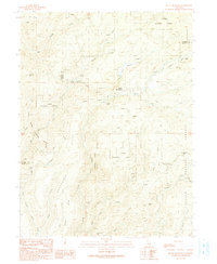
(46)- 1991 Map of Humbug Valley
 1991 Humbug Valley1991 Print · USGSPlumas County high country in the early nineties reveals a landscape of isolated ranching and historic transit routes. Trace the path of the Humboldt Road or locate family sites like Baccala Ranch and Lemm Ranch near the meadows.
 - 1991 Map of Jonesville
 1991 Jonesville1991 Print · USGSThe high Sierra country of Butte County comes into focus in the early nineties, showing a landscape defined by mountain camps and alpine reservoirs. Genealogists and hikers can trace the Pacific Crest National Scenic Trail past Jonesville, Butte Creek House, and the remote Carr Mine.
 - 1991 Map of Devils Parade Ground
 1991 Devils Parade Ground1991 Print · USGSThe high ridges of Tehama and Butte counties are captured here in the early nineties, showing a landscape of wilderness areas and remote timber pines. Researchers can trace the Beaver Creek Pack Trail through the Ishi Wilderness or locate sites like Campbellville and Polk Springs.
 - 1991 Map of Butte Meadows
 1991 Butte Meadows1991 Print · USGSThe High Sierra foothills near the Tehama and Butte County line are captured here in the early nineties. Genealogists and local historians can trace the foundations of Butte Meadows, locate the Butte Meadows Cem, and follow the historic Humboldt Road.
 - 1991 Map of Barkley Mountain
 1991 Barkley Mountain1991 Print · USGSThe Tehama backcountry comes into focus during the early nineties, showing a landscape defined by forest boundaries and wilderness preserves. Researchers can trace remote sites like Savercool Place, the Yellowjacket (Site), and landmarks such as Barkley Mountain.
 - 1991 Map of Onion Butte
 1991 Onion Butte1991 Print · USGSThe high ridges and deep canyons of Tehama County are captured in the early 1990s within the Lassen National Forest. Local history researchers can trace old fire roads and backcountry camps, locating the Colby Lookout Tower, Potato Patch Campground, and the heights of Onion Summit.
 - 1991 Map of Humboldt Peak
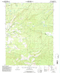
 1991 Humboldt Peak1991 Print · USGSThe high Sierra Nevada backcountry of Tehama and Plumas counties is captured here in the early nineties. Researchers can trace the intersection of historic routes like the Lassen Trail and Humboldt Road near Humboldt Peak and Robbers Roost.
 - 1995 Map of Childs Meadows, 1997 Print
 1995 Childs Meadows1997 Print · USGSThe high meadows and volcanic plateaus of the Lassen National Forest are captured here in the mid-1990s. Researchers can locate remote high-altitude landmarks like Smith Cabin, Wilson Lake, and the volcanic peaks of Ice Cave Mountain.
 - 1995 Map of Dewitt Peak, 1997 Print
 1995 Dewitt Peak1997 Print · USGSTehama County's rugged eastern uplands are shown in the mid-1990s as a landscape of state wildlife areas and national forest. Researchers can trace historic family-named locations like Thompson Place, Facht Homestead, and Wells Place among the ridges.
 - 1995 Map of Onion Butte, 1997 Print
 1995 Onion Butte1997 Print · USGSThe high timberlands of Tehama County are shown here in the mid-1990s as the Forest Service managed the rugged Lassen interior. Researchers can trace historic access routes like the State Game Refuge Trail or locate the Lookout on Colby Mountain.2 unique versions available
 - 1995 Map of Manton, 1997 Print
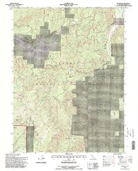
 1995 Manton1997 Print · USGSThe Shasta and Tehama county line meets in the mid-1990s near the small settlement of Manton. Researchers can trace the region's complex water and power history through the Union Canal, Volta Powerhouse, and the Lookout Digger atop Digger Butte.2 unique versions available
 - 1995 Map of Butte Meadows, 1997 Print
 1995 Butte Meadows1997 Print · USGSThe high country of the Lassen National Forest comes into focus during the mid-1990s, showing the intersection of logging and recreation. Researchers can trace historic routes like Humboldt Road and locate the Butte Meadows Cem or the scout camp at Camp Lassen.
 - 1995 Map of Stover Mountain, 1998 Print
 1995 Stover Mountain1998 Print · USGSIn the mid-1990s, this area of the Lassen National Forest was a hub for outdoor activity and remote settlement. You can trace the Pacific Crest National Scenic Trail past Stover Mountain and locate the small St Bernard community and Cem.
 - 1995 Map of Humboldt Peak, 1998 Print
 1995 Humboldt Peak1998 Print · USGSHigh in the southern Cascades during the mid-nineties, this survey captures the intersection of three counties and the rugged mountain transit routes of the era. Researchers can trace the path of the Humboldt Road and locate remote landmarks like Robbers Roost, Eagle Rocks, and Butt Mountain.
 - 1995 Map of Lyonsville, 1998 Print
 1995 Lyonsville1998 Print · USGSNorthern California's timber and ranching country comes into focus in the mid-nineties, showing the high-elevation landscape of the Lassen National Forest. Local historians can trace the sites of Bells Camp and Lyonsville or locate the remote Cem and Cline Ranch.
 - 1995 Map of Jonesville, 1998 Print
 1995 Jonesville1998 Print · USGSThe high sierra backcountry of Butte County during the mid-1990s reveals a landscape of remote mountain camps and alpine reservoirs. Genealogists and hikers can trace the Pacific Crest National Scenic Trail past Jonesville and the Carr Mine.
 - 1995 Map of Reading Peak, 1998 Print
 1995 Reading Peak1998 Print · USGSThe volcanic landscape of the southern Cascades is captured in the mid-nineties as it spans the borders of Plumas, Shasta, and Tehama counties. Researchers can trace the path of the Pacific Crest National Scenic Trail past geothermal landmarks like Bumpass Hell Spring and the resort at Drakesbad.
 - 1995 Map of Devils Parade Ground, 1998 Print
 1995 Devils Parade Ground1998 Print · USGSThe western Sierra Nevada foothills come alive in the mid-1990s, where ridge-top settlements meet deep wilderness canyons. Trace the remote outpost of Campbellville or explore the rugged landmarks of Devils Kitchen and Devils Parade Ground.
 - 1995 Map of Inskip Hill, 1998 Print
 1995 Inskip Hill1998 Print · USGSTehama County's volcanic foothills and conservation lands are captured here in the mid-1990s. Genealogists and historians can trace legacy landholdings such as Childs Ranch, Shults Ranch, and the McKenzie Place near the distinctive Inskip Caves.
 - 1995 Map of Finley Butte, 1998 Print
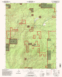
 1995 Finley Butte1998 Print · USGSTehama County's rugged ridge country is detailed here during the late twentieth century, showing a landscape defined by private ranches and public forest lands. You can trace local family landmarks and rural holdings such as Lyman Springs, Wilson Ranch, and the Shake House.2 unique versions available
 - 1995 Map of Humbug Valley, 1998 Print
 1995 Humbug Valley1998 Print · USGSPlumas County high country is shown in the mid-1990s as a landscape of remote ranches and high-altitude meadow systems. Researchers can trace the path of the Pacific Crest National Scenic Trail or locate historical sites like Baccala Ranch and Soldier Meadows.
 - 1995 Map of Campbell Mound, 1998 Print
 1995 Campbell Mound1998 Print · USGSUpper Sacramento Valley foothills meet the volcanic edges of the southern Cascades in this mid-nineties survey of Tehama and Butte counties. Researchers can trace remote landmarks like Franks Cabin, the isolated Campbell Mound, and the timber lands of Burroughs Pinery.
 - 1995 Map of Lassen Peak, 1998 Print
 1995 Lassen Peak1998 Print · USGSGeothermal activity and high peaks define this 1990s survey of the Southern Cascades. Trace backcountry routes like the Summit Trail to find geologic landmarks including Bumpass Hell Mud Pots, Sulphur Works, and Lake Helen.
 - 1995 Map of Mineral, 1998 Print
 1995 Mineral1998 Print · USGSThe mountain community of Mineral is shown in the mid-1990s as a focal point for federal land management. Researchers can locate the Lassen Volcanic Natl Park Headquarters, Camp Tehama, and the remote Belfast Meadows within the surrounding timberland.
 - 1995 Map of Barkley Mountain, 1998 Print
 1995 Barkley Mountain1998 Print · USGSTehama County's wilderness interior is shown in the mid-1990s as a landscape of deep canyons and high ridges. Genealogists and historians can locate former sites like Yellowjacket and Savercool Place or trace landmarks such as Barkley Mountain and Four Lantern Flat.
Showing maps 1-25 of 46
Top cities of Tehama County
- Red Bluff historical maps
- Corning historical maps
- Los Molinos historical maps
- Rancho Tehama Reserve historical maps
- Tehama historical maps
- Vina historical maps
See more
Frequently asked questions
- What are the different types of historical maps available for Tehama County?
- What is the oldest map of Tehama County?
- Where can I purchase historical maps of Tehama County for my home or office?
- Where can I download high-res historical maps of Tehama County?
- Are there historical topographic maps available for Tehama County?
- Is there historical aerial imagery available for Tehama County?
- Where are historical maps of Tehama County sourced from?