1970s Maps of Tehama County, California
Explore 3 historic maps of Tehama County from the 1970s. These maps offer a rare glimpse into what life looked like during the 1970s — showing old roads, neighborhoods, homes, and landmarks that have changed or disappeared over time.
Whether you're researching your family's past, planning a metal detecting trip, or studying how Tehama County's landscape evolved across the 1970s, these high-resolution maps are a powerful tool for exploring the history of this region.
- Focus on a specific era: All maps on this page are from the 1970s, giving you a focused view of this time period.
- See what’s changed: Compare century-old streets, trails, and buildings to today's modern landscape using overlays and satellite layers.
- Research with precision: Use these maps for genealogy, historical research, land use analysis, or educational projects.
- View, download, or print: Maps are fully viewable online in high resolution, and can be downloaded or printed for your own records.
Start exploring Tehama County's history through authentic maps from the 1970s. This is your window into the past.
Tehama County, CA maps
(3)- 1979 Map of Red Bluff
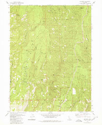
 1979 Red Bluff1979 Print · USGSTehama and Shasta counties come alive in the late seventies as the agricultural heart of the northern valley meets the high wilderness. Genealogists and local historians can trace the rail-and-river corridor from Red Bluff to Los Molinos, finding sites like Balls Ferry and the Southern Pacific line.3 unique versions available
 - 1979 Map of Cohasset, 1980 Print
 1979 Cohasset1980 Print · USGSRidge-top life in Butte County during the late seventies is captured here as small communities like Cohasset and Forest Ranch began to expand. Genealogists and researchers can locate the Forest Ranch Cem, the Anderson Mill (Site), and several family landmarks including Spencer Ranch.4 unique versions available
 - 1979 Map of Garberville, 1996 Print
 1979 Garberville1996 Print · USGSThe redwood forests and river canyons of Humboldt and Trinity counties are shown here in the late seventies. Genealogists and historians can trace rail-side life along the Northwestern Pacific RR or locate small settlements like Fort Seward, Alderpoint, and Zenia.
End of results
Showing maps 1-3 of 3
Top cities of Tehama County
- Red Bluff historical maps
- Corning historical maps
- Los Molinos historical maps
- Rancho Tehama Reserve historical maps
- Tehama historical maps
- Vina historical maps
See more
Frequently asked questions
- What are the different types of historical maps available for Tehama County?
- What is the oldest map of Tehama County?
- Where can I purchase historical maps of Tehama County for my home or office?
- Where can I download high-res historical maps of Tehama County?
- Are there historical topographic maps available for Tehama County?
- Is there historical aerial imagery available for Tehama County?
- Where are historical maps of Tehama County sourced from?