1940s Maps of Ventura County, California
Explore 56 historic maps of Ventura County from the 1940s. These maps offer a rare glimpse into what life looked like during the 1940s — showing old roads, neighborhoods, homes, and landmarks that have changed or disappeared over time.
Whether you're researching your family's past, planning a metal detecting trip, or studying how Ventura County's landscape evolved across the 1940s, these high-resolution maps are a powerful tool for exploring the history of this region.
- Focus on a specific era: All maps on this page are from the 1940s, giving you a focused view of this time period.
- See what’s changed: Compare century-old streets, trails, and buildings to today's modern landscape using overlays and satellite layers.
- Research with precision: Use these maps for genealogy, historical research, land use analysis, or educational projects.
- View, download, or print: Maps are fully viewable online in high resolution, and can be downloaded or printed for your own records.
Start exploring Ventura County's history through authentic maps from the 1940s. This is your window into the past.
Ventura County, CA maps
(56)- 1940 Map of Pico
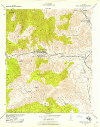
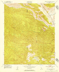
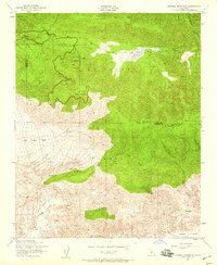
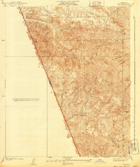 1940 Pico1940 Print · USGSThe northern reaches of the Santa Susana Mountains appear here in the late 1930s, showing the complex canyons of the Los Angeles and Ventura county line. Researchers can trace early settlements and remote outposts like Pico and La Quinta or locate high-country landmarks such as Oat Mtn Lookout.
 - 1940 Map of Chatsworth
 1940 Chatsworth1940 Print · USGSThe northwest San Fernando Valley appears in the 1940s as a land of iconic movie ranches and burgeoning citrus communities. Researchers can trace the early footprints of Chatsworth and Canoga Park or locate family-named sites like Iverson Ranch and Brandies Ranch.
 - 1940 Map of Castaic
 1940 Castaic1940 Print · USGSNorth of Los Angeles in the 1940s, the canyons around the Santa Clara River supported a network of isolated waystations and small schools. Genealogists can trace family footprints at Liveoak Sch, Valverde Lodge, or the agricultural Wayside Farm No 1.3 unique versions available
 - 1941 Map of Ventura
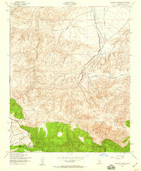
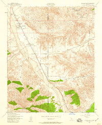
 1941 Ventura1941 Print · USGSCoastal Ventura and the Ojai Valley are shown in the early 1940s, just as the region began its mid-century growth. Genealogists and historians can trace family properties like the Schafer Farm, locate the historic Matilija Hot Springs, or follow the Southern Pacific rail line.4 unique versions available
 - 1941 Map of Piru, 1963 Print
 1941 Piru1963 Print · USGSVentura County ranching and rail life are captured here during the early 1940s as citrus and oil industries shaped the valley. Researchers can trace historic family holdings like the Frey Ranch and locate vanished local landmarks such as San Cayetano Sch or the Temescal Guard Station.
 - 1941 Map of Santa Susana, 1964 Print
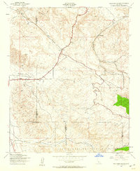
 1941 Santa Susana1964 Print · USGSVentura and Los Angeles counties meet in this 1940s landscape of steep canyons and early oil development. Researchers can trace the ranching history of Brandeis Ranch and Iverson Ranch or locate industrial sites like the Newhall-Potrero Oil Field.2 unique versions available
 - 1942 Map of Santa Paula
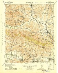
 1942 Santa Paula1942 Print · USGSVentura County's fertile valleys and burgeoning oil industry are documented here during the early war years. Genealogists and historians can trace the rail-linked settlements of Saticoy and Santa Paula, find rural schoolhouses like Center Sch, and locate industrial sites like the Timber Canyon Oil Co.
 - 1942 Map of Hueneme
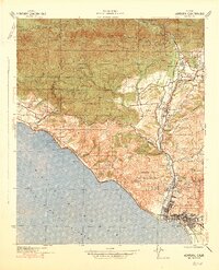
 1942 Hueneme1942 Print · USGSVentura County's coastal plain and agricultural heartland are shown here at the start of the 1940s. Genealogists and historians can trace early residential tracts at Silver Strand, the wartime growth of Port Hueneme, and the layout of Camarillo State Hospital.
 - 1942 Map of Wheeler Springs, 1957 Print
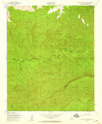
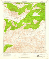
 1942 Wheeler Springs1957 Print · USGSBackcountry Ventura County comes alive in the early 1940s, showing a landscape of forest stations and family ranches. Researchers can trace the development of Wheeler Springs, find remote homesteads like Felt Ranch, and locate the Wheeler Gorge Guard Station.
 - 1942 Map of Frazier Mountain, 1957 Print
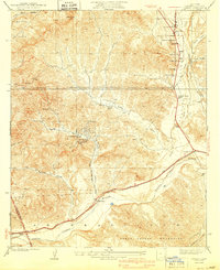
 1942 Frazier Mountain1957 Print · USGSThe mountain passes of Kern and Ventura counties were centers of mining and early petroleum transit during the 1940s. Genealogists and historians can trace family holdings at Lebec Oaks Ranch and Maxy Ranch or locate the historic Old Fort Tejon.
 - 1942 Map of Ballinger Canyon, 1958 Print
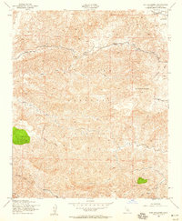
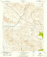 1942 Ballinger Canyon1958 Print · USGSThe high desert canyons of the California interior come to life in the early 1940s at the convergence of four county lines. Researchers can trace historic ranch sites like Klipstein Ranch and remote outposts such as Camp Dix near the Cuyama Valley floor.
 - 1943 Map of Santa Susana
 1943 Santa Susana1943 Print · USGSSouthern California ranching and oil industries intersect in the early 1940s along the Santa Susana Mountains. Trace historic boundaries and sites like Tapo Ranch, the Newhall-Potrero Oil Field, and the Southern Pacific rail line.
 - 1943 Map of Hueneme
 1943 Hueneme1943 Print · USGSVentura County's coastal plains and ranch lands are captured here during the early 1940s. Genealogists and researchers can trace the rural school districts of Springville Sch, the vast grounds of Camarillo State Hospital, and early seaside developments like Silver Strand.
 - 1943 Map of Triunfo Pass
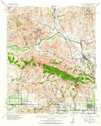
 1943 Triunfo Pass1943 Print · USGSThe Conejo Valley and Santa Monica Mountains are shown here during the early war years, when ranching and small coastal outposts defined the region. Local researchers can locate family landholdings like Fillmore Ranch or trace the early development of the Thousand Oaks Community and Newbury Park.
 - 1943 Map of Topatopa Mountains, 1949 Print
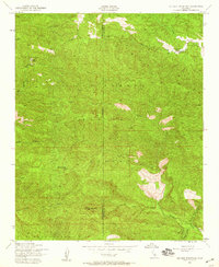
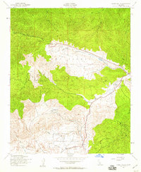
 1943 Topatopa Mountains1949 Print · USGSDeep in the Ventura County backcountry during the 1940s, this survey captures a remote wilderness within the LOS PADRES NATIONAL FOREST. Trace the old trails and drainage routes near Hartman Guard Station, Hines Peak, and Sespe Creek.3 unique versions available
 - 1943 Map of San Nicolas Island, 1952 Print
 1943 San Nicolas Island1952 Print · USGSSan Nicolas Island was a key offshore outpost during the second World War, as shown in this 1943 survey of its isolated Ventura County terrain. Researchers can trace landforms and landmarks from Dutch Harbor to the northern Garden and the prominent eastern Spit.
 - 1943 Map of Rancho Nuevo Creek, 1954 Print
 1943 Rancho Nuevo Creek1954 Print · USGSThe high backcountry of the California Coast Ranges is documented here during the early 1940s, centered on the Los Padres National Forest. Researchers can trace the remote Apache Sch and the high-elevation Ranger Sta near Potrero Seco.3 unique versions available
 - 1943 Map of Old Man Mountain, 1959 Print
 1943 Old Man Mountain1959 Print · USGSSanta Barbara and Ventura counties are mapped here during the early 1940s, showing the remote high country of the southern Los Padres region. Researchers can locate isolated landmarks like Upper Hartman Ranch and follow the rugged drainages of Sespe Creek and Matilija Creek.3 unique versions available
 - 1943 Map of Apache Canyon, 1959 Print
 1943 Apache Canyon1959 Print · USGSThe Ventura and Kern County line in the early 1940s is defined here by high-country meadows and forest infrastructure. Researchers can trace the County Industrial Road Camp and isolated water sources like Nettle Spring and Mystery Spring.4 unique versions available
 - 1943 Map of San Guillermo, 1959 Print
 1943 San Guillermo1959 Print · USGSThe high backcountry of the Los Padres National Forest is captured here in the early 1940s. Researchers can trace the early layout of Lockwood Valley to locate the Three Falls Boy Scout Camp, Plush Ranch, and the winding Wagon Road through the mountains.3 unique versions available
 - 1943 Map of Sawmill Mountain, 1959 Print
 1943 Sawmill Mountain1959 Print · USGSHigh in the mountain borderlands of Ventura and Kern counties during the 1940s, this area shows a landscape of forest management and early recreation. Trace the sites of Camp Condor, the Lookout Tower on Mt Pinos, and the Ski Run near Cerro Noroeste.4 unique versions available
 - 1943 Map of Santiago Creek, 1959 Print
 1943 Santiago Creek1959 Print · USGSThe California coast ranges come into focus during the early 1940s, showing the high ridges and deep canyons at the Kern and Ventura county line. Trace the remote terrain of San Emidio along the waters of Santiago Creek and Bitter Creek.3 unique versions available
 - 1943 Map of Ballinger Canyon, 1959 Print
 1943 Ballinger Canyon1959 Print · USGSThe high desert borderlands of Kern and Ventura counties were captured just as the wartime decade drew to a close. Researchers can trace remote family outposts like Klipstein Ranch and landmarks like Camp Dix across the Cuyama Valley.4 unique versions available
 - 1943 Map of Cuddy Valley, 1959 Print
 1943 Cuddy Valley1959 Print · USGSVentura and Kern counties meet in these high mountain valleys during the 1940s, showing a landscape of mining and summer camps. Researchers can locate the Stauffer post office, the Chuchupate Ranger Sta, and old workings like the Jewel Mine.6 unique versions available
 - 1943 Map of Cuyama Peak, 1959 Print
 1943 Cuyama Peak1959 Print · USGSThe high desert ranchlands of the Cuyama Valley come to life in the early 1940s, showing a landscape defined by seasonal riverbeds and remote outposts. Researchers can trace historic family holdings like the Monreal Ranch and Stutz Ranch near the settlement of Ventucopa.5 unique versions available
Showing maps 1-25 of 56
Top cities of Ventura County
- Oxnard historical maps
- Thousand Oaks historical maps
- Simi Valley historical maps
- Ventura historical maps
- Camarillo historical maps
- Moorpark historical maps
See more
Frequently asked questions
- What are the different types of historical maps available for Ventura County?
- What is the oldest map of Ventura County?
- Where can I purchase historical maps of Ventura County for my home or office?
- Where can I download high-res historical maps of Ventura County?
- Are there historical topographic maps available for Ventura County?
- Is there historical aerial imagery available for Ventura County?
- Where are historical maps of Ventura County sourced from?