1990s Maps of Ventura County, California
Explore 53 historic maps of Ventura County from the 1990s. These maps offer a rare glimpse into what life looked like during the 1990s — showing old roads, neighborhoods, homes, and landmarks that have changed or disappeared over time.
Whether you're researching your family's past, planning a metal detecting trip, or studying how Ventura County's landscape evolved across the 1990s, these high-resolution maps are a powerful tool for exploring the history of this region.
- Focus on a specific era: All maps on this page are from the 1990s, giving you a focused view of this time period.
- See what’s changed: Compare century-old streets, trails, and buildings to today's modern landscape using overlays and satellite layers.
- Research with precision: Use these maps for genealogy, historical research, land use analysis, or educational projects.
- View, download, or print: Maps are fully viewable online in high resolution, and can be downloaded or printed for your own records.
Start exploring Ventura County's history through authentic maps from the 1990s. This is your window into the past.
Ventura County, CA maps
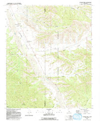
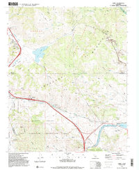
(53)- 1991 Map of Devils Heart Peak
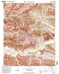
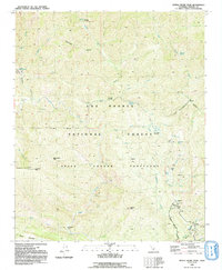 1991 Devils Heart Peak1991 Print · USGSVentura County's high country is captured here in the early nineties within the Sespe Condor Sanctuary. Researchers can trace the drainage of Sespe Creek and locate remote backcountry points like McDonald Campsite, Dough Flat, and Hot Springs.2 unique versions available
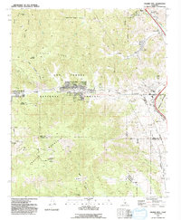
 - 1991 Map of Wheeler Springs
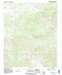
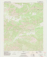
 1991 Wheeler Springs1991 Print · USGSVentura County's backcountry comes into focus in the early nineties, centered on the recreational and forest service hubs of the Santa Ynez Mountains. Hikers and historians can trace the paths to Wheeler Springs and locate early campsites like Maple Campsite and Potrero John Campsite.2 unique versions available
 - 1991 Map of Lockwood Valley
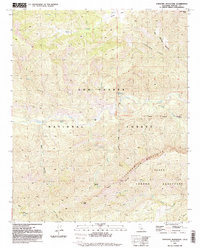
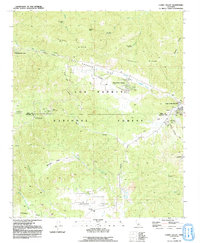
 1991 Lockwood Valley1991 Print · USGSVentura County's high-country wilderness is documented here in the early nineties within the Los Padres National Forest. Researchers can locate several remote camp locations like Halfmoon Campground, various mining prospects, and the convergence of Piru Creek and Mutau Creek.2 unique versions available
 - 1991 Map of Sawmill Mountain
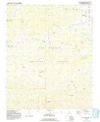
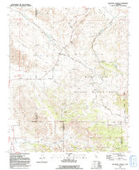
 1991 Sawmill Mountain1991 Print · USGSThe high country of the Ventura and Kern county line is captured here in the early nineties, centered on the Pine Mountain Club community. Researchers can trace the massive San Andreas Rift Zone across the mountains or locate remote outposts like Sheep Camp and the Condor Observation Site.2 unique versions available
 - 1991 Map of Santiago Creek
 1991 Santiago Creek1991 Print · USGSThe high desert canyons and the San Andreas Fault define this Kern and Ventura County borderland in the early nineties. Geologists and local historians can trace the San Andreas Rift Zone as it cuts between the Bitter Creek National Wildlife Refuge and Santiago Corrals.
 - 1991 Map of Topatopa Mountains
 1991 Topatopa Mountains1991 Print · USGSVentura County's high country during the early 1990s is captured here, detailing the protected lands within the Los Padres National Forest. Researchers can trace the remote reaches of Sespe Creek, locate Willet Hot Springs, and identify prominent landmarks like Hines Peak.2 unique versions available
 - 1991 Map of Alamo Mountain
 1991 Alamo Mountain1991 Print · USGSVentura County's high wilderness is documented here in the early nineties, showing a landscape defined by isolated mines and historic homestead sites. Researchers can trace the locations of the Harris Mill, Baker Cabin, and the Castaic Mine within the Los Padres National Forest.2 unique versions available
 - 1991 Map of Old Man Mountain
 1991 Old Man Mountain1991 Print · USGSHigh in the coastal ranges during the late eighties, this survey captures the intersection of Santa Barbara and Ventura counties. Trace family-named landmarks like Upper Hartman Ranch or the peak of Old Man Mountain and the headwaters of Matilija Creek.2 unique versions available
 - 1991 Map of Cuyama Peak
 1991 Cuyama Peak1991 Print · USGSVentucopa and the upper Cuyama Valley are documented in the early nineties, showing a landscape defined by sharp canyons and forest service outposts. Researchers can trace land use through the Cuyama Peak Lookout, the small settlement of Burges, and the winding Cuyama River.2 unique versions available
 - 1991 Map of Reyes Peak
 1991 Reyes Peak1991 Print · USGSVentura County's high country is captured here in the early nineties, showing the backcountry camps and fire stations of the mountains. Researchers can trace remote sites like Camp Scheideck and Ozena Fire Station along the Cuyama River.2 unique versions available
 - 1991 Map of Lion Canyon
 1991 Lion Canyon1991 Print · USGSVentura County's interior mountains were a haven for backcountry recreation and fire monitoring in the early nineties. Researchers can trace the trails to the Thorn Point Lookout, locate the Landing Strip, and identify old sites like Rancho Grande.
 - 1991 Map of Rancho Nuevo Creek
 1991 Rancho Nuevo Creek1991 Print · USGSBackcountry Ventura and Santa Barbara counties are shown in the early nineties, centered on the protected lands of the Dick Smith Wilderness. Trace remote trails and campsites like Tinta Campground, Rancho Nuevo Campground, and the high peak of Lizard Head.
 - 1991 Map of Apache Canyon
 1991 Apache Canyon1991 Print · USGSVentura and Kern counties meet in this high-elevation wilderness in the early nineties. Researchers can trace the trails and seasonal camps around Nettle Spring Campground and find remote water sources like Blue Rock Spring and Mystery Spring.2 unique versions available
 - 1991 Map of Cuddy Valley
 1991 Cuddy Valley1991 Print · USGSVentura and Kern counties meet along the geological fracture of the San Andreas Rift Zone during the late twentieth century. Researchers can trace the layout of mountain communities like Pinon Pines Estates or locate historical points like the Stauffer (Site) and Adobe.2 unique versions available
 - 1991 Map of San Guillermo Mtn
 1991 San Guillermo Mtn1991 Print · USGSVentura County's high country is documented here in the early nineties, showing a landscape of forest service trails and remote camps. Detail-oriented researchers can trace the National Recreation Trail and locate sites like Pine Spring Campground and Fishbowls Campsite.2 unique versions available
 - 1991 Map of Ballinger Canyon
 1991 Ballinger Canyon1991 Print · USGSThe high-desert terrain of Kern and San Luis Obispo counties is captured here in the early nineties, dominated by the San Andreas Rift Zone. Researchers can trace old land grants like the Cuyama Grant and find quiet locales like Adobe and Stubblefield.
 - 1991 Map of Cobblestone Mtn, 1992 Print
 1991 Cobblestone Mtn1992 Print · USGSVentura County conservation and backcountry ranching history are on full display in the early nineties. Genealogists and hikers can trace Whitaker Ranch (Site) or locate remote spots like Log Cabin Campsite and Blue Point Campground.2 unique versions available
 - 1991 Map of Lebec, 1992 Print
 1991 Lebec1992 Print · USGSThe mountain passes of the Tejon area are captured here in the early nineties as a critical junction of infrastructure and recreation. Researchers can trace the San Andreas Rift Zone past Lebec and locate local landmarks like Castac Lake and the California Aqueduct.2 unique versions available
 - 1991 Map of Frazier Mtn, 1992 Print
 1991 Frazier Mtn1992 Print · USGSThe high mountain passes and tectonic rifts of Kern County are captured here in the early nineties. Researchers can trace the San Andreas Rift Zone, the grounds of Old Fort Tejon, and remote sites like Frazier Mine.2 unique versions available
 - 1991 Map of Black Mountain, 1992 Print
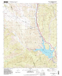 1991 Black Mountain1992 Print · USGSSouthern California's rugged backcountry at the junction of Ventura and Los Angeles counties is shown here during the early nineties. Genealogists and local historians can locate the former Kinsey Ranch and Bailey Homestead near the shores of Pyramid Lake.2 unique versions available
 - 1991 Map of Triunfo Pass, 1995 Print
 1991 Triunfo Pass1995 Print · USGSThe coastal canyons of the Santa Monica Mountains are mapped here in the early nineties as the region's parklands and remote schools were well-established. Trace the old canyon roads to find the Yerba Buena Sch, Decker Sch, and the shoreline at Solromar.
 - 1991 Map of Val Verde, 1995 Print
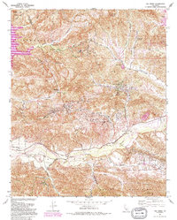 1991 Val Verde1995 Print · USGSThe northern Santa Susana Mountains meet the Santa Clara River in the 1990s, revealing an era of intense oil extraction and ranching. Genealogists and historians can trace family holdings like Lechler Ranch alongside industrial landmarks like Mayo Spur and the Ramona Oil Field.
 - 1993 Map of San Nicolas Island
 1993 San Nicolas Island1993 Print · USGSSan Nicolas Island in the early nineties serves as a key military outpost and offshore landmark. Researchers can trace the layout of the U. S. Naval Reservation, the central Landing Strip, and coastal features like Dutch Harbor.
 - 1994 Map of Triunfo Pass, 1999 Print
 1994 Triunfo Pass1999 Print · USGSThe Ventura and Los Angeles county line crosses these coastal mountains during the late twentieth century as recreation areas expanded. Genealogists and historians can locate the Yerba Buena Sch, the settlement of Solromar, and the crossing at Triunfo Pass.
 - 1995 Map of Val Verde, 1999 Print
 1995 Val Verde1999 Print · USGSNorth of Los Angeles in the mid-nineties, the Santa Clara River valley remained a landscape of active oil fields and sprawling ranches. Genealogists and local historians can trace the foundations of Val Verde, locate the Cem near Hasley, and explore the legacy of Stanley Ranch.
Showing maps 1-25 of 53
Top cities of Ventura County
- Oxnard historical maps
- Thousand Oaks historical maps
- Simi Valley historical maps
- Ventura historical maps
- Camarillo historical maps
- Moorpark historical maps
See more
Frequently asked questions
- What are the different types of historical maps available for Ventura County?
- What is the oldest map of Ventura County?
- Where can I purchase historical maps of Ventura County for my home or office?
- Where can I download high-res historical maps of Ventura County?
- Are there historical topographic maps available for Ventura County?
- Is there historical aerial imagery available for Ventura County?
- Where are historical maps of Ventura County sourced from?