1930s Maps of Ventura County, California
Explore 15 historic maps of Ventura County from the 1930s. These maps offer a rare glimpse into what life looked like during the 1930s — showing old roads, neighborhoods, homes, and landmarks that have changed or disappeared over time.
Whether you're researching your family's past, planning a metal detecting trip, or studying how Ventura County's landscape evolved across the 1930s, these high-resolution maps are a powerful tool for exploring the history of this region.
- Focus on a specific era: All maps on this page are from the 1930s, giving you a focused view of this time period.
- See what’s changed: Compare century-old streets, trails, and buildings to today's modern landscape using overlays and satellite layers.
- Research with precision: Use these maps for genealogy, historical research, land use analysis, or educational projects.
- View, download, or print: Maps are fully viewable online in high resolution, and can be downloaded or printed for your own records.
Start exploring Ventura County's history through authentic maps from the 1930s. This is your window into the past.
Ventura County, CA maps
(15)- 1931 Map of Whitaker Peak
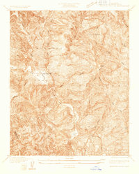
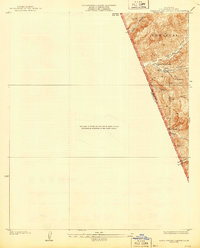
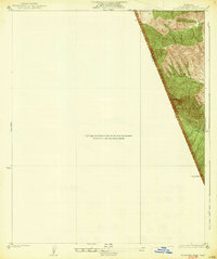
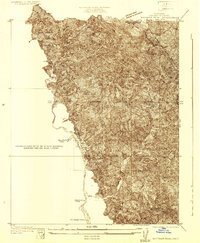 1931 Whitaker Peak1931 Print · USGSThe northwestern mountains of Los Angeles County appear here in the early 1930s, showing a landscape defined by forest service outposts and deep canyons. Researchers can trace the original locations of Agua Blanca Camp, the Piru Ranger Station, and the city-run Oak Flat Playground.
 - 1931 Map of Santa Felicia Canyon
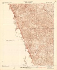
 1931 Santa Felicia Canyon1931 Print · USGSCanyon ranching and cattle camps define the Ventura-Los Angeles border during the early 1930s. Genealogists and researchers can trace the locations of the Dohany Cattle Camp, Martinez Ranch, and Leckler Ranch.
 - 1931 Map of Castaic
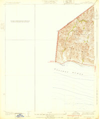
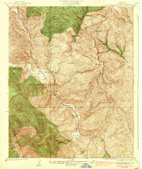
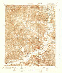 1931 Castaic1931 Print · USGSCastaic and the Santa Clara River valley appear here in the early 1930s, caught between the era of ranching and the rise of the oil industry. Researchers can find family landmarks like Sloane Ranch and the Val Verde Lodge, or trace the old U S Highway No 99.
 - 1932 Map of Seminole
 1932 Seminole1932 Print · USGSThe Santa Monica Mountains and Las Virgenes interior are captured here in the early thirties, showing the rural foothills before modern development. Trace early canyon settlements and school sites like Malibu Junction, Picture City, and Cornell Sch.2 unique versions available
 - 1932 Map of Russell Valley
 1932 Russell Valley1932 Print · USGSThe western Santa Monica Mountains and the ranch lands of the early 1930s are captured here as the region began to modernize. Researchers can trace early transport routes like Decker Road and the original Ventura Highway through Russell Valley.2 unique versions available
 - 1932 Map of Beartrap Canyon
 1932 Beartrap Canyon1932 Print · USGSThe northern reaches of Los Angeles County appear in the early 1930s as a vital transit corridor through the mountains. Researchers can trace the path of U S Highway No 99 past the General Petroleum Company Liebre Pumping Sta and the lonely Halfway Inn.
 - 1932 Map of Arroyo Sequit
 1932 Arroyo Sequit1932 Print · USGSCoastal Los Angeles County is captured here in the early thirties, showing the rugged intersection of the mountains and the sea. Trace early transit routes along the State Highway and follow the natural paths of Arroyo Sequit Creek and Nicholas Canyon.3 unique versions available
 - 1932 Map of Dry Canyon
 1932 Dry Canyon1932 Print · USGSThe western San Fernando Valley appears in the early thirties as a landscape of large ranchos and nascent mountain communities. Genealogists and historians can trace the early footprints of Calabasas, the rural Calabasas School, and the winding Mulholland Highway.3 unique versions available
 - 1933 Map of Chatsworth
 1933 Chatsworth1933 Print · USGSThe Chatsworth area in the early thirties shows a unique blend of old ranching estates and new valley subdivisions. You can trace early property lines at Rancho Sombra del Roble or locate historic landmarks like the Garden of The Gods and Oakwood Cemetery.
 - 1933 Map of Gorman
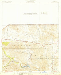
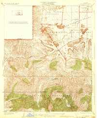
 1933 Gorman1933 Print · USGSThe Tejon Pass corridor comes alive in the early 1930s as a vital link for travelers on Highway No. 99. Trace early mountain settlements like Gorman and Alamo Ranch along the route through the Santa Barbara National Forest.
 - 1935 Map of Santa Felicia Canyon
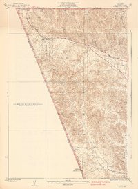
 1935 Santa Felicia Canyon1935 Print · USGSVentura and Los Angeles Counties are seen here in the mid-1930s along the steep canyon lands of the Temascal region. Genealogists and researchers can trace early land use through named sites like Lechler Ranch, Black Ranch, and the Doheny Cattle Camp No 2.3 unique versions available
 - 1935 Map of Whitaker Peak
 1935 Whitaker Peak1935 Print · USGSThe mountain backcountry of the Los Angeles and Ventura county line is captured here in the mid-1930s. Genealogists and researchers can trace early forest outposts like Agua Blanca Camp, the Piru Ranger Station, and the path of Highway No 99.4 unique versions available
 - 1938 Map of Beartrap Canyon
 1938 Beartrap Canyon1938 Print · USGSUpper Los Angeles County in the late thirties is captured here as a critical transportation corridor through the coastal mountains. Researchers can trace the original path of Route 99 and locate roadside landmarks like the Halfway Inn and the Liebre Pumping Sta.3 unique versions available
 - 1938 Map of Gorman
 1938 Gorman1938 Print · USGSThe northern Los Angeles County borderlands come alive in the late 1930s, focusing on the critical mountain pass connecting the coast to the interior. Trace the path of early motor travel along the Old Ridge Route or locate historic outposts like Gorman and Alamo Ranch.3 unique versions available
 - 1938 Map of Black Mountain
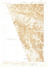
 1938 Black Mountain1938 Print · USGSThe mountain border between Ventura and Los Angeles counties appears here in the early 1930s during a period of expanding forest management. Researchers can trace the rugged course of Piru Creek and locate natural water sources like the secluded Spring near Dome Mtn.3 unique versions available
End of results
Showing maps 1-15 of 15
Top cities of Ventura County
- Oxnard historical maps
- Thousand Oaks historical maps
- Simi Valley historical maps
- Ventura historical maps
- Camarillo historical maps
- Moorpark historical maps
See more
Frequently asked questions
- What are the different types of historical maps available for Ventura County?
- What is the oldest map of Ventura County?
- Where can I purchase historical maps of Ventura County for my home or office?
- Where can I download high-res historical maps of Ventura County?
- Are there historical topographic maps available for Ventura County?
- Is there historical aerial imagery available for Ventura County?
- Where are historical maps of Ventura County sourced from?