1970s Maps of Ventura County, California
Explore 8 historic maps of Ventura County from the 1970s. These maps offer a rare glimpse into what life looked like during the 1970s — showing old roads, neighborhoods, homes, and landmarks that have changed or disappeared over time.
Whether you're researching your family's past, planning a metal detecting trip, or studying how Ventura County's landscape evolved across the 1970s, these high-resolution maps are a powerful tool for exploring the history of this region.
- Focus on a specific era: All maps on this page are from the 1970s, giving you a focused view of this time period.
- See what’s changed: Compare century-old streets, trails, and buildings to today's modern landscape using overlays and satellite layers.
- Research with precision: Use these maps for genealogy, historical research, land use analysis, or educational projects.
- View, download, or print: Maps are fully viewable online in high resolution, and can be downloaded or printed for your own records.
Start exploring Ventura County's history through authentic maps from the 1970s. This is your window into the past.
Ventura County, CA maps
(8)- 1975 Map of Los Angeles, 1977 Print
 1975 Los Angeles1977 Print · USGSSouthern California is captured in a period of significant growth during the mid-seventies, showing the urban sprawl from the coast to the high desert. Researchers can trace the development of the Pacific Coast Hwy and find aerospace landmarks like Edwards Air Force Base and the Flight Test Center (NASA).2 unique versions available
 - 1976 Map of Devils Heart Peak
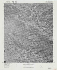
 1976 Devils Heart Peak1976 Print · USGSCovers Ventura County, including United States, California, and other nearby areas
 - 1976 Map of Calabasas, 1980 Print
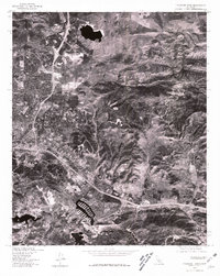
 1976 Calabasas1980 Print · USGSCovers Ventura County, including Los Angeles, Simi Valley, and other nearby areas2 unique versions available
 - 1976 Map of Thousand Oaks, 1981 Print
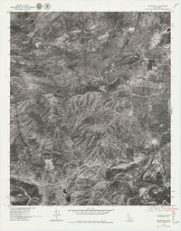
 1976 Thousand Oaks1981 Print · USGSThousand Oaks is shown in the mid-seventies just as modern suburban development began to reshape the valley. Local historians can trace the early footprint of modern neighborhoods as they expanded toward Simi Peak and the natural draws of Skeleton Canyon.
 - 1977 Map of Ballinger Canyon
 1977 Ballinger Canyon1977 Print · USGSCovers Ventura County, including Kern County, San Luis Obispo County, and other nearby areas
 - 1977 Map of Cuyama Peak
 1977 Cuyama Peak1977 Print · USGSCovers Ventura County, including Ventucopa, Santa Barbara County, and other nearby areas
 - 1978 Map of Black Mtn
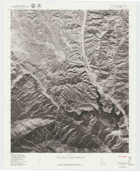 1978 Black Mtn1978 Print · USGSCovers Ventura County, including Caswell, Los Angeles County, and other nearby areas
 - 1979 Map of Los Angeles
 1979 Los Angeles1979 Print · USGSSouthern California at the close of the 1970s reveals a sprawling network of suburban growth and massive infrastructure projects. Researchers can trace established rail lines like the Southern Pacific alongside newer settlements and landmarks like Virginia Colony and Griffith Park.
End of results
Showing maps 1-8 of 8
Top cities of Ventura County
- Oxnard historical maps
- Thousand Oaks historical maps
- Simi Valley historical maps
- Ventura historical maps
- Camarillo historical maps
- Moorpark historical maps
See more
Frequently asked questions
- What are the different types of historical maps available for Ventura County?
- What is the oldest map of Ventura County?
- Where can I purchase historical maps of Ventura County for my home or office?
- Where can I download high-res historical maps of Ventura County?
- Are there historical topographic maps available for Ventura County?
- Is there historical aerial imagery available for Ventura County?
- Where are historical maps of Ventura County sourced from?