Old Maps of Greenwood Village, Colorado for Metal Detecting
Plan your next treasure hunt with 45 historic maps of Greenwood Village. Find old homesites, ghost towns, trails, and gathering spots that may be lost to time — perfect for identifying promising metal detecting locations.
- Locate forgotten sites: Uncover places like long-lost settlements, abandoned rail lines, or gathering spots.
- Plan better hunts: Use map overlays combined with LiDAR or satellite views to narrow in on historically rich areas.
- Made for detectorists: Thousands of hobbyists use these maps to discover relics, coins, and hidden history.
Use these historic maps to boost your research and find new opportunities beneath the surface of Greenwood Village.
Greenwood Village, CO maps
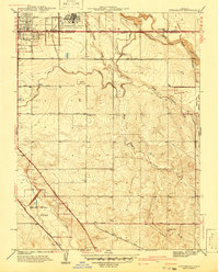
(45)- 1890 Map of East Denver
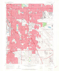
 1890 East Denver1890 Print · USGSDenver and the surrounding plains are captured in the late frontier era as a complex web of irrigation canals and iron rails. Researchers can trace early water systems like the High Line Ditch or locate early settlements such as Parker's and Scranton.
 - 1935 Map of East Denver Nos. 3 and 4
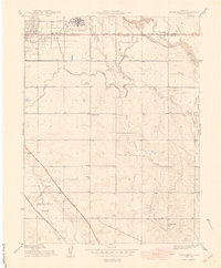
 1935 East Denver Nos. 3 and 41935 Print · USGSSoutheast Denver and the surrounding High Plains are captured here in the mid-1930s as residential growth began to push into Douglas County. Researchers can locate early landmarks like Fairmount Cemetery, the settlement of Sullivan, and the Melvin Sch.
 - 1940 Map of Englewood
 1940 Englewood1940 Print · USGSBefore the postwar boom, South Denver and Englewood were a landscape of grand country clubs and critical water infrastructure. Trace the early boundaries of Lowry Field Military Reservation and historic sites like Sullivan and the University of Denver.
 - 1941 Map of Fitzsimons
 1941 Fitzsimons1941 Print · USGSArapahoe County was a landscape of military expansion and rural education just before the war. Trace the early boundaries of the Fitzsimons General Hospital and find local landmarks like Pleasant View Sch and the High Line Canal.2 unique versions available
 - 1942 Map of Highland Ranch
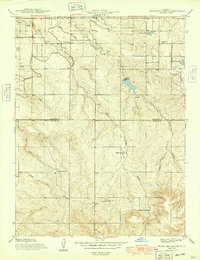
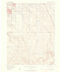
 1942 Highland Ranch1942 Print · USGSThe northern Douglas County ranchlands appear here in the early 1940s as a quiet expanse of large family estates and critical water canals. Researchers can trace the early boundaries of Highland Ranch, locate the Cheese Ranch, and find rural landmarks like Curtis Sch and the Englewood Dam.
 - 1942 Map of Parker
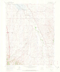
 1942 Parker1942 Print · USGSSoutheast of Denver in the late thirties and early forties, this landscape shows the rural agricultural roots and water management systems of Douglas County. Genealogists can locate family-named landmarks and community centers like Parker, Melvin, and the Happy Canyon Sch.
 - 1944 Map of Englewood
 1944 Englewood1944 Print · USGSDenver and its southern suburbs appear during a period of significant mid-century growth and military expansion. Genealogists and local historians can trace the early grids of Englewood, find the original University of Denver campus, or locate family plots in Fairmount Cemetery.
 - 1948 Map of Fitzsimons
 1948 Fitzsimons1948 Print · USGSThe eastern edges of Denver and Aurora were defined by major military installations and high-plains irrigation in the late 1940s. Genealogists and historians can trace the early development of Smoky Hill Park and the grounds of Fitzsimons General Hospital.
 - 1949 Map of Highland Ranch
 1949 Highland Ranch1949 Print · USGSArapahoe and Douglas counties were still defined by sprawling cattle operations and critical water infrastructure during the late 1940s. Genealogists and local historians can locate early landmarks like Cheese Ranch, Curtis Sch, and the original Highland Ranch headquarters.2 unique versions available
 - 1949 Map of Parker
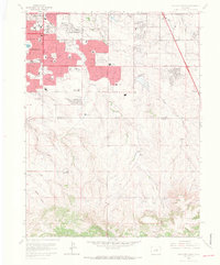
 1949 Parker1949 Print · USGSThe high plains south of Denver are captured here in the late 1940s, a period of rural agriculture before the region's rapid suburban growth. Genealogists and historians can trace old homestead routes and irrigation works like the Arapaho Canal or find the sites of Cherry Creek Sch and Melvin.
 - 1950 Map of Englewood
 1950 Englewood1950 Print · USGSDenver and Englewood are seen during a period of rapid post-war expansion, blending urban civic centers with emerging suburban country clubs. Researchers can trace historic burial sites at Fairmount Cemetery or locate the settlement of Sullivan near the Highline Canal.
 - 1953 Map of Denver, 1964 Print
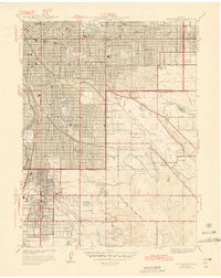
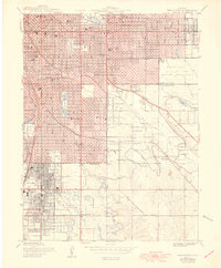
 1953 Denver1964 Print · USGSDenver and the Colorado Front Range are captured here during a decade of post-war growth and military expansion. Researchers can trace the sprawling rail lines of the Union Pacific, locate the State Capitol, and explore historic mountain mining hubs like Central City.6 unique versions available
 - 1957 Map of Denver
 1957 Denver1957 Print · USGSDenver and the Colorado Front Range are seen here during a mid-century period of intense military and urban expansion. Trace the footprints of the Rocky Mountain Arsenal, the early United States Air Force Academy, and the Lowry AF Base.
 - 1957 Map of Parker, 1958 Print
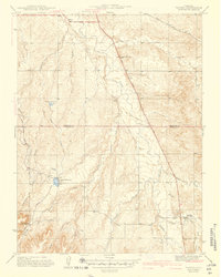
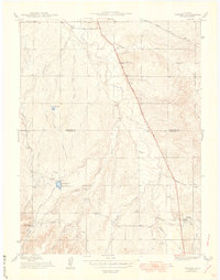
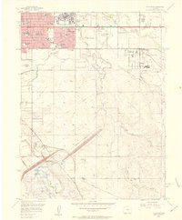
 1957 Parker1958 Print · USGSParker and the surrounding Douglas County ranch lands are caught in a moment of early development during the late fifties. Genealogists and historians can locate the Parker townsite, the Cemetery, and early infrastructure like the Aurora Water Supply.2 unique versions available
 - 1957 Map of Highlands Ranch, 1958 Print
 1957 Highlands Ranch1958 Print · USGSDouglas and Arapahoe counties are shown here in the late fifties as the area south of Denver began its suburban transition. Genealogists and local historians can trace the foundations of Greenwood Village, the footprint of Cheese Ranch, and the early site of Bar None Airport.2 unique versions available
 - 1957 Map of Fitzsimons, 1958 Print
 1957 Fitzsimons1958 Print · USGSAurora and eastern Arapahoe County are captured here during a mid-century era of rapid growth and military activity. Researchers can find specific local landmarks like Mount Nebo Cem, Fitzsimons Army Hospital, and the Drive-in Theater.2 unique versions available
 - 1957 Map of Englewood, 1958 Print
 1957 Englewood1958 Print · USGSDenver and Englewood are seen during a period of intense mid-century expansion, from the downtown state buildings to the nascent suburbs. Researchers can locate vanished institutions and early aviation sites like Lowry Air Force Base and Stapleton Field Municipal Airport.
 - 1958 Map of Denver
 1958 Denver1958 Print · USGSDenver and the Colorado Front Range are captured here during the mid-century suburban boom. Trace the footprints of military installations like Buckley Air Force Base alongside the established rail networks of the Colorado & Southern Ry.
 - 1960 Map of Denver
 1960 Denver1960 Print · USGSDenver and the Colorado Front Range are seen here at a pivotal moment of postwar expansion into the plains and foothills. Researchers can trace the mid-century rail network of the Denver & Rio Grande Western RR and locate historic institutional landmarks like Buckley Field and the Colorado School of Mines.
 - 1965 Map of Fitzsimons, 1966 Print
 1965 Fitzsimons1966 Print · USGSAurora and East Denver are captured during a period of intense mid-century growth, as military installations and suburban neighborhoods began to transform the plains. Genealogists and historians can locate dozens of local landmarks like Fitzsimons General Hospital, Highline Canal, and Meadow Hills Country Club.8 unique versions available
 - 1965 Map of Englewood, 1967 Print
 1965 Englewood1967 Print · USGSDenver and Englewood are shown during a period of rapid suburban maturation in the mid-sixties. Local researchers can trace the development of Lowry Air Force Base, the historic Fairmount Cemetery, and the urban sprawl surrounding the University of Denver.9 unique versions available
 - 1965 Map of Parker, 1967 Print
 1965 Parker1967 Print · USGSThe Douglas and Arapahoe county line area in the mid-sixties shows a landscape of rural gulches transitioning toward suburban development. Researchers can trace the early layout of Grandview Estates, the Lewis Cem, and the massive Cherry Creek Reservoir.7 unique versions available
 - 1965 Map of Highlands Ranch, 1967 Print
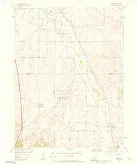
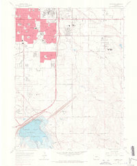
 1965 Highlands Ranch1967 Print · USGSThe Highlands Ranch area is captured here during the mid-sixties as suburban neighborhoods began to push south from Denver. Researchers can trace the early footprint of Littleton and Greenwood Village alongside historic rural properties like McArthur Ranch and Cheesman Ranch.8 unique versions available
 - 1981 Map of Denver East
 1981 Denver East1981 Print · USGSEastern Colorado comes alive in the early eighties as the Front Range urban corridor pushes into the plains. Genealogists and historians can trace the growth of Aurora and Brighton alongside the historic Union Pacific line and the massive Rocky Mountain Arsenal.2 unique versions available
 - 1997 Map of Englewood, 1999 Print
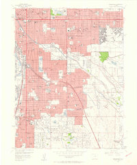
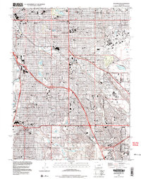 1997 Englewood1999 Print · USGSThe Denver metropolitan area is captured here during a period of significant suburban maturity in the late nineties. Genealogists and local historians can locate prominent landmarks such as Fairmount Cemetery, St Marys Academy, and the University of Denver.
Showing maps 1-25 of 45
Top cities near Greenwood Village
- Denver historical maps
- Aurora historical maps
- Lakewood historical maps
- Thornton historical maps
- Arvada historical maps
- Westminster historical maps
See more
Frequently asked questions
- What are the different types of historical maps available for Greenwood Village?
- What is the oldest map of Greenwood Village?
- Where can I purchase historical maps of Greenwood Village for my home or office?
- Where can I download high-res historical maps of Greenwood Village?
- Are there historical topographic maps available for Greenwood Village?
- Is there historical aerial imagery available for Greenwood Village?
- Where are historical maps of Greenwood Village sourced from?