1960s Maps of Custer County, Colorado
Explore 12 historic maps of Custer County from the 1960s. These maps offer a rare glimpse into what life looked like during the 1960s — showing old roads, neighborhoods, homes, and landmarks that have changed or disappeared over time.
Whether you're researching your family's past, planning a metal detecting trip, or studying how Custer County's landscape evolved across the 1960s, these high-resolution maps are a powerful tool for exploring the history of this region.
- Focus on a specific era: All maps on this page are from the 1960s, giving you a focused view of this time period.
- See what’s changed: Compare century-old streets, trails, and buildings to today's modern landscape using overlays and satellite layers.
- Research with precision: Use these maps for genealogy, historical research, land use analysis, or educational projects.
- View, download, or print: Maps are fully viewable online in high resolution, and can be downloaded or printed for your own records.
Start exploring Custer County's history through authentic maps from the 1960s. This is your window into the past.
Custer County, CO maps
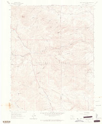
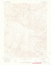
(12)- 1960 Map of Beck Mountain, 1963 Print
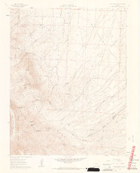 1960 Beck Mountain1963 Print · USGSHigh-country ranching and remote mountain passes define this 1960s survey of the Sangre de Cristo range. Trace the location of the Beck School, family landmarks like Henrich Ranch, and high-altitude routes through Music Pass.6 unique versions available
 - 1960 Map of Devils Gulch, 1963 Print
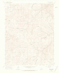
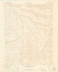 1960 Devils Gulch1963 Print · USGSHigh ranching country along the Custer and Huerfano county line is shown here at the start of the 1960s. Genealogists and historians can trace the locations of family-held water rights and homesteads including Akin Ranch, the Bradford (Site), and Hess Windmill.4 unique versions available
 - 1962 Map of Pueblo
 1962 Pueblo1962 Print · USGSThe Front Range and high plains meet in the early sixties as military installations and industrial mining shape the corridor from Colorado Springs to Pueblo. Genealogists can trace family names through rural landmarks like the Columbine School, Hanover Church, and Fairview Cem.
 - 1963 Map of Wetmore, 1965 Print
 1963 Wetmore1965 Print · USGSCuster and Pueblo counties appear here in the early 1960s, showing the intersection of local ranching life and national forest land. Researchers can trace the water-carved landscape of Hardscrabble Creek and locate historic sites like Wetmore, Greenwood, and the Don K Ranch.3 unique versions available
 - 1963 Map of Hardscrabble Mountain, 1965 Print
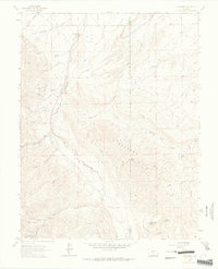
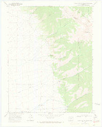
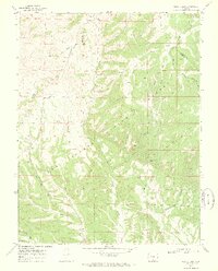
 1963 Hardscrabble Mountain1965 Print · USGSCuster County was a landscape of high peaks and isolated school districts in the early 1960s. Researchers can locate the Silver Park Sch and the settlement of Ilse, or trace the paths of the Highline Trail near Hardscrabble Mountain.3 unique versions available
 - 1963 Map of Saint Charles Peak, 1966 Print
 1963 Saint Charles Peak1966 Print · USGSThe high country of the Front Range unfolds here in the early sixties, showing the rugged divide between Custer and Pueblo counties. Genealogists and hikers can trace the old Mace Trail or locate family-named sites like Burris Meadow and Fairview.3 unique versions available
 - 1963 Map of Deer Peak, 1966 Print
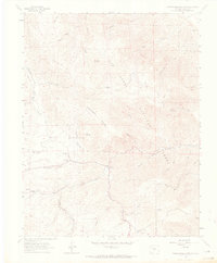
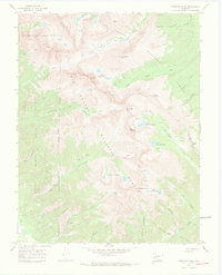
 1963 Deer Peak1966 Print · USGSThe high alpine peaks of the Sangre de Cristo foothills are captured here in the mid-1960s. Genealogists and historians can trace high-country life through sites like Abbey Summer Camp, the prominent radio tower, and early mountain clearings like Lilly Park.3 unique versions available
 - 1966 Map of Pueblo
 1966 Pueblo1966 Print · USGSThe Front Range and Arkansas River Valley are captured here in the mid-1960s, showing a landscape shaped by mining, military expansion, and rail. Researchers can locate numerous country schools and mines, such as the Lytle School, Pioneer Cem, and Empire Zinc Mine.
 - 1967 Map of Valley View Hot Springs, 1971 Print
 1967 Valley View Hot Springs1971 Print · USGSSaguache County ranching and mining history come alive in the late sixties along the mountain front. Genealogists and industrial historians can locate the Cotton Creek Cem, the Orient Mine, and an Old Railroad Grade used to haul ore.2 unique versions available
 - 1967 Map of Crestone Peak, 1971 Print
 1967 Crestone Peak1971 Print · USGSHigh in the Sangre de Cristo Range during the late sixties, this survey captures the transition from historic mining to wilderness recreation. Trace old mines and alpine pack routes like the Rainbow Trail and Music Pass Trail.6 unique versions available
 - 1969 Map of San Isabel, 1973 Print
 1969 San Isabel1973 Print · USGSThe high Sangre de Cristo foothills near the Custer and Pueblo county lines are captured here in the late sixties. Researchers can trace historic mountain routes like the Cisneros Trail and Bartlett Trail or locate landmarks such as Rooster Spring and Lazy Acres Camp.2 unique versions available
 - 1969 Map of Bear Creek, 1973 Print
 1969 Bear Creek1973 Print · USGSHuerfano and Custer counties come together at Greenhorn Mountain in the late sixties, a landscape of high-country drainage and forest. Researchers can trace historic access routes like Gardner Road and locate remote prospects and Blue Spring.3 unique versions available
End of results
Showing maps 1-12 of 12
Top cities of Custer County
Frequently asked questions
- What are the different types of historical maps available for Custer County?
- What is the oldest map of Custer County?
- Where can I purchase historical maps of Custer County for my home or office?
- Where can I download high-res historical maps of Custer County?
- Are there historical topographic maps available for Custer County?
- Is there historical aerial imagery available for Custer County?
- Where are historical maps of Custer County sourced from?