Old Maps of Lake County, Colorado for Genealogy
Trace your family roots with 115 historic maps of Lake County. These high-res maps reveal old neighborhoods, homesites, landmarks, and streets — helping you uncover where your ancestors lived and how the area evolved over time.
- Explore historic neighborhoods: Identify where your relatives may have lived in the 1800s or 1900s.
- Compare maps over time: Trace the changes in streets, buildings, and landmarks for multi-generational research.
- Perfect for genealogy & ancestry research: Used by family historians and researchers to map out lineage and migration.
These maps are an incredible resource for exploring your personal connection to Lake County's past.
Lake County, CO maps
(115)- 1889 Map of Leadville, 1955 Print
 1889 Leadville1955 Print · USGSThe Colorado high country at the peak of its mining era reveals a landscape of high-altitude rail lines and booming silver camps. Genealogists and historians can trace the early rail routes of the Colorado Midland Railway, find the origins of Leadville, and locate mountain settlements like Alma and Kokomo.
 - 1891 Map of Leadville
 1891 Leadville1891 Print · USGSThe Silver City and its surrounding mining camps are caught at their industrial height in the 1880s and 90s. Trace the competing rail lines and high-altitude settlements from Holy Cross City to the busy streets of Leadville and London Park City.7 unique versions available
 - 1909 Map of Mount Jackson, 1955 Print
 1909 Mount Jackson1955 Print · USGSPitkin County was a thriving center of high-country mining and railroading during the early 1900s. Genealogists and historians can trace the rail lines of the Colorado Midland Railway and locate vanished sites like Ashcroft and the Little Annie Mine.2 unique versions available
 - 1911 Map of Mount Jackson
 1911 Mount Jackson1911 Print · USGSThe high Rockies of Pitkin and Eagle Counties are captured here at the peak of the mountain rail era. Researchers can trace the dual tracks of the Colorado Midland RR and the Denver and Rio Grande RR past Aspen and the Little Annie Mine.3 unique versions available
 - 1934 Map of Climax
 1934 Climax1934 Print · USGSThe Colorado high country in the mid-1930s reveals a landscape of industrial mining and high-altitude transport. Trace the routes of the Colorado and Southern RR or locate the historic mining district of Quartzville and the London Mine.
 - 1935 Map of Mount Elbert, 1955 Print
 1935 Mount Elbert1955 Print · USGSThe Lake County high country comes alive in the mid-1930s, showing a landscape defined by mining, mountain trails, and the headwaters of the Arkansas. Genealogists and researchers can trace the rail stops at Yale Sta, old mines like the Columbine Mine, and early mountain pathways like the Mt Elbert Trail.4 unique versions available
 - 1938 Map of Mt. Lincoln
 1938 Mt. Lincoln1938 Print · USGSSummit and Park counties are captured here in the late 1930s, documenting the high-altitude mining landscape of the Tenmile Range. Researchers can trace the early footprints of Alma, the mining sites at Kokomo and London, and historic routes over Mosquito Pass.7 unique versions available
 - 1938 Map of Mount Elbert, 1944 Print
 1938 Mount Elbert1944 Print · USGSThe Colorado high country in the late thirties is defined by its massive peaks and the industrial rail lines of the Arkansas River valley. Trace historic mining sites like Columbine Mine and rail stops at Malta and Yale Sta.
 - 1939 Map of Mount Elbert
 1939 Mount Elbert1939 Print · USGSThe high peaks and mining corridors of Lake County are captured here in the late thirties as the industrial legacy of the Rockies met new conservation and water projects. Genealogists and historians can trace the rail lines through Leadville, locate the Columbine Mine, or find the Soda Springs Sch near the Arkansas River.2 unique versions available
 - 1942 Map of Leadville, 1943 Print
 1942 Leadville1943 Print · USGSHigh in the Rockies during the early war years, this area served as a critical hub for military training and mining operations. Trace the rail lines of the Denver and Rio Grande Western RR and find local landmarks like the U. S. Fish Hatchery or the Adelaide mine.
 - 1945 Map of Mount Lincoln
 1945 Mount Lincoln1945 Print · USGSBreckenridge and the surrounding mining districts were still active industrial hubs when this survey was updated in the mid-1940s. Researchers can trace historic claims and mineral landmarks such as USLM No 16 and the remote high-altitude site of Climax.2 unique versions available
 - 1949 Map of Holy Cross, 1955 Print
 1949 Holy Cross1955 Print · USGSThe Eagle River valley and the high-altitude terrain of the Sawatch Range are captured here just after the war. You can trace the military history of Camp Hale and find old mining claims like the Matchless Mine or the remote Holy Cross City.7 unique versions available
 - 1951 Map of Holy Cross
 1951 Holy Cross1951 Print · USGSHigh in the Sawatch Mountains during the post-war era, this region shows a landscape shaped by military training and alpine mining. Researchers can trace the layout of Camp Hale, locate the Homestake Mine, or find the high-altitude Evergreen Cem.2 unique versions available
 - 1957 Map of Leadville, 1978 Print
 1957 Leadville1978 Print · USGSHigh-country mining and rail transport define the central Colorado Rockies during the mid-to-late twentieth century. Researchers can trace the industrial footprints of Gilman and Climax, find small rail stops like Malta, and follow the Denver and Rio Grande Western RR.2 unique versions available
 - 1959 Map of Leadville
 1959 Leadville1959 Print · USGSThe Colorado high country in the late fifties is a landscape of mining history and military training, from the streets of Leadville to the Camp Hale grounds. Genealogists and historians can trace the Denver and Rio Grande Western RR alongside now-deserted sites like Ashcroft and Independence.
 - 1960 Map of Leadville
 1960 Leadville1960 Print · USGSThe Colorado high country in the mid-fifties comes alive through its mining camps, river valleys, and rail lines. Trace the industrial legacy of the Climax Molybdenum Mine and explore the alpine reaches of the Camp Hale Military Reservation.2 unique versions available
 - 1960 Map of Mount Champion, 1964 Print
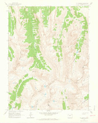 1960 Mount Champion1964 Print · USGSThe high Sawatch Range is documented here at the start of the 1960s, capturing the high-altitude divide between the Roaring Fork and Fryingpan basins. Researchers can trace the legacy of alpine mining at the Champion Mine or follow routes across the Continental Divide and South Fork Pass.4 unique versions available
 - 1960 Map of Independence Pass, 1965 Print
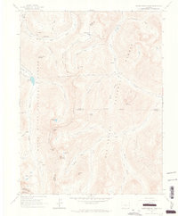 1960 Independence Pass1965 Print · USGSThe high country around the Continental Divide was still a landscape of active water engineering and remnant mining in the 1960s. Researchers can trace the trans-basin New York Collection Canal and find mining era sites like Independence and Ruby Mine.5 unique versions available
 - 1961 Map of South Peak, 1963 Print
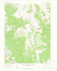 1961 South Peak1963 Print · USGSThe high mountain divide of the central Rockies is captured in the early sixties as it straddles three counties. Trace the path of the Denver and Rio Grande Western near Columbia or locate the Old Railroad Grade and Buffalo Meadows.3 unique versions available
 - 1961 Map of Mount Sherman, 1963 Print
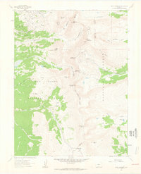 1961 Mount Sherman1963 Print · USGSThe Mosquito Range was a hive of high-altitude industry in the early sixties, as shown by this detailed survey of the Lake and Park County line. Researchers can trace historic mining operations like the Hilltop Mine and Printer Boy Hill or locate the old Sawmill near Weston Pass.5 unique versions available
 - 1962 Map of Leadville
 1962 Leadville1962 Print · USGSThe Colorado high country in the early sixties was a rugged landscape of mining camps, military training grounds, and emerging ski towns. Researchers can trace the legacy of Camp Hale, locate the Molybdenum mine near Leadville, and follow the Denver and Rio Grande Western RR through the canyons.
 - 1964 Map of Leadville
 1964 Leadville1964 Print · USGSColorado's high country is captured here during the mid-1960s, showing the intersection of mining history and mountain transport. Trace the legacy of high-altitude industry at the Climax Molybdenum Mine or follow the rails of the Colorado and Southern Ry past Leadville.
 - 1967 Map of Granite, 1972 Print
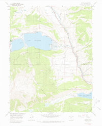 1967 Granite1972 Print · USGSThe Arkansas River valley during the mid-sixties reveals a landscape of high-altitude mining and early mountain tourism. Researchers can trace the Denver and Rio Grande Western RR as it passes Granite and locate the Columbine Mine.3 unique versions available
 - 1967 Map of Mount Elbert, 1972 Print
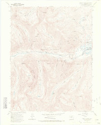 1967 Mount Elbert1972 Print · USGSThe Sawatch Range reaches its zenith in the late sixties, showing the high-altitude mines and trails surrounding Mount Elbert. Trace historic claims like the Golden Fleece Mine or locate the shoreline of the Twin Lakes Reservoir.4 unique versions available
 - 1967 Map of Mount Massive, 1972 Print
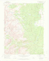 1967 Mount Massive1972 Print · USGSHigh in the Sawatch Range during the late sixties, this survey details the intersection of industrial engineering and mountain wilderness. Researchers can trace the Old RR Grade and find historic sites like Soda Springs or the Leadville National Fish Hatchery.5 unique versions available
Showing maps 1-25 of 115
Top cities of Lake County
Frequently asked questions
- What are the different types of historical maps available for Lake County?
- What is the oldest map of Lake County?
- Where can I purchase historical maps of Lake County for my home or office?
- Where can I download high-res historical maps of Lake County?
- Are there historical topographic maps available for Lake County?
- Is there historical aerial imagery available for Lake County?
- Where are historical maps of Lake County sourced from?