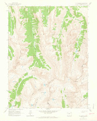
1960 Map of Mount Champion
USGS Topo · Published 1964About this map
The Continental Divide serves as the high-altitude spine of this 1960 survey, separating the headwaters of the Roaring Fork River from the Fryingpan River drainage. High in the mountains, industrial artifacts of the mining era persist, notably the Champion Mine and its accompanying Aerial Tramway near the peak of Mt Champion. This landscape is defined by its glaciated basins, containing numerous high-altitude water bodies such as Lost Man Lake, Independence Lake, and Linkins Lake.
Find a feature on this map
36 named features on this map. Tap any name to fly to it.
Don’t see what you’re looking for? This feature index may not catch every label — zoom into the map to look around manually.
Map Details
Editions of this 1960 Mount Champion Map
4 editions found
Other maps of this area

1889 · Leadville
USGS Topo · 1:125,000

1891 · Leadville
USGS Topo · 1:125,000

1909 · Mount Jackson
USGS Topo · 1:125,000

1911 · Mount Jackson
USGS Topo · 1:125,000

1935 · Mount Elbert
USGS Topo · 1:62,500

1938 · Mount Elbert
USGS Topo · 1:62,500

1939 · Mount Elbert
USGS Topo · 1:62,500

1942 · Leadville
USGS Topo · 1:125,000

1949 · Holy Cross
USGS Topo · 1:62,500

1951 · Holy Cross
USGS Topo · 1:62,500