2020s Maps of Fort Collins, Colorado
Explore 7 historic maps of Fort Collins from the 2020s. These maps offer a rare glimpse into what life looked like during the 2020s — showing old roads, neighborhoods, homes, and landmarks that have changed or disappeared over time.
Whether you're researching your family's past, planning a metal detecting trip, or studying how Fort Collins's landscape evolved across the 2020s, these high-resolution maps are a powerful tool for exploring the history of this region.
- Focus on a specific era: All maps on this page are from the 2020s, giving you a focused view of this time period.
- See what’s changed: Compare century-old streets, trails, and buildings to today's modern landscape using overlays and satellite layers.
- Research with precision: Use these maps for genealogy, historical research, land use analysis, or educational projects.
- View, download, or print: Maps are fully viewable online in high resolution, and can be downloaded or printed for your own records.
Start exploring Fort Collins's history through authentic maps from the 2020s. This is your window into the past.
Fort Collins, CO maps
(7)- 2022 Map of Windsor, 2022 Print
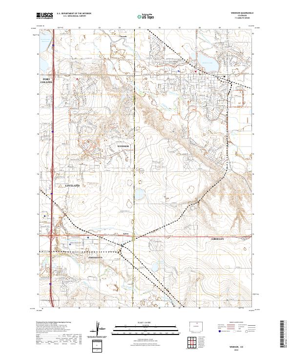 2022 Windsor2022 Print · USGSNorthern Colorado enters the twenty-first century as a landscape defined by historic water engineering and growing towns. Researchers can trace the legacy of irrigation at Greeley Number 2 Canal and locate the Lakeview Cem near Windsor Lake.
 - 2022 Map of Masonville, 2022 Print
 2022 Masonville2022 Print · USGSThe area west of Loveland and Fort Collins is captured here in the early 2020s, showcasing a landscape of high-desert ridges and historic ranches. Genealogists can trace family names at the Rhodes Family Cem and Boothroyd - Hutchinson Cem or explore the rugged Devil's Backbone.
 - 2022 Map of Fort Collins, 2022 Print
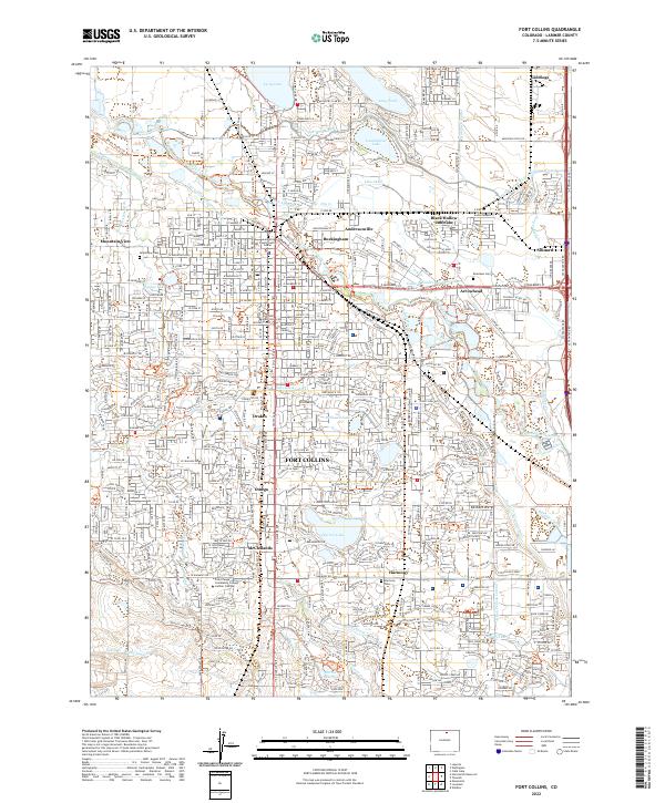 2022 Fort Collins2022 Print · USGSFort Collins in the 2020s shows a dense network of historic neighborhoods and modern institutions shaped by the Cache la Poudre River. Researchers can trace family sites at Grandview Cem or locate early settlements like Buckingham and McClellands.
 - 2022 Map of Loveland, 2022 Print
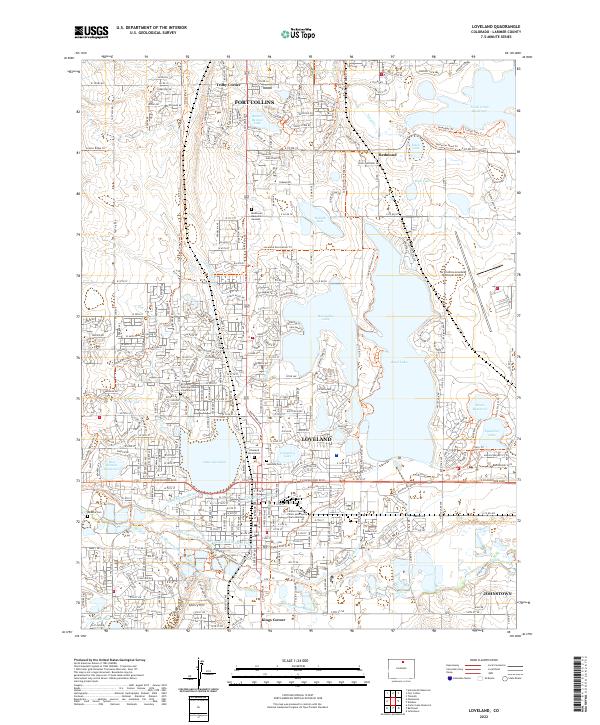 2022 Loveland2022 Print · USGSLarimer County at the start of the 2020s shows a sophisticated landscape of water management and suburban expansion. Researchers can trace the complex irrigation systems of the Big Thompson River or find family sites at Modena Cem and Loveland Burial Park.
 - 2022 Map of Timnath, 2022 Print
 2022 Timnath2022 Print · USGSNorthern Colorado at the peak of its modern development reveals a landscape of irrigation canals and growing municipalities. Trace local roots at Timnath Cem or follow the historic waterways like Boxelder Ditch and the Cache la Poudre River.
 - 2022 Map of Horsetooth Reservoir, 2022 Print
 2022 Horsetooth Reservoir2022 Print · USGSThe eastern foothills of the Rockies meet the western edge of Fort Collins in this recent survey of Larimer County. Researchers can locate remote burial sites like the U S Soldier Grave and Patterson Grave or trace water systems from College Lake to the shoreline of Horsetooth Reservoir.
 - 2022 Map of Wellington, 2022 Print
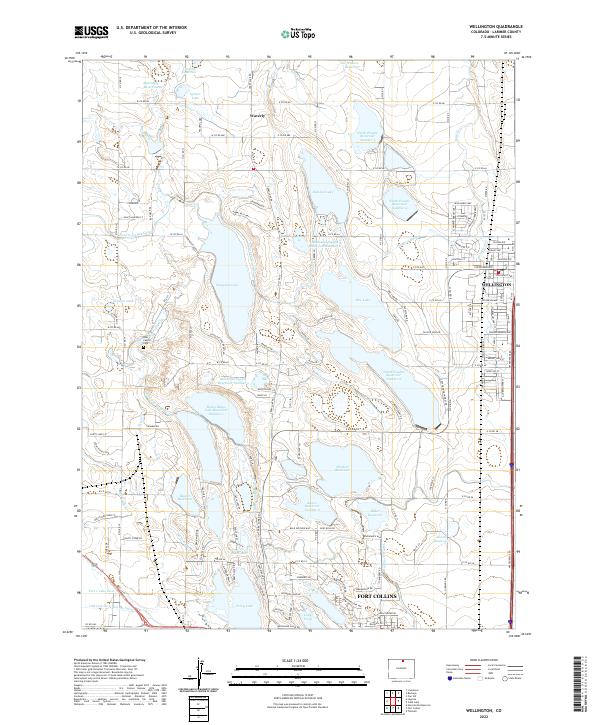 2022 Wellington2022 Print · USGSNorthern Colorado's high plains are defined by an intricate network of irrigation canals and reservoirs in the early 2020s. Researchers can trace historic water rights and family ties through features like the Poudre Valley Canal, Waverly, and the Reu Family Cem.
End of results
Showing maps 1-7 of 7
Top cities near Fort Collins
- Greeley historical maps
- Loveland historical maps
- Windsor historical maps
- Johnstown historical maps
- Severance historical maps
- Milliken historical maps
See more
Top neighborhoods of Fort Collins
- Harmony Crossing historical maps
- Library Stage historical maps
- Meadow Lark Heights historical maps
- Fairway Estates historical maps
- Oakridge Estates historical maps
- Fairway Estates historical maps
See more
Frequently asked questions
- What are the different types of historical maps available for Fort Collins?
- What is the oldest map of Fort Collins?
- Where can I purchase historical maps of Fort Collins for my home or office?
- Where can I download high-res historical maps of Fort Collins?
- Are there historical topographic maps available for Fort Collins?
- Is there historical aerial imagery available for Fort Collins?
- Where are historical maps of Fort Collins sourced from?