1970s Maps of Logan County, Colorado
Explore 27 historic maps of Logan County from the 1970s. These maps offer a rare glimpse into what life looked like during the 1970s — showing old roads, neighborhoods, homes, and landmarks that have changed or disappeared over time.
Whether you're researching your family's past, planning a metal detecting trip, or studying how Logan County's landscape evolved across the 1970s, these high-resolution maps are a powerful tool for exploring the history of this region.
- Focus on a specific era: All maps on this page are from the 1970s, giving you a focused view of this time period.
- See what’s changed: Compare century-old streets, trails, and buildings to today's modern landscape using overlays and satellite layers.
- Research with precision: Use these maps for genealogy, historical research, land use analysis, or educational projects.
- View, download, or print: Maps are fully viewable online in high resolution, and can be downloaded or printed for your own records.
Start exploring Logan County's history through authentic maps from the 1970s. This is your window into the past.
Logan County, CO maps
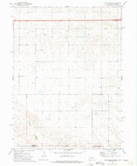
(27)- 1971 Map of Twin Buttes, 1973 Print
 1971 Twin Buttes1973 Print · USGSThe high plains of southeastern Colorado come into focus in the early 1970s, showing a landscape defined by water and wind. Genealogists and historians can locate a solitary Grave and trace the paths of North Butte Creek and Two Butte Creek through the prairie.
 - 1971 Map of Messex, 1984 Print
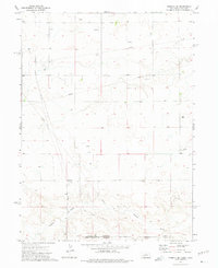
 1971 Messex1984 Print · USGSThe South Platte River valley in the early seventies shows a complex irrigation landscape at the borders of Logan and Morgan Counties. Researchers can trace the Union Pacific rail line through small settlements like Messex and locate landmarks such as the Roosevelt School and Merino Cemetery.
 - 1971 Map of Merino, 1984 Print
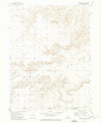
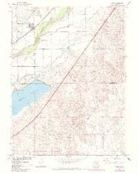 1971 Merino1984 Print · USGSNortheastern Colorado’s agricultural heartland is captured here in the early 1970s, where the river and rail meet at the town of Merino. Researchers can trace the extensive irrigation network including the Pawnee Ditch and the shoreline of the massive Prewitt Reservoir.
 - 1972 Map of Clarkville, 1975 Print
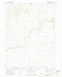
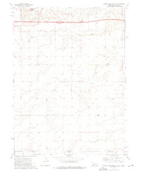
 1972 Clarkville1975 Print · USGSEastern Colorado ranching country is documented here in the early 1970s, at the junction of three counties. Local historians and genealogists can trace family landmarks like Rockland Cem and Bryant Cem, or locate the site of Almhof.2 unique versions available
 - 1972 Map of Easterly Airport, 1975 Print
 1972 Easterly Airport1975 Print · USGSThe Nebraska-Colorado state line is captured here in the early 1970s, showcasing a landscape of high plains ranching and active oil exploration. Researchers can locate the Mount Vernon Community Center, the Easterly Airport, and the seasonal paths of Sand Draw.
 - 1972 Map of New Haven, 1975 Print
 1972 New Haven1975 Print · USGSThe high plains of Northeast Colorado are captured here in the early seventies, showing a quiet rural landscape at the meeting point of three counties. Genealogists and local historians can trace the early layout of New Haven and the paths of Coyote Creek and Red Willow Creek.
 - 1972 Map of Lorenzo, 1975 Print
 1972 Lorenzo1975 Print · USGSThe Nebraska-Colorado border country comes into focus in the early 1970s, showcasing a landscape of high plains industry and rail-line settlements. You can trace the Burlington Northern tracks past the Cem at Lorenzo down to the border hamlet of Nebco.
 - 1972 Map of Potter SW, 1975 Print
 1972 Potter SW1975 Print · USGSThe Nebraska and Colorado borderlands meet in this early 1970s survey, capturing a landscape defined by ranching terrain and energy development. Researchers can trace industrial growth through an extensive Oil Field, numerous Oil Wells, and the path of Sidney Draw.
 - 1972 Map of Lodgepole SW, 1975 Print
 1972 Lodgepole SW1975 Print · USGSThe Nebraska-Colorado borderlands are captured here in the early 1970s, showing a remote agricultural landscape shaped by high plains drainages. Genealogists can locate specific burial sites like Czech Slovensky Cem and Swankee Cem near the seasonal banks of Cow Creek.
 - 1972 Map of Glacken Hill, 1975 Print
 1972 Glacken Hill1975 Print · USGSThe High Plains of Colorado meet at the border of Logan and Washington Counties in the early seventies. Genealogists and local historians can trace the sparse settlement of Fitzjohn or locate specific landmarks like Glacken Hill and the Radio Tower.
 - 1972 Map of St Petersburg, 1975 Print
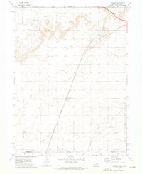
 1972 St Petersburg1975 Print · USGSThe high plains of Logan County come into focus during the early 1970s, showing a landscape of small settlements and industrial infrastructure. Genealogists and local historians can locate the St Peters Cem and trace the layout of St Petersburg near Sandy Creek.
 - 1972 Map of Rockland, 1975 Print
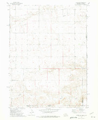
 1972 Rockland1975 Print · USGSThe Colorado plains at the Logan and Phillips County line appear in the early seventies as a landscape of remote ranching outposts and ephemeral waterways. Genealogists and local historians can trace the locations of Rockland, Hunt, and the seasonal flows of Sandy Creek.
 - 1972 Map of Kimball SE, 1975 Print
 1972 Kimball SE1975 Print · USGSThe Nebraska and Colorado borderlands are captured in the early 1970s, showing a landscape defined by energy production and high-plains topography. Trace the local impact of the Oil and Gas Field along Sidney Draw and locate scattered oil wells.
 - 1972 Map of Leroy, 1975 Print
 1972 Leroy1975 Print · USGSThe high plains of eastern Colorado come into focus in the early 1970s, showing a rural landscape defined by ranching sections and early energy infrastructure. Genealogists and local historians can locate the Leroy Cem, trace the winding Sandy Creek, and identify industrial Gravel Pits that shaped the local economy.
 - 1972 Map of Potter SE, 1975 Print
 1972 Potter SE1975 Print · USGSThe Nebraska and Colorado border region in the early seventies reveals a landscape of high plains drainage and industrial utility. Genealogists and local historians can trace the small settlement of Olsen and activity near Sidney Draw or the various Gravel Pits.
 - 1972 Map of Sidney Muni. Airport, 1976 Print
 1972 Sidney Muni. Airport1976 Print · USGSThe Nebraska-Colorado high plains are captured in the early seventies as Interstate 80 and modern aviation reshape the landscape near Sidney. Researchers can locate the Grand Prairie Cem, Trinity Sch, and a mid-century Drive-in Theater.
 - 1972 Map of Sidney SE, 1976 Print
 1972 Sidney SE1976 Print · USGSThe high plains of the Nebraska-Colorado border are captured here in the early seventies, just as the modern interstate system reached this rural stretch. Researchers can trace the original county line and locate local landmarks like School No 97 and several Gravel Pits along Cow Creek.
 - 1973 Map of Buffalo Springs Ranch NW, 1976 Print
 1973 Buffalo Springs Ranch NW1976 Print · USGSThe High Plains along the Logan and Washington County line are captured in the early 1970s, showing a landscape of institutional research and frontier history. Genealogists and historians can locate the Historical Marker (Summit Springs Battlefield) and the Colo State University Research Station.
 - 1973 Map of Buffalo Springs Ranch NE, 1976 Print
 1973 Buffalo Springs Ranch NE1976 Print · USGSThe Colorado plains at the Logan and Washington county line appear here during the early seventies. Genealogists and researchers can locate rural gathering spots like the Kelly Community Center and trace landmarks like Rock Creek and the Pipeline.3 unique versions available
 - 1977 Map of Dipper Spring, 1978 Print
 1977 Dipper Spring1978 Print · USGSThe High Plains of northeast Colorado are shown in the 1970s at the intersection of Weld and Logan Counties. Genealogists and historians can trace ranching and energy land use through Cervi Ranch and features like Dipper Gap and Hackberry Reservoir.
 - 1977 Map of Stoneham NE, 1978 Print
 1977 Stoneham NE1978 Print · USGSNortheastern Colorado rangeland at the Logan-Weld county line comes into focus in the late seventies. Researchers can trace the water systems of the East Stoneham Reservoir and Pawnee Inlet No 2 or locate scattered petroleum sites like an Oil Well and Drill Hole.
 - 1977 Map of Avalo SE, 1978 Print
 1977 Avalo SE1978 Print · USGSThe Weld and Logan county line in the late 1970s shows a landscape of prairie drainages and emerging energy development. Genealogists and historians can trace local landmarks like Kester or follow the paths of Cedar Creek and Spring Creek across the open plains.
 - 1978 Map of Kirchnavy Butte
 1978 Kirchnavy Butte1978 Print · USGSLogan County during the late 1970s shows a landscape of high plateaus and energy exploration. Researchers can trace the intersection of cattle country and industry through sites like Kirchnavy Butte, Dead Man Spring, and the vast Peetz Table.
 - 1978 Map of Chimney Canyons
 1978 Chimney Canyons1978 Print · USGSLogan County ranching and energy development meet in the late 1970s among the high plains canyons. Researchers can locate the Rocky Buttes School, trace the extent of the local Oil Field, and find landmarks like West Chimney and The Rocks.
 - 1978 Map of North Sterling Reservoir
 1978 North Sterling Reservoir1978 Print · USGSLogan County's high plains were defined by water management and energy exploration in the late seventies. Researchers can trace the extensive shoreline of North Sterling Reservoir, the North Sterling Canal, and rural landmarks like the Rodeo Ground.
Showing maps 1-25 of 27
Top cities of Logan County
- Sterling historical maps
- Fleming historical maps
- Merino historical maps
- Peetz historical maps
- Iliff historical maps
- Crook historical maps
Frequently asked questions
- What are the different types of historical maps available for Logan County?
- What is the oldest map of Logan County?
- Where can I purchase historical maps of Logan County for my home or office?
- Where can I download high-res historical maps of Logan County?
- Are there historical topographic maps available for Logan County?
- Is there historical aerial imagery available for Logan County?
- Where are historical maps of Logan County sourced from?