1900s (20th Century) Maps of Logan County, Colorado
Explore 63 historic maps of Logan County from the 1900s (20th Century). These maps offer a rare glimpse into what life looked like during the 1900s — showing old roads, neighborhoods, homes, and landmarks that have changed or disappeared over time.
Whether you're researching your family's past, planning a metal detecting trip, or studying how Logan County's landscape evolved across the 1900s, these high-resolution maps are a powerful tool for exploring the history of this region.
- Focus on a specific era: All maps on this page are from the 1900s, giving you a focused view of this time period.
- See what’s changed: Compare century-old streets, trails, and buildings to today's modern landscape using overlays and satellite layers.
- Research with precision: Use these maps for genealogy, historical research, land use analysis, or educational projects.
- View, download, or print: Maps are fully viewable online in high resolution, and can be downloaded or printed for your own records.
Start exploring Logan County's history through authentic maps from the 1900s. This is your window into the past.
Logan County, CO maps
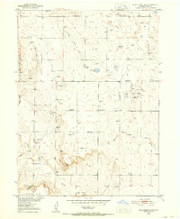
(63)- 1951 Map of Reiradon Hill, 1952 Print
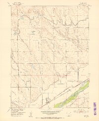
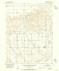
 1951 Reiradon Hill1952 Print · USGSLogan County ranching and state infrastructure meet in the early fifties among the high ridges of the plains. Trace local landmarks like Fyffe School, the State Patrol Pistol Range, and family-named elevations including VABM Meyers.4 unique versions available
 - 1951 Map of Willard, 1952 Print
 1951 Willard1952 Print · USGSWillard and the surrounding Logan County plains are captured here in the early 1950s, showing a landscape defined by the railroad and irrigation. Researchers can trace the Chicago Burlington and Quincy rail line, locate Prairie Lawn Cemetery, and find the Pawnee Valley School.3 unique versions available
 - 1951 Map of Messex, 1952 Print
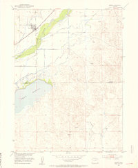
 1951 Messex1952 Print · USGSEastern Colorado plains life in the early fifties revolves around the river and the rails. Trace family roots at the Roosevelt School or Merino Cemetery, and explore the vital irrigation systems including the Sterling Canal and Prewitt Reservoir.4 unique versions available
 - 1951 Map of Sterling South, 1952 Print
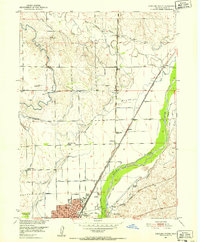
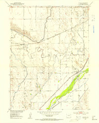
 1951 Sterling South1952 Print · USGSThe South Platte River valley and the city of Sterling are shown here in the early fifties, at the height of the sugar beet era. Genealogists and researchers can trace the rail corridors of the Union Pacific and identify landmarks like Riverside Cemetery, Columbine Sch, and the Sugar Factory.4 unique versions available
 - 1951 Map of Sterling North, 1952 Print
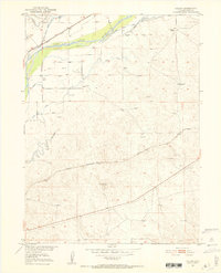
 1951 Sterling North1952 Print · USGSLogan County in the early fifties shows a thriving agricultural hub centered on the South Platte River. Genealogists and local historians can trace rural school districts like Springdale Valley School and the early campus of Sterling Junior College.4 unique versions available
 - 1951 Map of Galien, 1952 Print
 1951 Galien1952 Print · USGSLogan County ranching and irrigation are captured here in the early fifties, following the path of the South Platte River. Genealogists and historians can trace the Union Pacific rail line and locate specific family landmarks like the Frank Blair Ranch and the Harris Ranch Gate.4 unique versions available
 - 1951 Map of Wild Horse Lake, 1952 Print
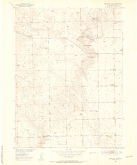
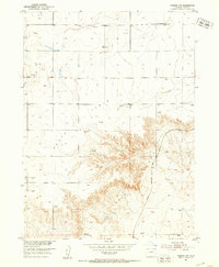
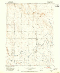
 1951 Wild Horse Lake1952 Print · USGSThe Logan County high plains come into focus in the early fifties during a period of oil discovery and post-war rural development. Trace family landmarks like Graylin School and Liberty School alongside the emerging derricks of the Yenter Pool.2 unique versions available
 - 1951 Map of Atwood NE, 1953 Print
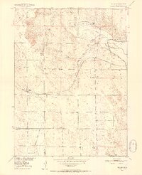
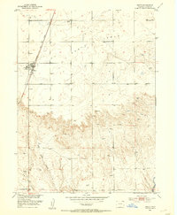
 1951 Atwood NE1953 Print · USGSLogan County in the early fifties reveals a productive landscape of high-plains ranching and emerging energy production. Researchers can locate rural landmarks like the Mt Hope School and Drive-in Theater, or trace irrigation networks along the North Sterling Canal.2 unique versions available
 - 1951 Map of Iliff, 1953 Print
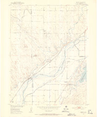
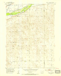
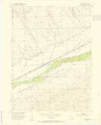
 1951 Iliff1953 Print · USGSLogan County ranching and rail history come to life in the early 1950s along the South Platte River. Local researchers can trace the Union Pacific line through Iliff, locate the site of Selma (Aban'd), and follow the paths of the Iliff Ditch and Lewis Creek.3 unique versions available
 - 1951 Map of Merino, 1953 Print
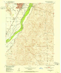
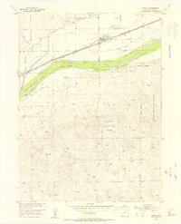
 1951 Merino1953 Print · USGSMerino and the surrounding plains are captured in the early fifties, showcasing a landscape shaped by irrigation and the railroad. Genealogists and researchers can trace the Union Pacific line, the South Platte River corridor, and the waters of Prewitt Reservoir.3 unique versions available
 - 1951 Map of Atwood, 1953 Print
 1951 Atwood1953 Print · USGSLogan County, Colorado, is captured here in the early 1950s as a thriving agricultural and rail corridor along the South Platte River. Researchers can trace the intersection of the Union Pacific railroad and the Atwood townsite, alongside rural landmarks like the Columbine School and local Oil Wells.4 unique versions available
 - 1951 Map of Padroni NW, 1953 Print
 1951 Padroni NW1953 Print · USGSThe high plains of Logan County are captured here in the early 1950s, showing the dramatic transition from Peetz Table down into Lewis Canyon. Researchers can locate the Buss Ranch and trace the Chicago Burlington and Quincy railroad line.3 unique versions available
 - 1952 Map of Padroni, 1953 Print
 1952 Padroni1953 Print · USGSLogan County ranching and irrigation systems are in full view in the early fifties. Genealogists and historians can locate the Valentine School, the settlement of Padroni, and the rail siding at Jessica alongside the Chicago Burlington and Quincy line.2 unique versions available
 - 1953 Map of Peetz, 1954 Print
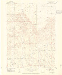
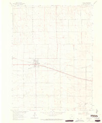
 1953 Peetz1954 Print · USGSHigh plains ranching and rail transport define this Logan County landscape in the early fifties. Researchers can trace the layout of Peetz, locate family roots at Peetz Cem, and follow the Chicago Burlington and Quincy tracks.
 - 1953 Map of Tamarack Ranch, 1954 Print
 1953 Tamarack Ranch1954 Print · USGSThe ranching country of Logan County is captured here in the early fifties, showing a landscape defined by the South Platte River and the vital Union Pacific rail line. Researchers can trace historic water rights and homesteads through Harmony Ditch and family lands like Tamarack Ranch or Yost Ranch.5 unique versions available
 - 1953 Map of Crook, 1954 Print
 1953 Crook1954 Print · USGSLogan County ranching and rail transport converge at the South Platte River during the early fifties. Genealogists and historians can trace the irrigation network through Harmony Ditch No 1 and locate family operations like Condon Ranch.6 unique versions available
 - 1953 Map of Twin Buttes, 1954 Print
 1953 Twin Buttes1954 Print · USGSThe Logan County high plains in the early fifties show a landscape defined by ranching and vital irrigation projects. Genealogists and historians can trace family-named sites like Lynch Cem and Barber Cem alongside the North Sterling Outlet Canal.3 unique versions available
 - 1953 Map of Proctor, 1954 Print
 1953 Proctor1954 Print · USGSLogan County’s river valley is captured here in the early fifties, showcasing the intersection of irrigation and rail infrastructure. Trace the early settlement of Proctor and the vital water networks of Harmony Ditch and the South Platte River.5 unique versions available
 - 1953 Map of Haystack Butte, 1954 Print
 1953 Haystack Butte1954 Print · USGSLogan County ranching and water management come into focus in the early 1950s, showing a landscape defined by high plateaus and complex irrigation. Researchers can trace rural infrastructure from the Lauderback School to the Sterling North Lateral and Haystack Butte.2 unique versions available
 - 1953 Map of Julesburg Reservoir, 1954 Print
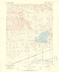 1953 Julesburg Reservoir1954 Print · USGSNear the Logan and Sedgwick county line in the early 1950s, this area centers on the vital Julesburg Reservoir and the South Platte River corridor. Genealogists and historians can trace the Union Pacific rail line through Red Lion and locate the rural Lakeside School.4 unique versions available
 - 1954 Map of Sterling
 1954 Sterling1954 Print · USGSNortheastern Colorado and the Nebraska borderlands are defined by the river-and-rail corridors of the mid-twentieth century. Researchers can trace the development of agricultural hubs from Sterling and Fort Morgan to smaller rail stops along the Union Pacific and Burlington Northern lines.3 unique versions available
 - 1954 Map of Scottsbluff, 1958 Print
 1954 Scottsbluff1958 Print · USGSThe Nebraska Panhandle's iconic landmarks and rail corridors are captured here during the mid-1950s. Researchers can trace the path of the North Platte River past Chimney Rock or locate the sprawling Sioux Ordnance Depot and the historic streets of Sidney.3 unique versions available
 - 1958 Map of Scottsbluff
 1958 Scottsbluff1958 Print · USGSThe Nebraska panhandle in the late fifties was a vital corridor of rail-and-river transport defined by the North Platte River and the Union Pacific. Genealogists and historians can trace rail stops like Reddus Station, explore the grounds of the Sioux Ordnance Depot, or locate landmarks like Chimney Rock.2 unique versions available
 - 1958 Map of Sterling
 1958 Sterling1958 Print · USGSNortheastern Colorado thrived along the river and rail corridors during the late fifties. Genealogists and historians can trace family-named irrigation works like Davis Brothers Ditch and agricultural hubs from Peetz to Fort Morgan.
 - 1962 Map of Fleming, 1963 Print
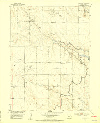
 1962 Fleming1963 Print · USGSLogan County’s agricultural heart is captured here in the early 1960s, centered on the vital rail corridor through Fleming. Researchers can trace the town's local landmarks and the Chicago Burlington and Quincy line, alongside rural features like Vanden and Fleming Cem.3 unique versions available
Showing maps 1-25 of 63
Top cities of Logan County
- Sterling historical maps
- Fleming historical maps
- Merino historical maps
- Peetz historical maps
- Iliff historical maps
- Crook historical maps
Frequently asked questions
- What are the different types of historical maps available for Logan County?
- What is the oldest map of Logan County?
- Where can I purchase historical maps of Logan County for my home or office?
- Where can I download high-res historical maps of Logan County?
- Are there historical topographic maps available for Logan County?
- Is there historical aerial imagery available for Logan County?
- Where are historical maps of Logan County sourced from?