Old Maps of Mesa County, Colorado for Metal Detecting
Plan your next treasure hunt with 517 historic maps of Mesa County. Find old homesites, ghost towns, trails, and gathering spots that may be lost to time — perfect for identifying promising metal detecting locations.
- Locate forgotten sites: Uncover places like long-lost settlements, abandoned rail lines, or gathering spots.
- Plan better hunts: Use map overlays combined with LiDAR or satellite views to narrow in on historically rich areas.
- Made for detectorists: Thousands of hobbyists use these maps to discover relics, coins, and hidden history.
Use these historic maps to boost your research and find new opportunities beneath the surface of Mesa County.
Mesa County, CO maps
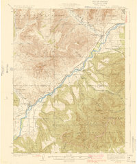
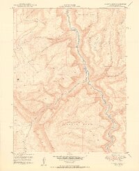
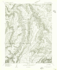
(517)- 1885 Map of East Tavaputs
 1885 East Tavaputs1885 Print · USGSEastern Utah in the mid-1880s was a landscape of massive plateaus and vital rail corridors. Researchers can trace the path of the Denver and Rio Grande Western through the Grand River Valley or locate water sources like Asphalt Creek and Bitter Water Creek.6 unique versions available
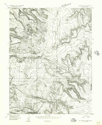
 - 1885 Map of La Sal
 1885 La Sal1885 Print · USGSSoutheast Utah in the mid-1880s remains a frontier of dramatic river canyons and high mountain peaks. Genealogists and historians can trace the early footprints of Moab and Plainfield or locate the high summits of Mt Peale and the path of the Green River.6 unique versions available
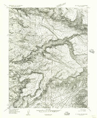
 - 1916 Map of Paradox Valley, 1955 Print
 1916 Paradox Valley1955 Print · USGSWestern Colorado during the height of early mineral exploration is documented here across the high plateaus and deep river canyons. Genealogists and historians can locate remote outpost camps like Shamrock Camp or Sunny Jim Camp and industrial landmarks such as the Coke Ovens.
 - 1922 Map of Paradox Valley
 1922 Paradox Valley1922 Print · USGSMontrose and San Miguel Counties are shown here during the early twentieth-century mining era, featuring a network of ore-processing camps and early river settlements. Researchers can trace historic industrial sites like the Cashin Mine and Coke Ovens or locate early rural institutions such as the Radium School.2 unique versions available
 - 1929 Map of Grand Valley
 1929 Grand Valley1929 Print · USGSThe Colorado River corridor near the Garfield and Mesa County line reveals a landscape of early oil shale exploration and rail-side growth in the late 1920s. Genealogists can locate family landmarks like Cunningham Ranch and remote schools including Crawford Sch and Battlement Sch.3 unique versions available
 - 1929 Map of Roan Creek
 1929 Roan Creek1929 Print · USGSThe Colorado oil shale country is captured here in the late 1920s as industry and ranching met in the canyons. Researchers can locate remote schools like Dry Fork Sch, the INDEX SHALE PLANT, and early family outposts including Wilcoxson Ranch.3 unique versions available
 - 1934 Map of Colorado National Monument
 1934 Colorado National Monument1934 Print · USGSMesa County was beginning to see the formalization of its famous canyonlands in the mid-1930s. You can trace early park infrastructure near Park Headquarters and follow the original switchbacks of the Serpents Trail past the Coke Ovens.
 - 1948 Map of Roc Creek, 1955 Print
 1948 Roc Creek1955 Print · USGSMontrose and Mesa Counties at the height of the post-war mining boom reveal a landscape of deep canyons and mesa tops. Trace the early uranium era through the Radium Cycle Mine, the Rajah Mine, and the remote Paradox Sch along the Dolores River.
 - 1949 Map of Roc Creek
 1949 Roc Creek1949 Print · USGSMontrose County was a center of mineral exploration in the late 1940s as the search for atomic materials transformed the high desert. Researchers can trace the era's mining activity at the Radium Cycle Mine and Rajah Mine or locate the local Paradox Sch in the valley floor.2 unique versions available
 - 1949 Map of Juanita Arch, 1955 Print
 1949 Juanita Arch1955 Print · USGSThe Colorado-Utah border region comes alive in the late 1940s, revealing a landscape defined by both geologic wonders and the burgeoning uranium mining industry. Researchers can trace the rugged access roads leading to the Depression Mines, Juanita Arch, and the deep canyons of the Dolores River.
 - 1949 Map of Atkinson Creek, 1955 Print
 1949 Atkinson Creek1955 Print · USGSWestern Colorado's canyon and mesa country is captured here during the post-war uranium boom era. Researchers can trace the industrial footprint of Wright Mines and local landmarks like Spring Creek Ranch and Hog Park.
 - 1949 Map of Red Canyon, 1955 Print
 1949 Red Canyon1955 Print · USGSThe canyons of Montrose County come alive in this post-war survey of the Colorado plateau. Researchers can trace the legacy of mineral exploration through numerous named sites like the Ophir Mine, Shamrock Mines, and the riverside Placer Mines.2 unique versions available
 - 1949 Map of Calamity Mesa, 1955 Print
 1949 Calamity Mesa1955 Print · USGSPost-war mineral exploration defines this Western Colorado plateau in the late 1940s. Genealogists and industrial historians can trace the footprint of mining operations at Calamity Camp and the Hidden Treasure Mine.2 unique versions available
 - 1949 Map of Gateway, 1957 Print
 1949 Gateway1957 Print · USGSMesa County was a hub of geological exploration in the late 1940s as the Atomic Energy Commission surveyed the canyonlands. Trace the early mining footprint at Vanaking No 1 Mine, the outpost at Tenderfoot Camp, and the winding Dolores River.2 unique versions available
 - 1950 Map of Juanita Arch
 1950 Juanita Arch1950 Print · USGSMesa County is shown at the height of the uranium boom in the early fifties, where the Dolores River carves through massive mesas. Researchers can trace early mining activity at the Maverick Mines or locate the natural Juanita Arch.3 unique versions available
 - 1950 Map of Calamity Mesa
 1950 Calamity Mesa1950 Print · USGSMesa County mining operations are shown in detail during the early Cold War uranium boom. Researchers can trace the rugged access roads leading to Calamity Camp and Outlaw Camp or locate the Hidden Treasure Mine.2 unique versions available
 - 1950 Map of Pine Mountain
 1950 Pine Mountain1950 Print · USGSMesa County was a hub of resource mapping and forestry in the early postwar era. You can trace the steep routes of the Snowshoe Trail and Basin Trail as they navigate from Pine Mountain down into Yellowjacket Canyon.2 unique versions available
 - 1950 Map of Atkinson Creek
 1950 Atkinson Creek1950 Print · USGSThe San Miguel River valley and surrounding mesas are captured here during the mid-century mining boom. Local history researchers can trace the roads leading to the Wright Mine or locate early ranching landmarks like Spring Creek Ranch and Hog Park.2 unique versions available
 - 1950 Map of Red Canyon
 1950 Red Canyon1950 Print · USGSCanyon country at the Mesa and Montrose County line comes into focus in 1950 as postwar mineral exploration intensified. Local historians and mineral enthusiasts can locate the North Star Mine, Club Ranch, and several inactive placer mines along the Dolores River.2 unique versions available
 - 1952 Map of Gateway
 1952 Gateway1952 Print · USGSThe canyon country around the Dolores River was a center of mineral exploration in the early fifties. Researchers can locate uranium-era workings like the Vanaking No 1 Mine and trace the early routes of the Pickett Trail.2 unique versions available
 - 1954 Map of Mt Peale 1 NE
 1954 Mt Peale 1 NE1954 Print · USGSThe high borderlands between Utah and Colorado come into focus in the mid-1950s, showing a remote landscape of national forest and rugged canyons. Researchers can trace early water management at Buckeye Res and locate the site of a rural Sawmill near Pine Flat.
 - 1954 Map of Mt. Waas 4 SE, 1955 Print
 1954 Mt. Waas 4 SE1955 Print · USGSThe high plateau country along the Utah-Colorado border comes into focus in the mid-1950s, showing a landscape shaped by timber and ranching. Researchers can locate remote sites like the Sawmill, Kirks Basin, and water sources at Pace Lake.
 - 1954 Map of Mt. Waas 4 NE, 1955 Print
 1954 Mt. Waas 4 NE1955 Print · USGSThe high canyons along the Utah and Colorado border are captured here in the mid-fifties, just as aerial photogrammetry was refining our view of the desert. Researchers can trace the course of the Dolores River and find evidence of early mineral exploration at a lonely Prospect or the remote Landing Field.
 - 1954 Map of Mt. Waas 1 NE, 1956 Print
 1954 Mt. Waas 1 NE1956 Print · USGSThe Utah-Colorado state line crosses this high plateau region in the mid-1950s, revealing a landscape of steep canyons and water-dependent infrastructure. Researchers can trace the path of Coach Creek, locate remote water sources like Reservoir, and follow the deep cuts of Marble Canyon.
 - 1954 Map of Mt. Waas 1 SE, 1956 Print
 1954 Mt. Waas 1 SE1956 Print · USGSThe Utah and Colorado borderlands appear in the mid-1950s as a high-altitude frontier of mesas and canyons along the Dolores River. Researchers can trace old routes like the Jeep Trail through Ryan Park or locate the remote Landing Strip near Buckskin Gulch.
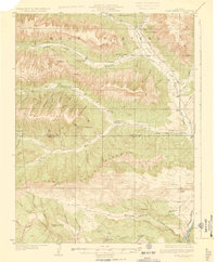
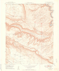
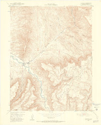
Showing maps 1-25 of 517
Top cities of Mesa County
- Grand Junction historical maps
- Fruita historical maps
- Palisade historical maps
- Loma historical maps
- De Beque historical maps
- Collbran historical maps
Frequently asked questions
- What are the different types of historical maps available for Mesa County?
- What is the oldest map of Mesa County?
- Where can I purchase historical maps of Mesa County for my home or office?
- Where can I download high-res historical maps of Mesa County?
- Are there historical topographic maps available for Mesa County?
- Is there historical aerial imagery available for Mesa County?
- Where are historical maps of Mesa County sourced from?