2000s (21st Century) Maps of Mesa County, Colorado
Explore 380 historic maps of Mesa County from the 2000s (21st Century). These maps offer a rare glimpse into what life looked like during the 2000s — showing old roads, neighborhoods, homes, and landmarks that have changed or disappeared over time.
Whether you're researching your family's past, planning a metal detecting trip, or studying how Mesa County's landscape evolved across the 2000s, these high-resolution maps are a powerful tool for exploring the history of this region.
- Focus on a specific era: All maps on this page are from the 2000s, giving you a focused view of this time period.
- See what’s changed: Compare century-old streets, trails, and buildings to today's modern landscape using overlays and satellite layers.
- Research with precision: Use these maps for genealogy, historical research, land use analysis, or educational projects.
- View, download, or print: Maps are fully viewable online in high resolution, and can be downloaded or printed for your own records.
Start exploring Mesa County's history through authentic maps from the 2000s. This is your window into the past.
Mesa County, CO maps
(380)- 2001 Map of Dolores Point South, 2004 Print
 2001 Dolores Point South2004 Print · USGSThe high plateaus along the Utah-Colorado state line are captured here at the start of the millennium. Local history researchers can trace high-elevation landmarks such as Kirks Basin, Pace Lake, and the remote Fish & Game Cabin.
 - 2001 Map of Roc Creek, 2004 Print
 2001 Roc Creek2004 Print · USGSThe western Colorado borderlands come alive in the early 2000s, showing a landscape defined by uranium mining history and deep canyons. Researchers can trace historic extraction sites like the Radium Cycle Mine or locate the lone Grave near the Dolores River.
 - 2001 Map of Dolores Point North, 2004 Print
 2001 Dolores Point North2004 Print · USGSThe high desert canyons along the Utah-Colorado border come into sharp focus in this late twentieth-century revision. Researchers can trace historic mining activity near Dolores Point or locate water sources like D P Spring and the Dolores River.
 - 2001 Map of Elk Knob, 2004 Print
 2001 Elk Knob2004 Print · USGSGunnison and Delta counties at the dawn of the 2000s are shown as a landscape of national forests and high basins. Researchers can trace land-use patterns at Tolan Place or follow the water from Stove Basin down to Muddy Creek.
 - 2001 Map of Buckeye Reservoir, 2004 Print
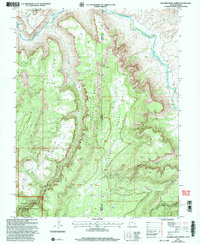
 2001 Buckeye Reservoir2004 Print · USGSThe Colorado-Utah border country at the start of the twenty-first century is defined by its high plateaus and the vital waters of the Buckeye Reservoir. Researchers can trace old 4WD tracks through the Manti-La Sal National Forest to find remote landmarks like Pine Flat and the Prospect above Sinbad Valley.
 - 2010 Map of Clifton, 2010 Print
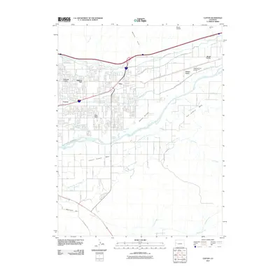 2010 Clifton2010 Print · USGSCovers Mesa County, including Grand Junction, Palisade, and other nearby areas
 - 2010 Map of Mesa, 2010 Print
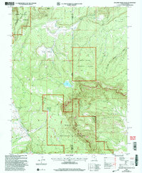
 2010 Mesa2010 Print · USGSCovers Mesa County, including John Held Corner, Mesa, and other nearby areas
 - 2010 Map of Fruita, 2010 Print
 2010 Fruita2010 Print · USGSCovers Mesa County, including Grand Junction, Fruita, and other nearby areas
 - 2010 Map of Highline Lake, 2010 Print
 2010 Highline Lake2010 Print · USGSCovers Mesa County, including Garfield County, United States, and other nearby areas
 - 2010 Map of Colorado National Monument, 2010 Print
 2010 Colorado National Monument2010 Print · USGSCovers Mesa County, including Grand Junction, Fruita, and other nearby areas
 - 2010 Map of Ruby Canyon, 2010 Print
 2010 Ruby Canyon2010 Print · USGSCovers Mesa County, including United States, Colorado, and other nearby areas
 - 2010 Map of Ruby Lee Reservoir, 2010 Print
 2010 Ruby Lee Reservoir2010 Print · USGSCovers Mesa County, including Garfield County, United States, and other nearby areas
 - 2010 Map of Grand Junction, 2010 Print
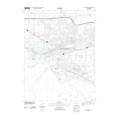 2010 Grand Junction2010 Print · USGSCovers Mesa County, including Grand Junction, Appleton, and other nearby areas
 - 2010 Map of Badger Wash, 2010 Print
 2010 Badger Wash2010 Print · USGSCovers Mesa County, including Garfield County, United States, and other nearby areas
 - 2010 Map of Corcoran Peak, 2010 Print
 2010 Corcoran Peak2010 Print · USGSCovers Mesa County, including Garfield County, United States, and other nearby areas
 - 2010 Map of Sieber Canyon, 2010 Print
 2010 Sieber Canyon2010 Print · USGSCovers Mesa County, including United States, Colorado, and other nearby areas
 - 2010 Map of Cameo, 2010 Print
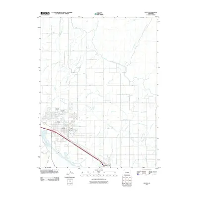
 2010 Cameo2010 Print · USGSCovers Mesa County, including Cameo, United States, and other nearby areas
 - 2010 Map of Round Mountain, 2010 Print
 2010 Round Mountain2010 Print · USGSCovers Mesa County, including United States, Colorado, and other nearby areas
 - 2010 Map of Corcoran Point, 2010 Print
 2010 Corcoran Point2010 Print · USGSCovers Mesa County, including Grand Junction, United States, and other nearby areas
 - 2010 Map of Mack, 2010 Print
 2010 Mack2010 Print · USGSCovers Mesa County, including Fruita, Loma, and other nearby areas
 - 2010 Map of Wagon Track Ridge, 2010 Print
 2010 Wagon Track Ridge2010 Print · USGSCovers Mesa County, including Akin, Garfield County, and other nearby areas
 - 2010 Map of Winter Flats, 2010 Print
 2010 Winter Flats2010 Print · USGSCovers Mesa County, including Garfield County, United States, and other nearby areas
 - 2010 Map of Battleship Rock, 2010 Print
 2010 Battleship Rock2010 Print · USGSCovers Mesa County, including United States, Colorado, and other nearby areas
 - 2010 Map of Whitewater, 2010 Print
 2010 Whitewater2010 Print · USGSCovers Mesa County, including Whitewater, Kannah, and other nearby areas
 - 2010 Map of Bieser Creek, 2010 Print
 2010 Bieser Creek2010 Print · USGSCovers Mesa County, including United States, Colorado, and other nearby areas
Showing maps 1-25 of 380
Top cities of Mesa County
- Grand Junction historical maps
- Fruita historical maps
- Palisade historical maps
- Loma historical maps
- De Beque historical maps
- Collbran historical maps
Frequently asked questions
- What are the different types of historical maps available for Mesa County?
- What is the oldest map of Mesa County?
- Where can I purchase historical maps of Mesa County for my home or office?
- Where can I download high-res historical maps of Mesa County?
- Are there historical topographic maps available for Mesa County?
- Is there historical aerial imagery available for Mesa County?
- Where are historical maps of Mesa County sourced from?