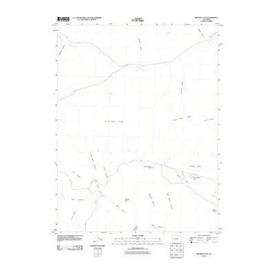
2010 Map of Winter Flats
USGS Topo · Published 2010About this map
Winter Flats and the surrounding high desert plateau of Mesa County are defined by a network of seasonal watercourses and complex canyon systems. The landscape is marked by land management features such as the Soap Retention Dam and Deer Retention Dam, which manage runoff in an arid environment. Deep drainages like Main Canyon, Alkali Canyon, and Pine Gulch cut through the terrain, while the prominent South Shale Ridge serves as a significant geographical divide. Modern access to this ranching and drainage landscape is provided by a grid of rural routes including South Dry Fork Rd and V 20 Rd. Notable landmarks for navigation in this stretch of the Colorado backcountry include Redrock Point and the perennial water source at Willow Spring, situated near the head of Gothard Gulch.
Find a feature on this map
32 named features on this map. Tap any name to fly to it.
Don’t see what you’re looking for? This feature index may not catch every label — zoom into the map to look around manually.
Map Details
Editions of this 2010 Winter Flats Map
This is the sole edition of this map. No revisions or reprints were ever made.
Other maps of this area

1929 · Roan Creek
USGS Topo · 1:62,500

1955 · Cameo
USGS Topo · 1:24,000

1956 · Grand Junction
USGS Topo · 1:250,000

1959 · Grand Junction
USGS Topo · 1:250,000

1960 · Grand Junction
USGS Topo · 1:250,000

1962 · Grand Junction
USGS Topo · 1:250,000
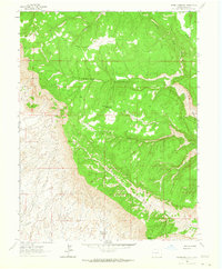
1962 · Round Mountain
USGS Topo · 1:24,000

1962 · Corcoran Point
USGS Topo · 1:24,000

1964 · Grand Junction
USGS Topo · 1:250,000

1965 · Grand Junction
USGS Topo · 1:250,000