1980s Maps of Montrose County, Colorado
Explore 10 historic maps of Montrose County from the 1980s. These maps offer a rare glimpse into what life looked like during the 1980s — showing old roads, neighborhoods, homes, and landmarks that have changed or disappeared over time.
Whether you're researching your family's past, planning a metal detecting trip, or studying how Montrose County's landscape evolved across the 1980s, these high-resolution maps are a powerful tool for exploring the history of this region.
- Focus on a specific era: All maps on this page are from the 1980s, giving you a focused view of this time period.
- See what’s changed: Compare century-old streets, trails, and buildings to today's modern landscape using overlays and satellite layers.
- Research with precision: Use these maps for genealogy, historical research, land use analysis, or educational projects.
- View, download, or print: Maps are fully viewable online in high resolution, and can be downloaded or printed for your own records.
Start exploring Montrose County's history through authentic maps from the 1980s. This is your window into the past.
Montrose County, CO maps
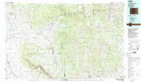
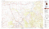
(10)- 1980 Map of Delta
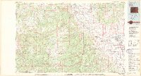 1980 Delta1980 Print · USGSWestern Colorado during the 1980s reveals a rugged landscape of high mesas and deep canyons where the mining and ranching economy thrived. Genealogists and researchers can trace local landmarks like Peis Green Corner or locate mining operations including the Peach Mines and Yellowbird Mines.3 unique versions available
 - 1982 Map of La Sal, 1983 Print
 1982 La Sal1983 Print · USGSThe high desert of southeastern Utah meets the Colorado border in the early eighties, showing a landscape defined by deep canyons and mining. Trace the industrial operations at Lisbon Mine or explore the early mapping of The Needles and Island in the Sky.2 unique versions available
 - 1983 Map of Nucla
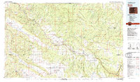 1983 Nucla1983 Print · USGSWestern Colorado’s canyon country is documented here during the early eighties, showcasing a region defined by uranium mining and high-plateau ranching. Trace local genealogy and industrial footprints through settlements like Uravan and Naturita or remote sites such as the Morning Glory Mine.2 unique versions available
 - 1983 Map of Montrose
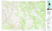
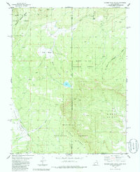
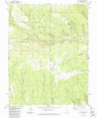
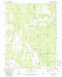
 1983 Montrose1983 Print · USGSThe Uncompahgre Valley and high San Juan peaks come together in the early eighties, showing a landscape defined by deep canyons and mountain mining towns. Genealogists and hikers can trace old routes near Ouray, Lake City, and the Pelican Mine.2 unique versions available
 - 1983 Map of Paonia
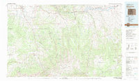
 1983 Paonia1983 Print · USGSWestern Colorado's North Fork Valley and West Elk high country are shown here in the early eighties as a hub of coal mining and orchard farming. Researchers can trace historic extraction sites like the Colby Mine, rural settlements such as Maher, and landmarks like the Hotchkiss Nat Fish Hatchery.2 unique versions available
 - 1983 Map of Moab
 1983 Moab1983 Print · USGSThe Colorado River corridor near Moab is captured here in the early eighties, showcasing a landscape of uranium mining and iconic parklands. Trace the Denver and Rio Grande Western RR as it passes through Cisco or locate landmarks like Delicate Arch and the Telluride Mines.3 unique versions available
 - 1985 Map of Dolores Point South, 1986 Print
 1985 Dolores Point South1986 Print · USGSThe high plateau of Beaver Mesa and the depths of Sinbad Valley define this mid-1980s borderland survey. Map collectors and researchers can trace remote Mines, isolated Prospects, and the winding Pack Trail across the Utah-Colorado line.2 unique versions available
 - 1986 Map of Ray Mesa
 1986 Ray Mesa1986 Print · USGSThe high plateaus of the Utah-Colorado border were a hub of nuclear-era mining during the mid-eighties. Miners and historians can trace the locations of legendary sites like the Vanadium Queen Mine, Uranium Girl Mine, and the remote Landing Strip on Ray Mesa.
 - 1986 Map of Lisbon Gap
 1986 Lisbon Gap1986 Print · USGSThe high-desert borderlands of Utah and Colorado are documented here in the mid-1980s, highlighting a landscape of mesas and deep-cut washes. Researchers can trace mineral exploration and remote land use through landmarks like Lisbon Gap, Horsethief Point, and various prospects.
 - 1986 Map of Buckeye Reservoir
 1986 Buckeye Reservoir1986 Print · USGSThe high ridges and deep valleys of the Colorado-Utah border come into focus in the mid-1980s. Local researchers can trace old mining sites like the Valley View Mine and rugged 4WD routes near Buckeye Reservoir and Sinbad Valley.
End of results
Showing maps 1-10 of 10
Top cities of Montrose County
Frequently asked questions
- What are the different types of historical maps available for Montrose County?
- What is the oldest map of Montrose County?
- Where can I purchase historical maps of Montrose County for my home or office?
- Where can I download high-res historical maps of Montrose County?
- Are there historical topographic maps available for Montrose County?
- Is there historical aerial imagery available for Montrose County?
- Where are historical maps of Montrose County sourced from?