1970s Maps of Montrose County, Colorado
Explore 14 historic maps of Montrose County from the 1970s. These maps offer a rare glimpse into what life looked like during the 1970s — showing old roads, neighborhoods, homes, and landmarks that have changed or disappeared over time.
Whether you're researching your family's past, planning a metal detecting trip, or studying how Montrose County's landscape evolved across the 1970s, these high-resolution maps are a powerful tool for exploring the history of this region.
- Focus on a specific era: All maps on this page are from the 1970s, giving you a focused view of this time period.
- See what’s changed: Compare century-old streets, trails, and buildings to today's modern landscape using overlays and satellite layers.
- Research with precision: Use these maps for genealogy, historical research, land use analysis, or educational projects.
- View, download, or print: Maps are fully viewable online in high resolution, and can be downloaded or printed for your own records.
Start exploring Montrose County's history through authentic maps from the 1970s. This is your window into the past.
Montrose County, CO maps
(14)- 1973 Map of Camel Back, 1975 Print
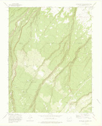
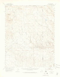
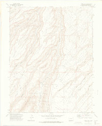 1973 Camel Back1975 Print · USGSThe Uncompahgre Plateau during the early 1970s reveals a landscape of high mesas and isolated cabins. Trace the paths of early settlers and forest rangers along Divide Road to landmarks like the Ben Lower Cabin and Potter Spring.2 unique versions available
 - 1973 Map of Ute, 1975 Print
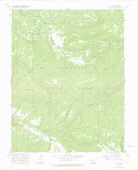 1973 Ute1975 Print · USGSThe Uncompahgre high country in the early seventies shows a landscape of timber and remote ranching. Trace old mountain routes like the Ray Trail to find Maupin Cow Camp, Monument Lake, and a lonely mountain Cem.3 unique versions available
 - 1973 Map of Big Bucktail Creek, 1975 Print
 1973 Big Bucktail Creek1975 Print · USGSMontrose County in the early seventies is mapped here as a landscape of high mesas and river irrigation. Researchers can trace the flow of the San Miguel River through the Doing Ditch and locate the small Cem near Pinon.2 unique versions available
 - 1973 Map of Dry Creek Basin, 1975 Print
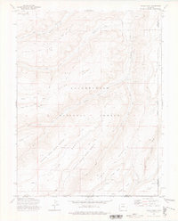
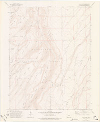
 1973 Dry Creek Basin1975 Print · USGSMontrose County in the early 1970s shows a high-desert landscape defined by water engineering and ranching access. Researchers can trace the drainage of Dry Creek Basin or locate the Olathe Reservoir No 1 and the remote Temple Park.2 unique versions available
 - 1973 Map of Pryor Creek, 1975 Print
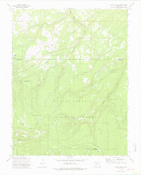 1973 Pryor Creek1975 Print · USGSHigh-altitude forest management and remote camps define this Colorado landscape during the 1970s. Researchers can trace historic access routes like the Old Paradox Road while locating the Silesca Guard Sta and Donley Camp.3 unique versions available
 - 1973 Map of Antone Spring, 1976 Print
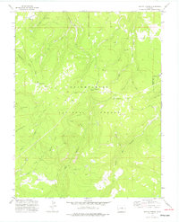 1973 Antone Spring1976 Print · USGSMontrose and Ouray Counties are shown in the 1970s as a landscape of high-altitude camps and primitive trails. You can trace the routes of the Roubideau Trail and Transfer Road to historic sites like Gray Cow Camp and Darling Lake.2 unique versions available
 - 1973 Map of Moore Mesa, 1976 Print
 1973 Moore Mesa1976 Print · USGSThe high mesas of Montrose County are documented here in the early 1970s, showing the seasonal ranching outposts of the western slope. Researchers can trace land use patterns through scattered landmarks like Beach Cow Camp, Blackburn Cow Camp, and the Mesa Guard Sta.2 unique versions available
 - 1973 Map of Starvation Point, 1976 Print
 1973 Starvation Point1976 Print · USGSMontrose and Mesa counties are captured in the early 1970s, showcasing a landscape of high-country cattle camps and mining claims. Genealogists and historians can trace the Copper King Mine, the isolated Fortyseven Cow Camp, and landmarks like Starvation Point.
 - 1973 Map of Government Springs, 1976 Print
 1973 Government Springs1976 Print · USGSThe high mesa country of the San Juan foothills is documented here in the early 1970s, showing a landscape defined by forest boundaries and remote water sources. Researchers can trace historic access routes like Dave Wood Road and locate specific landmarks such as Government Springs and Dewdrop Springs.3 unique versions available
 - 1973 Map of Cottonwood Basin, 1976 Print
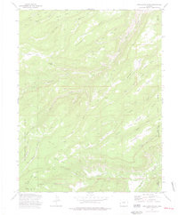
 1973 Cottonwood Basin1976 Print · USGSThe Uncompahgre Plateau in the 1970s is shown as a network of remote mesa-top trails and vital upland water sources. Researchers can trace historic seasonal outposts and water management features like Fall Cabin Camp, the Harry White Reservoirs, and Twin Lake.2 unique versions available
 - 1973 Map of Kelso Point, 1976 Print
 1973 Kelso Point1976 Print · USGSMesa and Montrose counties are shown here in the early 1970s, showcasing a landscape of isolated mesas and deep creek forks. Researchers can trace the remote Picket Corral Ranch and high-altitude landmarks like Love Lake and Sawmill Mesa.3 unique versions available
 - 1973 Map of Davis Point, 1976 Print
 1973 Davis Point1976 Print · USGSThe Uncompahgre National Forest plateau is captured here in the early seventies, detailing a landscape of steep mesas and canyon drainages. Researchers can trace historic access routes like Transfer Road and the Roubideau Trail past landmarks such as Davis Point and Moore Basin Lake.3 unique versions available
 - 1973 Map of Escalante Forks, 1977 Print
 1973 Escalante Forks1977 Print · USGSMesa and Delta counties in the early 1970s reveal a high-plateau landscape defined by remote forest service trails and vital water sources. Researchers can trace historic stock routes and mountain outposts like the Gunnison Palmer Trail, Remlap, and Steamboat Spring.3 unique versions available
 - 1974 Map of La Sal, 1975 Print
 1974 La Sal1975 Print · USGSThe high plateau and jagged peaks of the Utah-Colorado border come alive in the 1970s, showing a landscape defined by ranching and Cold War-era mining. Genealogists and historians can trace old homesteads like Pine Lodge Ranch or locate the numerous named claims including the Vanadium Queen Mine and Uranium Girl Mine.
End of results
Showing maps 1-14 of 14
Top cities of Montrose County
Frequently asked questions
- What are the different types of historical maps available for Montrose County?
- What is the oldest map of Montrose County?
- Where can I purchase historical maps of Montrose County for my home or office?
- Where can I download high-res historical maps of Montrose County?
- Are there historical topographic maps available for Montrose County?
- Is there historical aerial imagery available for Montrose County?
- Where are historical maps of Montrose County sourced from?