1950s Maps of Montrose County, Colorado
Explore 24 historic maps of Montrose County from the 1950s. These maps offer a rare glimpse into what life looked like during the 1950s — showing old roads, neighborhoods, homes, and landmarks that have changed or disappeared over time.
Whether you're researching your family's past, planning a metal detecting trip, or studying how Montrose County's landscape evolved across the 1950s, these high-resolution maps are a powerful tool for exploring the history of this region.
- Focus on a specific era: All maps on this page are from the 1950s, giving you a focused view of this time period.
- See what’s changed: Compare century-old streets, trails, and buildings to today's modern landscape using overlays and satellite layers.
- Research with precision: Use these maps for genealogy, historical research, land use analysis, or educational projects.
- View, download, or print: Maps are fully viewable online in high resolution, and can be downloaded or printed for your own records.
Start exploring Montrose County's history through authentic maps from the 1950s. This is your window into the past.
Montrose County, CO maps
(24)- 1950 Map of Anderson Mesa
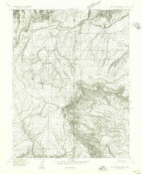
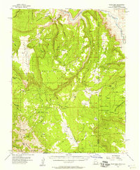
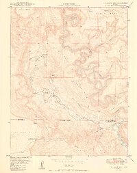 1950 Anderson Mesa1950 Print · USGSMontrose and San Miguel Counties are shown at the height of post-war mineral exploration in the late 1940s. Researchers can trace early mining operations like Morning Star Mine and The Raven Mine near the loops of Dolores River.2 unique versions available
 - 1950 Map of Atkinson Creek
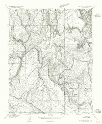
 1950 Atkinson Creek1950 Print · USGSThe San Miguel River valley and surrounding mesas are captured here during the mid-century mining boom. Local history researchers can trace the roads leading to the Wright Mine or locate early ranching landmarks like Spring Creek Ranch and Hog Park.2 unique versions available
 - 1950 Map of Red Canyon
 1950 Red Canyon1950 Print · USGSCanyon country at the Mesa and Montrose County line comes into focus in 1950 as postwar mineral exploration intensified. Local historians and mineral enthusiasts can locate the North Star Mine, Club Ranch, and several inactive placer mines along the Dolores River.2 unique versions available
 - 1954 Map of Mt Peale 1 SE
 1954 Mt Peale 1 SE1954 Print · USGSThe Utah and Colorado borderlands reveal an intense era of mineral exploration in the mid-fifties. Researchers can trace historic mining claims like the Vanadium Queen Mine and Yellow Bird Mine alongside landmarks like The Horn.
 - 1954 Map of Mt Peale 1 NE
 1954 Mt Peale 1 NE1954 Print · USGSThe high borderlands between Utah and Colorado come into focus in the mid-1950s, showing a remote landscape of national forest and rugged canyons. Researchers can trace early water management at Buckeye Res and locate the site of a rural Sawmill near Pine Flat.
 - 1954 Map of Mt. Waas 4 SE, 1955 Print
 1954 Mt. Waas 4 SE1955 Print · USGSThe high plateau country along the Utah-Colorado border comes into focus in the mid-1950s, showing a landscape shaped by timber and ranching. Researchers can locate remote sites like the Sawmill, Kirks Basin, and water sources at Pace Lake.
 - 1954 Map of Mt Peale 4 NE, 1955 Print
 1954 Mt Peale 4 NE1955 Print · USGSThe high borderlands of San Juan County and western Colorado are captured in the mid-1950s before extensive modern development. Researchers can trace the rugged transition from Moosey Point down through Greasewood Canyon and into the Lower Lisbon Valley.
 - 1954 Map of La Sal, 1957 Print
 1954 La Sal1957 Print · USGSThe La Sal Mountains at the peak of the mid-century uranium boom reveal a rugged landscape of high-altitude mining and ranching. Researchers can trace numerous prospects and operations like the Vanadium Queen Mine, Uranium Girl Mine, and the early settlement at Old La Sal.6 unique versions available
 - 1954 Map of Lisbon Valley, 1957 Print
 1954 Lisbon Valley1957 Print · USGSLisbon Valley's ranching and mining landscape is captured here in the mid-fifties, just as early aerial photography was refining regional maps. Genealogists and historians can trace local landmarks like Woods Ranch, Patterson Ranch, and the West Summit School.5 unique versions available
 - 1954 Map of Polar Mesa, 1957 Print
 1954 Polar Mesa1957 Print · USGSThe Utah-Colorado borderlands in the mid-1950s are defined here by high plateaus and the deep canyons of the Dolores River. Researchers can trace early uranium-era infrastructure like the Landing Strip near Dolores Point and high-altitude landmarks including Mt Waas and Pace Lake.4 unique versions available
 - 1955 Map of Olathe NW, 1956 Print
 1955 Olathe NW1956 Print · USGSDelta and Montrose counties in the mid-1950s showcase a high-desert landscape transformed by irrigation and rail. Researchers can trace the path of the Denver and Rio Grande Western railroad or locate old waterworks like the East Selig Canal and Peach Valley Dam No 1.5 unique versions available
 - 1955 Map of Black Ridge, 1956 Print
 1955 Black Ridge1956 Print · USGSWestern Colorado's landscape is captured here in the mid-1950s as water management and rugged geography shaped the county line. Researchers can trace irrigation history through the Scenic Ditch or locate landmarks like Green Mountain Reservoir No 1 and Red Canyon.6 unique versions available
 - 1955 Map of Olathe, 1956 Print
 1955 Olathe1956 Print · USGSThe Uncompahgre Valley in the mid-1950s is shown here as an intricate patchwork of irrigated farmland and essential rail transport. Genealogists can locate old family-named landmarks and institutions like the Menoken Sch, Coal Creek Sch, and Olathe Cem.7 unique versions available
 - 1955 Map of Red Rock Canyon, 1957 Print
 1955 Red Rock Canyon1957 Print · USGSMontrose County at the middle of the twentieth century reveals the dramatic contours of the Gunnison River and its surrounding canyons. Trace early land use through the State Tunnel Dam, a Mine (abandoned), and the established boundaries of Bostwick Park.5 unique versions available
 - 1956 Map of Curecanti Needle, 1957 Print
 1956 Curecanti Needle1957 Print · USGSThe Gunnison River country during the mid-fifties reveals a high-desert landscape of ranching outposts and deep canyons. Researchers can locate the Rimrock Sch (Aband), the namesake Curecanti Needle, and isolated homesites like Knott Ranch.5 unique versions available
 - 1956 Map of Cimarron, 1957 Print
 1956 Cimarron1957 Print · USGSThe Gunnison River valley and the canyon country of Montrose County are captured here in the mid-fifties. Researchers can trace the path of the Old Railroad Grade and locate the District No 9 Sch (Aband) near the Cimarron settlement.4 unique versions available
 - 1956 Map of Montrose, 1963 Print
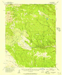
 1956 Montrose1963 Print · USGSThe Colorado western slope in the late fifties and early sixties shows a landscape defined by the Denver & Rio Grande Western RR and the Gunnison River. Trace the development of Blue Mesa Reservoir or locate high-country sites like the Bachelor Mine.3 unique versions available
 - 1956 Map of Moab, 1972 Print
 1956 Moab1972 Print · USGSThe Colorado Plateau and La Sal Mountains appear here in the mid-fifties, just as the uranium boom and energy exploration were reshaping the Four Corners. Researchers can trace the Denver and Rio Grande Western through Cisco or locate the remote outpost of Uravan and Looking Glass Rock.3 unique versions available
 - 1957 Map of Cathedral Peak
 1957 Cathedral Peak1957 Print · USGSThe high plateau and deep canyons of Montrose County come into focus in the late fifties. Researchers can trace remote ranching outposts like Gates Camp and follow the high-altitude water systems of Gould Reservoir and Meek Reservoir.7 unique versions available
 - 1957 Map of X Lazy F Ranch, 1959 Print
 1957 X Lazy F Ranch1959 Print · USGSThe Colorado high country in the mid-1950s reveals a landscape of isolated ranching and federal forest management. Genealogists and historians can trace the remote X Lazy F Ranch and water features like Allen Pond, Blue Lake, and the complex drainage of Curecanti Creek.6 unique versions available
 - 1957 Map of Cerro Summit, 1959 Print
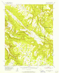
 1957 Cerro Summit1959 Print · USGSThe high mountain pass at Cerro Summit is captured in the late 1950s, revealing a landscape shaped by early irrigation and rail transit. Researchers can trace the Old Railroad Grade and locate former habitations at Lujane and Cedar Creek.7 unique versions available
 - 1957 Map of Grizzly Ridge, 1959 Print
 1957 Grizzly Ridge1959 Print · USGSMontrose County in the late fifties was a landscape of deep canyons and high mesas, where the Black Canyon of the Gunnison shaped all local movement. Trace the early road network around Orchard Corner and locate technical landmarks like the East Portal and Vernal Ditch.5 unique versions available
 - 1959 Map of Moab
 1959 Moab1959 Print · USGSSoutheast Utah and Western Colorado are mapped here in the late fifties, just as the uranium boom was transforming the remote canyon lands. Genealogists and historians can trace the foundations of Moab and Nucla, or locate mining sites and landmarks like Uravan and Dead Horse Point.
 - 1959 Map of Montrose
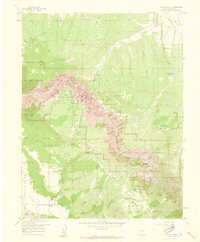
 1959 Montrose1959 Print · USGSWestern Colorado in the late fifties is defined by the high peaks and river valleys of the Southern Rockies. Genealogists and historians can trace the paths of the Denver & Rio Grande Western RR or locate mountain settlements like Crawford, Lazear, and Doyleville.
End of results
Showing maps 1-24 of 24
Top cities of Montrose County
Frequently asked questions
- What are the different types of historical maps available for Montrose County?
- What is the oldest map of Montrose County?
- Where can I purchase historical maps of Montrose County for my home or office?
- Where can I download high-res historical maps of Montrose County?
- Are there historical topographic maps available for Montrose County?
- Is there historical aerial imagery available for Montrose County?
- Where are historical maps of Montrose County sourced from?