Old Maps of Montrose County, Colorado for Academic Research
Study the evolution of Montrose County with 423 high-resolution historic maps. Whether you're teaching, researching, or modeling changes in land use, these maps provide essential visual documentation of urban, environmental, and geographic change.
- Analyze long-term change: Track patterns in development, transportation, and natural features.
- Ideal for environmental or urban studies: Support academic projects with primary historical map data.
- Use in the classroom or lab: Educators and researchers rely on these maps to bring historical context to life.
These maps are a powerful tool for teaching, research, and visualizing how Montrose County has changed over the decades.
Montrose County, CO maps
(423)- 1885 Map of La Sal
 1885 La Sal1885 Print · USGSSoutheast Utah in the mid-1880s remains a frontier of dramatic river canyons and high mountain peaks. Genealogists and historians can trace the early footprints of Moab and Plainfield or locate the high summits of Mt Peale and the path of the Green River.6 unique versions available
 - 1908 Map of Uncompahgre, 1954 Print
 1908 Uncompahgre1954 Print · USGSThe Gunnison River canyon and high mesas defined life in this corner of Colorado during the early twentieth century. Genealogists and historians can trace the Denver and Rio Grande Railroad line through mountain outposts like Sapinero, Cebolla, and the Gunnison Mine.2 unique versions available
 - 1909 Map of Montrose, 1960 Print
 1909 Montrose1960 Print · USGSThe Uncompahgre Valley and surrounding peaks come into focus during the first decade of the twentieth century. Researchers can trace the Denver and Rio Grande Western RR through Ridgway to Bachelor Switch and the Blaine Mine.
 - 1911 Map of Uncompahgre
 1911 Uncompahgre1911 Print · USGSThe Colorado high country at the start of the twentieth century reveals a landscape of isolated mining camps and vital mountain railways. Genealogists and historians can trace the Denver and Rio Grande RR through Sapinero to remote operations like the Gunnison Mine and Capitol City.2 unique versions available
 - 1911 Map of Montrose
 1911 Montrose1911 Print · USGSThe Uncompahgre River valley and the Denver and Rio Grande RR define the landscape of this region before the First World War. Researchers can trace the early layout of Montrose, the mining influence at Blaine Mine, and the route through Ridgway.3 unique versions available
 - 1916 Map of Paradox Valley, 1955 Print
 1916 Paradox Valley1955 Print · USGSWestern Colorado during the height of early mineral exploration is documented here across the high plateaus and deep river canyons. Genealogists and historians can locate remote outpost camps like Shamrock Camp or Sunny Jim Camp and industrial landmarks such as the Coke Ovens.
 - 1922 Map of Paradox Valley
 1922 Paradox Valley1922 Print · USGSMontrose and San Miguel Counties are shown here during the early twentieth-century mining era, featuring a network of ore-processing camps and early river settlements. Researchers can trace historic industrial sites like the Cashin Mine and Coke Ovens or locate early rural institutions such as the Radium School.2 unique versions available
 - 1948 Map of Roc Creek, 1955 Print
 1948 Roc Creek1955 Print · USGSMontrose and Mesa Counties at the height of the post-war mining boom reveal a landscape of deep canyons and mesa tops. Trace the early uranium era through the Radium Cycle Mine, the Rajah Mine, and the remote Paradox Sch along the Dolores River.
 - 1948 Map of Bull Canyon, 1955 Print
 1948 Bull Canyon1955 Print · USGSWestern Colorado's high desert mining country is captured here just as the atomic age spurred new interest in the Plateau's mineral wealth. Researchers can locate remote extraction sites like Wild Steer Mines and Jo Dandy Mine or trace the early Monogram Trail.
 - 1948 Map of Uravan, 1955 Print
 1948 Uravan1955 Print · USGSMining operations along the San Miguel River are at their peak in the late 1940s as the atomic era begins. Researchers can trace the industrial footprint of uranium production through local landmarks like the Club Mines, Uravan, and the Bitter Creek Mines.2 unique versions available
 - 1948 Map of Naturita NW, 1957 Print
 1948 Naturita NW1957 Print · USGSWestern Colorado mining and ranching lands are captured here just after the war, showing the stark divide between the Paradox Valley floor and the surrounding heights. Researchers can trace mid-century industrial sites like the Thunderbolt Mine or locate water sources such as Spectacle Reservoir.4 unique versions available
 - 1948 Map of Paradox, 1957 Print
 1948 Paradox1957 Print · USGSWestern Colorado's canyon country comes into focus in the late 1940s, highlighting the unique drainage of the Paradox Valley. Genealogists and mining historians can locate the old sites of Paradox and Bedrock, or trace the workings of the Cashin Mine.
 - 1949 Map of Bull Canyon
 1949 Bull Canyon1949 Print · USGSThe Colorado uranium belt comes into focus during the late 1940s as industry and exploration transform this high-mesa landscape. Researchers can trace early mining operations like the Wild Steer Mines and Rim Rock Mine alongside remote sites like Indian Henrys Cabin.2 unique versions available
 - 1949 Map of Davis Mesa
 1949 Davis Mesa1949 Print · USGSMontrose County was at the center of the post-war mining boom when this survey was conducted in the late 1940s. Genealogists and industrial historians can trace specific operations like the Florence-Nellie Mine, Republican Mine, and Cripple Creek Mine.2 unique versions available
 - 1949 Map of Uravan
 1949 Uravan1949 Print · USGSThe mining community of Uravan sits at a crossroads of Cold War industry and high-desert geography in the late 1940s. Genealogists and historians can trace numerous specific extraction sites like the Media Mine, Fortyfive-Ninety Mine, and the Bitter Creek Mines.2 unique versions available
 - 1949 Map of Paradox
 1949 Paradox1949 Print · USGSWestern Colorado ranching and early mining are well-established in this late 1940s survey. Researchers can trace remote mineral claims like the Cliffdweller Mine and the irrigation network of Paradox Valley near Bedrock.2 unique versions available
 - 1949 Map of Naturita NW
 1949 Naturita NW1949 Print · USGSThe Paradox Valley and Monogram Mesa are captured here in the late 1940s as regional mining intensified. Researchers can locate the Thunderbolt Mine and trace the complex drainages of Dry Creek and West Fork Basin Creek.2 unique versions available
 - 1949 Map of Roc Creek
 1949 Roc Creek1949 Print · USGSMontrose County was a center of mineral exploration in the late 1940s as the search for atomic materials transformed the high desert. Researchers can trace the era's mining activity at the Radium Cycle Mine and Rajah Mine or locate the local Paradox Sch in the valley floor.2 unique versions available
 - 1949 Map of Atkinson Creek, 1955 Print
 1949 Atkinson Creek1955 Print · USGSWestern Colorado's canyon and mesa country is captured here during the post-war uranium boom era. Researchers can trace the industrial footprint of Wright Mines and local landmarks like Spring Creek Ranch and Hog Park.
 - 1949 Map of Red Canyon, 1955 Print
 1949 Red Canyon1955 Print · USGSThe canyons of Montrose County come alive in this post-war survey of the Colorado plateau. Researchers can trace the legacy of mineral exploration through numerous named sites like the Ophir Mine, Shamrock Mines, and the riverside Placer Mines.2 unique versions available
 - 1949 Map of Anderson Mesa, 1955 Print
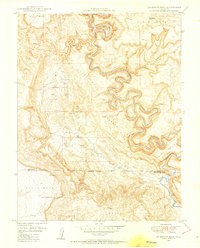 1949 Anderson Mesa1955 Print · USGSThe high mesas of western Colorado are documented here in the late 1940s as mineral exploration began to peak. Researchers can trace early uranium mining efforts at Morning Star Mine and The Raven Mine or follow the loops of the Dolores River past Muleshoe Bend.2 unique versions available
 - 1950 Map of Anderson Mesa
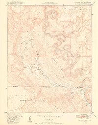 1950 Anderson Mesa1950 Print · USGSMontrose and San Miguel Counties are shown at the height of post-war mineral exploration in the late 1940s. Researchers can trace early mining operations like Morning Star Mine and The Raven Mine near the loops of Dolores River.2 unique versions available
 - 1950 Map of Atkinson Creek
 1950 Atkinson Creek1950 Print · USGSThe San Miguel River valley and surrounding mesas are captured here during the mid-century mining boom. Local history researchers can trace the roads leading to the Wright Mine or locate early ranching landmarks like Spring Creek Ranch and Hog Park.2 unique versions available
 - 1950 Map of Red Canyon
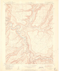 1950 Red Canyon1950 Print · USGSCanyon country at the Mesa and Montrose County line comes into focus in 1950 as postwar mineral exploration intensified. Local historians and mineral enthusiasts can locate the North Star Mine, Club Ranch, and several inactive placer mines along the Dolores River.2 unique versions available
 - 1954 Map of Mt Peale 1 SE
 1954 Mt Peale 1 SE1954 Print · USGSThe Utah and Colorado borderlands reveal an intense era of mineral exploration in the mid-fifties. Researchers can trace historic mining claims like the Vanadium Queen Mine and Yellow Bird Mine alongside landmarks like The Horn.
Showing maps 1-25 of 423
Top cities of Montrose County
Frequently asked questions
- What are the different types of historical maps available for Montrose County?
- What is the oldest map of Montrose County?
- Where can I purchase historical maps of Montrose County for my home or office?
- Where can I download high-res historical maps of Montrose County?
- Are there historical topographic maps available for Montrose County?
- Is there historical aerial imagery available for Montrose County?
- Where are historical maps of Montrose County sourced from?