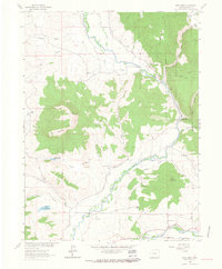
1960s Maps of Routt County, Colorado
Explore 36 historic maps of Routt County from the 1960s. These maps offer a rare glimpse into what life looked like during the 1960s — showing old roads, neighborhoods, homes, and landmarks that have changed or disappeared over time.
Whether you're researching your family's past, planning a metal detecting trip, or studying how Routt County's landscape evolved across the 1960s, these high-resolution maps are a powerful tool for exploring the history of this region.
- Focus on a specific era: All maps on this page are from the 1960s, giving you a focused view of this time period.
- See what’s changed: Compare century-old streets, trails, and buildings to today's modern landscape using overlays and satellite layers.
- Research with precision: Use these maps for genealogy, historical research, land use analysis, or educational projects.
- View, download, or print: Maps are fully viewable online in high resolution, and can be downloaded or printed for your own records.
Start exploring Routt County's history through authentic maps from the 1960s. This is your window into the past.
Routt County, CO maps
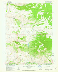
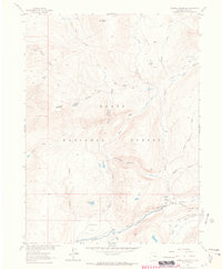
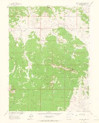
(36)- 1960 Map of Leadville
 1960 Leadville1960 Print · USGSThe Colorado high country in the mid-fifties comes alive through its mining camps, river valleys, and rail lines. Trace the industrial legacy of the Climax Molybdenum Mine and explore the alpine reaches of the Camp Hale Military Reservation.2 unique versions available
 - 1960 Map of Craig
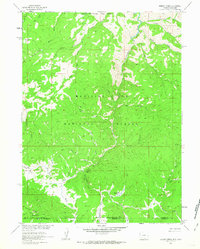
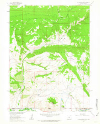
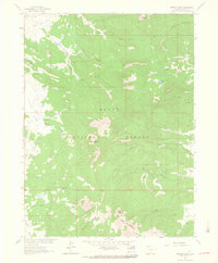
 1960 Craig1960 Print · USGSNorthwest Colorado in the 1950s is a landscape of mountain summits and industrial growth at the headwaters of the West. Genealogists and historians can trace rail-town development along the Denver and Salt Lake line, while locating Uranium Mines and settlements like Craig, Meeker, and Steamboat Springs.
 - 1961 Map of Grieve Reservoir, 1963 Print
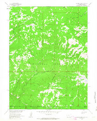
 1961 Grieve Reservoir1963 Print · USGSThe high-country ranching borderlands of Carbon County appear here in the early sixties as the Missouri River Basin development program reached into the Rockies. Genealogists and historians can locate the Battle Creek Sch and Anderson Cem along the Little Snake River, alongside landmarks like the Boyer Ranch.2 unique versions available
 - 1961 Map of Dudley Creek, 1963 Print
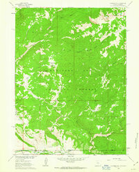
 1961 Dudley Creek1963 Print · USGSThe high Sierra Madre range at the Wyoming-Colorado border is captured here in the early sixties, showing the remote wilderness of the Medicine Bow National Forest. Trace the path of the Continental Divide near industrial and seasonal sites like the Broadway Mine and Finch Cow Camp.4 unique versions available
 - 1961 Map of Solomon Creek, 1963 Print
 1961 Solomon Creek1963 Print · USGSHigh in the Sierra Madre during the early sixties, this terrain showcases a remote landscape defined by the Continental Divide and high-country grazing. Trace the Elkhorn Stock Trail, locate the Veda Mine, and follow the Little Snake River headwaters.4 unique versions available
 - 1961 Map of Fletcher Peak, 1963 Print
 1961 Fletcher Peak1963 Print · USGSHigh in the Sierra Madre at the turn of the 1960s, this survey captures the intersection of the Continental Divide and the Wyoming-Colorado border. Researchers can trace the ranching and mining footprint through the Standard Mine, the isolated Rasmussen Ranch, and the Hackmaster Ditch.4 unique versions available
 - 1962 Map of Rawlins
 1962 Rawlins1962 Print · USGSSouthern Wyoming at the dawn of the sixties shows a landscape shaped by the Union Pacific and the high peaks of the Medicine Bow Mountains. Researchers can trace the path of the old stage routes through Overland Stage Station and Fort Fred Steele.
 - 1962 Map of Leadville
 1962 Leadville1962 Print · USGSThe Colorado high country in the early sixties was a rugged landscape of mining camps, military training grounds, and emerging ski towns. Researchers can trace the legacy of Camp Hale, locate the Molybdenum mine near Leadville, and follow the Denver and Rio Grande Western RR through the canyons.
 - 1962 Map of Craig
 1962 Craig1962 Print · USGSNorthwest Colorado in the early sixties is a land of high-elevation ranching and remote river valleys. Genealogists and historians can trace the Denver and Rio Grande Western rail lines and locate early settlements like Hahns Peak, Meeker, and Juniper Springs.
 - 1962 Map of Cottonwood Rim, 1963 Print
 1962 Cottonwood Rim1963 Print · USGSThe Wyoming-Colorado borderlands are captured here in the early sixties, showing the high-elevation terrain of the Medicine Bow National Forest. Researchers can trace the path of the Stock Driveway or locate remote landmarks like the Sandstone Ranger Sta and Sheep Mountain.4 unique versions available
 - 1962 Map of West Fork Lake, 1964 Print
 1962 West Fork Lake1964 Print · USGSThe high alpine terrain along the Continental Divide comes into focus in the early sixties as a region of forest management and seasonal livestock movement. Trace the paths of early travelers along the Stock Driveway or find remote landmarks like West Fork Lake and Silver City Creek.5 unique versions available
 - 1962 Map of Tumble Mountain, 1964 Print
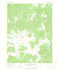
 1962 Tumble Mountain1964 Print · USGSHigh-country ranching and towering peaks define this 1960s study of the Routt County backcountry. Trace the remote river life at Focus Ranch or explore the steep drainages around Tumble Mountain and Columbus Mountain.3 unique versions available
 - 1962 Map of Rocky Peak, 1964 Print
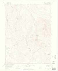
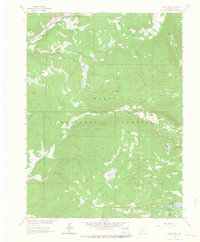
 1962 Rocky Peak1964 Print · USGSThe Routt County backcountry comes alive in this early 1960s survey of the mountain drainages north of the Yampa valley. Researchers can trace the early footprint of Strawberry Park and find local landmarks like the Steamboat Springs Airport and the Dry Lake Campground.3 unique versions available
 - 1962 Map of Farwell Mountain, 1964 Print
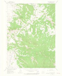
 1962 Farwell Mountain1964 Print · USGSRoutt National Forest in the early sixties was a landscape of high peaks and vital river headwaters. Researchers can trace historic backcountry access via the Three Island Lake Trail (Pack) and locate remote sites like Seedhouse Guard Station.3 unique versions available
 - 1962 Map of Hahns Peak, 1964 Print
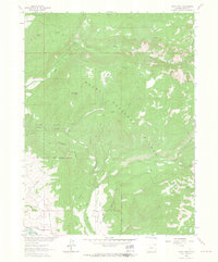
 1962 Hahns Peak1964 Print · USGSThe Colorado high country around the Routt National Forest is shown here during the 1960s, a period marked by both active ranching and historic mining sites. Trace the locations of legacy operations like the Royal Flush Mine and Master Key Mine, or locate the Hahns Peak Lookout Tower.5 unique versions available
 - 1962 Map of Shield Mountain, 1964 Print
 1962 Shield Mountain1964 Print · USGSRoutt County high country is documented here in the early sixties, showing a landscape of remote peaks and ranching outposts. Researchers can locate the Three Forks Ranch, an early Cem, and miles of Pack Trails winding past Shield Mountain.4 unique versions available
 - 1962 Map of Floyd Peak, 1964 Print
 1962 Floyd Peak1964 Print · USGSRoutt National Forest was a vast expanse of high-altitude basins and river forks in the early sixties. High-country researchers can trace primitive routes like the Big Creek Ridge Trail and locate isolated landmarks such as Wapiti Ranch, Swamp Park, and Lake Margaret.3 unique versions available
 - 1962 Map of Bears Ears Peaks, 1964 Print
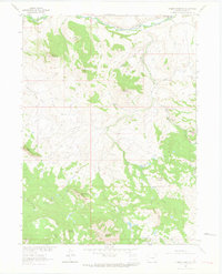
 1962 Bears Ears Peaks1964 Print · USGSThe Elkhead Mountains of Northwest Colorado are captured here in the early 1960s, showing a landscape of high summits and seasonal grazing parks. Researchers can trace remote routes like the Lookout Trail and locate the California Park Guard Station.6 unique versions available
 - 1962 Map of Meaden Peak, 1964 Print
 1962 Meaden Peak1964 Print · USGSRoutt County in the early sixties is captured here as a landscape of high summits and isolated ranching outposts. Trace the remote network of Jeep Trails connecting Jolley Ranch and Smith Ranch with landmarks like Meaden Peak and Sand Mountain.3 unique versions available
 - 1962 Map of Elkhorn Mountain, 1964 Print
 1962 Elkhorn Mountain1964 Print · USGSHigh in the Colorado Rockies in the early sixties, this map shows a landscape of timbered peaks and high-altitude meadows. Researchers can trace the location of the Elkhorn Mine, find the Dead Mexican Park Grave, or locate the Summit Creek Guard Station.5 unique versions available
 - 1962 Map of Clark, 1964 Print
 1962 Clark1964 Print · USGSRoutt County valley life and high-country mining are captured here in the early sixties. Researchers can trace the Moon Hill School and Greenville Mine, or locate river landmarks like Glen Eden and Moon Hill Bridge.5 unique versions available
 - 1962 Map of Mad Creek, 1964 Print
 1962 Mad Creek1964 Print · USGSRoutt County mountain valleys and high peaks are captured here in the early sixties, showing the intersection of ranching life and heavy rail. Genealogists and hikers can trace the Elk Mountain Cem, the settlement at Mystic, and old trails into the Routt National Forest.3 unique versions available
 - 1964 Map of Craig
 1964 Craig1964 Print · USGSNorthwestern Colorado's high country is captured here during the mid-sixties, from the Yampa River valley to the high peaks of the Park Range. Local researchers can trace the Denver and Rio Grande Western rail line and locate Uranium Mines near Lay.
 - 1964 Map of Leadville
 1964 Leadville1964 Print · USGSColorado's high country is captured here during the mid-1960s, showing the intersection of mining history and mountain transport. Trace the legacy of high-altitude industry at the Climax Molybdenum Mine or follow the rails of the Colorado and Southern Ry past Leadville.
 - 1965 Map of Craig
 1965 Craig1965 Print · USGSNorthwest Colorado in the mid-sixties is defined by its massive river basins and high mountain ranges flanking the Continental Divide. Trace the routes of the Denver and Rio Grande Western through old settlements like McCoy and Kremmling.
Showing maps 1-25 of 36
Top cities of Routt County
- Steamboat Springs historical maps
- Hayden historical maps
- Oak Creek historical maps
- Yampa historical maps
- Phippsburg historical maps
Frequently asked questions
- What are the different types of historical maps available for Routt County?
- What is the oldest map of Routt County?
- Where can I purchase historical maps of Routt County for my home or office?
- Where can I download high-res historical maps of Routt County?
- Are there historical topographic maps available for Routt County?
- Is there historical aerial imagery available for Routt County?
- Where are historical maps of Routt County sourced from?