2000s (21st Century) Maps of Routt County, Colorado
Explore 327 historic maps of Routt County from the 2000s (21st Century). These maps offer a rare glimpse into what life looked like during the 2000s — showing old roads, neighborhoods, homes, and landmarks that have changed or disappeared over time.
Whether you're researching your family's past, planning a metal detecting trip, or studying how Routt County's landscape evolved across the 2000s, these high-resolution maps are a powerful tool for exploring the history of this region.
- Focus on a specific era: All maps on this page are from the 2000s, giving you a focused view of this time period.
- See what’s changed: Compare century-old streets, trails, and buildings to today's modern landscape using overlays and satellite layers.
- Research with precision: Use these maps for genealogy, historical research, land use analysis, or educational projects.
- View, download, or print: Maps are fully viewable online in high resolution, and can be downloaded or printed for your own records.
Start exploring Routt County's history through authentic maps from the 2000s. This is your window into the past.
Routt County, CO maps
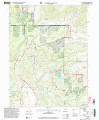
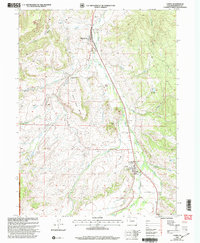
(327)- 2000 Map of Pagoda
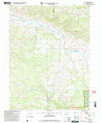 2000 Pagoda2000 Print · USGSThe Williams Fork valley and its surrounding high-country forests are captured here at the turn of the millennium. Local researchers can trace old mining and water history through features like the Cedar Creek Mine, the Pagoda settlement, and Sullivan Reservoir.
 - 2000 Map of Pagoda Peak
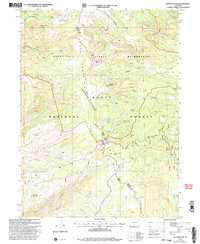
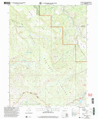 2000 Pagoda Peak2000 Print · USGSHigh Colorado wilderness at the turn of the millennium centers on the prominent Pagoda Peak and the surrounding national forests. Local historians and hikers can trace the path of the Flat Tops Scenic Byway near Vaughan Lake and the remote reaches of Stinsby Reservoir.
 - 2000 Map of Bears Ears Peaks, 2004 Print
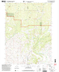
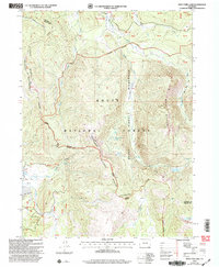
 2000 Bears Ears Peaks2004 Print · USGSRoutt County at the turn of the millennium remains a high-country wilderness defined by forest service outposts and traditional trails. Researchers can trace historic management sites like the Grizzly Creek Guard Station and landmarks such as Bears Ears Peaks.
 - 2000 Map of Rocky Peak, 2004 Print
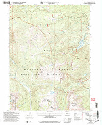
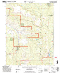
 2000 Rocky Peak2004 Print · USGSRoutt County at the start of the twenty-first century reveals a landscape defined by the Routt National Forest and the upper reaches of the Yampa River. Map collectors can trace the Cabin Creek Trail into the Mount Zirkel Wilderness or locate the Steamboat Springs Airport in the valley.
 - 2000 Map of Walton Peak, 2004 Print
 2000 Walton Peak2004 Print · USGSThe high Divide country of the Southern Rockies is captured here at the turn of the millennium, straddling the Routt and Grand county line. Researchers can trace the protected waters of the Sarvis Creek Wilderness and the ascent to Walton Peak.
 - 2000 Map of Clark, 2004 Print
 2000 Clark2004 Print · USGSUpper Elk River valley life at the turn of the millennium centered on the small mountain communities of Clark and Glen Eden. Local history researchers can locate the Moon Hill Sch, trace the Greenville Road, and find the site of the Greenville Mine.
 - 2000 Map of Slide Mountain, 2004 Print
 2000 Slide Mountain2004 Print · USGSHigh-country ranching and forest lands meet at the Moffat and Routt county line in the years following the millennium. Genealogists and historians can trace water rights and high-altitude access through landmarks like Anderson Reservoir, Tipton Ditch, and the historic Bears Ears Trail.
 - 2000 Map of Orno Peak, 2004 Print
 2000 Orno Peak2004 Print · USGSGarfield and Routt counties are shown at the turn of the millennium, defined by the high plateaus and alpine drainages of the Flat Tops Wilderness. Researchers can trace historic routes like the Ute Trail and locate remote landmarks like Orno Peak and Yamcolo Reservoir.
 - 2000 Map of Quaker Mountain, 2004 Print
 2000 Quaker Mountain2004 Print · USGSRoutt County high country is shown here at the turn of the century as a network of forest roads and watersheds. Researchers can trace land management through features like California Park, Quaker Mountain, and Mc Kinlay Ditch No 1.
 - 2000 Map of Lynx Pass, 2004 Print
 2000 Lynx Pass2004 Print · USGSThe high timber and drainage divides of Routt and Grand counties come into focus at the turn of the millennium. Outdoor historians and researchers can trace the routes through Lynx Pass, the site of a Guard Sta, and across the distinctive Muddy Slide.
 - 2000 Map of Mad Creek, 2004 Print
 2000 Mad Creek2004 Print · USGSRoutt County at the turn of the millennium shows a landscape defined by the confluence of the Elk River valley and high forest terrain. Researchers can locate the Elk Mountain Cemetery and trace the complex water systems of the Keller Ditch and Trull Creek.
 - 2000 Map of Davis Peak, 2004 Print
 2000 Davis Peak2004 Print · USGSJackson and Routt counties meet along the Continental Divide in this high-altitude survey from the turn of the millennium. Trace the paths of the Buffalo Ridge Trail to remote landmarks like Seven Lakes and Lake Eileen.
 - 2000 Map of Toponas, 2004 Print
 2000 Toponas2004 Print · USGSThe ranching and forest lands of Routt County are seen here at the turn of the millennium, showing a landscape defined by mountain irrigation and high-altitude basins. Local historians can trace the irrigation network from Stillwater Ditch to the valley floor near Toponas and Egeria.
 - 2000 Map of Elkhorn Mountain, 2004 Print
 2000 Elkhorn Mountain2004 Print · USGSThe Routt National Forest comes into focus in this late-twentieth-century study of high-country mining and land management. Trace the legacy of early prospectors at Elkhorn Mine and follow seasonal cattle routes like the Elkhorn Stock Driveway.
 - 2000 Map of Sand Point, 2004 Print
 2000 Sand Point2004 Print · USGSThe high plateaus of the Colorado Rockies are captured here at the turn of the millennium, documenting a landscape of rugged peaks and vital water infrastructure. Researchers can trace historic irrigation systems like the Trout Creek School Ditch and Last Chance Ditch near Sand Point.
 - 2000 Map of Buffalo Pass, 2004 Print
 2000 Buffalo Pass2004 Print · USGSThe high alpine crest of the Park Range is captured here at the turn of the century, centered on the historic Buffalo Pass. Hikers and researchers can trace the Continental Divide National Scenic Trail as it passes high-elevation water bodies like Summit Lake and Lake Dinosaur.
 - 2000 Map of West Fork Lake, 2004 Print
 2000 West Fork Lake2004 Print · USGSHigh in the Colorado Rockies at the turn of the century, this survey documents the rugged ridgelines where the Continental Divide meets the Sierra Madre. Outdoorsmen and researchers can trace the routes of the Wyoming Trail past alpine landmarks like West Fork Lake and the Hog Park Guard Station.
 - 2000 Map of Trapper, 2004 Print
 2000 Trapper2004 Print · USGSHigh-altitude forests and ranching infrastructure define this Routt County landscape as it appeared in the early 2000s. Trace the network of irrigation and fishing sites like Finger Rock Fish Hatchery, Egeria Creek Reservoir, and Trapper.
 - 2000 Map of Dunckley Pass, 2004 Print
 2000 Dunckley Pass2004 Print · USGSRoutt and Rio Blanco counties meet at the high plateaus of this turn-of-the-century survey. Researchers can trace the rugged transition from Egry Mesa to the Flat Tops Wilderness, passing through Dunckley Pass and Sheriff Reservoir.
 - 2000 Map of Floyd Peak, 2004 Print
 2000 Floyd Peak2004 Print · USGSThe high country of Routt County is documented here at the turn of the millennium, showing a landscape of alpine lakes and forest trails. Researchers can trace the Wilderness Boundary and locate landmarks like Wapiti Ranch and Swamp Park.
 - 2000 Map of Yampa, 2004 Print
 2000 Yampa2004 Print · USGSYampa and Phippsburg are captured at the turn of the century, showing a mix of mountain ranching, rail history, and forest management. Genealogists and researchers can locate landmarks such as the Yampa Ranger Sta, old Strip Mines, and the distinct formation of Finger Rock.
 - 2000 Map of Mount Werner, 2004 Print
 2000 Mount Werner2004 Print · USGSThe high country of the Routt National Forest is captured here at the turn of the century, centered on the Steamboat Ski Area. Researchers can trace the Continental Divide and locate remote landmarks like Fish Creek Reservoir and Lake Percy.
 - 2000 Map of Green Ridge, 2004 Print
 2000 Green Ridge2004 Print · USGSRoutt National Forest at the turn of the millennium shows a landscape defined by protected wilderness and alpine recreation. Trace the early infrastructure of the Stagecoach Ski Area or follow the Silver Creek Trail through Wheeler Basin.
 - 2000 Map of Dunckley, 2004 Print
 2000 Dunckley2004 Print · USGSThe Williams Fork Mountains and the Routt National Forest defined this high-country landscape at the turn of the millennium. Researchers can trace land use through features like the Strip Mine, the settlement at Dunckley, and reservoirs such as Shaffer Reservoir.
 - 2000 Map of Gore Mountain, 2004 Print
 2000 Gore Mountain2004 Print · USGSRoutt and Grand Counties are captured here at the turn of the century, showing a high alpine landscape where two national forests meet. Researchers can trace the rugged drainage of Sarvis Creek and the steep terrain surrounding Gore Mountain and the Morrison Divide.
Showing maps 1-25 of 327
Top cities of Routt County
- Steamboat Springs historical maps
- Hayden historical maps
- Oak Creek historical maps
- Yampa historical maps
- Phippsburg historical maps
Frequently asked questions
- What are the different types of historical maps available for Routt County?
- What is the oldest map of Routt County?
- Where can I purchase historical maps of Routt County for my home or office?
- Where can I download high-res historical maps of Routt County?
- Are there historical topographic maps available for Routt County?
- Is there historical aerial imagery available for Routt County?
- Where are historical maps of Routt County sourced from?