Old Maps of Routt County, Colorado for Hiking & Exploration
Hike through history with 416 historic maps of Routt County. Explore old trails, ghost towns, and forgotten backroads — perfect for outdoor adventurers and local explorers.
- Rediscover forgotten places: Map out old mining camps, roads, and footpaths that no longer exist on modern maps.
- Layer with modern tools: Combine with LiDAR or satellite views to plan hikes through historical terrain.
- Made for exploration: Popular among hikers, overlanders, and local history lovers.
Use these maps to find adventure and explore the hidden past of Routt County.
Routt County, CO maps
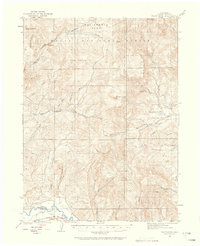
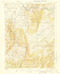
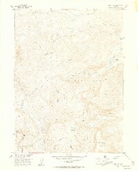
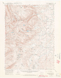
(416)- 1911 Map of Hahns Peak, 1954 Print
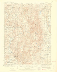 1911 Hahns Peak1954 Print · USGSThe northern Park Range and the Continental Divide appear in great detail just after the first decade of the twentieth century. Researchers can locate remote schools and ranches like Moon Hill School, the Elkhorn Mine, and the settlement of Pearl.2 unique versions available
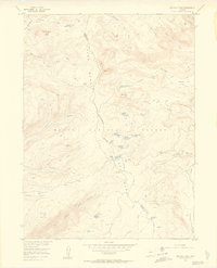
 - 1913 Map of Hahns Peak
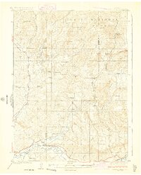
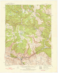
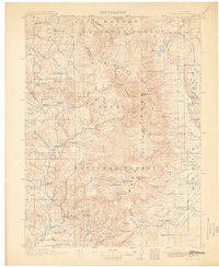 1913 Hahns Peak1913 Print · USGSRoutt County was a landscape of high-country mining and isolated homesteads in the early 1900s. Researchers can trace the era's rural infrastructure through old schoolhouses like Moon Hill School, the Elkhorn Mine, and settlements such as Columbine.2 unique versions available
 - 1916 Map of Daton Peak, 1958 Print
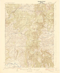
 1916 Daton Peak1958 Print · USGSThe Yampa Valley and Williams Fork Mountains are captured here in the mid-1910s during the height of early coal mining. Trace local genealogy and industry through the Cary Mines, the Pagoda School, and the remote Willow Creek Store.2 unique versions available
 - 1920 Map of Daton Peak
 1920 Daton Peak1920 Print · USGSNorthwest Colorado in the era of early mountain ranching and coal mining features a landscape of isolated homesteads and high peaks. Genealogists and historians can trace family-named sites like Jim Dunns Mine, Cary Ranch, and the Pagoda School.2 unique versions available
 - 1923 Map of Elkhead Creek, 1955 Print
 1923 Elkhead Creek1955 Print · USGSMoffat and Routt counties in the early 1920s reveal a landscape of mountain ranching and coal mining before modern development. Genealogists can trace a network of one-room schoolhouses like Dry Fork School and Elkhead School, or locate old family claims near Seymour Mine.5 unique versions available
 - 1923 Map of Pilot Knob, 1958 Print
 1923 Pilot Knob1958 Print · USGSRoutt County mountain life and early industry are captured here in the early 1920s, showing the high-altitude parks and remote schoolhouses of the period. Genealogists and researchers can trace rural homesteads near Gantts Cabin, several early mines like the Ducey Mine, and small community centers like Deep Creek School.4 unique versions available
 - 1924 Map of Elkhead Creek
 1924 Elkhead Creek1924 Print · USGSNorthwest Colorado in the 1920s was a landscape of remote coal mines and scattered one-room schoolhouses along the Yampa River. Genealogists can trace family roots through numerous sites like Elkhead School, the Seymour Mine, and the Bears Ears Ranger Station.2 unique versions available
 - 1924 Map of Mt. Harris
 1924 Mt. Harris1924 Print · USGSRoutt County coal country and the Yampa River valley are captured in the mid-twenties, showing the rise of rail-side settlements and mining camps. Trace early homesteads and community hubs like Coal View, Pinnacle PO, and the Chicago Mine.4 unique versions available
 - 1925 Map of Pilot Knob
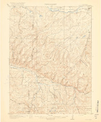
 1925 Pilot Knob1925 Print · USGSRoutt County in the early twenties reveals a landscape of high-altitude parks and remote mountain mining. Genealogists and researchers can trace early rural life through Gantts Cabin, the Long Gulch School, and the Ducey Mine.2 unique versions available
 - 1926 Map of Mount Harris
 1926 Mount Harris1926 Print · USGSRoutt County's coal and ranching country comes alive in the mid-1920s as the Denver and Salt Lake railroad follows the Yampa River. Genealogists and historians can trace the foundations of local life through rural schools like Windy Point School and vanished mining-era stops such as Coal View.2 unique versions available
 - 1927 Map of Glenwood Springs, 1956 Print
 1927 Glenwood Springs1956 Print · USGSGarfield County’s mountain interior comes to life in the 1920s, showing the high-country settlements and early forest service infrastructure across the Colorado River valley. Genealogists can trace family footprints at Sweetwater Lake Sch, the Shoshone Power Plant, and remote outposts like Hip Roof Cabin.3 unique versions available
 - 1930 Map of Glenwood Springs
 1930 Glenwood Springs1930 Print · USGSGlenwood Springs and the Colorado River corridor are captured here during the late prohibition era, showing the region's transition into a center for power and rail transport. Researchers can trace the Denver and Rio Grande Western Railroad to Dotsero or find remote outposts like Hip Roof Cabin and Transfer Springs Ranger Sta.4 unique versions available
 - 1932 Map of Savery
 1932 Savery1932 Print · USGSSouthern Wyoming ranching and mining country meet at the edge of the Rockies in the early thirties. Genealogists and historians can locate rural schools like Ketchum Sch, the operations of Pioneer Coal Co, and the remote Tullis settlement.3 unique versions available
 - 1939 Map of Saratoga
 1939 Saratoga1939 Print · USGSThe North Platte valley comes alive in the late 1930s as a vital corridor for ranching and transport. Researchers can trace the Saratoga and Encampment Railroad or locate early rural schools like Benton Creek Sch and the Big Cr Mine.3 unique versions available
 - 1940 Map of Savery
 1940 Savery1940 Print · USGSThe high country of the Wyoming-Colorado border is captured here as the ranching and forest service outposts of the early twentieth century were becoming established. Researchers can trace the remote Snake River drainage and find historic sites like Tullis, Savery, and the Rambler Ranger Sta.2 unique versions available
 - 1954 Map of Rawlins, 1968 Print
 1954 Rawlins1968 Print · USGSThe high plains and mountain ranges of southern Wyoming are shown here in the mid-1950s as the Union Pacific railroad and early highways fueled local industry. Genealogists and historians can trace old homesteads and outposts like the Overland Stage Station, the Utah Oil Refining Station, and the Hadsell Winter Headquarters.2 unique versions available
 - 1954 Map of Craig, 1973 Print
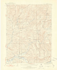
 1954 Craig1973 Print · USGSNorthwest Colorado and the high mountain parks are captured in the mid-fifties, showing the region's ranching, mining, and timber centers. Genealogists and historians can trace rail corridors like the Denver and Rio Grande Western and old towns such as Axial, Milner, and Coalmont.3 unique versions available
 - 1955 Map of Davis Peak, 1956 Print
 1955 Davis Peak1956 Print · USGSThe high alpine country of the Park Range comes into focus during the mid-1950s, showing a landscape defined by seasonal industry and rugged navigation. Researchers can trace the Stock Driveway, locate an early Sawmill (Aband), and find remote water features like Seven Lakes.5 unique versions available
 - 1955 Map of Buffalo Pass, 1956 Print
 1955 Buffalo Pass1956 Print · USGSThe high Continental Divide in the mid-fifties is captured here during a period of Missouri River Basin development surveys. Researchers can trace historic high-country routes like the Wyoming Trail and locate the Summit Lake Guard Sta near Buffalo Pass.6 unique versions available
 - 1955 Map of Mount Zirkel, 1957 Print
 1955 Mount Zirkel1957 Print · USGSThe high peaks of the Park Range in the mid-1950s are preserved here, centered on the Continental Divide and the settlement at Slavonia. Local historians can trace old wilderness trails and primitive camps near Mount Zirkel, Mica Lake, and Three Island Lake.6 unique versions available
 - 1955 Map of Mount Ethel, 1957 Print
 1955 Mount Ethel1957 Print · USGSThe Park Range highlands and the Continental Divide define this Colorado wilderness as it appeared in the mid-1950s. Trace the paths of the historic Wyoming Trail and Rainbow Lake Trail to remote landmarks like Mount Ethel and Big Creek Lake.6 unique versions available
 - 1955 Map of Mount Ethel, 1969 Print
 1955 Mount Ethel1969 Print · USGSThe high Colorado wilderness and its ranching fringes are captured here in the mid-1950s. Trace old family operations like the Carlstrom Bros Ranch and Irvine Ranch, or locate the remote Butler Sch and Grizzly Guard Station.3 unique versions available
 - 1956 Map of Storm Mountain, 1958 Print
 1956 Storm Mountain1958 Print · USGSThe high alpine country of the Routt National Forest is captured here in the mid-1950s, showing the intersection of three Colorado counties. Trace the paths of early travelers across the Continental Divide and locate remote landmarks like Fishhook Lake or Storm Mountain.4 unique versions available
 - 1956 Map of Walton Peak, 1958 Print
 1956 Walton Peak1958 Print · USGSThe high divide of the Gore Range was a wilderness of forest boundaries and pack trails in the mid-1950s. Trace the path of the Buffalo Park Trail or locate the remote State Highway Radio Relay Station near the headwaters of Service Creek.4 unique versions available
 - 1956 Map of Gore Pass, 1958 Print
 1956 Gore Pass1958 Print · USGSThe high mountain divide between Grand and Routt Counties comes into focus during the mid-1950s, showing a landscape defined by timber and ranching. Researchers can locate remote sites like Strutsell Sawmill, Snowshoe Ranch, and the Bible Institute Camp.4 unique versions available
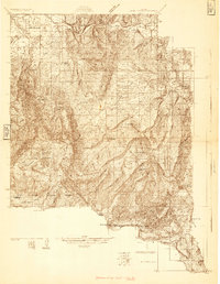
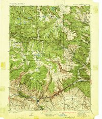
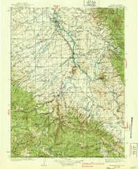
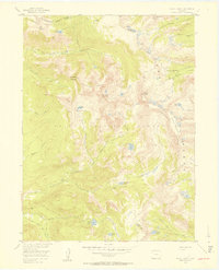
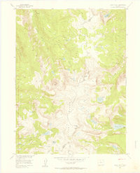
Showing maps 1-25 of 416
Top cities of Routt County
- Steamboat Springs historical maps
- Hayden historical maps
- Oak Creek historical maps
- Yampa historical maps
- Phippsburg historical maps
Frequently asked questions
- What are the different types of historical maps available for Routt County?
- What is the oldest map of Routt County?
- Where can I purchase historical maps of Routt County for my home or office?
- Where can I download high-res historical maps of Routt County?
- Are there historical topographic maps available for Routt County?
- Is there historical aerial imagery available for Routt County?
- Where are historical maps of Routt County sourced from?