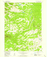
1950s Maps of Routt County, Colorado
Explore 17 historic maps of Routt County from the 1950s. These maps offer a rare glimpse into what life looked like during the 1950s — showing old roads, neighborhoods, homes, and landmarks that have changed or disappeared over time.
Whether you're researching your family's past, planning a metal detecting trip, or studying how Routt County's landscape evolved across the 1950s, these high-resolution maps are a powerful tool for exploring the history of this region.
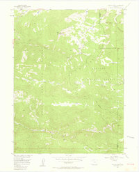
- Focus on a specific era: All maps on this page are from the 1950s, giving you a focused view of this time period.
- See what’s changed: Compare century-old streets, trails, and buildings to today's modern landscape using overlays and satellite layers.
- Research with precision: Use these maps for genealogy, historical research, land use analysis, or educational projects.
- View, download, or print: Maps are fully viewable online in high resolution, and can be downloaded or printed for your own records.
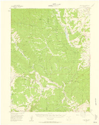
Start exploring Routt County's history through authentic maps from the 1950s. This is your window into the past.
Routt County, CO maps
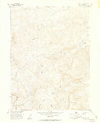
(17)- 1954 Map of Rawlins, 1968 Print
 1954 Rawlins1968 Print · USGSThe high plains and mountain ranges of southern Wyoming are shown here in the mid-1950s as the Union Pacific railroad and early highways fueled local industry. Genealogists and historians can trace old homesteads and outposts like the Overland Stage Station, the Utah Oil Refining Station, and the Hadsell Winter Headquarters.2 unique versions available
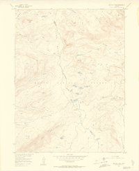
 - 1954 Map of Craig, 1973 Print
 1954 Craig1973 Print · USGSNorthwest Colorado and the high mountain parks are captured in the mid-fifties, showing the region's ranching, mining, and timber centers. Genealogists and historians can trace rail corridors like the Denver and Rio Grande Western and old towns such as Axial, Milner, and Coalmont.3 unique versions available
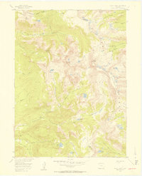
 - 1955 Map of Davis Peak, 1956 Print
 1955 Davis Peak1956 Print · USGSThe high alpine country of the Park Range comes into focus during the mid-1950s, showing a landscape defined by seasonal industry and rugged navigation. Researchers can trace the Stock Driveway, locate an early Sawmill (Aband), and find remote water features like Seven Lakes.5 unique versions available
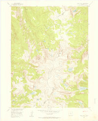
 - 1955 Map of Buffalo Pass, 1956 Print
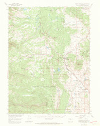
 1955 Buffalo Pass1956 Print · USGSThe high Continental Divide in the mid-fifties is captured here during a period of Missouri River Basin development surveys. Researchers can trace historic high-country routes like the Wyoming Trail and locate the Summit Lake Guard Sta near Buffalo Pass.6 unique versions available
 - 1955 Map of Mount Zirkel, 1957 Print
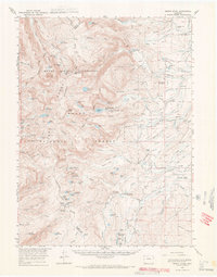
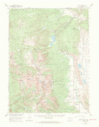
 1955 Mount Zirkel1957 Print · USGSThe high peaks of the Park Range in the mid-1950s are preserved here, centered on the Continental Divide and the settlement at Slavonia. Local historians can trace old wilderness trails and primitive camps near Mount Zirkel, Mica Lake, and Three Island Lake.6 unique versions available
 - 1955 Map of Mount Ethel, 1957 Print
 1955 Mount Ethel1957 Print · USGSThe Park Range highlands and the Continental Divide define this Colorado wilderness as it appeared in the mid-1950s. Trace the paths of the historic Wyoming Trail and Rainbow Lake Trail to remote landmarks like Mount Ethel and Big Creek Lake.6 unique versions available
 - 1955 Map of Mount Ethel, 1969 Print
 1955 Mount Ethel1969 Print · USGSThe high Colorado wilderness and its ranching fringes are captured here in the mid-1950s. Trace old family operations like the Carlstrom Bros Ranch and Irvine Ranch, or locate the remote Butler Sch and Grizzly Guard Station.3 unique versions available
 - 1956 Map of Storm Mountain, 1958 Print
 1956 Storm Mountain1958 Print · USGSThe high alpine country of the Routt National Forest is captured here in the mid-1950s, showing the intersection of three Colorado counties. Trace the paths of early travelers across the Continental Divide and locate remote landmarks like Fishhook Lake or Storm Mountain.4 unique versions available
 - 1956 Map of Walton Peak, 1958 Print
 1956 Walton Peak1958 Print · USGSThe high divide of the Gore Range was a wilderness of forest boundaries and pack trails in the mid-1950s. Trace the path of the Buffalo Park Trail or locate the remote State Highway Radio Relay Station near the headwaters of Service Creek.4 unique versions available
 - 1956 Map of Gore Pass, 1958 Print
 1956 Gore Pass1958 Print · USGSThe high mountain divide between Grand and Routt Counties comes into focus during the mid-1950s, showing a landscape defined by timber and ranching. Researchers can locate remote sites like Strutsell Sawmill, Snowshoe Ranch, and the Bible Institute Camp.4 unique versions available
 - 1956 Map of Pearl, 1969 Print
 1956 Pearl1969 Print · USGSThe Colorado high country in the mid-fifties comes alive through this survey of the northern wilderness and ranchlands. Genealogists and historians can trace legacy landholdings and industry from the Smelter Stack at Pearl to isolated sites like Fort Boettcher and the Swede Group Mines.2 unique versions available
 - 1956 Map of Rabbit Ears Peak, 1970 Print
 1956 Rabbit Ears Peak1970 Print · USGSNorth-central Colorado at the height of the mid-century demonstrates a rugged alpine economy focused on ranching and forestry. Researchers can trace historic high-altitude homesteads and sites like Anderson Ranch, Rabbit Ears Lodge, and the remote De Berard Ranch.3 unique versions available
 - 1957 Map of Craig
 1957 Craig1957 Print · USGSNorthwest Colorado in the mid-fifties is a landscape of mountain ranching and rail-dependent river towns. Researchers can trace historic coal mining at the Sudduth Mine, follow the Denver and Rio Grande Western tracks, and locate vanished settlements like Pearl.
 - 1957 Map of Leadville, 1978 Print
 1957 Leadville1978 Print · USGSHigh-country mining and rail transport define the central Colorado Rockies during the mid-to-late twentieth century. Researchers can trace the industrial footprints of Gilman and Climax, find small rail stops like Malta, and follow the Denver and Rio Grande Western RR.2 unique versions available
 - 1958 Map of Rawlins
 1958 Rawlins1958 Print · USGSSouthern Wyoming at the mid-century shows a landscape defined by the Union Pacific Railroad and the high basins of the Continental Divide. Researchers can trace old transportation routes near Fort Fred Steele or explore the mining history around Hanna and Medicine Bow.2 unique versions available
 - 1958 Map of Craig
 1958 Craig1958 Print · USGSNorthwest Colorado and the High Rockies are captured here in the mid-fifties, showing a landscape of burgeoning water projects and mountain ranching. Genealogists and historians can trace old homesteads and mountain outposts from Grand Lake to Meeker, alongside industrial landmarks like Uranium Mines and the Denver and Rio Grande Western railroad.
 - 1959 Map of Leadville
 1959 Leadville1959 Print · USGSThe Colorado high country in the late fifties is a landscape of mining history and military training, from the streets of Leadville to the Camp Hale grounds. Genealogists and historians can trace the Denver and Rio Grande Western RR alongside now-deserted sites like Ashcroft and Independence.
End of results
Showing maps 1-17 of 17
Top cities of Routt County
- Steamboat Springs historical maps
- Hayden historical maps
- Oak Creek historical maps
- Yampa historical maps
- Phippsburg historical maps
Frequently asked questions
- What are the different types of historical maps available for Routt County?
- What is the oldest map of Routt County?
- Where can I purchase historical maps of Routt County for my home or office?
- Where can I download high-res historical maps of Routt County?
- Are there historical topographic maps available for Routt County?
- Is there historical aerial imagery available for Routt County?
- Where are historical maps of Routt County sourced from?