1980s Maps of Weld County, Colorado
Explore 6 historic maps of Weld County from the 1980s. These maps offer a rare glimpse into what life looked like during the 1980s — showing old roads, neighborhoods, homes, and landmarks that have changed or disappeared over time.
Whether you're researching your family's past, planning a metal detecting trip, or studying how Weld County's landscape evolved across the 1980s, these high-resolution maps are a powerful tool for exploring the history of this region.
- Focus on a specific era: All maps on this page are from the 1980s, giving you a focused view of this time period.
- See what’s changed: Compare century-old streets, trails, and buildings to today's modern landscape using overlays and satellite layers.
- Research with precision: Use these maps for genealogy, historical research, land use analysis, or educational projects.
- View, download, or print: Maps are fully viewable online in high resolution, and can be downloaded or printed for your own records.
Start exploring Weld County's history through authentic maps from the 1980s. This is your window into the past.
Weld County, CO maps
(6)- 1981 Map of Cheyenne
 1981 Cheyenne1981 Print · USGSCheyenne and the surrounding high plains are captured here in the early eighties, showcasing the intersection of major rail lines and interstate highways. Genealogists and historians can trace the development of outlying ranching communities like Carpenter, Arcola, and the border town of Pine Bluffs.2 unique versions available
 - 1982 Map of Eaton
 1982 Eaton1982 Print · USGSNorthern Colorado and the Wyoming borderlands are captured here in the early eighties, showcasing a vast agricultural and rail landscape. Trace family roots and vanished infrastructure through Chalk Bluffs, the Great Western railroad, and Keota.2 unique versions available
 - 1982 Map of Greeley, 1983 Print
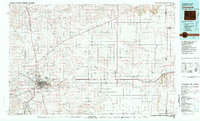
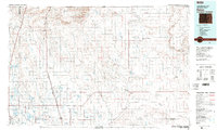
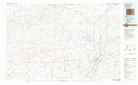
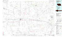
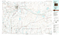 1982 Greeley1983 Print · USGSNorth-central Colorado is shown in the early eighties as a thriving hub of river-valley agriculture and energy production. Researchers can trace the water-rights history and rail networks connecting Greeley to the Spindle Oil Field and Fort Lupton.
 - 1983 Map of Sterling
 1983 Sterling1983 Print · USGSThe Colorado high plains and the South Platte River valley come into focus in the early 1980s, centered on the hub of Sterling. Researchers can trace old transport routes like the Old Railroad Grade or locate remote outposts like Avalo and Westplains.
 - 1984 Map of Estes Park
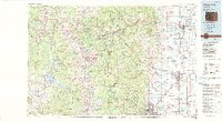 1984 Estes Park1984 Print · USGSThe northern Front Range and high peaks come into focus during the mid-eighties, showing the intersection of mountain wilderness and urban expansion. Trace the rail lines of the Union Pacific, the shores of Lake Granby, and historic mountain towns like Gold Hill or Eldora.3 unique versions available
 - 1985 Map of Kimball
 1985 Kimball1985 Print · USGSThe Nebraska-Colorado borderlands in the mid-1980s show a landscape of oil production and transcontinental rail. Trace the rail corridor through Bushnell, Dix, and Potter or locate the sprawling Ammunition Depot (Abandoned) near Brownson.2 unique versions available
End of results
Showing maps 1-6 of 6
Top cities of Weld County
- Greeley historical maps
- Evans historical maps
- Firestone historical maps
- Frederick historical maps
- Severance historical maps
- Fort Lupton historical maps
See more
Frequently asked questions
- What are the different types of historical maps available for Weld County?
- What is the oldest map of Weld County?
- Where can I purchase historical maps of Weld County for my home or office?
- Where can I download high-res historical maps of Weld County?
- Are there historical topographic maps available for Weld County?
- Is there historical aerial imagery available for Weld County?
- Where are historical maps of Weld County sourced from?