Old Maps of Weld County, Colorado for Academic Research
Study the evolution of Weld County with 623 high-resolution historic maps. Whether you're teaching, researching, or modeling changes in land use, these maps provide essential visual documentation of urban, environmental, and geographic change.
- Analyze long-term change: Track patterns in development, transportation, and natural features.
- Ideal for environmental or urban studies: Support academic projects with primary historical map data.
- Use in the classroom or lab: Educators and researchers rely on these maps to bring historical context to life.
These maps are a powerful tool for teaching, research, and visualizing how Weld County has changed over the decades.
Weld County, CO maps
(623)- 1902 Map of Greeley
 1902 Greeley1902 Print · USGSThe northern Colorado plains come alive in this survey of the South Platte and Cache la Poudre river valleys. Researchers can trace early railroad expansion and irrigation networks while locating specific homesteads like Klugs Ranch and old coal operations such as the Black Prince Coal Mine.4 unique versions available
 - 1904 Map of Niwot
 1904 Niwot1904 Print · USGSThe northern Colorado plains come alive in the early 1900s, showcasing a landscape shaped by coal mining and extensive irrigation. Genealogists and historians can trace family roots through settlements like Hygiene, Niwot, and Erie, or locate industrial sites such as Dixon Mill and the Gladstone Mine.3 unique versions available
 - 1906 Map of Loveland, 1954 Print
 1906 Loveland1954 Print · USGSThe Colorado plains meet the Front Range in the early 1900s, showing a landscape transformed by early irrigation and rail. Genealogists can trace family names across Loveland and Berthoud or locate rural sites like Masonville and Benson Lake.5 unique versions available
 - 1908 Map of Loveland
 1908 Loveland1908 Print · USGSThe Front Range foothills of Larimer County come alive in this early 1900s survey, showing a landscape transformed by water engineering and rail. Trace the original irrigation lines like Louden Ditch and find early industrial sites like the Plaster Mill.7 unique versions available
 - 1908 Map of Eaton, 1957 Print
 1908 Eaton1957 Print · USGSWeld and Larimer counties are seen here in the early twentieth century as irrigation and rail lines transformed the high plains. Researchers can trace the development of agricultural hubs like Pierce and Severance alongside rural landmarks like Albert School and the Indian Springs Coal Mine.
 - 1910 Map of Eaton
 1910 Eaton1910 Print · USGSNorthern Colorado at the turn of the century shows a landscape transformed by railroads and early irrigation projects. Genealogists can locate many family-named landmarks like Slaxton Ranch and rural schoolhouses including Abbot School and Birch School.3 unique versions available
 - 1911 Map of Cheyenne, 1961 Print
 1911 Cheyenne1961 Print · USGSCheyenne was a bustling rail and military center in the years before the Great War. Genealogists and historians can trace the footprint of Fort D.A. Russell and find early rural sites like Campstool and Paola.
 - 1914 Map of Cheyenne
 1914 Cheyenne1914 Print · USGSCheyenne stands at the crossroads of three major railroads in the years before the Great War. Researchers can trace the layout of the Fort D.A. Russell Military Reservation and find local landmarks like Ridley School and Campstool.3 unique versions available
 - 1949 Map of Gowanda, 1957 Print
 1949 Gowanda1957 Print · USGSWeld County’s mid-century farming landscape is captured here, showing the intricate water and rail networks before modern development altered the valley. Genealogists and historians can trace local landmarks like the Rinn Valley Grange, Stone School, and the Union Pacific rail corridor.6 unique versions available
 - 1949 Map of Fort Lupton, 1964 Print
 1949 Fort Lupton1964 Print · USGSNortheastern Colorado agriculture and transit come alive in this post-war survey of the Platte River valley. Genealogists and historians can trace the footprint of rural life through Hillside Cemetery, Wattenberg Sch, and the Union Pacific rail line.6 unique versions available
 - 1949 Map of Platteville, 1966 Print
 1949 Platteville1966 Print · USGSThe Colorado plains near the South Platte River are shown here in the late 1940s, highlighting a landscape defined by irrigation and rail. Researchers can trace the Union Pacific corridor through Platteville, find St Francis Cemetery, and locate the Site of Old Fort Vasquez.5 unique versions available
 - 1949 Map of Hudson, 1967 Print
 1949 Hudson1967 Print · USGSHudson and the surrounding Weld County prairie are captured here in the late 1940s, showing a landscape defined by rail and irrigation. Genealogists and local historians can locate Mountain View Cem, the community of Tonville, and various waterworks like the Beebe Canal.8 unique versions available
 - 1950 Map of Frederick
 1950 Frederick1950 Print · USGSThe coal-rich corridor of Weld County is caught in a moment of industrial transition during the early 1950s. Genealogists and historians can trace the mining family hubs of Frederick, Firestone, and Dacono, alongside local schools like Mount View School and the Shamrock Mine.7 unique versions available
 - 1950 Map of Greeley
 1950 Greeley1950 Print · USGSGreeley and Evans thrive at the mid-century confluence of the Cache La Poudre and South Platte Rivers. Researchers can trace historic neighborhoods and landmarks like the Spanish Colony, Linn Grove Cemetery, and the Union Pacific rail network.8 unique versions available
 - 1950 Map of Gowanda
 1950 Gowanda1950 Print · USGSWeld County farming and rail communities thrive along the river bottom in the years following the war. Researchers can locate the Pearl Howlett School, trace the Great Western tracks, and identify family landmarks like the Rinn Valley Grange.2 unique versions available
 - 1950 Map of Platteville
 1950 Platteville1950 Print · USGSThe South Platte River valley in the mid-twentieth century shows an intensive irrigation landscape supporting the agricultural community of Platteville. Genealogists and local historians can trace the Union Pacific rail line and locate the Site of Old Fort Vasquez or the St Francis Cemetery.2 unique versions available
 - 1950 Map of Fort Lupton
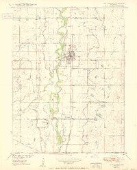 1950 Fort Lupton1950 Print · USGSFort Lupton and the South Platte River valley are captured in detail during the post-war era, showing a landscape shaped by rail and irrigation. Genealogists can locate family landmarks like Hillside Cemetery, Porter Sch, and the small settlement of Wattenberg.2 unique versions available
 - 1950 Map of Windsor
 1950 Windsor1950 Print · USGSWindsor and the surrounding plains of Weld and Larimer Counties appear here in the mid-twentieth century as a thriving agricultural and rail corridor. Researchers can trace the layout of small rail stops like Kelim and Officer or locate rural landmarks like Oklahoma School and Jeffers Sch.8 unique versions available
 - 1950 Map of Kersey
 1950 Kersey1950 Print · USGSWeld County irrigation and rail networks are in full swing at the midpoint of the century. Genealogists and researchers can trace local landmarks like Spanish Village, Lone Tree Sch, and the confluence of the river systems at The Delta.5 unique versions available
 - 1950 Map of Cheyenne
 1950 Cheyenne1950 Print · USGSCheyenne and its surrounding high plains are captured here during a period of post-war expansion and military prominence. Researchers can trace the layout of the Fort Francis E Warren Military Reservation or locate family ranch sites like Rees Brothers Ranch and Diamond Camp.
 - 1950 Map of South Roggen, 1952 Print
 1950 South Roggen1952 Print · USGSThis mid-century survey of the Colorado plains near the Weld-Adams county line documents a rural landscape transitioning into the modern era. Researchers can trace the path of the Henrylyn Canal and locate the Television Relay Station or the settlement at South Roggen.3 unique versions available
 - 1950 Map of Greasewood Lake, 1952 Print
 1950 Greasewood Lake1952 Print · USGSThe Colorado high plains during the post-war energy boom show a ranching landscape beginning to share space with oil exploration. Trace old homesteading remnants like the Prairie Queen School (Aban'd) and reliable water sources like Greasewood Lake and Sandborn Draw.
 - 1950 Map of Wiggins SW, 1952 Print
 1950 Wiggins SW1952 Print · USGSThe Colorado high plains of Weld and Morgan counties are captured here in the mid-century, defined by vital water infrastructure and rural school districts. Genealogists and historians can trace the locations of the Kiowa School and the path of the Gaynor Nile Ditch.2 unique versions available
 - 1950 Map of Tampa, 1952 Print
 1950 Tampa1952 Print · USGSThe eastern Colorado plains come into focus in the mid-twentieth century as a landscape of isolated ranches and vital rail links. Genealogists and historians can trace the rural infrastructure around Tampa and Lutz Ranch or follow the path of the CHICAGO BURLINGTON AND QUINCY railroad.4 unique versions available
 - 1950 Map of Barnesville, 1952 Print
 1950 Barnesville1952 Print · USGSWeld County ranching and irrigation systems are captured here during the mid-century, following the development of the Missouri River Basin. Genealogists can locate the Cem (First Permanent Settlers in Weld Co 1840) and trace old rail stops like Barnesville Station.5 unique versions available
Showing maps 1-25 of 623
Top cities of Weld County
- Greeley historical maps
- Evans historical maps
- Firestone historical maps
- Frederick historical maps
- Severance historical maps
- Fort Lupton historical maps
See more
Frequently asked questions
- What are the different types of historical maps available for Weld County?
- What is the oldest map of Weld County?
- Where can I purchase historical maps of Weld County for my home or office?
- Where can I download high-res historical maps of Weld County?
- Are there historical topographic maps available for Weld County?
- Is there historical aerial imagery available for Weld County?
- Where are historical maps of Weld County sourced from?