1990s Maps of Weld County, Colorado
Explore 41 historic maps of Weld County from the 1990s. These maps offer a rare glimpse into what life looked like during the 1990s — showing old roads, neighborhoods, homes, and landmarks that have changed or disappeared over time.
Whether you're researching your family's past, planning a metal detecting trip, or studying how Weld County's landscape evolved across the 1990s, these high-resolution maps are a powerful tool for exploring the history of this region.
- Focus on a specific era: All maps on this page are from the 1990s, giving you a focused view of this time period.
- See what’s changed: Compare century-old streets, trails, and buildings to today's modern landscape using overlays and satellite layers.
- Research with precision: Use these maps for genealogy, historical research, land use analysis, or educational projects.
- View, download, or print: Maps are fully viewable online in high resolution, and can be downloaded or printed for your own records.
Start exploring Weld County's history through authentic maps from the 1990s. This is your window into the past.
Weld County, CO maps
(41)- 1991 Map of Arcola, 1995 Print
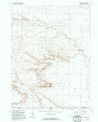 1991 Arcola1995 Print · USGSThe high plains along the Wyoming and Colorado border appear in the early 1990s as a landscape of remote drainages and industrial relics. Trace the Old Railroad Grade past Arcola and locate landmarks like Chalk Bluffs and Porter Creek.
 - 1991 Map of Pine Bluffs SW, 1995 Print
 1991 Pine Bluffs SW1995 Print · USGSHigh Plains ranching and the interstate border define this landscape in the early nineties. Genealogists and researchers can trace family-named sites like Kelly Ranch and Baumann Ranch or locate the Butler Landing Strip.
 - 1991 Map of Carpenter, 1995 Print
 1991 Carpenter1995 Print · USGSNear the Wyoming-Colorado border in the early nineties, the small community of Carpenter remained a quiet agricultural hub. Local historians can trace the remnants of the Old Railroad Grade and locate family markers at the village Cem.
 - 1991 Map of Pine Bluffs SE, 1995 Print
 1991 Pine Bluffs SE1995 Print · USGSHigh Plains ranching territory meets at the convergence of three states in the early nineties. Genealogists and land researchers can trace the jagged Pine Bluffs escarpment and the historic Johnson land division near Muddy Creek.
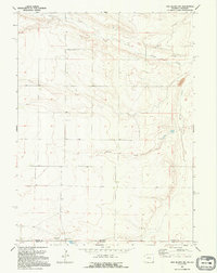
 - 1994 Map of Cheyenne South
 1994 Cheyenne South1994 Print · USGSCheyenne and its southern suburbs are captured in the mid-1990s as the city expanded toward the Colorado line. Genealogists and historians can locate Orchard Valley, the Athol Camp, and numerous local landmarks like Goins Sch and the Intermountain Speedway.2 unique versions available
 - 1997 Map of Eastman Creek SE, 2000 Print
 1997 Eastman Creek SE2000 Print · USGSNorthern Colorado's high plains were a managed ranching landscape in the late nineties, defined by essential water sources and federal grazing lands. Genealogists and historians can trace family-named infrastructure like the McNamara Jr Windmill and Erickson Windmill Water Tank across the Pawnee National Grassland.
 - 1997 Map of Buckingham, 2000 Print
 1997 Buckingham2000 Print · USGSThe high plains of Colorado are captured in the late nineties as a region of energy development and federal land management. Trace the small settlement of Buckingham and the industrial layout of Oil Wells, a remote Landing Strip, and the Pawnee National Grassland.
 - 1997 Map of Chalk Bluffs East, 2000 Print
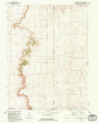
 1997 Chalk Bluffs East2000 Print · USGSHigh plains ranching and public lands meet at the edge of the Colorado breaks in the late 1990s. Researchers can trace remote water improvements and homestead landmarks like Eagle Rock Ranch, Canyon Windmill, and Sauer Well.
 - 1997 Map of Keota NW, 2000 Print
 1997 Keota NW2000 Print · USGSThe high plains of Weld County come into focus during the late 1990s as the Pawnee National Grassland meets working ranch land. Trace the industrial footprint of the era through an Oil Well, several Gravel Pits, and the winding path of Jackson Draw.
 - 1997 Map of Pawnee Buttes, 2000 Print
 1997 Pawnee Buttes2000 Print · USGSWeld County high plains and the iconic Pawnee Buttes are shown in the late nineties as part of the Pawnee National Grassland. Trace the ranching and energy landscape through landmarks like Buttes Windmill and remote sites such as Elizabeth Spring.
 - 1997 Map of Carr East, 2000 Print
 1997 Carr East2000 Print · USGSThe high plains of northern Colorado in the late twentieth century reveal a landscape of remote ranching and essential water infrastructure. Researchers can trace family-named sites like Davis Windmill and the settlement at Carr, or explore the boundaries of the Pawnee National Grassland.
 - 1997 Map of Dipper Spring, 2000 Print
 1997 Dipper Spring2000 Print · USGSThe high plains of Northeast Colorado are captured here in the late nineties, documenting the intersection of public lands and the energy industry. Researchers can trace ranching and resource history through features like Cervi Ranch, Indian Caves Windmill, and Sidney.
 - 1997 Map of Keota SE, 2000 Print
 1997 Keota SE2000 Print · USGSThe High Plains of Weld and Morgan Counties are captured in the late nineties, showing a landscape shaped by conservation and resource extraction. Genealogists and local historians can locate Horst Cemetery or trace the path of Coal Bank Draw and various Wells.
 - 1997 Map of Dover, 2000 Print
 1997 Dover2000 Print · USGSWeld County’s High Plains are shown in the late 1990s as a hub for rangeland research and conservation. Genealogists and local historians can trace the small settlement of Dover, find industrial markers like Gravel Pits, and locate the Pawnee National Grasslands Research Center.
 - 1997 Map of Eastman Creek South, 2000 Print
 1997 Eastman Creek South2000 Print · USGSThe Weld County high plains come into focus in the late nineties, showing the vital water and research infrastructure of the Colorado prairie. Trace the legacy of rangeland management at the Central Plains Experimental Range Headquarters or locate family-named landmarks like Allenbaw Windmill and Worley Windmill.
 - 1997 Map of Antelope Reservoir, 2000 Print
 1997 Antelope Reservoir2000 Print · USGSThe High Plains of Weld County come into focus in the late nineties, showcasing a landscape defined by water management and energy. Researchers can trace irrigation networks like the Pierce Lateral and find the site of the Pierce Oil Field or Boyd Springs.
 - 1997 Map of Dolan Spring, 2000 Print
 1997 Dolan Spring2000 Print · USGSThe high plains of Weld County come into focus during the late 1990s as a landscape defined by ranching heritage and conservation. Genealogists and historians can trace the isolated Sunnyside Cemetery and a network of water features like Dolan Spring and Mule Shoe Windmill.
 - 1997 Map of Raymer NE, 2000 Print
 1997 Raymer NE2000 Print · USGSThe High Plains of Weld County come into focus in the late nineties, showing a landscape defined by federal conservation and energy development. Researchers can locate family landmarks like the Raymer Cemetery or trace water sources such as Skyline Windmill and Wild Horse Creek.
 - 1997 Map of Grover NE, 2000 Print
 1997 Grover NE2000 Print · USGSThe northern Colorado high plains appear here in the late nineties as a landscape of ranching and strategic defense. Researchers can locate the Zion Church, its nearby Cemetery, and the Cold War-era Missile Site among the expansive Pawnee National Grassland.
 - 1997 Map of Keota, 2000 Print
 1997 Keota2000 Print · USGSWeld County ranching and rail life are captured here in the late 1990s as the high plains settlement of Keota sits along the Burlington Northern tracks. Researchers can trace local landmarks and water sources like the Cemetery, Wildhorse Reservoir, and the uniquely named Doublebarrel Windmill.
 - 1997 Map of Stoneham NE, 2000 Print
 1997 Stoneham NE2000 Print · USGSThe high plains of Logan County are captured here in the late nineties, defined by the protected expanse of the Pawnee National Grassland. Researchers can trace water management and energy sites like East Stoneham Reservoir and Hot Shot Well.
 - 1997 Map of Hereford Se, 2000 Print
 1997 Hereford Se2000 Print · USGSHigh plains ranching and resource management define this Weld County landscape in the late nineties. Genealogists and historians can trace water rights and family-named landmarks like McKay Windmill, Osborn Well, and the Landing Strip.
 - 1997 Map of Gatehook Spring, 2000 Print
 1997 Gatehook Spring2000 Print · USGSWeld County’s high plains are captured in the late nineties, showing a landscape of managed public land and grazing infrastructure. Researchers can locate the Midway School, a strategic Missile Site, and several vital water sources like Gatehook Spring.
 - 1997 Map of Grover SE, 2000 Print
 1997 Grover SE2000 Print · USGSThe high plains of Weld County come into focus during the late nineties, showing a landscape defined by ranching life and government land management. Researchers can trace the importance of water through landmarks like Last Chance Windmill, Hillside Well, and the Pawnee National Grassland.
 - 1997 Map of Vim School, 2000 Print
 1997 Vim School2000 Print · USGSWeld County ranching and energy landscapes are captured here in the late nineties, documenting a sparse network of prairie schoolhouses and family-named windmills. Genealogists and historians can locate Vim School, Rockaway School, and landmarks like Bourlier Windmill across the Pawnee National Grassland.
Showing maps 1-25 of 41
Top cities of Weld County
- Greeley historical maps
- Evans historical maps
- Firestone historical maps
- Frederick historical maps
- Severance historical maps
- Fort Lupton historical maps
See more
Frequently asked questions
- What are the different types of historical maps available for Weld County?
- What is the oldest map of Weld County?
- Where can I purchase historical maps of Weld County for my home or office?
- Where can I download high-res historical maps of Weld County?
- Are there historical topographic maps available for Weld County?
- Is there historical aerial imagery available for Weld County?
- Where are historical maps of Weld County sourced from?