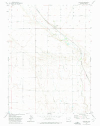
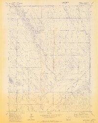
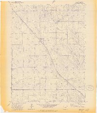
1970s Maps of Weld County, Colorado
Explore 45 historic maps of Weld County from the 1970s. These maps offer a rare glimpse into what life looked like during the 1970s — showing old roads, neighborhoods, homes, and landmarks that have changed or disappeared over time.
Whether you're researching your family's past, planning a metal detecting trip, or studying how Weld County's landscape evolved across the 1970s, these high-resolution maps are a powerful tool for exploring the history of this region.
- Focus on a specific era: All maps on this page are from the 1970s, giving you a focused view of this time period.
- See what’s changed: Compare century-old streets, trails, and buildings to today's modern landscape using overlays and satellite layers.
- Research with precision: Use these maps for genealogy, historical research, land use analysis, or educational projects.
- View, download, or print: Maps are fully viewable online in high resolution, and can be downloaded or printed for your own records.
Start exploring Weld County's history through authentic maps from the 1970s. This is your window into the past.
Weld County, CO maps
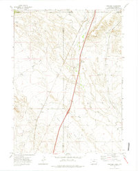
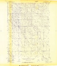
(45)- 1971 Map of Hudson, 1972 Print
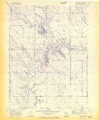
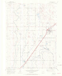 1971 Hudson1972 Print · USGSThe agricultural plains of Weld County come into focus during the early seventies, showing a landscape shaped by irrigation and rail. Researchers can trace the Burlington Northern line through Hudson and Tonville, or locate Mountain View Cem near the area's many reservoirs.
 - 1972 Map of Dutch Girl Lake, 1974 Print
 1972 Dutch Girl Lake1974 Print · USGSNortheastern Colorado in the early seventies was a landscape of open range and emerging energy development. Genealogists and historians can locate the isolated Pilgrim Cem or trace the early distribution of Gas Wells and Oil Wells across Greasewood Flats.2 unique versions available
 - 1972 Map of Grover North, 1974 Print
 1972 Grover North1974 Print · USGSThe northern reaches of Weld County come into focus during the early 1970s, where the high plains break into a dramatic escarpment. Trace the Burlington Northern railroad and the Home of Peace Cemetery near the community of Grover.2 unique versions available
 - 1972 Map of Chalk Bluffs SW, 1974 Print
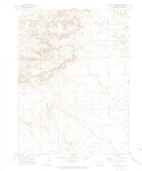
 1972 Chalk Bluffs SW1974 Print · USGSWeld County ranching and agricultural research are captured here in the early 1970s. Researchers can trace the hydrology of Owl Creek and Eastman Creek or locate the Central Plains Exper. Range Hdqrs. amidst a landscape of isolated wells.
 - 1972 Map of Keota SE, 1974 Print
 1972 Keota SE1974 Print · USGSThe prairie landscape along the Weld and Morgan County line was dominated by rural resource extraction in the early 1970s. Researchers can locate family landmarks like the Horst Cem and trace seasonal drainage along Bank Draw.3 unique versions available
 - 1972 Map of Briggsdale, 1974 Print
 1972 Briggsdale1974 Print · USGSThe high plains of Weld County come into focus in the early 1970s, centered on the ranching and farming community of Briggsdale. Genealogists and historians can trace the Old Railroad Grade, locate the Briggsdale Cem, and explore the landforms of the Seven Cross Hills.3 unique versions available
 - 1972 Map of Keota NW, 1974 Print
 1972 Keota NW1974 Print · USGSHigh plains ranching and resource extraction define this Weld County landscape during the early seventies. Genealogists and historians can trace the topography around Seven Cross Hill and locate industrial landmarks like a local Oil Well and Gravel Pits.2 unique versions available
 - 1972 Map of Chalk Bluffs East, 1974 Print
 1972 Chalk Bluffs East1974 Print · USGSWeld County ranchlands are captured here in the early seventies, showing a landscape defined by seasonal water and high plains escarpments. Researchers can locate Eagle Rock Ranch and its namesake Eagle Rock Res near the prominent Chalk Bluffs.3 unique versions available
 - 1972 Map of Carr East, 1974 Print
 1972 Carr East1974 Print · USGSWeld County and the Wyoming borderlands are captured in the early seventies as a hub of ranching and rail activity. Genealogists and historians can trace family-named landmarks like Stephens Windmill and the settlement at Carr along the Union Pacific Railroad.3 unique versions available
 - 1972 Map of Carr West, 1974 Print
 1972 Carr West1974 Print · USGSThe high plains border where Colorado meets Wyoming was a vital rail corridor in the early 1970s. Genealogists and rail historians can trace the paths of the Union Pacific and Colorado and Southern past Warren and the Natural Fort.3 unique versions available
 - 1972 Map of Reno Reservoir, 1974 Print
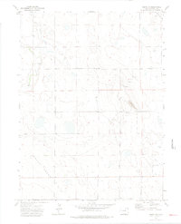
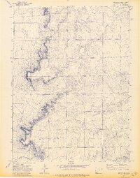
 1972 Reno Reservoir1974 Print · USGSWeld County in the early 1970s shows a landscape organized by water and livestock in this rural Colorado survey. Researchers can trace the courses of Geary Creek and Willow Creek toward the critical local landmark of Reno Reservoir.
 - 1972 Map of Hereford, 1974 Print
 1972 Hereford1974 Print · USGSNorthern Weld County comes into focus in the early seventies, showing a landscape defined by the Burlington Northern railroad. Genealogists and historians can trace the local water and energy infrastructure through features like Hereford, Crow Creek, and scattered Wells.2 unique versions available
 - 1972 Map of Chalk Bluffs West, 1974 Print
 1972 Chalk Bluffs West1974 Print · USGSWeld County ranching lands and high plains topography are captured here in the early seventies. Genealogists and local historians can trace family-named water sources and landmarks like Milligan Well, McCormick Windmill, and the prominent Chalk Bluffs.2 unique versions available
 - 1972 Map of Cornish, 1974 Print
 1972 Cornish1974 Print · USGSWeld County ranching and irrigation patterns are clearly visible in this early 1970s study of the high plains. Researchers can trace rural lineages at the Flying G Ranch or locate the tiny settlements of Cornish and Anderson near the Old Railroad Grade.3 unique versions available
 - 1972 Map of Keota, 1974 Print
 1972 Keota1974 Print · USGSThe high plains of Weld County are shown here during the early 1970s, focused on the small settlement of Keota. Genealogists and historians can trace local landmarks like the Cem, the Burlington Northern rail line, and the Wild Horse Reservoir.2 unique versions available
 - 1972 Map of Baker Draw, 1974 Print
 1972 Baker Draw1974 Print · USGSThe high plains of Weld County come into focus during the early 1970s, showing a landscape shaped by seasonal water and energy infrastructure. Researchers can trace the path of the Pipeline across the terrain and locate water sources like Sand Res No 1 and Baker Draw.2 unique versions available
 - 1972 Map of Bushnell SW, 1974 Print
 1972 Bushnell SW1974 Print · USGSThe High Plains energy landscape of the early 1970s is captured here at the intersection of the Nebraska and Colorado borders. Local researchers can trace the footprint of the Oil Field and locate industrial landmarks like the Pipeline and various Oil Well sites.
 - 1972 Map of Grover South, 1974 Print
 1972 Grover South1974 Print · USGSWeld County high plains life in the early seventies centers on the settlement of Grover. Genealogists and historians can locate the Sligo Cem, the local High Sch, and the extensive Keota Oil Field along the Burlington Northern rail line.2 unique versions available
 - 1972 Map of Grover SE, 1974 Print
 1972 Grover SE1974 Print · USGSWeld County ranching and resource extraction lands are captured here during the early 1970s. Trace the seasonal flow of Wild Horse Creek or locate local landmarks like the settlement of Sidney and a prominent Radio Tower.3 unique versions available
 - 1972 Map of Dover, 1974 Print
 1972 Dover1974 Print · USGSNorthern Weld County in the early 1970s is shown here as a landscape of wide-open ranch land and vital rail corridors. Genealogists and historians can trace the small settlements of Dover and Miller along the Union Pacific railroad and Lone Tree Creek.2 unique versions available
 - 1972 Map of Fosston, 1974 Print
 1972 Fosston1974 Print · USGSHigh Plains ranching and early transit define this Weld County landscape in the early seventies. Genealogists and historians can trace the Old Railroad Grade past Fosston to the community at Osgood Ch.
 - 1972 Map of Chalk Bluffs SE, 1974 Print
 1972 Chalk Bluffs SE1974 Print · USGSNorthern Weld County in the early seventies shows a landscape of wide-open plains and vital watercourses. Genealogists and researchers can trace the paths of West Fork Willow Creek and Coal Creek or locate the distinctive Wildhorse Tit landmark.
 - 1972 Map of Grover NE, 1974 Print
 1972 Grover NE1974 Print · USGSThe high plains of Weld County in the early seventies reveal a landscape of wide-open terrain and essential community landmarks. Genealogists and researchers can locate the Zion Ch, a local Cem, and the drainage of Sidney Draw.3 unique versions available
 - 1972 Map of Carr SW, 1974 Print
 1972 Carr SW1974 Print · USGSThe Colorado high plains in the early seventies reveal a landscape of remote rail sidings and vital water management. Genealogists and researchers can trace the diagonal Colorado and Southern Railroad past Bulger and Agate, or locate the Indian Springs Mine.
 - 1972 Map of Hereford SE, 1975 Print
 1972 Hereford SE1975 Print · USGSWeld County ranching lands and high plains drainages are captured in the early seventies, showing a landscape defined by water and wire. Trace the winding paths of Little Crow Creek and Geary Creek near the old sites of Porter and Willow.
Showing maps 1-25 of 45
Top cities of Weld County
- Greeley historical maps
- Evans historical maps
- Firestone historical maps
- Frederick historical maps
- Severance historical maps
- Fort Lupton historical maps
See more
Frequently asked questions
- What are the different types of historical maps available for Weld County?
- What is the oldest map of Weld County?
- Where can I purchase historical maps of Weld County for my home or office?
- Where can I download high-res historical maps of Weld County?
- Are there historical topographic maps available for Weld County?
- Is there historical aerial imagery available for Weld County?
- Where are historical maps of Weld County sourced from?