Old Maps of Panama City Beach, Florida for Metal Detecting
Plan your next treasure hunt with 40 historic maps of Panama City Beach. Find old homesites, ghost towns, trails, and gathering spots that may be lost to time — perfect for identifying promising metal detecting locations.
- Locate forgotten sites: Uncover places like long-lost settlements, abandoned rail lines, or gathering spots.
- Plan better hunts: Use map overlays combined with LiDAR or satellite views to narrow in on historically rich areas.
- Made for detectorists: Thousands of hobbyists use these maps to discover relics, coins, and hidden history.
Use these historic maps to boost your research and find new opportunities beneath the surface of Panama City Beach.
Panama City Beach, FL maps
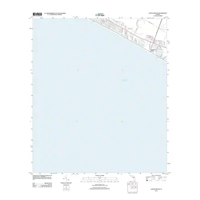
(40)- 1943 Map of Laguna Beach
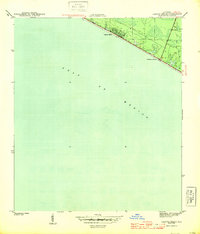 1943 Laguna Beach1943 Print · USGSThe Florida Panhandle coast appears at the height of the war years, showing a sparsely settled shoreline along the Gulf of Mexico. Local historians can trace the early residential grids and coastal roads of Laguna Beach and Gulf Resort Beach before the post-war development boom.5 unique versions available
 - 1943 Map of Panama City Beach
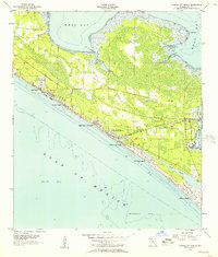
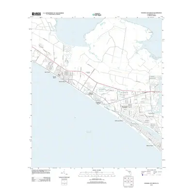
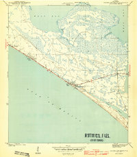 1943 Panama City Beach1943 Print · USGSPanama City Beach and the surrounding Florida coast are shown during the early 1940s before the era of high-rise development. Researchers can trace the original footprints of Betty Lou Beach and Florida Beach or follow the shoreline of Grand Lagoon.3 unique versions available
 - 1943 Map of Seminole Hills, 1969 Print
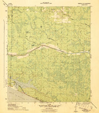
 1943 Seminole Hills1969 Print · USGSCoastal Bay County was a landscape of intricate wetlands and new shoreline settlements during the early 1940s. Genealogists and historians can trace the early footprints of Sunnyside and Laird or locate landmarks like County Line Landing and Powell Lake.
 - 1943 Map of West Bay, 1969 Print
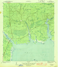
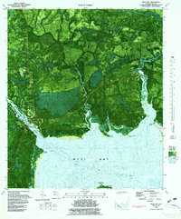
 1943 West Bay1969 Print · USGSCoastal Florida in the early 1940s is defined by its winding waterways and undeveloped shoreline. Historians can trace early navigation along the Intracoastal Waterway and locate natural landmarks like Walsonham Point and Burnt Mill Creek.
 - 1944 Map of Seminole Hills
 1944 Seminole Hills1944 Print · USGSThe Florida Panhandle shoreline and interior wetlands are shown during the mid-forties, just as coastal communities were establishing themselves. Researchers can trace the early layout of Hollywood Beach and Sunnyside or locate old crossings at County Line Landing.4 unique versions available
 - 1944 Map of West Bay
 1944 West Bay1944 Print · USGSThe coastal village of West Bay and the surrounding Florida panhandle wetlands are captured in the mid-1940s. Trace the path of the Intracoastal Waterway and the winding reaches of Burnt Mill Creek and Crooked Creek.4 unique versions available
 - 1954 Map of Tallahassee, 1967 Print
 1954 Tallahassee1967 Print · USGSThe Florida Panhandle and South Georgia are captured here during a period of mid-century growth and military expansion. Researchers can trace the development of Panama City, the footprint of Tyndall Air Force Base, and the rail lines of the Atlantic Coast Line.4 unique versions available
 - 1955 Map of Panama City Beach, 1957 Print
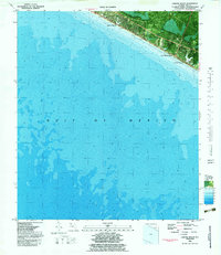
 1955 Panama City Beach1957 Print · USGSThe Florida coast near Panama City Beach appears in the mid-1950s as a burgeoning string of shoreline communities. Researchers can trace the early development of Bid-A-Wee and Long Beach Resort alongside the U S Naval Reservation.2 unique versions available
 - 1959 Map of Tallahassee
 1959 Tallahassee1959 Print · USGSFlorida's Panhandle and the Big Bend region appear here in the mid-fifties, showing a landscape defined by its great river systems and developing coast. Trace the early layout of Panama City, the expansive Apalachicola National Forest, and the coastal St Marks Lighthouse.
 - 1960 Map of Tallahassee
 1960 Tallahassee1960 Print · USGSThe Florida Panhandle and southern Georgia are captured here in the mid-twentieth century, showing a region defined by its rivers and military installations. Genealogists and historians can trace the growth of Tallahassee or locate coastal landmarks like the St Marks Lighthouse and Tyndall Air Force Base.
 - 1981 Map of Panama City
 1981 Panama City1981 Print · USGSPanama City and the Florida Panhandle coast are captured here in the early eighties, showing the region's balance of military installations and maritime industry. Researchers can trace the Atlanta and St Andrews Bay RR or locate coastal sites like Tyndall Air Force Base and Dead Lake.2 unique versions available
 - 1982 Map of Seminole Hills, 1983 Print
 1982 Seminole Hills1983 Print · USGSThe Florida Panhandle coast near the Walton and Bay County line comes into focus in the early eighties as beachfront communities begin to expand. Trace the shifting shoreline at Philips Inlet or locate landmarks like Powell Lake and Hollywood Beach.
 - 1982 Map of Laguna Beach, 1983 Print
 1982 Laguna Beach1983 Print · USGSThe Florida Panhandle coastline is documented in the early eighties as beach communities began to expand along the emerald waters. Genealogists and local historians can trace the early footprints of Laguna Beach, Gulf Resort Beach, and Lullwater Beach.
 - 1982 Map of Panama City Beach, 1984 Print
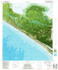 1982 Panama City Beach1984 Print · USGSPanama City Beach and the surrounding Gulf front appear here in the early eighties as coastal development expanded around the bayous. Researchers can trace the layout of Gulf Lagoon Beach or locate community landmarks like Hutchison School and St Bernadette Ch.2 unique versions available
 - 1982 Map of West Bay, 1984 Print
 1982 West Bay1984 Print · USGSCoastal Florida in the early eighties is documented here through a hybrid of aerial photography and topographic data. Genealogists and researchers can trace the vicinity of Woodville, locate a local Cemetery, and study the path of the Intracoastal Waterway near West Bay.2 unique versions available
 - 1988 Map of Tallahassee
 1988 Tallahassee1988 Print · USGSThe Florida Panhandle and South Georgia are captured here in the late eighties, showing the expansion of the regional highway network and coastal growth. Genealogists and historians can trace rail lines like the Seaboard System Railroad or locate family roots in Blountstown, Graceville, or Crawfordville.2 unique versions available
 - 1994 Map of West Bay, 1998 Print
 1994 West Bay1998 Print · USGSCoastal Bay County is captured here in the mid-1990s, centered on the historic settlement of West Bay and its connection to the Intracoastal Waterway. Genealogists and local historians can locate the community Cemetery, trace Vinson Road, and find landmarks like the Lookout Tower and Drawbridge.
 - 2012 Map of West Bay, 2012 Print
 2012 West Bay2012 Print · USGSCovers Panama City Beach, including West Bay, Bay County, and other nearby areas
 - 2012 Map of Laguna Beach, 2012 Print
 2012 Laguna Beach2012 Print · USGSCovers Panama City Beach, including Laguna Beach, Gulf Resort Beach, and other nearby areas
 - 2012 Map of Seminole Hills, 2012 Print
 2012 Seminole Hills2012 Print · USGSCovers Panama City Beach, including Laird, Hollywood Beach, and other nearby areas
 - 2012 Map of Panama City Beach, 2012 Print
 2012 Panama City Beach2012 Print · USGSCovers Panama City Beach, including Biltmore Beach, Lower Grand Lagoon, and other nearby areas
 - 2015 Map of Panama City Beach, 2015 Print
 2015 Panama City Beach2015 Print · USGSCovers Panama City Beach, including Biltmore Beach, Lower Grand Lagoon, and other nearby areas
 - 2015 Map of Laguna Beach, 2015 Print
 2015 Laguna Beach2015 Print · USGSCovers Panama City Beach, including Laguna Beach, Gulf Resort Beach, and other nearby areas
 - 2015 Map of West Bay, 2015 Print
 2015 West Bay2015 Print · USGSCovers Panama City Beach, including West Bay, Bay County, and other nearby areas
 - 2015 Map of Seminole Hills, 2015 Print
 2015 Seminole Hills2015 Print · USGSCovers Panama City Beach, including Laird, Hollywood Beach, and other nearby areas
Showing maps 1-25 of 40
Top cities near Panama City Beach
- Panama City historical maps
- Upper Grand Lagoon historical maps
- Lynn Haven historical maps
- Freeport historical maps
- Beacon Beach historical maps
- Ebro historical maps
See more
Top neighborhoods of Panama City Beach
- Bid-A-Wee historical maps
- Edgewater Gulf Beach historical maps
- Florida Beach historical maps
- Gulf Resort Beach historical maps
- West Panama City Beach historical maps
- Bahama Beach historical maps
See more
Frequently asked questions
- What are the different types of historical maps available for Panama City Beach?
- What is the oldest map of Panama City Beach?
- Where can I purchase historical maps of Panama City Beach for my home or office?
- Where can I download high-res historical maps of Panama City Beach?
- Are there historical topographic maps available for Panama City Beach?
- Is there historical aerial imagery available for Panama City Beach?
- Where are historical maps of Panama City Beach sourced from?