Old Maps of Ocala, Florida for Genealogy
Trace your family roots with 36 historic maps of Ocala. These high-res maps reveal old neighborhoods, homesites, landmarks, and streets — helping you uncover where your ancestors lived and how the area evolved over time.
- Explore historic neighborhoods: Identify where your relatives may have lived in the 1800s or 1900s.
- Compare maps over time: Trace the changes in streets, buildings, and landmarks for multi-generational research.
- Perfect for genealogy & ancestry research: Used by family historians and researchers to map out lineage and migration.
These maps are an incredible resource for exploring your personal connection to Ocala's past.
Ocala, FL maps
(36)- 1892 Map of Dunnellon
 1892 Dunnellon1892 Print · USGSMarion and Levy counties were at the center of a phosphate boom in the early 1890s, anchored by the riverfront settlement of Dunnellon. Researchers can trace the early industrial footprint of Eagle Mines, find rural community hubs like Cotton Plant, and locate historical crossings such as Fish Ferry.
 - 1894 Map of Dunnellon
 1894 Dunnellon1894 Print · USGSMarion and Citrus counties were centers of a burgeoning phosphate boom in the early 1890s, where river and rail infrastructure converged. You can trace early mining operations like the Chicago Mine and Eagle Mine alongside historic river crossings at Fisk Ferry.5 unique versions available
 - 1895 Map of Ocala
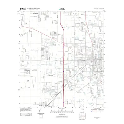
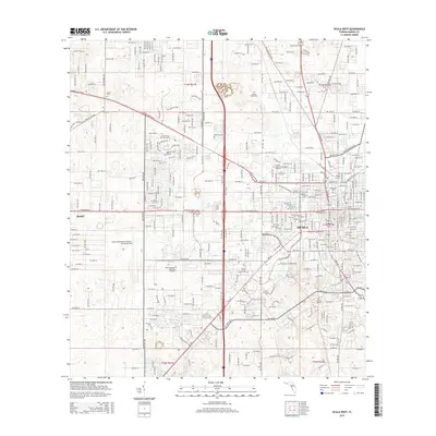
 1895 Ocala1895 Print · USGSMarion County at the end of the nineteenth century was a bustling intersection of rail and water. Researchers can trace the early footprints of Ocala and Silver Springs, or locate smaller stops along the Florida Southern R. R. like Santos and Belleview.7 unique versions available
 - 1954 Map of Cotton Plant, 1955 Print
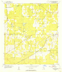 1954 Cotton Plant1955 Print · USGSMarion County in the mid-fifties is a landscape of rural settlements and intersecting rail lines. Genealogists and historians can locate old churches and community centers like Mars Hill Ch, Cotton Plant, and the railway siding at Martel.2 unique versions available
 - 1954 Map of Dunnellon, 1960 Print
 1954 Dunnellon1960 Print · USGSDunnellon and rural Marion County appear in the mid-1950s as a landscape of phosphate mining, railroads, and fresh water springs. Genealogists and historians can trace family locations near Zion Hill Cem, Cotton Plant, and the Circle Square Ranch.
 - 1954 Map of Gainesville, 1965 Print
 1954 Gainesville1965 Print · USGSMid-century North Central Florida comes into focus as a landscape of timber, rails, and river towns along the Gulf. Trace family roots in established centers like Gainesville or follow the path of the Suwannee River to the coastal docks of Cedar Key.3 unique versions available
 - 1958 Map of Gainesville
 1958 Gainesville1958 Print · USGSNorth Central Florida’s rail and river networks are frozen in time just before the interstate era. Genealogists and historians can trace the paths of the Atlantic Coast Line through Gainesville or locate coastal settlements like Steinhatchee and Cedar Key.
 - 1959 Map of Gainesville
 1959 Gainesville1959 Print · USGSNorth Florida in the mid-fifties is seen here from the Gulf coast to the inland lakes, showing the rail-and-river network before modern highways dominated. Researchers can trace the paths of the Seaboard Air Line through towns like Chiefland and Micanopy, or explore the coastal inlets of Waccasassa Bay.
 - 1967 Map of Ocala East, 1969 Print
 1967 Ocala East1969 Print · USGSThe eastern edges of Ocala and the famous waters of Silver Springs are captured here during a pivotal era of infrastructure planning. Trace the route of the Proposed Cross Florida Barge Canal and locate historic sites like the Fort King Burial Grounds and Camp Roosevelt.
 - 1968 Map of Ocala West, 1969 Print
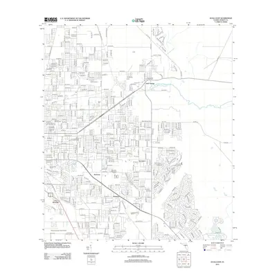
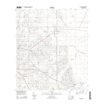
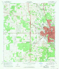 1968 Ocala West1969 Print · USGSOcala entered a period of rapid westward expansion in the late sixties, as new residential developments began to crest the local limestone ridges. Researchers can trace the footprint of community institutions like Central Florida Jr College and Howard High Sch or locate family plots at Kendrick Cem and Lincoln Mem Cem.2 unique versions available
 - 1968 Map of Shady, 1970 Print
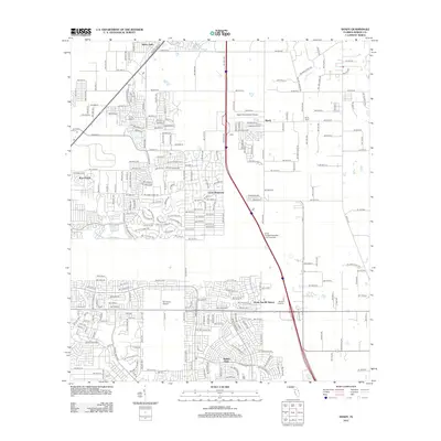
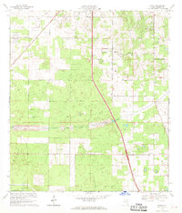 1968 Shady1970 Print · USGSMarion County in the late sixties shows a landscape on the verge of massive change as the Proposed Cross Florida Barge Canal was being surveyed. Researchers can trace rural community roots at Shady Grove Ch, locate the old RR Grade, or find the former Claypit and Lookout Tower.
 - 1978 Map of Ocala, 1980 Print
 1978 Ocala1980 Print · USGSFlorida's interior heartland and Gulf coast are seen here in the late seventies, showing the transition from freshwater springs to coastal hammocks. Genealogists and historians can trace the Seaboard Coast Line Railroad through Chiefland, Bronson, and Dunnellon.2 unique versions available
 - 1991 Map of Ocala West
 1991 Ocala West1991 Print · USGSOcala's western corridor was rapidly evolving into a regional hub of education and aviation during the early nineties. Researchers can trace the development of Central Florida Jr College and local landmarks like Vanguard High Sch and the Old Railroad Grade.
 - 1991 Map of Cotton Plant
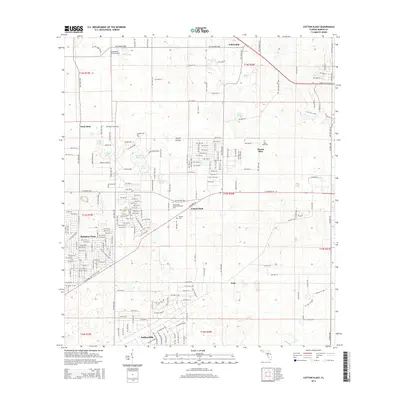
 1991 Cotton Plant1991 Print · USGSMarion County in the early nineties reveals a transition from traditional rural life to a noted equestrian and residential landscape. Researchers can trace historic church sites and cemeteries like Wesley Chapel Cem and Siloam Ch Cem alongside the Classic Mile Racetrack.
 - 1991 Map of Ocala East
 1991 Ocala East1991 Print · USGSThe eastern edges of Ocala and the headwaters of the Silver River are captured here during the rapid development of the early nineties. Genealogists and researchers can trace local landmarks like Highland Memorial Park (Cem), the Fort King Burial Grounds, and the rail lines of the Seaboard System.
 - 1991 Map of Shady
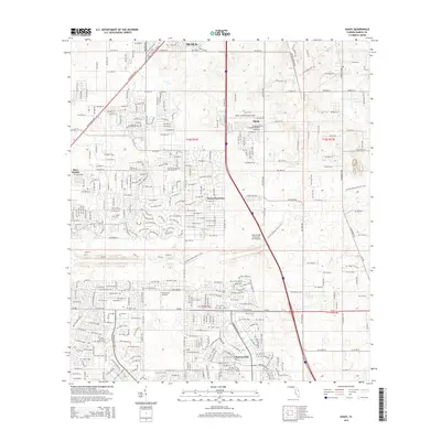
 1991 Shady1991 Print · USGSMarion County experiences significant residential expansion during the early nineties, with emerging suburban tracts appearing alongside rural homesteads. Genealogists and researchers can trace local roots through landmarks like Barnes Cem, Shady Grove Ch, and the settlements of Shady and Martel.
 - 2012 Map of Cotton Plant, 2012 Print
 2012 Cotton Plant2012 Print · USGSCovers Ocala, including Mount Olive, Cotton Plant, and other nearby areas
 - 2012 Map of Ocala East, 2012 Print
 2012 Ocala East2012 Print · USGSCovers Ocala, including Huntington, Montague, and other nearby areas
 - 2012 Map of Ocala West, 2012 Print
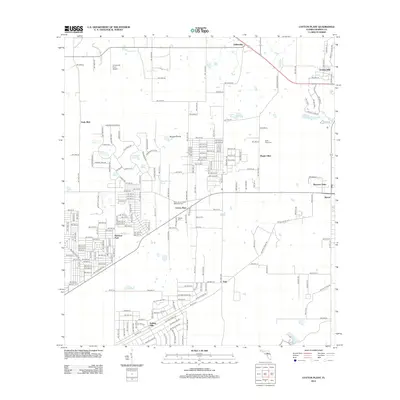
 2012 Ocala West2012 Print · USGSCovers Ocala, including Martel, Ocala Ridge, and other nearby areas
 - 2012 Map of Shady, 2012 Print
 2012 Shady2012 Print · USGSCovers Ocala, including Shady, Marion Oaks, and other nearby areas
 - 2015 Map of Ocala East, 2015 Print
 2015 Ocala East2015 Print · USGSCovers Ocala, including Huntington, Montague, and other nearby areas
 - 2015 Map of Ocala West, 2015 Print
 2015 Ocala West2015 Print · USGSCovers Ocala, including Martel, Ocala Ridge, and other nearby areas
 - 2015 Map of Cotton Plant, 2015 Print
 2015 Cotton Plant2015 Print · USGSCovers Ocala, including Mount Olive, Cotton Plant, and other nearby areas
 - 2015 Map of Shady, 2015 Print
 2015 Shady2015 Print · USGSCovers Ocala, including Shady, Marion Oaks, and other nearby areas
 - 2018 Map of Cotton Plant, 2018 Print
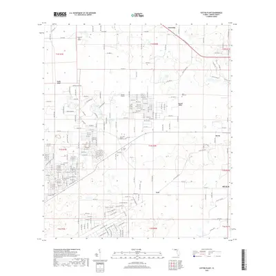 2018 Cotton Plant2018 Print · USGSCovers Ocala, including Mount Olive, Cotton Plant, and other nearby areas
Showing maps 1-25 of 36
Top cities near Ocala
Top neighborhoods of Ocala
- Maricamp historical maps
- Cimarron historical maps
- Fore Ranch historical maps
- Carlton Arms historical maps
- Canterbury Circle Apartments historical maps
- Parkside Garden Apartments historical maps
See more
Frequently asked questions
- What are the different types of historical maps available for Ocala?
- What is the oldest map of Ocala?
- Where can I purchase historical maps of Ocala for my home or office?
- Where can I download high-res historical maps of Ocala?
- Are there historical topographic maps available for Ocala?
- Is there historical aerial imagery available for Ocala?
- Where are historical maps of Ocala sourced from?