1940s Maps of Tybee Island, Georgia
Explore 6 historic maps of Tybee Island from the 1940s. These maps offer a rare glimpse into what life looked like during the 1940s — showing old roads, neighborhoods, homes, and landmarks that have changed or disappeared over time.
Whether you're researching your family's past, planning a metal detecting trip, or studying how Tybee Island's landscape evolved across the 1940s, these high-resolution maps are a powerful tool for exploring the history of this region.
- Focus on a specific era: All maps on this page are from the 1940s, giving you a focused view of this time period.
- See what’s changed: Compare century-old streets, trails, and buildings to today's modern landscape using overlays and satellite layers.
- Research with precision: Use these maps for genealogy, historical research, land use analysis, or educational projects.
- View, download, or print: Maps are fully viewable online in high resolution, and can be downloaded or printed for your own records.
Start exploring Tybee Island's history through authentic maps from the 1940s. This is your window into the past.
Tybee Island, GA maps
(6)- 1945 Map of Bluffton
 1945 Bluffton1945 Print · USGSThe Carolina Lowcountry and Georgia's sea islands appear here in the mid-forties, before modern bridges transformed the coast. Trace the early footprints of Bluffton and Spanish Wells, or locate maritime landmarks like Buckingham Ferry and the Oyster Packing Plant.
 - 1945 Map of Wassaw Sound
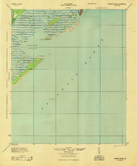 1945 Wassaw Sound1945 Print · USGSThe Georgia coast near Savannah comes alive in this mid-century survey of the barrier islands and tidal sounds. Genealogists and historians can trace the early layout of Savannah Beach or the pristine reaches of Wassaw Island and Petit Chou Island.
 - 1946 Map of Brunswick, 1948 Print
 1946 Brunswick1948 Print · USGSCoastal Georgia in the mid-forties reveals a landscape defined by the Camp Stewart Military Reservation and the sprawling barrier islands. Genealogists and historians can trace the rail-and-river network through inland towns like Ludowici and Jesup, or locate coastal landmarks like the St Simon Light.
 - 1947 Map of Savannah
 1947 Savannah1947 Print · USGSCoastal Georgia and South Carolina are captured here in the mid-forties, showing the rail-and-river networks of the Lowcountry. Genealogists and researchers can trace old crossroads and river towns from Statesboro to Beaufort, alongside military sites like Camp Stewart and Parris Island.
 - 1948 Map of Brunswick
 1948 Brunswick1948 Print · USGSCoastal Georgia in the late 1940s is defined here by its labyrinthine barrier islands and the massive footprint of Camp Stewart. Genealogists and historians can trace the rail-tied growth of Jesup and Hinesville or locate coastal landmarks like St Simon Light.
 - 1948 Map of Savannah
 1948 Savannah1948 Print · USGSThe Georgia and South Carolina Lowcountry comes alive in this post-war survey of the coast and its river-fed hinterlands. Genealogists and historians can trace rail lines like the Central of Georgia RR and find established settlements such as Isle of Hope and Sylvania.
End of results
Showing maps 1-6 of 6
Top cities near Tybee Island
- Savannah historical maps
- Hilton Head Island historical maps
- Wilmington Island historical maps
- Skidaway Island historical maps
- Whitemarsh Island historical maps
- Bluffton historical maps
See more
Frequently asked questions
- What are the different types of historical maps available for Tybee Island?
- What is the oldest map of Tybee Island?
- Where can I purchase historical maps of Tybee Island for my home or office?
- Where can I download high-res historical maps of Tybee Island?
- Are there historical topographic maps available for Tybee Island?
- Is there historical aerial imagery available for Tybee Island?
- Where are historical maps of Tybee Island sourced from?