1950s Maps of Tybee Island, Georgia
Explore 5 historic maps of Tybee Island from the 1950s. These maps offer a rare glimpse into what life looked like during the 1950s — showing old roads, neighborhoods, homes, and landmarks that have changed or disappeared over time.
Whether you're researching your family's past, planning a metal detecting trip, or studying how Tybee Island's landscape evolved across the 1950s, these high-resolution maps are a powerful tool for exploring the history of this region.
- Focus on a specific era: All maps on this page are from the 1950s, giving you a focused view of this time period.
- See what’s changed: Compare century-old streets, trails, and buildings to today's modern landscape using overlays and satellite layers.
- Research with precision: Use these maps for genealogy, historical research, land use analysis, or educational projects.
- View, download, or print: Maps are fully viewable online in high resolution, and can be downloaded or printed for your own records.
Start exploring Tybee Island's history through authentic maps from the 1950s. This is your window into the past.
Tybee Island, GA maps
(5)- 1955 Map of Savannah Beach North, 1956 Print
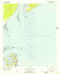 1955 Savannah Beach North1956 Print · USGSThe coastal border of South Carolina and Georgia comes alive in the mid-1950s, detailing the shifting sands and maritime defenses of the Atlantic coast. Researchers can trace the military grounds of Fort Screven or locate the historic Tybee Lighthouse and the small Cem on Tybee Island.3 unique versions available
 - 1955 Map of Fort Pulaski, 1957 Print
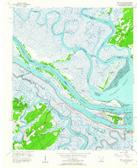 1955 Fort Pulaski1957 Print · USGSCoastal South Carolina and Georgia meet at the mouth of the Savannah River in the mid-fifties, where salt marshes and tidal islands define the border. Researchers can trace historic family sites on Daufuskie Island like Mary Field Cem or locate the Lighthouse (Abandoned) near Fort Pulaski.2 unique versions available
 - 1956 Map of Brunswick, 1968 Print
 1956 Brunswick1968 Print · USGSThe Georgia coast in the mid-twentieth century is a wild expanse of barrier islands and massive river deltas. You can trace the development of the maritime economy and military presence at Brunswick, or locate historic sites like Fort Frederica National Monument and Harris Neck National Wildlife Refuge.2 unique versions available
 - 1957 Map of Savannah Beach South, 1959 Print
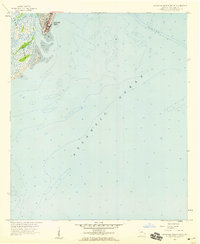 1957 Savannah Beach South1959 Print · USGSCoastal Georgia in the late fifties is captured here as Savannah Beach meets the sea. Researchers can trace the early layout of South End and explore the maritime landscape of Tybee Creek and the surrounding Tidal Flat.2 unique versions available
 - 1957 Map of Savannah, 1967 Print
 1957 Savannah1967 Print · USGSThe Lowcountry and Georgia coastal plain are shown here in the late fifties, prior to modern expansion. Researchers can trace the rail-and-river economy through the Central of Georgia lines and the Ogeechee River wetlands.4 unique versions available
End of results
Showing maps 1-5 of 5
Top cities near Tybee Island
- Savannah historical maps
- Hilton Head Island historical maps
- Wilmington Island historical maps
- Skidaway Island historical maps
- Whitemarsh Island historical maps
- Bluffton historical maps
See more
Frequently asked questions
- What are the different types of historical maps available for Tybee Island?
- What is the oldest map of Tybee Island?
- Where can I purchase historical maps of Tybee Island for my home or office?
- Where can I download high-res historical maps of Tybee Island?
- Are there historical topographic maps available for Tybee Island?
- Is there historical aerial imagery available for Tybee Island?
- Where are historical maps of Tybee Island sourced from?