Old Maps of Tybee Island, Georgia for Hiking & Exploration
Hike through history with 37 historic maps of Tybee Island. Explore old trails, ghost towns, and forgotten backroads — perfect for outdoor adventurers and local explorers.
- Rediscover forgotten places: Map out old mining camps, roads, and footpaths that no longer exist on modern maps.
- Layer with modern tools: Combine with LiDAR or satellite views to plan hikes through historical terrain.
- Made for exploration: Popular among hikers, overlanders, and local history lovers.
Use these maps to find adventure and explore the hidden past of Tybee Island.
Tybee Island, GA maps
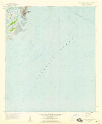
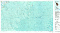
(37)- 1920 Map of Wassaw Sound
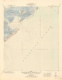 1920 Wassaw Sound1920 Print · USGSCoastal Georgia at the end of the Great War era reveals a landscape of tidal marshes and strategic barrier islands. Researchers can trace historic landmarks like the Great Wassaw Old Battery, the Cup of Hotel, and the winding Wilmington River.
 - 1920 Map of Bluffton
 1920 Bluffton1920 Print · USGSThe Georgia and South Carolina coastlines meet here in the early twentieth century, showing a world defined by tidal rivers and island outposts. Researchers can trace historic maritime landmarks like Ft. Pulaski, the Long Island Ferry, and family settlements at Spanish Wells or Hickory Bluff.
 - 1945 Map of Bluffton
 1945 Bluffton1945 Print · USGSThe Carolina Lowcountry and Georgia's sea islands appear here in the mid-forties, before modern bridges transformed the coast. Trace the early footprints of Bluffton and Spanish Wells, or locate maritime landmarks like Buckingham Ferry and the Oyster Packing Plant.
 - 1945 Map of Wassaw Sound
 1945 Wassaw Sound1945 Print · USGSThe Georgia coast near Savannah comes alive in this mid-century survey of the barrier islands and tidal sounds. Genealogists and historians can trace the early layout of Savannah Beach or the pristine reaches of Wassaw Island and Petit Chou Island.
 - 1946 Map of Brunswick, 1948 Print
 1946 Brunswick1948 Print · USGSCoastal Georgia in the mid-forties reveals a landscape defined by the Camp Stewart Military Reservation and the sprawling barrier islands. Genealogists and historians can trace the rail-and-river network through inland towns like Ludowici and Jesup, or locate coastal landmarks like the St Simon Light.
 - 1947 Map of Savannah
 1947 Savannah1947 Print · USGSCoastal Georgia and South Carolina are captured here in the mid-forties, showing the rail-and-river networks of the Lowcountry. Genealogists and researchers can trace old crossroads and river towns from Statesboro to Beaufort, alongside military sites like Camp Stewart and Parris Island.
 - 1948 Map of Brunswick
 1948 Brunswick1948 Print · USGSCoastal Georgia in the late 1940s is defined here by its labyrinthine barrier islands and the massive footprint of Camp Stewart. Genealogists and historians can trace the rail-tied growth of Jesup and Hinesville or locate coastal landmarks like St Simon Light.
 - 1948 Map of Savannah
 1948 Savannah1948 Print · USGSThe Georgia and South Carolina Lowcountry comes alive in this post-war survey of the coast and its river-fed hinterlands. Genealogists and historians can trace rail lines like the Central of Georgia RR and find established settlements such as Isle of Hope and Sylvania.
 - 1955 Map of Savannah Beach North, 1956 Print
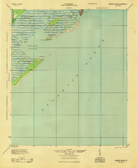
 1955 Savannah Beach North1956 Print · USGSThe coastal border of South Carolina and Georgia comes alive in the mid-1950s, detailing the shifting sands and maritime defenses of the Atlantic coast. Researchers can trace the military grounds of Fort Screven or locate the historic Tybee Lighthouse and the small Cem on Tybee Island.3 unique versions available
 - 1955 Map of Fort Pulaski, 1957 Print
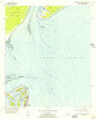
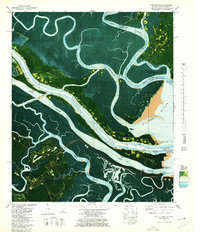
 1955 Fort Pulaski1957 Print · USGSCoastal South Carolina and Georgia meet at the mouth of the Savannah River in the mid-fifties, where salt marshes and tidal islands define the border. Researchers can trace historic family sites on Daufuskie Island like Mary Field Cem or locate the Lighthouse (Abandoned) near Fort Pulaski.2 unique versions available
 - 1956 Map of Brunswick, 1968 Print
 1956 Brunswick1968 Print · USGSThe Georgia coast in the mid-twentieth century is a wild expanse of barrier islands and massive river deltas. You can trace the development of the maritime economy and military presence at Brunswick, or locate historic sites like Fort Frederica National Monument and Harris Neck National Wildlife Refuge.2 unique versions available
 - 1957 Map of Savannah Beach South, 1959 Print
 1957 Savannah Beach South1959 Print · USGSCoastal Georgia in the late fifties is captured here as Savannah Beach meets the sea. Researchers can trace the early layout of South End and explore the maritime landscape of Tybee Creek and the surrounding Tidal Flat.2 unique versions available
 - 1957 Map of Savannah, 1967 Print
 1957 Savannah1967 Print · USGSThe Lowcountry and Georgia coastal plain are shown here in the late fifties, prior to modern expansion. Researchers can trace the rail-and-river economy through the Central of Georgia lines and the Ogeechee River wetlands.4 unique versions available
 - 1960 Map of Savannah
 1960 Savannah1960 Print · USGSCoastal Georgia and the South Carolina Lowcountry are captured in the late fifties, showcasing the intricate web of islands and tidal rivers before modern expansion. Researchers can trace the rail lines of the Atlantic Coast Line or locate sites like Parris Island, Beaufort, and the Tybee Lighthouse.
 - 1961 Map of Savannah
 1961 Savannah1961 Print · USGSThe Georgia and South Carolina Lowcountry comes alive in this mid-century survey of coastal marshes, barrier islands, and river networks. Genealogists and historians can trace the paths of the Seaboard Air Line RR, locate family sites near Isle of Hope, or study the grounds of Fort Stewart Military Reservation.2 unique versions available
 - 1961 Map of Brunswick
 1961 Brunswick1961 Print · USGSThe Georgia coast at the start of the 1960s was a landscape of deep tidal marshes and growing military installations. Genealogists and historians can trace rail-linked towns like Limerick Station or explore coastal landmarks from Fort Frederica National Monument to Sapelo Island.
 - 1978 Map of Tybee Island North
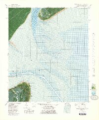 1978 Tybee Island North1978 Print · USGSThe Georgia and South Carolina coastlines meet in the late seventies at the mouth of the Savannah River. Maritime historians and coastal researchers can trace the historic fortifications at Fort Screven and the shifting shoals around Bloody Pt and Tybee Knoll Spit.
 - 1978 Map of Fort Pulaski
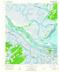
 1978 Fort Pulaski1978 Print · USGSThe coastal borderlands of Georgia and South Carolina are captured here in the late seventies, showing the tidal marshes where the Savannah River meets the sea. Researchers can trace the Old Railroad Grade and locate historic markers like Daufuskie Landing and Fort Pulaski National Monument.2 unique versions available
 - 1978 Map of Beaufort
 1978 Beaufort1978 Print · USGSCoastal South Carolina and Georgia come to life in this detailed bathymetric study from the late seventies, featuring the intricate Sea Islands and the Savannah River mouth. Researchers can trace military history at Parris Island or locate inland settlements like Switzerland and Old Sheldon.2 unique versions available
 - 1978 Map of Brunswick
 1978 Brunswick1978 Print · USGSThe Georgia coast and its barrier islands are captured in the late 1970s, as I-95 and the rail lines shaped the growth of coastal towns. Genealogists and historians can trace family locations across the islands or locate sites near Fort Stewart, Darien, and Ludowici.2 unique versions available
 - 1979 Map of Tybee Island South
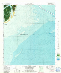 1979 Tybee Island South1979 Print · USGSTybee Island and the Georgia coast are captured here in the late seventies during a period of active shoreline management. Researchers can trace the Beach Renourished 1976 zone and locate coastal settlements like Spanish Hammock and South End.2 unique versions available
 - 1980 Map of Wassaw Sound, 1983 Print
 1980 Wassaw Sound1983 Print · USGSThe Georgia coast in the early eighties reveals a fascinating mix of strategic fortifications and preserved barrier islands. Trace the marshes around Wilmington Island or locate the grounds of Fort Pulaski National Monument and the Wassaw National Wildlife Refuge.2 unique versions available
 - 2011 Map of Tybee Island South, 2011 Print
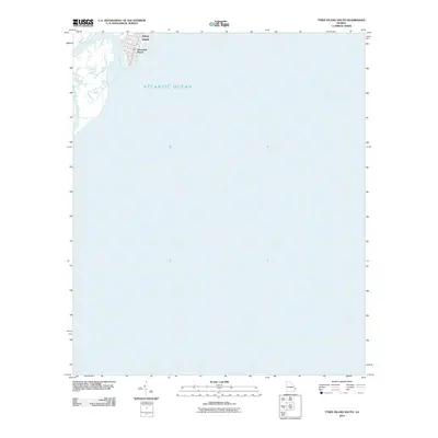 2011 Tybee Island South2011 Print · USGSCovers Tybee Island, including Chatham County, United States, and other nearby areas
 - 2011 Map of Tybee Island North, 2011 Print
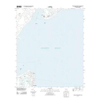 2011 Tybee Island North2011 Print · USGSCovers Tybee Island, including Hilton Head Island, Chatham County, and other nearby areas
 - 2011 Map of Fort Pulaski, 2011 Print
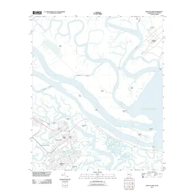 2011 Fort Pulaski2011 Print · USGSCovers Tybee Island, including Wilmington Island, Talahi Island, and other nearby areas
Showing maps 1-25 of 37
Top cities near Tybee Island
- Savannah historical maps
- Hilton Head Island historical maps
- Wilmington Island historical maps
- Skidaway Island historical maps
- Whitemarsh Island historical maps
- Bluffton historical maps
See more
Frequently asked questions
- What are the different types of historical maps available for Tybee Island?
- What is the oldest map of Tybee Island?
- Where can I purchase historical maps of Tybee Island for my home or office?
- Where can I download high-res historical maps of Tybee Island?
- Are there historical topographic maps available for Tybee Island?
- Is there historical aerial imagery available for Tybee Island?
- Where are historical maps of Tybee Island sourced from?