Old Maps of Forsyth County, Georgia for Hiking & Exploration
Hike through history with 94 historic maps of Forsyth County. Explore old trails, ghost towns, and forgotten backroads — perfect for outdoor adventurers and local explorers.
- Rediscover forgotten places: Map out old mining camps, roads, and footpaths that no longer exist on modern maps.
- Layer with modern tools: Combine with LiDAR or satellite views to plan hikes through historical terrain.
- Made for exploration: Popular among hikers, overlanders, and local history lovers.
Use these maps to find adventure and explore the hidden past of Forsyth County.
Forsyth County, GA maps
(94)- 1890 Map of Suwanee
 1890 Suwanee1890 Print · USGSNorth Georgia in the 1890s was a landscape of river-powered commerce and gold prospecting. Genealogists and historians can trace family-named river crossings like Jones Ferry and Pirkle's Ferry or locate the historic Kin Mori Gold Mine.
 - 1891 Map of Gainesville
 1891 Gainesville1891 Print · USGSNorth Georgia in the early 1890s appears as a landscape of rail-junction towns and river-powered industry centered on Hall and Jackson Counties. Researchers can trace historic river crossings like Browns Bridge and Keiths Fy, or locate nineteenth-century landmarks such as Oconee Mills and Flowery Branch.5 unique versions available
 - 1894 Map of Suwanee
 1894 Suwanee1894 Print · USGSNorth Georgia in the late nineteenth century was a landscape of river ferries and rising industry, from marble quarries to gold mines. Genealogists can trace family landmarks like Fields Cross Roads, the Kin Mori Gold Mine, and Fort Buffington.6 unique versions available
 - 1926 Map of Tate, 1968 Print
 1926 Tate1968 Print · USGSNorthern Georgia's ridge-and-valley corridor is captured here in the mid-twenties, showcasing a landscape of mining and rail commerce. Trace early industrial sites like the Franklin Gold Mine and old crossroads like Ball Ground or Nelson.
 - 1928 Map of Tate
 1928 Tate1928 Print · USGSNorth Georgia’s mineral and mountain heritage comes to life in the late 1920s as the rail line connects the marble and gold districts. Researchers can locate family roots at the Franklin Gold Mine, Old Damascus Church, or Burroughs Crossroads.
 - 1954 Map of Greenville, 1965 Print
 1954 Greenville1965 Print · USGSThe Upstate and Northeast Georgia are captured here during a decade of massive transformation as new reservoirs reshaped the Piedmont. Genealogists and hikers can trace the Appalachian Trail over Brasstown Bald or locate old community centers like Demorest, Westminster, and Royston.3 unique versions available
 - 1955 Map of Rome
 1955 Rome1955 Print · USGSThe tri-state borderlands of Georgia, Alabama, and Tennessee appear in the mid-fifties as a landscape of ridge-and-valley industry and river navigation. Genealogists can trace family footprints near Chattanooga, the iron works of Gadsden, and textile towns like Trion or Summerville.
 - 1956 Map of Duluth, 1957 Print
 1956 Duluth1957 Print · USGSGwinnett and Fulton counties are captured in the mid-fifties, just as the rural river settlements began to evolve. Genealogists can trace early landmarks like Shake Rag, Hull High Sch, and the many churches from Warsaw to Brookwood.4 unique versions available
 - 1956 Map of Roswell, 1957 Print
 1956 Roswell1957 Print · USGSNorthern Fulton County in the mid-fifties remains a world of quiet crossroads and rural parishes before the modern expansion. Researchers can trace ancestral locations at Crabapple, Newtown, and Lebanon Ch, or locate the County Prison Camp and Rock Quarry.5 unique versions available
 - 1956 Map of Birmingham, 1957 Print
 1956 Birmingham1957 Print · USGSNorth Georgia in the mid-1950s reveals a landscape of tight-knit rural communities and family-named roads. Trace your heritage through the Union Hill Sch, the Holbrook Campground, and country churches like Boiling Spring Ch.4 unique versions available
 - 1958 Map of Greenville
 1958 Greenville1958 Print · USGSThe Piedmont and Blue Ridge foothills come alive in this mid-century survey of the Upstate and Northeast Georgia. Trace the regional rail-and-river economy through the Southern Railway corridors and early reservoir developments like Lake Sidney Lanier.
 - 1958 Map of Rome, 1966 Print
 1958 Rome1966 Print · USGSNorthwest Georgia and neighboring Tennessee and Alabama are captured here in the late fifties, showcasing a landscape of high ridges and river valleys. Researchers can trace historic rail lines like the Seaboard Air Line RR and explore the bounds of Cloudland Canyon State Park or Fort Oglethorpe.3 unique versions available
 - 1961 Map of Rome
 1961 Rome1961 Print · USGSNorthwest Georgia and neighboring Tennessee and Alabama are shown here at a moment of significant mid-century growth. Researchers can trace the rail networks of the Central of Georgia or locate landmarks within Chickamauga and Chattanooga Nat Military Park.
 - 1963 Map of Rome
 1963 Rome1963 Print · USGSThe tri-state corner of Georgia, Alabama, and Tennessee is captured here during a period of massive reservoir expansion and post-war growth. Genealogists and historians can trace the rail corridors of the Southern Ry or locate landmarks like Fort Oglethorpe and Cloudland Canyon State Park.
 - 1964 Map of Buford Dam, 1965 Print
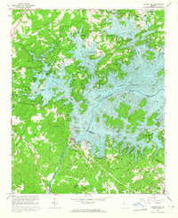 1964 Buford Dam1965 Print · USGSForsyth County landscape during the mid-sixties reveals the profound changes following the creation of Lake Sidney Lanier. Genealogists and historians can trace traditional landmarks like Beaver Ruin Cem and Chattahoochee Sch alongside the massive Buford Dam.4 unique versions available
 - 1964 Map of Coal Mountain, 1965 Print
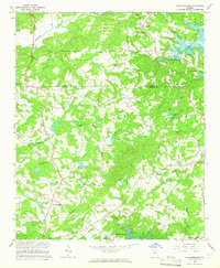 1964 Coal Mountain1965 Print · USGSForsyth and Dawson counties are captured during the mid-sixties as the landscape adjusted to the presence of Lake Sidney Lanier. Genealogists and local historians can trace family locations near Lumpkin, Silver City, and several country churches like Bethel Ch.3 unique versions available
 - 1964 Map of Cumming, 1965 Print
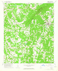 1964 Cumming1965 Print · USGSForsyth County during the mid-sixties shows a landscape of small rural communities and ridge-top landmarks. Researchers can locate family roots at country churches like Bethelview Ch or trace industrial sites like Sawnee Quarry and the Fish Hatchery.4 unique versions available
 - 1964 Map of Chestatee, 1965 Print
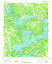 1964 Chestatee1965 Print · USGSThe Hall and Forsyth County borderland is transformed by the rising waters of Lake Sidney Lanier in the mid-sixties. Genealogists can trace family names at Bethel Tabernacle, Mayfield Ch, and Sardis Sch along the sprawling river-bay shoreline.3 unique versions available
 - 1964 Map of Suwanee, 1965 Print
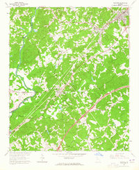 1964 Suwanee1965 Print · USGSIn the mid-1960s, Gwinnett County began shifting from a rail-and-river landscape to an expressway-centered economy. Genealogists can trace early landmarks like Old Suwanee Ch and Kemp Cem or locate community hubs like N Gwinnett High Sch.3 unique versions available
 - 1964 Map of Matt, 1965 Print
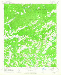 1964 Matt1965 Print · USGSNorth of Forsyth County in the mid-1960s, the rural landscape was defined by family-named roads and quiet river bends. Genealogists and local historians can trace legacy sites like Mt Tabor Cem, the community of Heardville, and the landmark Covered Bridge on Settingdown Creek.5 unique versions available
 - 1964 Map of Flowery Branch, 1965 Print
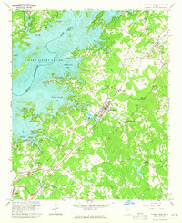 1964 Flowery Branch1965 Print · USGSNorth Georgia’s Hall County was undergoing a major transformation in the 1960s as the waters of Lake Sidney Lanier reshaped the terrain. Genealogists and local historians can trace the foundations of communities like Flowery Branch and Oakwood, alongside rural landmarks like Zion Hill Ch and Oscarville.4 unique versions available
 - 1973 Map of Ball Ground East, 1975 Print
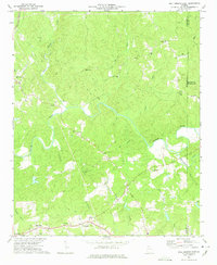 1973 Ball Ground East1975 Print · USGSCherokee County in the early seventies shows a landscape of small Piedmont communities and winding river valleys before the rapid suburban expansion of later decades. Trace old family routes and rural landmarks like Cane Creek Cem, the Ophir community, and Conn Creek Ch.2 unique versions available
 - 1979 Map of Commerce, 1980 Print
 1979 Commerce1980 Print · USGSThe Georgia and South Carolina Piedmont reached a period of significant regional growth in the late seventies. Genealogists and historians can trace family roots through locations like Blackberry Church, Old Pioneer Cem, and the Gillsville Sch.2 unique versions available
 - 1981 Map of Cartersville, 1982 Print
 1981 Cartersville1982 Print · USGSNorth Georgia at the start of the eighties shows a landscape defined by massive reservoirs and historic rail corridors. Researchers can trace the heritage of the Etowah Indian Mounds or locate old junctions along the Southern Railway and Seaboard Coast Line.2 unique versions available
 - 1992 Map of Roswell, 1993 Print
 1992 Roswell1993 Print · USGSThe North Fulton corridor was evolving rapidly in the early nineties as residential growth began to bridge the gap between Alpharetta and Roswell. Genealogists and local historians can trace legacy landmarks including Old Newton School, Greenlawn Cemetery, and the community of Crabapple.2 unique versions available
Showing maps 1-25 of 94
Top cities of Forsyth County
Frequently asked questions
- What are the different types of historical maps available for Forsyth County?
- What is the oldest map of Forsyth County?
- Where can I purchase historical maps of Forsyth County for my home or office?
- Where can I download high-res historical maps of Forsyth County?
- Are there historical topographic maps available for Forsyth County?
- Is there historical aerial imagery available for Forsyth County?
- Where are historical maps of Forsyth County sourced from?