1960s Maps of Hawaii
Explore 79 historic maps of Hawaii from the 1960s. These maps offer a rare glimpse into what life looked like during the 1960s — showing old roads, neighborhoods, homes, and landmarks that have changed or disappeared over time.
Whether you're researching your family's past, planning a metal detecting trip, or studying how Hawaii's landscape evolved across the 1960s, these high-resolution maps are a powerful tool for exploring the history of this region.
- Focus on a specific era: All maps on this page are from the 1960s, giving you a focused view of this time period.
- See what’s changed: Compare century-old streets, trails, and buildings to today's modern landscape using overlays and satellite layers.
- Research with precision: Use these maps for genealogy, historical research, land use analysis, or educational projects.
- View, download, or print: Maps are fully viewable online in high resolution, and can be downloaded or printed for your own records.
Start exploring Hawaii's history through authentic maps from the 1960s. This is your window into the past.
Hawaii maps
(79)- 1960 Map of Haleiwa, 1961 Print
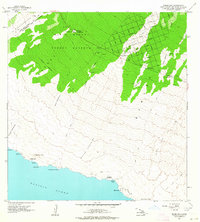
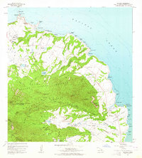
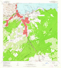
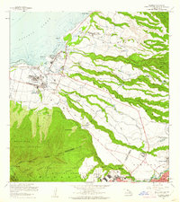 1960 Haleiwa1961 Print · USGSOahu's North Shore and the Wahiawa Plateau are documented here during the height of the mid-century plantation era. Genealogists and historians can trace laborers' quarters at Poamoho Camp, the industrial Sugar Mill in Waialua, and the layout of Schofield Barracks.2 unique versions available
 - 1960 Map of Kaunene, 1961 Print
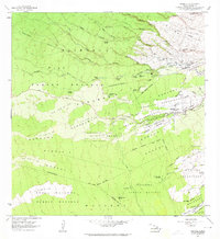
 1960 Kaunene1961 Print · USGSThe high slopes of the Big Island are captured here in the early sixties, showing a landscape defined by forest reserves and remote camps. Researchers can trace historic land divisions and upland sites like Gaspars Dairy, Hapuu Camp, and the Komakawai Waterholes.2 unique versions available
 - 1960 Map of Schofield Barracks, 1962 Print
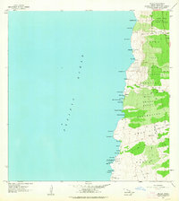
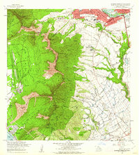 1960 Schofield Barracks1962 Print · USGSCentral Oahu and the Waianae Range are captured here during a period of significant military and agricultural activity. Researchers can trace the layout of Schofield Barracks, locate Kunia Camp, and find landmarks like Wheeler Field and Kolekole Pass.
 - 1960 Map of Kealakekua, 1972 Print
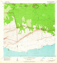
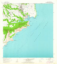
 1960 Kealakekua1972 Print · USGSCoastal Kona in the early sixties remains a place of deep heritage, where ancient landmarks and modern infrastructure coexist along the shoreline. Trace the historic Judd Trail or locate mid-century sites like the Kona Hospital and the Burial Ground for Kuamoo Battle Warriors.2 unique versions available
 - 1961 Map of Hawaii North
 1961 Hawaii North1961 Print · USGSThe Big Island's northern reaches are shown here in the early sixties, during the peak of the sugar era and before modern resort development. Researchers can trace the Hawaii Consolidated railroad, locate the Ahu a Umi Heiau Ruins, and explore sugar industry landmarks like the Pacific Sugar Mill.2 unique versions available
 - 1961 Map of Oahu
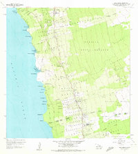
 1961 Oahu1961 Print · USGSOahu's strategic landscape is captured here during the early statehood era, showing the balance between burgeoning urban centers and massive military installations. Trace the path of the Oahu Railway and Land Co or locate historical sites like Schofield Barracks and Punchbowl Hill.
 - 1961 Map of Hawaii South
 1961 Hawaii South1961 Print · USGSThe southern region of the Big Island appears here in the early sixties, illustrating a landscape of volcanic craters and remote agricultural outposts. Genealogists and historians can trace the locations of Wood Valley Camp, the Koa Mill, and the ruins at Kahio.
 - 1962 Map of Hawaii South
 1962 Hawaii South1962 Print · USGSThe southern half of Hawaii Island in the early sixties showcases a landscape defined by volcanic rifts and coastal settlements. Researchers can trace the Hawaii Consolidated rail line, find the Kuee (Ruined) site, and locate remote camps like Hooper Camp.2 unique versions available
 - 1962 Map of Ewa, 1963 Print
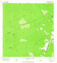
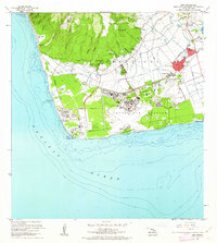 1962 Ewa1963 Print · USGSCoastal Oahu in the early sixties showcases a transition from plantation life to a modern military and industrial hub. Genealogists can trace family connections in Ewa and its surrounding worker communities like Tenney Village or Varona Village, while researchers can locate the massive Barbers Point Naval Air Station.2 unique versions available
 - 1962 Map of Milolii, 1964 Print
 1962 Milolii1964 Print · USGSThe South Kona coast in the early sixties reveals a landscape shaped by recent volcanic events and ancient Hawaiian heritage. Genealogists and historians can trace the Alika Lava Flow of 1919 and find archaeological sites like the Ahole Heiau and scattered coastal ruins.
 - 1962 Map of Puu Hou, 1964 Print
 1962 Puu Hou1964 Print · USGSThe southwestern Hawaii coast in the early sixties reveals a landscape shaped by volcanic history and early settlements. Trace the extent of the Lava Flow of 1868 and locate cultural sites such as Kahio (Site) and Kailikii (Site).
 - 1962 Map of Kahuku Ranch, 1964 Print
 1962 Kahuku Ranch1964 Print · USGSThe volcanic Kau District is captured here in the early sixties, showing the intersection of massive historical lava flows and ranching life. Trace the boundaries of the Kiolakaa-Keaa Homesteads or locate the Heiau o Malino and Naohulehua Cave.2 unique versions available
 - 1962 Map of Manuka Bay, 1964 Print
 1962 Manuka Bay1964 Print · USGSThe South Kona and Kau District shoreline remains largely undeveloped in the early sixties. Researchers can trace ancient cultural sites like a Heiau alongside military markers including a Bombing Target and the Coast Guard Reservation.2 unique versions available
 - 1962 Map of Pohue Bay, 1964 Print
 1962 Pohue Bay1964 Print · USGSCoastal Hawaii in the early sixties showcases a landscape shaped by volcanic activity and nascent development. Researchers can trace historic paths like the Petroglyphs Trail or locate remote landmarks including the Manuka Mauka House and Pohue Bay.3 unique versions available
 - 1962 Map of Ka Lae, 1964 Print
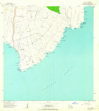 1962 Ka Lae1964 Print · USGSThe southern tip of Hawaii Island comes into focus in the early sixties, showing a landscape where ancient culture meets Cold War technology. Researchers can trace land divisions in Kamaoa Homesteads or locate historical sites like Heiau o Kalalea and the Astronomic Station.2 unique versions available
 - 1962 Map of Papa, 1964 Print
 1962 Papa1964 Print · USGSThe South Kona coast in the early sixties reveals a landscape shaped by recent volcanic eruptions and timber milling. Researchers can trace the paths of several major eruptions through the South Kona Forest Reserve or locate local landmarks like the Koa Mill and Hoopuloa Church.2 unique versions available
 - 1962 Map of Kauluoa Point, 1964 Print
 1962 Kauluoa Point1964 Print · USGSThe South Kona coastline of Hawaii is captured here shortly after the massive mid-century volcanic events. Researchers can trace the path of the Honokua Lava Flow of 1950 as it crosses through the Olelomoana Homesteads and near the Honokua Rock Wall.2 unique versions available
 - 1962 Map of Naalehu, 1964 Print
 1962 Naalehu1964 Print · USGSThe southern Kau District comes into focus in the early sixties, showing the vital sugar industry and homesteading patterns of the era. Genealogists and researchers can trace family lands in the Kaunamano Homesteads or locate historical landmarks like the Sugar Mill and Waiohinu Park.2 unique versions available
 - 1963 Map of Volcano, 1964 Print
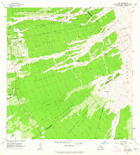
 1963 Volcano1964 Print · USGSThe community of Volcano and the surrounding forest reserves are captured here in the early 1960s. Genealogists and researchers can trace the early layout of Volcano and Glenwood, alongside iconic landmarks like the Thurston Lava Tube.
 - 1963 Map of Anahola, 1964 Print
 1963 Anahola1964 Print · USGSNortheastern Kauai in the early sixties shows a landscape defined by plantation-era water engineering and traditional settlements. Trace local history through the Hawaiian Homes tracts and Anahola village, or locate the old Kilauea Quarry and Spalding Monument.2 unique versions available
 - 1963 Map of Puu Makaala, 1964 Print
 1963 Puu Makaala1964 Print · USGSThe upland forests of Hawaii's Big Island are captured here in the early 1960s as homesteading and resource management shaped the landscape. Genealogists and historians can trace family plots in the Keaau Homesteads or follow the route of the Old Railroad Grade.2 unique versions available
 - 1963 Map of Piihonua, 1964 Print
 1963 Piihonua1964 Print · USGSThe South Hilo District is captured here in the early sixties, showing how historic eruptions shaped local development. Genealogists and historians can locate the Japanese Cemetery, Kaumana School, and the path of the Olaa Flume through the homesteads.
 - 1963 Map of Makaopuhi Crater, 1964 Print
 1963 Makaopuhi Crater1964 Print · USGSThe Puna coast and the volcanic highlands of Hawaii are shown here during a decade of significant eruptions. Researchers can trace historic lava flows across the Chain of Craters Road or locate the Ainahou Ranch and Kealakomo coastal sites.2 unique versions available
 - 1963 Map of Hilo, 1964 Print
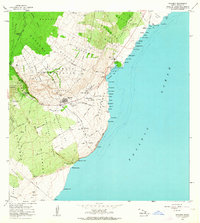
 1963 Hilo1964 Print · USGSHilo and its surrounding homesteads are captured in detail during the early sixties, showing the city's expansion against the backdrop of the Panaewa Forest Reserve. Researchers can trace old family footprints in the Waiakea Homesteads, locate the Sugar Mill, or find St Josephs High Sch and Rainbow Falls.2 unique versions available
 - 1963 Map of Lihue, 1964 Print
 1963 Lihue1964 Print · USGSKauai’s eastern coast and the growing town of Lihue are captured in the early sixties as the island’s modern infrastructure was taking shape. Genealogists and historians can trace local institutions like Wilcox Sch and Lihue High Sch, or find the historic Menehune Fishpond and Nawiliwili Light Station.2 unique versions available
Showing maps 1-25 of 79
Top cities of Hawaii
- Honolulu historical maps
- Waipahu historical maps
- East Honolulu historical maps
- Mililani historical maps
- Pearl City historical maps
- Hilo historical maps
See more
Top counties of Hawaii
- Honolulu County historical maps
- Hawaiʻi County historical maps
- Maui County historical maps
- Kauai County historical maps
Frequently asked questions
- What are the different types of historical maps available for Hawaii?
- What is the oldest map of Hawaii?
- Where can I purchase historical maps of Hawaii for my home or office?
- Where can I download high-res historical maps of Hawaii?
- Are there historical topographic maps available for Hawaii?
- Is there historical aerial imagery available for Hawaii?
- Where are historical maps of Hawaii sourced from?