1990s Maps of Hawaii
Explore 119 historic maps of Hawaii from the 1990s. These maps offer a rare glimpse into what life looked like during the 1990s — showing old roads, neighborhoods, homes, and landmarks that have changed or disappeared over time.
Whether you're researching your family's past, planning a metal detecting trip, or studying how Hawaii's landscape evolved across the 1990s, these high-resolution maps are a powerful tool for exploring the history of this region.
- Focus on a specific era: All maps on this page are from the 1990s, giving you a focused view of this time period.
- See what’s changed: Compare century-old streets, trails, and buildings to today's modern landscape using overlays and satellite layers.
- Research with precision: Use these maps for genealogy, historical research, land use analysis, or educational projects.
- View, download, or print: Maps are fully viewable online in high resolution, and can be downloaded or printed for your own records.
Start exploring Hawaii's history through authentic maps from the 1990s. This is your window into the past.
Hawaii maps
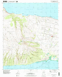
(119)- 1991 Map of Makalau, 2000 Print
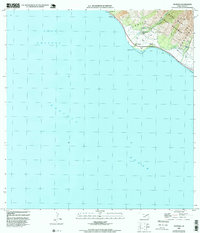
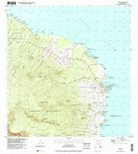
 1991 Makalau2000 Print · USGSThe northeast coast of the Lahaina District is captured here in the early nineties, showing a landscape defined by deep ravines and coastal fishponds. Researchers can trace the path of Keomuku Road past Shipwreck Beach and the historic Fishpond Keomuku.
 - 1991 Map of Garden Of The Gods, 2000 Print
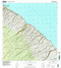
 1991 Garden Of The Gods2000 Print · USGSThe northwestern coast of Lana'i is documented here in the early nineties, showing the isolated shoreline and the complex drainage of the island's interior. Researchers can find the Garden of the Gods rock formations and coastal landmarks like Pōhakuloa Point Light and Polihua Beach.
 - 1991 Map of Kahoolawe West, 2001 Print
 1991 Kahoolawe West2001 Print · USGSKaho‘olawe’s western shore was documented in the early 1990s as a place of coastal navigation and high-altitude volcanic craters. You can trace the geography of the US Coast Guard Reservation and locate specific features like Southwest Point Light and Lua ‘O Keaualuna.
 - 1991 Map of Kahoolawe East, 2001 Print
 1991 Kahoolawe East2001 Print · USGSThe island of Kaho'olawe remained a place of geographic and military significance in the early nineties, centered on the high peak of Pu'u 'O Moa'ula Nui. Researchers can trace the coastal landforms from Hakioawa to Kanapou Bay and locate the offshore US Coast Guard Reservation.
 - 1991 Map of Waialeale, 2003 Print
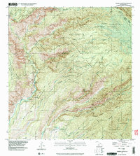
 1991 Waialeale2003 Print · USGSKauai's high interior peaks and vital watersheds are documented here during the early 1990s. Researchers can trace the island's water management history through several Rain Gages, the Upper Powerhouse, and falls like Uhau Iole Falls.
 - 1991 Map of Makaha Point, 2003 Print
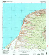 1991 Makaha Point2003 Print · USGSThe northwestern coast of Kauai shows a unique mix of military technology and wild terrain in the early nineties. Researchers can trace the footprint of the Pacific Missile Range Facility or locate landmarks like the Pu'uhonua Lookout and Pahole Spring.
 - 1991 Map of Kilohana, 2003 Print
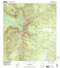
 1991 Kilohana2003 Print · USGSThe high slopes of Maui are captured here during the early 1990s, where the volcanic interior meets agricultural homesteads. Researchers can trace the layout of the Haleakala Homesteads and find landmarks like the Olinda State Facility and Ukulele Camp (Site).
 - 1991 Map of Waimea Canyon, 2003 Print
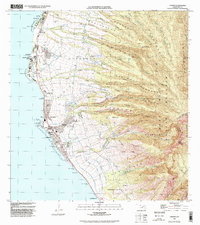
 1991 Waimea Canyon2003 Print · USGSKauai's interior highlands and deep canyon systems are preserved here in the early nineties, showing a landscape of protected reserves and remote mountain camps. Researchers can trace the network of wilderness outposts including Lonernea Camp and Wiliwili Camp, alongside landmarks like Waipoo Falls.
 - 1992 Map of Puu O Kali, 1999 Print
 1992 Puu O Kali1999 Print · USGSThe western slopes of Maui are shown during the early nineties as residential and agricultural subdivisions expand toward the coast. Researchers can trace land grants and water rights through the Waikoa Homesteads and the complex Haiku Ditch irrigation system.
 - 1992 Map of Lahaina, 1999 Print
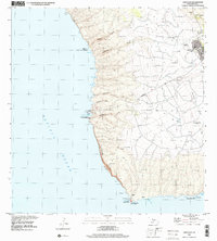
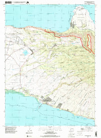
 1992 Lahaina1999 Print · USGSThe West Maui coastline in the early nineties showcases the transition from agricultural infrastructure to coastal development. Researchers can trace land divisions and local landmarks like Mala Wharf, the Hanakaoo Cemetery, and the Mill Stack near Lahaina.
 - 1992 Map of Olowalu, 1999 Print
 1992 Olowalu1999 Print · USGSCoastal West Maui in the 1990s was a landscape defined by its vital water systems and shoreline settlements. Researchers can trace the local water infrastructure from the Ukumehame Reservoir to the Olowalu Wharf, while locating family sites at Kilea and Mopua.
 - 1992 Map of Haiku, 1999 Print
 1992 Haiku1999 Print · USGSThe North Shore of Maui in the 1990s reveals a landscape of deep gulches and historical homesteads before the turn of the millennium. Genealogists and researchers can trace family lands in Haleakala Homesteads or locate the Mau Veterans Cemetery and Pauwela Point Lighthouse Pk.
 - 1992 Map of Haalelepaakai, 2000 Print
 1992 Haalelepaakai2000 Print · USGSLana'i City and the surrounding highlands are captured here in the early nineties as the island's landscape transitioned toward modern conservation. Researchers can trace historical sites from the Shrine (Buddhist Cem) to coastal Naha Fishpond and Halepalaoa Landing.
 - 1992 Map of Lanai City, 2000 Print
 1992 Lanai City2000 Print · USGSThe upland interior of Lāna‘i is mapped here in the early nineties, centered on the grid of Lāna‘i City and its surrounding homesteads. Researchers can trace the primary route of Kaumalapa‘u Road down to the harbor or locate the historic Kaunolū Site and Palaoa Point on the southern coast.
 - 1992 Map of Hauula, 2001 Print
 1992 Hauula2001 Print · USGSOahu's windward coast and central highlands are captured here in the early nineties, showing the island's blend of military infrastructure and natural preserves. Genealogists and historians can trace the developments of Hau'ula, Whitmore Village, and the expansive Schofield Barracks.
 - 1992 Map of Ahumoa, 2001 Print
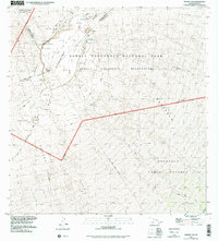
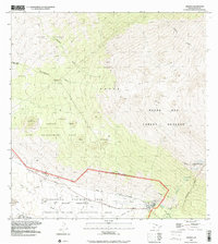 1992 Ahumoa2001 Print · USGSThe high slopes of Mauna Kea meet military training grounds in this early 1990s survey of Hawaii's volcanic interior. Researchers can trace the boundaries of the Pohakuloa Training Area and find remote water sources like Waihu Spring and Liloe Spring.
 - 1992 Map of Kahana, 2001 Print
 1992 Kahana2001 Print · USGSThe windward Oahu coastline in the 1990s reveals a landscape of coastal ponds and narrow settlements pressed against steep valley walls. Genealogists and hikers can trace property lines through the Grant Boundary or locate landmarks like the Ka'a'awa School and Huila Pond.
 - 1992 Map of Hana, 2002 Print
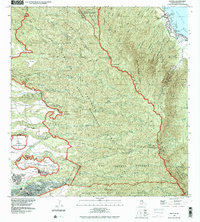
 1992 Hana2002 Print · USGSThe Hāna coast of Maui appeared as a blend of traditional homesteads and coastal villages in the early nineties. Researchers can trace land divisions like the Nāhiku Homesteads and find local landmarks such as the Hāna High and Elementary School or Mokae Landing (Site).
 - 1992 Map of Papaaloa, 2003 Print
 1992 Papaaloa2003 Print · USGSThe Hamakua Coast comes alive in the early nineties, showing the intricate network of upland homesteads and coastal villages. Genealogists and historians can trace family lands within the Papa'aloa Homesteads or locate the Tidal Wave Memorial at Laupahoehoe.
 - 1992 Map of Keanae, 2003 Print
 1992 Keanae2003 Print · USGSThe coastal homesteads of Maui's Ke'anae region are captured here in the 1990s, where the winding Hana Highway meets the sea. Researchers can trace the layout of Ke'anae Homesteads, the Old Ke'anae Landing, and local landmarks like Ke'anae Sch.
 - 1992 Map of Nahiku, 2003 Print
 1992 Nahiku2003 Print · USGSCoastal Maui meets the volcanic heights of Haleakalā in the early nineties, showing a landscape of deep valleys and protected reserves. Genealogists and hikers can locate the Nāhiku settlement, coastal cemeteries, and remote landmarks like Paliku Cabin and Kopiliula Falls.
 - 1993 Map of Mauna Loa, 1999 Print
 1993 Mauna Loa1999 Print · USGSThe summit of Mauna Loa is captured here in the late twentieth century, showing the evolving geology of the Big Island. Geologists and hikers can trace the Ainapo Trail to the Mauna Loa Cabin or study the extent of the Lava Flow of 1975.
 - 1993 Map of Kaunakakai, 1999 Print
 1993 Kaunakakai1999 Print · USGSMolokai's central corridor and north shore are shown here in the early nineties, from the bustling waterfront of the south to the isolated peninsula. Genealogists can trace homesteads and local landmarks like the Meyer Cemetery, Kamehameha Coconut Grove, and the Kalanianaole Colony.
 - 1993 Map of Molokai Airport, 1999 Print
 1993 Molokai Airport1999 Print · USGSCentral Molokai in the early nineties reveals a landscape of aviation and agriculture, centered on the Molokai Airport. Genealogists and historians can trace the detailed layouts of Hoolehua Homesteads or locate the Pakanaka Fishpond and the Naval Reservation.2 unique versions available
 - 1993 Map of Hualalai, 2000 Print
 1993 Hualalai2000 Print · USGSThis high-elevation survey of the Big Island captures the volcanic landscape and conservation lands during the 1990s. Researchers can trace historic footpaths like the Judd Trail and Pihapono Trail or locate remote landmarks like Shangri-la and Hainoa Crater.
Showing maps 1-25 of 119
Top cities of Hawaii
- Honolulu historical maps
- Waipahu historical maps
- East Honolulu historical maps
- Mililani historical maps
- Pearl City historical maps
- Hilo historical maps
See more
Top counties of Hawaii
- Honolulu County historical maps
- Hawaiʻi County historical maps
- Maui County historical maps
- Kauai County historical maps
Frequently asked questions
- What are the different types of historical maps available for Hawaii?
- What is the oldest map of Hawaii?
- Where can I purchase historical maps of Hawaii for my home or office?
- Where can I download high-res historical maps of Hawaii?
- Are there historical topographic maps available for Hawaii?
- Is there historical aerial imagery available for Hawaii?
- Where are historical maps of Hawaii sourced from?