1900s (20th Century) Maps of Honolulu County, Hawaii
Explore 84 historic maps of Honolulu County from the 1900s (20th Century). These maps offer a rare glimpse into what life looked like during the 1900s — showing old roads, neighborhoods, homes, and landmarks that have changed or disappeared over time.
Whether you're researching your family's past, planning a metal detecting trip, or studying how Honolulu County's landscape evolved across the 1900s, these high-resolution maps are a powerful tool for exploring the history of this region.
- Focus on a specific era: All maps on this page are from the 1900s, giving you a focused view of this time period.
- See what’s changed: Compare century-old streets, trails, and buildings to today's modern landscape using overlays and satellite layers.
- Research with precision: Use these maps for genealogy, historical research, land use analysis, or educational projects.
- View, download, or print: Maps are fully viewable online in high resolution, and can be downloaded or printed for your own records.
Start exploring Honolulu County's history through authentic maps from the 1900s. This is your window into the past.
Honolulu County, HI maps
(84)- 1952 Map of Waimea, 1954 Print
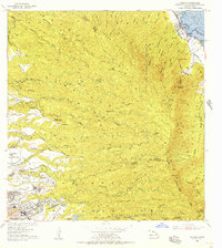
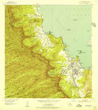
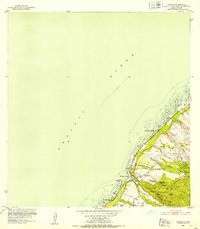 1952 Waimea1954 Print · USGSOahu's North Shore in the early fifties shows the early residential framing of Sunset Beach and the rugged forest reserves of the interior. Trace historic sites like Puu o Mahuka Heiau and follow the route of Kamehameha Highway past Waimea Bay.2 unique versions available
 - 1952 Map of Koko Head, 1954 Print
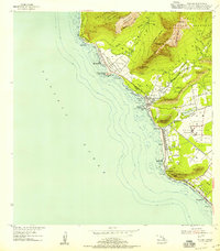
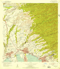
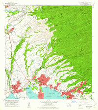
 1952 Koko Head1954 Print · USGSSoutheast Oahu's ridgelines and coastal plains are captured here in the early fifties, just as suburban expansion began reaching toward Koko Head. Researchers can trace early residential tracts like Aina Haina and the original footprint of Kuapa Pond or Waimanalo Village.
 - 1952 Map of Mokapu, 1954 Print
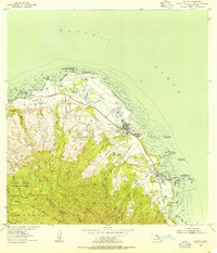
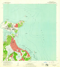
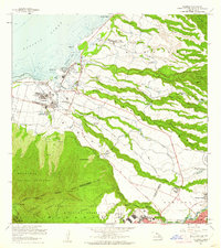
 1952 Mokapu1954 Print · USGSWindward Oahu's coastline is captured in the early fifties, showing the development of Kailua and Lanikai alongside major military installations. Genealogists and historians can trace local landmarks like the Heiau, Kailua Sky Ranch, and the Koolau Boys Home.
 - 1953 Map of Haleiwa, 1954 Print
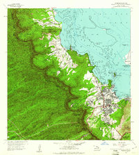
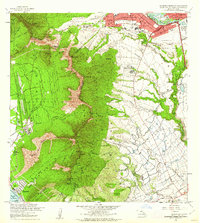
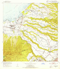 1953 Haleiwa1954 Print · USGSOahu's North Shore thrived as a plantation powerhouse in the early fifties, where sugar production and military presence shaped the land. Genealogists can trace family footprints through Kemoo Camp, Poamoho Camp, and the Kawailoa Soto Mission and School.
 - 1953 Map of Schofield Barracks, 1955 Print
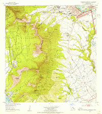 1953 Schofield Barracks1955 Print · USGSMid-century Oahu is depicted here during a period of significant military and agricultural activity. Historians can trace the development of Schofield Barracks and Wheeler Air Force Base or locate the old Kunia Camp.
 - 1953 Map of Honolulu, 1956 Print
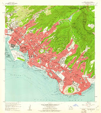
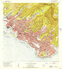 1953 Honolulu1956 Print · USGSMid-century Honolulu is captured here during a time of rapid urban expansion, from the bustling waterfront to the residential ridges. Researchers can trace the footprints of Fort Shafter, the historic Oahu Railway, and the early layout of the University of Hawaii.
 - 1953 Map of Ewa, 1956 Print
 1953 Ewa1956 Print · USGSCoastal Oahu in the early fifties was a landscape of military aviation and plantation life. Genealogists can trace family footprints through numerous worker settlements like Tenney Village and Renton Village or find the Sugar Mill that drove the local economy.
 - 1953 Map of Puuloa, 1956 Print
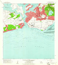
 1953 Puuloa1956 Print · USGSHonolulu and Pearl Harbor are documented here during a period of significant military and aviation expansion. Researchers can trace the mid-century footprints of the Damon Tract, locate Nimitz Sch, and explore the layout of Ford Island.
 - 1953 Map of Hauula, 1956 Print
 1953 Hauula1956 Print · USGSOahu's rugged interior and windward coast are captured here in the early fifties, showing the evolution of military and plantation lands. Trace the Abandoned RR near Hauula, the grounds of Leilehua High Sch, and landmarks like Sacred Falls (Kaliuwaa).
 - 1954 Map of Oahu
 1954 Oahu1954 Print · USGSMid-century Oahu is caught between its plantation roots and its growing role as a Pacific military hub. Trace the OR and L Co rail lines and explore the 1950s footprints of Pearl Harbor, Libbyville, and Waipahu.
 - 1954 Map of Waianae, 1955 Print
 1954 Waianae1955 Print · USGSThe leeward coast of Oahu is captured here in the mid-fifties, showing the development of coastal communities between the sea and the rugged heights. Genealogists and historians can trace Waianae Homesteads and significant cultural sites like Kaneaki Heiau.
 - 1954 Map of Kahuku, 1955 Print
 1954 Kahuku1955 Print · USGSThe northern tip of Oahu is captured here in the mid-1950s, showing a landscape defined by sugar production and coastal military infrastructure. Genealogists and historians can trace local landmarks like the Sugar Mill, the Laie Temple, and the Hawaii Infantry Training Camp.
 - 1954 Map of Kaena, 1955 Print
 1954 Kaena1955 Print · USGSThe western tip of Oahu is captured here in the mid-1950s, showing a landscape of coastal ranches and military airfields. Researchers can trace the Old Railroad Grade, locate the ancient Heiau at Keaau Homesteads, or find the Makua (Site) in the shadow of the peaks.
 - 1954 Map of Kahana, 1955 Print
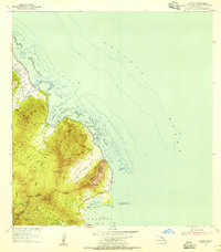 1954 Kahana1955 Print · USGSThe windward coast of Oahu is captured in the mid-fifties, showing a rural landscape before modern expansion. Historians can trace the Sugar Mill (Ruin) near Molii Pond or locate local landmarks like Mokolii Island (Chinamans Hat) and the Kahana settlement.2 unique versions available
 - 1954 Map of Kaneohe, 1956 Print
 1954 Kaneohe1956 Print · USGSWindward Oahu in the mid-fifties shows a landscape of mountain homesteads and expanding coastal settlements. Trace family land in the Waiahole Homesteads or locate local landmarks like the Territorial Hospital and the Heeia Radio Station.
 - 1954 Map of Waipahu, 1956 Print
 1954 Waipahu1956 Print · USGSOahu's south-central coastline and plantation interior are documented in the mid-fifties during a period of industrial and military growth. Genealogists and historians can trace rail lines like the Oahu Railway and industry sites like the Sugar Refinery and Waipio Camp A.
 - 1959 Map of Mokapu, 1960 Print
 1959 Mokapu1960 Print · USGSCoastal Oahu at the dawn of the 1960s reveals a mix of military installations and burgeoning seaside communities. Local historians can trace the early layouts of Lanikai and Kailua, alongside landmarks like the Kailua Sky Ranch and Bellows Air Force Base.2 unique versions available
 - 1959 Map of Koko Head, 1960 Print
 1959 Koko Head1960 Print · USGSSoutheastern Oahu in the late fifties shows a landscape of military bases and coastal growth before the major transformation of its ancient fishponds. Trace early neighborhood developments in Aina Haina and Portlock, or locate landmarks like Kuapa Pond and Koko Crater.
 - 1959 Map of Kaneohe, 1961 Print
 1959 Kaneohe1961 Print · USGSCoastal Oahu in the late fifties shows a mix of growing residential communities and traditional Hawaiian fishponds. Genealogists and historians can trace family roots through the Kokokahi Homesteads, locate old landmarks like St Anns Sch, or study the footprint of the State Hospital.
 - 1959 Map of Honolulu, 1961 Print
 1959 Honolulu1961 Print · USGSMid-century Honolulu is captured here during a transition toward modern statehood, showing a dense city bounded by the Koolau peaks and the Pacific. Trace the footprints of the Oahu Railway and Land Co, Iolani Palace, and Diamond Head.
 - 1959 Map of Waipahu, 1961 Print
 1959 Waipahu1961 Print · USGSCentral Oahu in the late fifties reveals a landscape defined by sugar plantations, pineapple research, and massive military installations. Researchers can trace the water network of the Waiahole Ditch, find the old Sugar Refinery, and locate the Kipapa Airfield near Waipio Acres.
 - 1959 Map of Puuloa, 1961 Print
 1959 Puuloa1961 Print · USGSThe Pearl Harbor vicinity in the late fifties showcases a landscape transformed by global aviation and defense. Researchers can trace the mid-century footprints of Hickam Village, the Honolulu Observatory, and the historic Salt Evaporators.2 unique versions available
 - 1960 Map of Haleiwa, 1961 Print
 1960 Haleiwa1961 Print · USGSOahu's North Shore and the Wahiawa Plateau are documented here during the height of the mid-century plantation era. Genealogists and historians can trace laborers' quarters at Poamoho Camp, the industrial Sugar Mill in Waialua, and the layout of Schofield Barracks.2 unique versions available
 - 1960 Map of Schofield Barracks, 1962 Print
 1960 Schofield Barracks1962 Print · USGSCentral Oahu and the Waianae Range are captured here during a period of significant military and agricultural activity. Researchers can trace the layout of Schofield Barracks, locate Kunia Camp, and find landmarks like Wheeler Field and Kolekole Pass.
 - 1961 Map of Oahu
 1961 Oahu1961 Print · USGSOahu's strategic landscape is captured here during the early statehood era, showing the balance between burgeoning urban centers and massive military installations. Trace the path of the Oahu Railway and Land Co or locate historical sites like Schofield Barracks and Punchbowl Hill.
Showing maps 1-25 of 84
Top cities of Honolulu County
- Honolulu historical maps
- Waipahu historical maps
- Mililani historical maps
- Pearl City historical maps
- Kailua historical maps
- Kapolei historical maps
See more
Frequently asked questions
- What are the different types of historical maps available for Honolulu County?
- What is the oldest map of Honolulu County?
- Where can I purchase historical maps of Honolulu County for my home or office?
- Where can I download high-res historical maps of Honolulu County?
- Are there historical topographic maps available for Honolulu County?
- Is there historical aerial imagery available for Honolulu County?
- Where are historical maps of Honolulu County sourced from?