2020s Maps of Honolulu County, Hawaii
Explore 17 historic maps of Honolulu County from the 2020s. These maps offer a rare glimpse into what life looked like during the 2020s — showing old roads, neighborhoods, homes, and landmarks that have changed or disappeared over time.
Whether you're researching your family's past, planning a metal detecting trip, or studying how Honolulu County's landscape evolved across the 2020s, these high-resolution maps are a powerful tool for exploring the history of this region.
- Focus on a specific era: All maps on this page are from the 2020s, giving you a focused view of this time period.
- See what’s changed: Compare century-old streets, trails, and buildings to today's modern landscape using overlays and satellite layers.
- Research with precision: Use these maps for genealogy, historical research, land use analysis, or educational projects.
- View, download, or print: Maps are fully viewable online in high resolution, and can be downloaded or printed for your own records.
Start exploring Honolulu County's history through authentic maps from the 2020s. This is your window into the past.
Honolulu County, HI maps
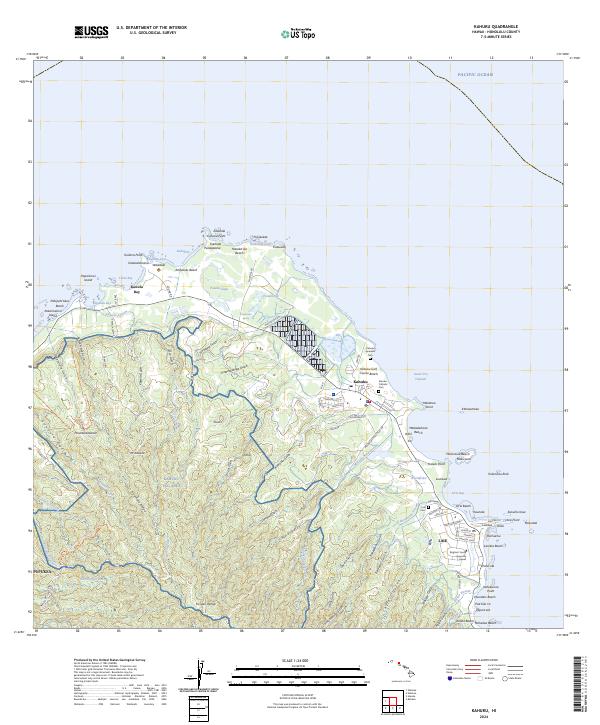
(17)- 2024 Map of Kahana, 2024 Print
 2024 Kahana2024 Print · USGSWindward Oahu's coastal landscape and steep ridges are documented here in the early twenty-first century. Genealogists and historians can trace traditional sites like Mōli'i Pond and 'Āpua Fishpond alongside the remnants of the Kualoa Sugar Mill Beach.
 - 2024 Map of Koko Head, 2024 Print
 2024 Koko Head2024 Print · USGSSoutheast O'ahu's modern shoreline and ridges appear here during a period of established residential development and preserved coastal landmarks. Researchers can trace local history from the Memorial Garden to the geological features of Hanauma Bay and Ka'au Crater.
 - 2024 Map of Haleiwa, 2024 Print
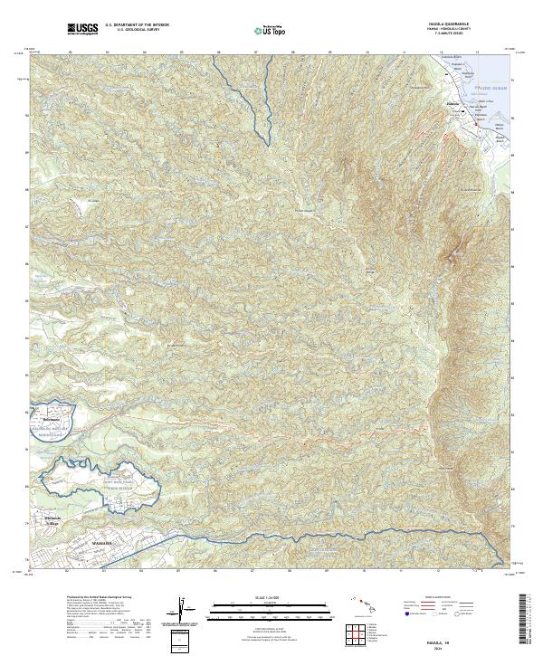
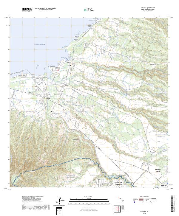 2024 Haleiwa2024 Print · USGSThe north shore of O’ahu at the start of the 2020s shows a complex blend of coastal life and military infrastructure. Researchers can trace historic local sites such as the Liliʙokalani Church Cem or the industrial legacy of the Wilson Ditch and Ranch Camp.
 - 2024 Map of Kaena OE W, 2024 Print
 2024 Kaena OE W2024 Print · USGSThe westernmost edge of O'ahu and the surrounding maritime expanse are the focus of this contemporary coastal survey. Researchers can locate the exact position of Ka'ena Point as it juts into the Pacific Ocean at the island's tip.
 - 2024 Map of Honolulu, 2024 Print
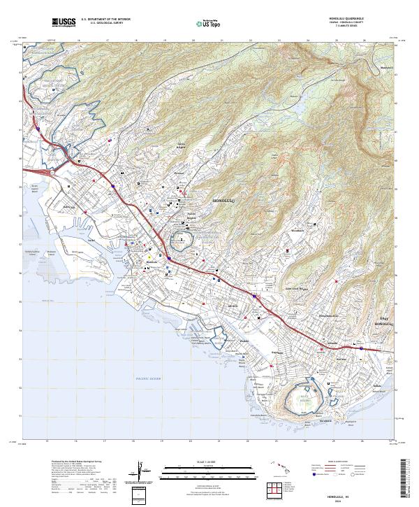 2024 Honolulu2024 Print · USGSModern Honolulu comes into sharp focus in this detailed survey, illustrating the city's expansion from the Pacific coast to the Ko'olau ridges. Genealogists and historians can trace institutional roots at the University of Hawaii at Manoa or locate ancestral sites like the Manoa Chinese Cem and the Royal Mausoleum State Monument.
 - 2024 Map of Mokapu Point, 2024 Print
 2024 Mokapu Point2024 Print · USGSThe windward coast of O'ahu is shown in the mid-2020s, highlighting the strategic and environmental landscape of the peninsula. Researchers can trace the military history of Marine Corps Base Hawaii alongside natural features like Kawainui Marsh and Ulupa‘u Crater.
 - 2024 Map of Koko Head OE E, 2024 Print
 2024 Koko Head OE E2024 Print · USGSThe eastern maritime reaches of Oahu are documented in this recent survey, capturing the coastal interface near the entrance to the Kaiwi Channel. Researchers can orient themselves along the shoreline at Makapu'u Point and trace the bathymetric expanse of the Pacific Ocean.
 - 2024 Map of Kaneohe, 2024 Print
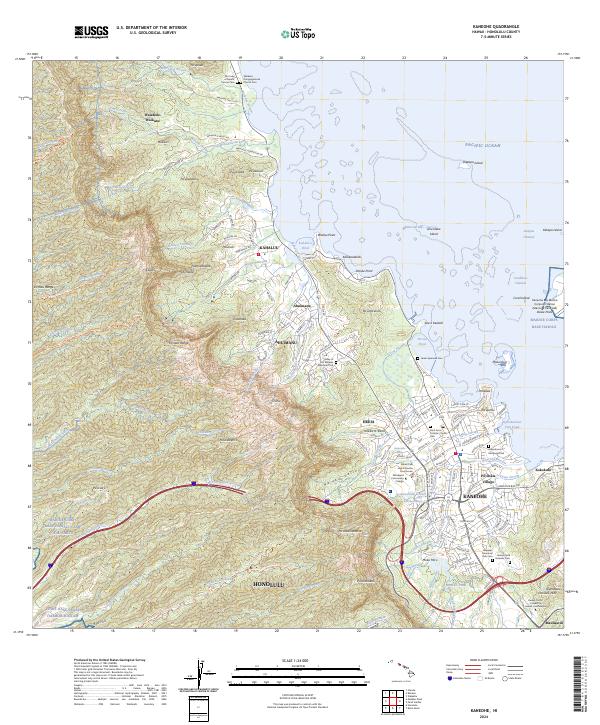 2024 Kaneohe2024 Print · USGSThe windward coast of Oahu comes alive in this contemporary record of its unique shorelines and mountain valleys. Researchers can trace the layout of Kaneohe, find family plots at Heeia Japanese Cem, and locate landmarks like He'eia Pond.
 - 2024 Map of Ewa, 2024 Print
 2024 Ewa2024 Print · USGSThe West O'ahu coast and Ewa Plain are shown in this recent survey during a period of significant suburban growth. Genealogists and historians can trace the traditional plantation clusters of Varona Village and Renton Village or find the Ewa Community Cem.
 - 2024 Map of Waipahu, 2024 Print
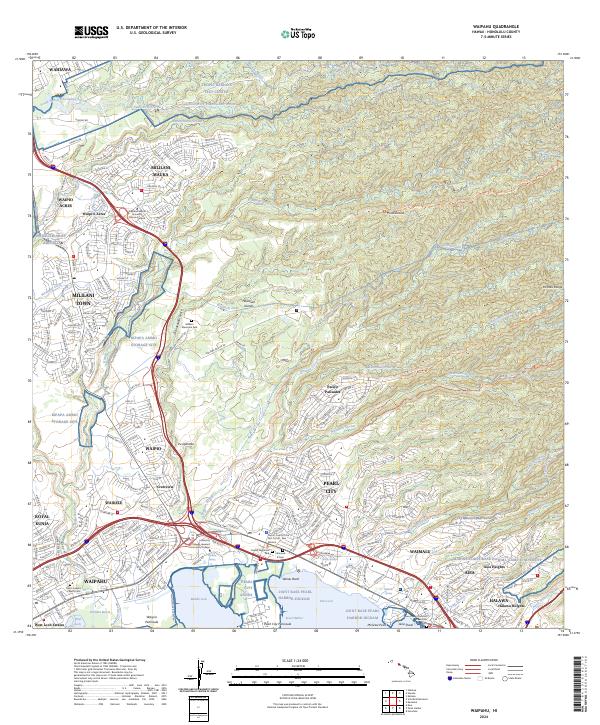 2024 Waipahu2024 Print · USGSThe northern shores of Pearl Harbor meet the residential and military heart of O'ahu in the early twenty-first century. Genealogists and historians can trace local landmarks like Saint Josephs Church Cem, Wheeler Army Airfield, and the Waiahole Ditch.
 - 2024 Map of Kaena, 2024 Print
 2024 Kaena2024 Print · USGSThe western extremity of Oahu is captured in the mid-2020s, showing a landscape defined by military reserves and steep coastal palis. Researchers can locate the Makua Protestant Cem, trace the Wai'anae Range ridges, and identify the Kaena Point Satellite Tracking Station.
 - 2024 Map of Kahuku, 2024 Print
 2024 Kahuku2024 Print · USGSThe northern tip of Oahu at the start of the 2020s shows a landscape of protected wetlands and coastal communities. Researchers can trace local heritage through the Kahuku Japanese Cem, the campus of Brigham Young University Hawaii, and landmarks like Kahuku Point.
 - 2024 Map of Pearl Harbor, 2024 Print
 2024 Pearl Harbor2024 Print · USGSHonolulu's southern coast is a modern landscape of strategic military bases and urban growth in the twenty-first century. Researchers can trace the layout of Joint Base Pearl Harbor-Hickam and the USS Arizona Memorial alongside neighborhoods like Iroquois Point and Ewa Beach.
 - 2024 Map of Hauula, 2024 Print
 2024 Hauula2024 Print · USGSNortheastern O'ahu and the central plateau are shown in detail during the mid-2020s, from the windward coast to the Wahiawa plains. Researchers can trace land use from the Hauula Community Cem to the Opae'ula Ditch and Helemano Military Reservation.
 - 2024 Map of Waianae, 2024 Print
 2024 Waianae2024 Print · USGSThe leeward coast of O‘ahu is documented here in the early twenty-first century, showing the integration of military lands and residential valleys. Researchers can locate family burial sites at Sacred Heart Catholic Cem or trace water infrastructure like the Mikilua Flume.
 - 2024 Map of Schofield Barracks, 2024 Print
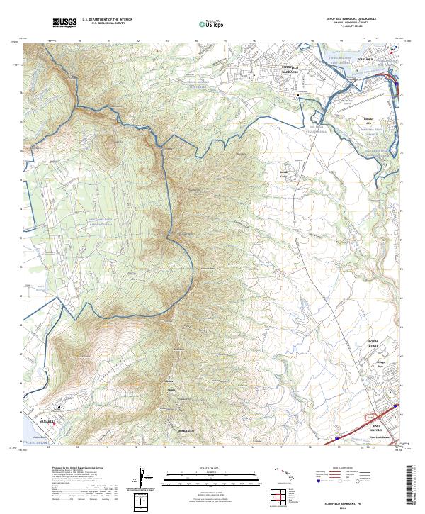 2024 Schofield Barracks2024 Print · USGSOahu's central corridor and leeward coast are shown in detail here during the mid-2020s, spanning from the mountain ridges to the sea. Researchers can trace the layout of Wheeler Army Airfield, locate the Schofield Veterans Cem, or find the Honouliuli National Historic Site.
 - 2024 Map of Waimea, 2024 Print
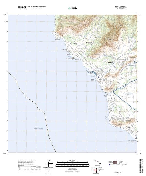
 2024 Waimea2024 Print · USGSThe North Shore of O'ahu is documented here in the mid-2020s, showing the intersection of coastal settlements and the island's steep interior gulches. Researchers can trace the path of the Waimea River to Waimea Falls or explore the residential layouts of Sunset Beach and Pupukea.
End of results
Showing maps 1-17 of 17
Top cities of Honolulu County
- Honolulu historical maps
- Waipahu historical maps
- Mililani historical maps
- Pearl City historical maps
- Kailua historical maps
- Kapolei historical maps
See more
Frequently asked questions
- What are the different types of historical maps available for Honolulu County?
- What is the oldest map of Honolulu County?
- Where can I purchase historical maps of Honolulu County for my home or office?
- Where can I download high-res historical maps of Honolulu County?
- Are there historical topographic maps available for Honolulu County?
- Is there historical aerial imagery available for Honolulu County?
- Where are historical maps of Honolulu County sourced from?