1970s Maps of Power County, Idaho
Explore 31 historic maps of Power County from the 1970s. These maps offer a rare glimpse into what life looked like during the 1970s — showing old roads, neighborhoods, homes, and landmarks that have changed or disappeared over time.
Whether you're researching your family's past, planning a metal detecting trip, or studying how Power County's landscape evolved across the 1970s, these high-resolution maps are a powerful tool for exploring the history of this region.
- Focus on a specific era: All maps on this page are from the 1970s, giving you a focused view of this time period.
- See what’s changed: Compare century-old streets, trails, and buildings to today's modern landscape using overlays and satellite layers.
- Research with precision: Use these maps for genealogy, historical research, land use analysis, or educational projects.
- View, download, or print: Maps are fully viewable online in high resolution, and can be downloaded or printed for your own records.
Start exploring Power County's history through authentic maps from the 1970s. This is your window into the past.
Power County, ID maps
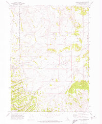
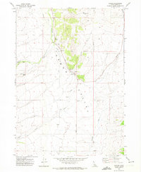
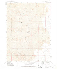
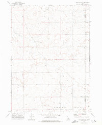
(31)- 1971 Map of Rockland East, 1973 Print
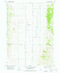
 1971 Rockland East1973 Print · USGSPower County, Idaho, in the early 1970s is documented here as a landscape of remote mountain canyons and high-valley ranching. Trace local genealogy and geography through landmarks like the Rockland settlement, the Cemetery, and the prominent Mollys Nipple peak.
 - 1971 Map of Bannock Peak, 1974 Print
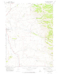
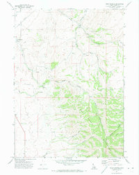
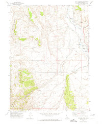
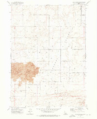
 1971 Bannock Peak1974 Print · USGSThe Deep Creek Mountains are captured in the early seventies, showcasing the high-elevation terrain along the Fort Hall Indian Reservation Boundary. Researchers can trace old routes like the Sawmill Cr Trail or locate remote landmarks like Bannock Peak and White Quartz Mtn.
 - 1971 Map of Flatiron Hill, 1974 Print
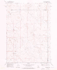
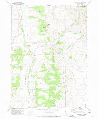 1971 Flatiron Hill1974 Print · USGSIn the early 1970s, this Power County landscape remained a rugged expanse of high-altitude ranching and forest lands. Genealogists and historians can trace the Fort Hall Indian Reservation Boundary and find local landmarks like Elkhead Ranch and the Cem.
 - 1971 Map of Schiller, 1974 Print
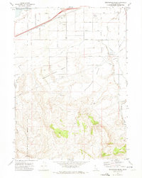
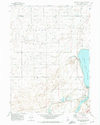
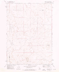
 1971 Schiller1974 Print · USGSPower County, Idaho, is captured here in the early 1970s as the regional economy revolved around the Snake River shoreline and the Michaud Flats. Genealogists and historians can trace the Union Pacific rail line, the rural settlement of Schiller, and the Indian Cem within the Fort Hall Indian Reservation.
 - 1971 Map of Sawmill Creek, 1974 Print
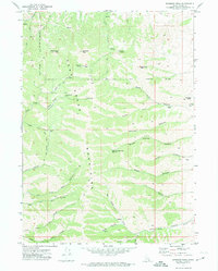
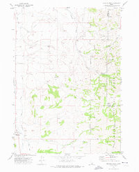
 1971 Sawmill Creek1974 Print · USGSPower County, Idaho, is shown in the early 1970s as a high-altitude landscape of springs and canyons along the reservation border. Trace historical paths like the Moonshine Trail and explore the geography of Sawmill Creek and Dry Canyon.
 - 1971 Map of Indian Springs, 1974 Print
 1971 Indian Springs1974 Print · USGSThe Deep Creek Mountains are captured here in the early 1970s, revealing a landscape of steep canyons and high-desert ranching. Researchers can trace land-use patterns at Garden Ranch, locate old Mines, and follow the path of Sunbeam Road.
 - 1971 Map of Wheatgrass Bench, 1974 Print
 1971 Wheatgrass Bench1974 Print · USGSIn the early 1970s, the border of the Fort Hall Indian Reservation met a landscape of rising benches and essential water infrastructure. Trace historical sites like the Sun Dance Ground, the local Cem, and the industrial Big Siphon Wasteway.
 - 1971 Map of Michaud Creek, 1974 Print
 1971 Michaud Creek1974 Print · USGSPower and Bannock counties meet in this early 1970s landscape of high-desert canyons and reservation lands. Researchers can trace the boundary of the Fort Hall Indian Reservation and locate specific landmarks like Eagletail Rock, the local Cem, and Outlaw Spring.2 unique versions available
 - 1971 Map of American Falls SW, 1974 Print
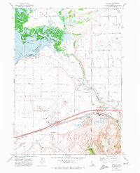
 1971 American Falls SW1974 Print · USGSPower County, Idaho, is captured in the early 1970s as a hub of river-fed industry and ranching along the American Falls Reservoir. Genealogists and researchers can trace the Union Pacific line and family landmarks like Western Home Ranch and Rueger Springs.
 - 1971 Map of Michaud, 1974 Print
 1971 Michaud1974 Print · USGSPower County and the Fort Hall Indian Reservation meet here in the early seventies as the Portneuf River feeds the reservoir. Genealogists and historians can trace family-named roads and sites like Reider Cemetery, Indian Cem, and the settlement of Michaud.4 unique versions available
 - 1971 Map of Aberdeen, 1974 Print
 1971 Aberdeen1974 Print · USGSBingham County agriculture and the Snake River irrigation network are in full view in the early seventies. Genealogists and historians can locate the Cem, the High Sch, and the local Aberdeen Airport amidst the Union Pacific rail lines.
 - 1971 Map of Neeley, 1974 Print
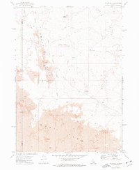
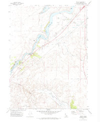 1971 Neeley1974 Print · USGSPower County, Idaho, is documented here in the early seventies as a landscape shaped by the historic Oregon Trail and modern irrigation. Genealogists and historians can locate the Neeley Cem, the Hunt Party Historical Site, and the landmarks of Massacre Rocks State Park.
 - 1971 Map of Pauline, 1974 Print
 1971 Pauline1974 Print · USGSArbon Valley in the early 1970s is a landscape of dispersed ranching and creek-side settlement. Researchers can locate family landmarks and rural infrastructure including the Arbon Sch, the community of Pauline, and the Fort Hall Indian Reservation boundary.
 - 1971 Map of American Falls, 1974 Print
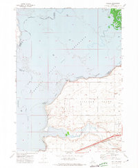
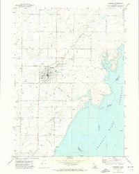
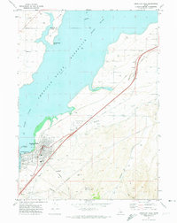 1971 American Falls1974 Print · USGSAmerican Falls is captured here in the early 1970s at the intersection of the Snake River and the Union Pacific rail line. Researchers can trace the town's civic layout, find Falls View Cem, and study the massive American Falls Dam and its reservoir.
 - 1971 Map of Rockland West, 1974 Print
 1971 Rockland West1974 Print · USGSThe Rockland valley in the early seventies shows a landscape of high-desert ranching and meticulous water management. Genealogists and historians can trace the irrigation network of West Ditch, the Landing Strip, and landmarks like Snyders Hole.
 - 1971 Map of Pocatello South, 1974 Print
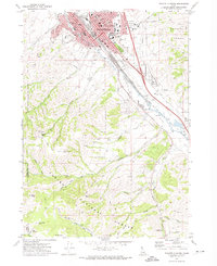 1971 Pocatello South1974 Print · USGSPocatello and the Portneuf River valley are captured in the early 1970s, showing the city's growth alongside Idaho State University. Trace local landmarks like Mountain View Cemetery, the Union Pacific rail lines, and Kinport Peak.3 unique versions available
 - 1972 Map of Rattlesnake Butte, 1975 Print
 1972 Rattlesnake Butte1975 Print · USGSThe volcanic landscape of the Snake River Plain in the early seventies reveals a remote region where the Lava Flow meets the high desert. Researchers can trace the rugged topography around Rattlesnake Butte and find signs of open-range ranching at a Corral and remote Well.
 - 1972 Map of Pillar Butte SE, 1976 Print
 1972 Pillar Butte SE1976 Print · USGSPower and Bingham counties in the early seventies reveal a high-desert landscape shaped by volcanic geology and agricultural engineering. Researchers can trace the edge of the Wapi Flow and locate dozens of remote wells and a small Cem in Pleasant Valley.
 - 1972 Map of Mosby Well, 1976 Print
 1972 Mosby Well1976 Print · USGSThe Snake River Plain high desert is captured here in the early 1970s, showing a landscape defined by its remote water sources. Researchers can trace the isolated network of a Jeep Trail leading to essential outposts like Mosby Well and Gasten Beattie Well.
 - 1972 Map of Mosby Butte, 1976 Print
 1972 Mosby Butte1976 Print · USGSPower County was a landscape of volcanic isolation in the early seventies, defined by the geological scars of the Great Rift. Researchers can trace the path of a remote Jeep Trail past landmarks like Sullivans Cave and the Bear Trap Lava Tube.
 - 1972 Map of Pillar Butte NE, 1977 Print
 1972 Pillar Butte NE1977 Print · USGSPower and Bingham counties meet in this high-desert landscape during the early 1970s. Researchers can trace the rugged network of Jeep Trails across Pleasant Valley and identify landmarks like Flat Top.
 - 1972 Map of Pillar Butte, 1977 Print
 1972 Pillar Butte1977 Print · USGSIn the early seventies, the volcanic high desert of Idaho was a landscape of basalt fissures and remote caves. Explorers and geologists can trace the rugged topography of the Great Rift to find Crystal Ice Cave, Kings Bowl, and Pillar Butte.
 - 1973 Map of Hartley Peak, 1976 Print
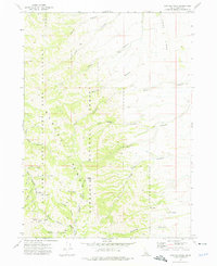 1973 Hartley Peak1976 Print · USGSThis early 1970s survey of the Sawtooth National Forest reveals a landscape defined by deep canyons and high ridges. Outdoor historians and researchers can trace old jeep trails leading to remote spots like Last Chance Gulch, Red Ledge, and Hartley Peak.
 - 1973 Map of Sublett Troughs, 1976 Print
 1973 Sublett Troughs1976 Print · USGSOneida County's high country is preserved here in the 1970s, showing a landscape of state bird sanctuaries and national forest lands. Local historians can trace old routes through Summit Springs Pass and locate remote sites like the Sublett Forest Service Station and Pine Creek Reservoir.
 - 1973 Map of Arbon, 1977 Print
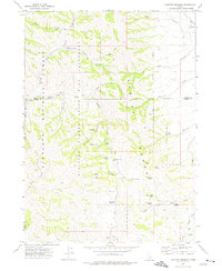
 1973 Arbon1977 Print · USGSArbon Valley in the early 1970s remains a landscape of quiet homesteads and high-country springs along the Power and Oneida County line. Researchers can locate the Arbon PO, trace family names at the Arbon Cem, and follow the path of Bannock Creek.
Showing maps 1-25 of 31
Top cities of Power County
Frequently asked questions
- What are the different types of historical maps available for Power County?
- What is the oldest map of Power County?
- Where can I purchase historical maps of Power County for my home or office?
- Where can I download high-res historical maps of Power County?
- Are there historical topographic maps available for Power County?
- Is there historical aerial imagery available for Power County?
- Where are historical maps of Power County sourced from?