Old Maps of Hancock County, Illinois for Metal Detecting
Plan your next treasure hunt with 181 historic maps of Hancock County. Find old homesites, ghost towns, trails, and gathering spots that may be lost to time — perfect for identifying promising metal detecting locations.
- Locate forgotten sites: Uncover places like long-lost settlements, abandoned rail lines, or gathering spots.
- Plan better hunts: Use map overlays combined with LiDAR or satellite views to narrow in on historically rich areas.
- Made for detectorists: Thousands of hobbyists use these maps to discover relics, coins, and hidden history.
Use these historic maps to boost your research and find new opportunities beneath the surface of Hancock County.
Hancock County, IL maps
(181)- 1903 Map of Kahoka
 1903 Kahoka1903 Print · USGSNortheast Missouri at the turn of the century shows a landscape defined by the convergence of major rivers and competing rail lines. Genealogists can trace family roots in early centers like Kahoka and Monticello, or locate riverfront crossings at St. Francisville and Canton.3 unique versions available
 - 1913 Map of Colchester
 1913 Colchester1913 Print · USGSWestern Illinois at the start of the twentieth century was a landscape of dense rural school districts and prairie rail towns. Trace the early footprints of Colchester and Tennessee, or locate forgotten sites like Vishnu Sprs and the Clay Mine.3 unique versions available
 - 1918 Map of La Harpe
 1918 La Harpe1918 Print · USGSWestern Illinois farm life in the late teens is captured here through a remarkably dense grid of rural schools and rail-fed townships. Genealogists can trace family footprints across dozens of local districts like Sunny Ridge School and Waggy School or along the Santa Fe line.4 unique versions available
 - 1932 Map of Lomax, 1957 Print
 1932 Lomax1957 Print · USGSWestern Illinois river towns and railroad junctions thrive during the early 1930s as the river remains a central artery for commerce and life. Genealogists can trace family footprints across dozens of rural landmarks, including Dallas City, Gittings Mound, and the uniquely named Froggie Sch.
 - 1933 Map of Carthage, 1965 Print
 1933 Carthage1965 Print · USGSHancock County was a thriving network of rail-side towns and rural schools in the early 1930s. Researchers can trace family ties at the County Farm or locate vanished landmarks like Young America School and Middle Creek Church.
 - 1936 Map of Keokuk
 1936 Keokuk1936 Print · USGSHancock County and the Mississippi River transition into a new era of hydroelectric power and rail transit in the 1930s. Genealogists can locate dozens of country schools and churches, from Froggy Sch and Sylvanvale Sch to Sanobia Ch.3 unique versions available
 - 1936 Map of Fort Madison
 1936 Fort Madison1936 Print · USGSThe Illinois shore of the Mississippi River is captured here in the mid-1930s, featuring the historic street grid of Nauvoo. Genealogists and local historians can trace a dense network of rural landmarks, including Jackson Cem and numerous country schoolhouses like Maple Grove Sch and Elliott Sch.3 unique versions available
 - 1937 Map of Carthage
 1937 Carthage1937 Print · USGSHancock County in the 1930s was a landscape defined by its rail-connected villages and a dense network of country schools. Genealogists can trace family footprints across dozens of local landmarks like Moss Ridge Cem, Young America Sch, and the County Farm.2 unique versions available
 - 1937 Map of Lomax
 1937 Lomax1937 Print · USGSThe riverfront and rail corridors of Henderson and Hancock Counties come alive in the late 1930s, documenting a time of active country schools and river commerce. Genealogists can locate family landmarks like Gittings Cem, Enterprise Ch, and distinctively named sites like Shake Rag Sch.2 unique versions available
 - 1946 Map of Augusta, 1957 Print
 1946 Augusta1957 Print · USGSWestern Illinois farm country at the end of the 1940s is detailed here as the rail-and-river economy transitions. Genealogists can trace family names at Sherwood Cem and Woodland Cem, or locate rural landmarks like Mt Horeb Ch and Timewell PO.2 unique versions available
 - 1946 Map of Mendon, 1958 Print
 1946 Mendon1958 Print · USGSThe fertile bottomlands of Adams County are seen here in the mid-1940s, as massive drainage projects reshaped the Mississippi River's eastern bank. Genealogists can locate family names and sites through numerous rural landmarks like Wesley Chapel Cem, Gentry Sch, and the Canton Ferry.
 - 1948 Map of Mendon
 1948 Mendon1948 Print · USGSUpper Adams County in the late 1940s reveals a landscape defined by Mississippi River engineering and tight-knit rural communities. Researchers can trace ancestral locations at New Providence Cem, several dozen one-room schoolhouses like Golden Sch, and the winding Bear Creek drainage.2 unique versions available
 - 1948 Map of Camp Point
 1948 Camp Point1948 Print · USGSWestern Illinois farm country thrives in the late 1940s, marked by a dense grid of township roads and early rail connections. Genealogists can locate dozens of country schools and burial grounds, from Lone Star Sch to the Friedhof Cem and Bowen Cem.2 unique versions available
 - 1949 Map of Augusta
 1949 Augusta1949 Print · USGSWestern Illinois at the end of the 1940s reveals a landscape of tight-knit rural communities and school districts. Genealogists can trace family footprints across dozens of local landmarks like Sulphur Springs Sch, Woodland Cem, and Mound Station Timewell PO.
 - 1950 Map of Keokuk, 1954 Print
 1950 Keokuk1954 Print · USGSThe Mississippi River borderlands of Iowa and Illinois come alive in the mid-century as the Keokuk Dam reshapes the valley. Genealogists can trace a remarkable concentration of local landmarks, from Moss Cem to numerous rural schoolhouses like Rocky Run Sch and Eureka Sch.
 - 1950 Map of Canton, 1967 Print
 1950 Canton1967 Print · USGSMissouri river life at mid-century centered on the busy transit hub of Canton and its surrounding rural school districts. Genealogists and historians can trace local landmarks like Culver-Stockton College, the Canton Ferry, and numerous country schools from Hardin Sch to Melrose Sch.3 unique versions available
 - 1951 Map of Canton
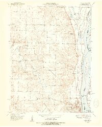 1951 Canton1951 Print · USGSThe Missouri-Illinois river border comes alive in the early fifties, showing the riverside economy of Canton and its connection to Meyer. Genealogists and historians can trace numerous country schools like Hazel Grove Sch and churches such as Shiloh Ch.2 unique versions available
 - 1958 Map of Burlington, 1968 Print
 1958 Burlington1968 Print · USGSThe tri-state river country of Iowa, Illinois, and Missouri is captured here in the mid-fifties, dominated by the Mississippi River and major rail lines. Genealogists and historians can trace the development of river towns like Keokuk or locate the sprawling Iowa Army Ammunition Plant.4 unique versions available
 - 1961 Map of Burlington
 1961 Burlington1961 Print · USGSThe tri-state borderlands along the Mississippi River are captured here during the late fifties and early sixties, showing the vital river-and-rail economy of Iowa, Illinois, and Missouri. Genealogists and historians can trace the development of major hubs like Galesburg and Macomb alongside landmark sites such as the Iowa Ordnance Plant and the historic river town of Nauvoo.
 - 1963 Map of Burlington
 1963 Burlington1963 Print · USGSThe tri-state river country of the Mississippi and Illinois valleys comes alive in this mid-century survey. Genealogists and historians can trace the industrial and academic growth of the region, from the Iowa Ordnance Plant to campuses like Knox College and Western Illinois University.
 - 1964 Map of Nauvoo, 1965 Print
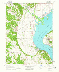 1964 Nauvoo1965 Print · USGSThe Mississippi River valley comes alive in the mid-sixties, showing the rail-linked communities of Nauvoo, Illinois, and Montrose, Iowa. Researchers can trace the Indian Treaty Boundary and locate local landmarks like Dundey Cemetery and Inspiration Point.2 unique versions available
 - 1964 Map of Hamilton, 1965 Print
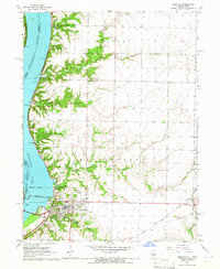 1964 Hamilton1965 Print · USGSHancock County sits at a mid-century crossroads where the river and rail economies meet. Researchers can trace the industrial footprint of the Keokuk Dam or find family landmarks like Oakwood Cem and the Golden Point Ch.2 unique versions available
 - 1964 Map of Lomax, 1965 Print
 1964 Lomax1965 Print · USGSThe Mississippi River floodplain and rail junctions of Henderson County are captured here in the mid-1960s. Genealogists can trace family sites at Gittings Cem and Freeland Cem or follow the heavy rail traffic through Lomax and Iowa Junction.
 - 1964 Map of Colusa, 1965 Print
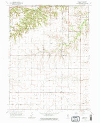 1964 Colusa1965 Print · USGSHancock County agriculture and rail life are captured here in the mid-1960s, showing the corridor of the Chicago Burlington and Quincy railroad. Genealogists can trace local roots through burial grounds like Harris Cem and the small settlements of Colusa and Adrian.2 unique versions available
 - 1964 Map of Burnside, 1965 Print
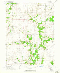 1964 Burnside1965 Print · USGSHancock County agricultural life in the mid-sixties is centered around the rail corridor of the Toledo Peoria and Western. Researchers can trace old township boundaries and family roots at Durham Cem or the small settlement of Disco.2 unique versions available
Showing maps 1-25 of 181
Top cities of Hancock County
- Hamilton historical maps
- Carthage historical maps
- Warsaw historical maps
- La Harpe historical maps
- Nauvoo historical maps
- Chili historical maps
See more
Frequently asked questions
- What are the different types of historical maps available for Hancock County?
- What is the oldest map of Hancock County?
- Where can I purchase historical maps of Hancock County for my home or office?
- Where can I download high-res historical maps of Hancock County?
- Are there historical topographic maps available for Hancock County?
- Is there historical aerial imagery available for Hancock County?
- Where are historical maps of Hancock County sourced from?