1970s Maps of Lee County, Illinois
Explore 7 historic maps of Lee County from the 1970s. These maps offer a rare glimpse into what life looked like during the 1970s — showing old roads, neighborhoods, homes, and landmarks that have changed or disappeared over time.
Whether you're researching your family's past, planning a metal detecting trip, or studying how Lee County's landscape evolved across the 1970s, these high-resolution maps are a powerful tool for exploring the history of this region.
- Focus on a specific era: All maps on this page are from the 1970s, giving you a focused view of this time period.
- See what’s changed: Compare century-old streets, trails, and buildings to today's modern landscape using overlays and satellite layers.
- Research with precision: Use these maps for genealogy, historical research, land use analysis, or educational projects.
- View, download, or print: Maps are fully viewable online in high resolution, and can be downloaded or printed for your own records.
Start exploring Lee County's history through authentic maps from the 1970s. This is your window into the past.
Lee County, IL maps
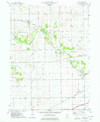
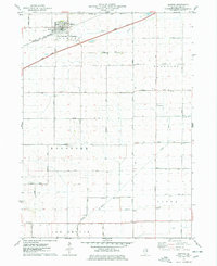
(7)- 1971 Map of Lee, 1973 Print
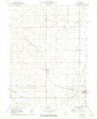 1971 Lee1973 Print · USGSNorthern Illinois farm country in the early seventies is documented here as the Burlington Northern railroad connected rural hubs. Genealogists can locate family sites at Union Cem, Calvary Ch, or follow the Old Railroad Grade.
 - 1971 Map of Paw Paw, 1973 Print
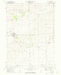 1971 Paw Paw1973 Print · USGSNorthern Illinois farm country near the intersection of Lee, DeKalb, and La Salle Counties is shown here in the early 1970s. Trace family history at the Wyoming Cemetery, locate the Rogers Brothers Landing Strip, and follow the Chicago Burlington and Northern Railroad through Rollo and Radley.
 - 1971 Map of Creston, 1973 Print
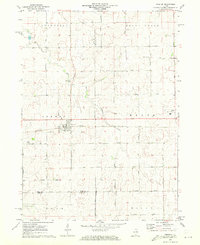 1971 Creston1973 Print · USGSCreston and its neighboring townships are captured in the early seventies during a period of established agricultural growth and institutional expansion. Trace local family history and property lines near Woodlawn Cem, Kishwaukee College, or along the Chicago and North Western rail line.2 unique versions available
 - 1975 Map of Rochelle, 1978 Print
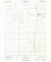
 1975 Rochelle1978 Print · USGSRochelle thrived as a vital Illinois rail hub during the mid-seventies, situated where two major western railroads met. Genealogists and local historians can trace the town's growth through its neighborhood schools like May Sch, the Lawnridge Cem, and the early layout of the Rochelle Municipal Airport.
 - 1975 Map of Steward, 1978 Print
 1975 Steward1978 Print · USGSSteward and the surrounding Illinois prairie are shown in the mid-1970s at the height of its rail-and-air utility. Researchers can trace family-named roads and rural infrastructure like Twelvemile Corner, Scarboro, and the Bresson Airport.
 - 1975 Map of Chana, 1978 Print
 1975 Chana1978 Print · USGSOgle County's rural landscape is captured here in the mid-1970s, showcasing the intersection of the Kite River and several major rail lines. Researchers can trace historic cemeteries like Chapel Hill Cem and local landmarks such as Ashton Ch or the settlement of Chana.
 - 1975 Map of Ashton, 1978 Print
 1975 Ashton1978 Print · USGSIn the mid-1970s, the village of Ashton and its surrounding townships anchored a productive Lee County landscape. Researchers can trace family roots and old land boundaries near the Reynolds Church, Reynolds Cemetery, and the Sword Landing Strip.
End of results
Showing maps 1-7 of 7
Frequently asked questions
- What are the different types of historical maps available for Lee County?
- What is the oldest map of Lee County?
- Where can I purchase historical maps of Lee County for my home or office?
- Where can I download high-res historical maps of Lee County?
- Are there historical topographic maps available for Lee County?
- Is there historical aerial imagery available for Lee County?
- Where are historical maps of Lee County sourced from?