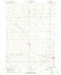
1971 Map of Lee
USGS Topo · Published 1973About this map
Lee straddles the boundary between Lee and De Kalb Counties in this early 1970s survey, a period when the agricultural character of north-central Illinois remained firmly defined by its rail connections and township boundaries. The village sits at the heart of a landscape divided into Alto, Milan, Willow Creek, and Shabbona townships. Significant local history is preserved in the placement of numerous cemeteries such as Southwest Cem and English Cem, often found at the periphery of settlement clusters or near the scattered Gravel Pits.
Find a feature on this map
36 named features on this map. Tap any name to fly to it.
Don’t see what you’re looking for? This feature index may not catch every label — zoom into the map to look around manually.
Map Details
Editions of this 1971 Lee Map
This is the sole edition of this map. No revisions or reprints were ever made.
Other maps of this area

1934 · De Kalb
USGS Topo · 1:62,500

1937 · De Kalb
USGS Topo · 1:62,500

1951 · Earlville
USGS Topo · 1:62,500

1952 · Rochelle
USGS Topo · 1:62,500

1952 · Mendota
USGS Topo · 1:62,500

1958 · Aurora
USGS Topo · 1:250,000

1961 · Aurora
USGS Topo · 1:250,000
1971 · Paw Paw
USGS Topo · 1:24,000
1971 · Waterman
USGS Topo · 1:24,000
1971 · Creston
USGS Topo · 1:24,000