Old Maps of Lee County, Illinois for Metal Detecting
Plan your next treasure hunt with 175 historic maps of Lee County. Find old homesites, ghost towns, trails, and gathering spots that may be lost to time — perfect for identifying promising metal detecting locations.
- Locate forgotten sites: Uncover places like long-lost settlements, abandoned rail lines, or gathering spots.
- Plan better hunts: Use map overlays combined with LiDAR or satellite views to narrow in on historically rich areas.
- Made for detectorists: Thousands of hobbyists use these maps to discover relics, coins, and hidden history.
Use these historic maps to boost your research and find new opportunities beneath the surface of Lee County.
Lee County, IL maps
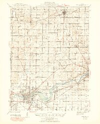
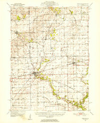
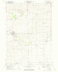
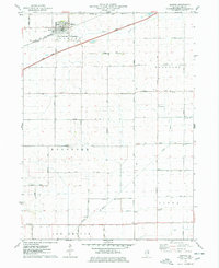
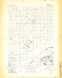
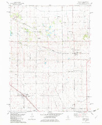
(175)- 1918 Map of Dixon
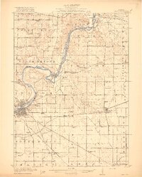 1918 Dixon1918 Print · USGSLee and Ogle Counties are captured at a pivotal moment during the First World War when the rural schoolhouse system was at its peak. Genealogists can trace family footprints across townships to landmarks like Grand Detour, Pennsylvania Corners, and the White Temple School.3 unique versions available
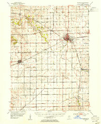
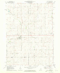
 - 1930 Map of Woodsung
 1930 Woodsung1930 Print · USGSNorthern Illinois at the dawn of the 1930s shows a landscape of tight-knit farming townships linked by the Lincoln Highway. Genealogists and local historians can trace schoolhouse locations like Stone Sch and Gap Grove Sch, or locate family sites near the Prairieville Cem.
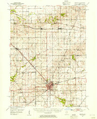
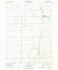
 - 1934 Map of De Kalb, 1965 Print
 1934 De Kalb1965 Print · USGSDeKalb and its surrounding townships thrive as a major rail and highway hub during the mid-1930s. Researchers can trace dozens of country schoolhouses like Toad Hollow Sch and find family plots at Woodlawn Cem or Fairview Cem.
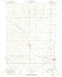
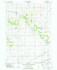
 - 1937 Map of De Kalb
 1937 De Kalb1937 Print · USGSMid-1930s De Kalb County is captured here as a thriving rail and agricultural hub during the peak of the Lincoln Highway era. Genealogists can trace family footprints across dozens of local school sites like Toad Hollow Sch and old cemeteries including Woodlawn Cem and Calvary Cem.2 unique versions available
 - 1946 Map of Sterling, 1969 Print
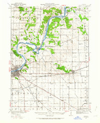
 1946 Sterling1969 Print · USGSThe Rock River corridor in the mid-1940s is captured here, showing the industrial heart of the region alongside its deep agricultural roots. Researchers can find dozens of country schools and cemeteries, including Buffalo Grove Sch, Zion Cem, and Oak Knoll Mem Park Cem.
 - 1948 Map of Sterling
 1948 Sterling1948 Print · USGSMid-century Sterling and Rock Falls are captured here during a time of robust rail and river activity. Genealogists can trace family roots through dozens of rural landmarks, including the Prairieville settlement, West Science Ridge Ch, and Hitt Cem.2 unique versions available
 - 1949 Map of Walnut
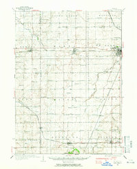
 1949 Walnut1949 Print · USGSThe rural landscapes of Bureau and Lee counties are captured in the late 1940s, a time when one-room schools and small rail towns anchored the prairie. Genealogists can trace family landmarks like Bowen Cem, Sturtz Sch, and the community of New Bedford along the Green River.3 unique versions available
 - 1950 Map of Dixon, 1964 Print
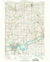
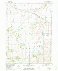
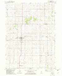
 1950 Dixon1964 Print · USGSThe Rock River valley in the mid-twentieth century shows a landscape of busy river towns and dense rural school districts. Genealogists can locate family-named landmarks like Tealls Corners School, Emmert School, and the White Temple church.2 unique versions available
 - 1951 Map of Amboy, 1952 Print
 1951 Amboy1952 Print · USGSNorthern Illinois during the early fifties reveals a landscape shaped by military industry and rail transport. Genealogists can locate family landmarks like Woodside Cem, Perkins Grove Ch, and the sprawling Green River Ordnance Plant.3 unique versions available
 - 1951 Map of Earlville, 1952 Print
 1951 Earlville1952 Print · USGSThe rural crossroads of north-central Illinois come to life in this early fifties survey of the area surrounding Earlville and Leland. Genealogists can trace family ties at the Baker Cem or St Clara Cem and locate vanished schoolhouses like Austin Sch.2 unique versions available
 - 1952 Map of Rochelle, 1954 Print
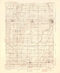
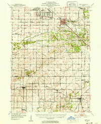
 1952 Rochelle1954 Print · USGSOgle and Lee Counties in the early fifties reveal a landscape of thriving rural schools and critical rail junctions centered on Rochelle. Genealogists can trace local roots through numerous landmarks including Reynolds Ch, Twin Grove Cem, and Willow Center Sch.3 unique versions available
 - 1952 Map of Mendota, 1954 Print
 1952 Mendota1954 Print · USGSMendota was a bustling railroad crossroads in the 1950s at the junction of three major lines. Genealogists can trace family roots through numerous country burial grounds and schoolhouses like Holy Cross Cem, Restland Cem, and Schlesinger Sch.3 unique versions available
 - 1958 Map of Aurora, 1969 Print
 1958 Aurora1969 Print · USGSNorthern Illinois in the late fifties shows a landscape of powerful river industry and expanding transport corridors. Genealogists and historians can trace the development of Aurora and Joliet or locate sites like the Elwood Ordnance Plant and Starved Rock.3 unique versions available
 - 1961 Map of Aurora
 1961 Aurora1961 Print · USGSNorthern Illinois at the height of the post-war era reveals a landscape of massive industrial works and thriving river towns. Genealogists and historians can trace the paths of the Lincoln Highway or locate long-standing landmarks like the Green River Ordnance Plant and Starved Rock State Park.
 - 1971 Map of Lee, 1973 Print
 1971 Lee1973 Print · USGSNorthern Illinois farm country in the early seventies is documented here as the Burlington Northern railroad connected rural hubs. Genealogists can locate family sites at Union Cem, Calvary Ch, or follow the Old Railroad Grade.
 - 1971 Map of Paw Paw, 1973 Print
 1971 Paw Paw1973 Print · USGSNorthern Illinois farm country near the intersection of Lee, DeKalb, and La Salle Counties is shown here in the early 1970s. Trace family history at the Wyoming Cemetery, locate the Rogers Brothers Landing Strip, and follow the Chicago Burlington and Northern Railroad through Rollo and Radley.
 - 1971 Map of Creston, 1973 Print
 1971 Creston1973 Print · USGSCreston and its neighboring townships are captured in the early seventies during a period of established agricultural growth and institutional expansion. Trace local family history and property lines near Woodlawn Cem, Kishwaukee College, or along the Chicago and North Western rail line.2 unique versions available
 - 1975 Map of Rochelle, 1978 Print
 1975 Rochelle1978 Print · USGSRochelle thrived as a vital Illinois rail hub during the mid-seventies, situated where two major western railroads met. Genealogists and local historians can trace the town's growth through its neighborhood schools like May Sch, the Lawnridge Cem, and the early layout of the Rochelle Municipal Airport.
 - 1975 Map of Steward, 1978 Print
 1975 Steward1978 Print · USGSSteward and the surrounding Illinois prairie are shown in the mid-1970s at the height of its rail-and-air utility. Researchers can trace family-named roads and rural infrastructure like Twelvemile Corner, Scarboro, and the Bresson Airport.
 - 1975 Map of Chana, 1978 Print
 1975 Chana1978 Print · USGSOgle County's rural landscape is captured here in the mid-1970s, showcasing the intersection of the Kite River and several major rail lines. Researchers can trace historic cemeteries like Chapel Hill Cem and local landmarks such as Ashton Ch or the settlement of Chana.
 - 1975 Map of Ashton, 1978 Print
 1975 Ashton1978 Print · USGSIn the mid-1970s, the village of Ashton and its surrounding townships anchored a productive Lee County landscape. Researchers can trace family roots and old land boundaries near the Reynolds Church, Reynolds Cemetery, and the Sword Landing Strip.
 - 1982 Map of Harmon
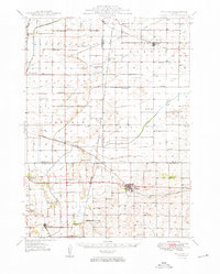
 1982 Harmon1982 Print · USGSHarmon and Hamilton townships are shown in the early 1980s at a critical rail intersection in rural Lee County. Genealogists and local historians can trace early community life through landmarks like Holy Cross Ch, Centenary Cem, and the rail stop at Van Petten.3 unique versions available
 - 1982 Map of New Bedford
 1982 New Bedford1982 Print · USGSThe Illinois prairie of the early 1980s is captured here, showing the rural intersection of Bureau and Whiteside counties. Genealogists can locate family sites near Fairfield Greenville Cem, while the Indian Treaty Boundary offers a glimpse into early land division.
 - 1982 Map of Ohio
 1982 Ohio1982 Print · USGSThe Illinois prairie near the Bureau and Lee County line is captured in the early eighties as a landscape of grid-roads and rail. Genealogists and local historians can trace the Old Indian Treaty Boundary and find family sites at St Marys Cem or North Prairie Cem.
 - 1982 Map of Sublette
 1982 Sublette1982 Print · USGSNorthern Illinois prairie land is captured here in the early eighties, showcasing the intersection of rail and rural life. Genealogists can locate family-named routes and landmarks like Montavon Road or St Marys Cem near Sublette.
Showing maps 1-25 of 175
Frequently asked questions
- What are the different types of historical maps available for Lee County?
- What is the oldest map of Lee County?
- Where can I purchase historical maps of Lee County for my home or office?
- Where can I download high-res historical maps of Lee County?
- Are there historical topographic maps available for Lee County?
- Is there historical aerial imagery available for Lee County?
- Where are historical maps of Lee County sourced from?