Old Maps of Pope County, Illinois for Academic Research
Study the evolution of Pope County with 115 high-resolution historic maps. Whether you're teaching, researching, or modeling changes in land use, these maps provide essential visual documentation of urban, environmental, and geographic change.
- Analyze long-term change: Track patterns in development, transportation, and natural features.
- Ideal for environmental or urban studies: Support academic projects with primary historical map data.
- Use in the classroom or lab: Educators and researchers rely on these maps to bring historical context to life.
These maps are a powerful tool for teaching, research, and visualizing how Pope County has changed over the decades.
Pope County, IL maps
(115)- 1916 Map of Golconda
 1916 Golconda1916 Print · USGSSouthern Illinois river life is frozen in time during this mid-1910s survey of the Ohio River frontier. Researchers can trace the early development of Golconda and Elizabethtown, or locate rural landmarks like Miller Cem and Cavins Store.
 - 1916 Map of Equality
 1916 Equality1916 Print · USGSSouthern Illinois before the First World War shows a landscape defined by the Saline River and industrial outposts. Genealogists and historians can trace family locations near Loves Store, explore the site of the Illinois Furnace, or locate vanished schoolhouses like Pisgah School.4 unique versions available
 - 1917 Map of Brownfield
 1917 Brownfield1917 Print · USGSSouthern Illinois in the years before the Great War is captured here through its dense network of rural schoolhouses and rail sidings. Researchers can locate family landmarks like Lackey Bridge, Allard College School, and Dixon Springs Sta (Renshaw P.O.).4 unique versions available
 - 1920 Map of Goloonda
 1920 Goloonda1920 Print · USGSThe Ohio River bottomlands of Livingston County are captured here just after the Great War, when river ferries and rural schoolhouses still anchored local life. Genealogists and researchers can trace family lands near Berry Ferry, Mt Pisgah Church, or the many district schools like Trimble School.
 - 1921 Map of Golconda
 1921 Golconda1921 Print · USGSThe Ohio River valley at the start of the 1920s reveals a bustling corridor of small river towns and rural school districts spanning Illinois and Kentucky. Genealogists and historians can trace family roots through dozens of local landmarks like Berrys Ferry, Cammens Store, and the Bethel Church.3 unique versions available
 - 1925 Map of Harrisburg
 1925 Harrisburg1925 Print · USGSSouthern Illinois coal country is in its prime during the 1920s, showing a landscape of rail-connected mining towns and remote hill settlements. Genealogists can locate dozens of country schools and churches like Mayhew School and Salem Church, alongside industrial landmarks like Wasson Mine No 2.3 unique versions available
 - 1926 Map of Paducah, 1967 Print
 1926 Paducah1967 Print · USGSThe riverfront cities of Paducah and Metropolis are shown at the height of the steam-and-rail era before the major mid-century dam projects. Genealogists can trace family names through dozens of rural landmarks like Weyer Cemetery, Hamilton Chapel, and the Little Union Sch.
 - 1929 Map of Smithland
 1929 Smithland1929 Print · USGSThe convergence of the Ohio, Tennessee, and Cumberland Rivers defines this late 1920s survey of the Kentucky-Illinois border. Genealogists and researchers can trace riverside life through Haddox Ferry, Smithland, and vanished schoolhouses like Yellowbird Sch.3 unique versions available
 - 1929 Map of Paducah
 1929 Paducah1929 Print · USGSThe confluence of the Ohio and Tennessee Rivers comes alive in the late twenties as a bustling hub of river and rail transport. Genealogists and historians can trace family roots through numerous local landmarks like West Paducah PO, Veyer Cemetery, and the County Sanitarium.4 unique versions available
 - 1936 Map of Smithland
 1936 Smithland1936 Print · USGSThe confluence of the Ohio and Tennessee Rivers is captured here in the mid-1930s, documenting a landscape of river-dependent towns and rural school districts. Genealogists can locate family sites like Sleeper Cemetery or Thompson Chapel and trace the original path of the Illinois Central Railroad.
 - 1936 Map of Little Cypress
 1936 Little Cypress1936 Print · USGSThe Ohio and Tennessee Rivers meet amidst a network of rural settlements in the mid-1930s. Researchers can trace family sites like Little Cypress or locate Kincaid Mounds and early churches like Chestnut Hill Ch.
 - 1939 Map of Harrisburg, 1959 Print
 1939 Harrisburg1959 Print · USGSSouthern Illinois at the end of the Depression era reveals a landscape of growing coal towns and dozens of rural school districts. Genealogists can trace family connections at Ward Cem, Stonefort, and rural outposts like McCormick and Allenby.
 - 1940 Map of Paducah, 1958 Print
 1940 Paducah1958 Print · USGSAcross the river from Illinois at the start of the 1940s, this area captures Paducah and Metropolis at a peak of rail and river activity. Researchers can trace the Illinois Central RR lines, locate family markers at Veyer Cemetery, and find rural landmarks like Klondike Sch and Palestine Ch.
 - 1942 Map of Smithland, 1957 Print
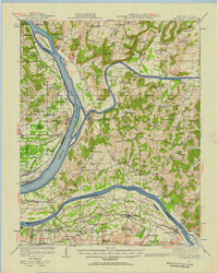 1942 Smithland1957 Print · USGSWestern Kentucky's river-driven economy is on full display during the early 1940s as the Ohio, Cumberland, and Tennessee rivers converge. Researchers can trace historic river crossings like Haddox Ferry and find family landmarks at Kincaid Mounds or the Klondike Mine.
 - 1949 Map of Paducah
 1949 Paducah1949 Print · USGSThe confluence of the Ohio, Mississippi, Tennessee, and Cumberland rivers at the close of the 1940s reveals a region bound by water and rail. Researchers can trace historic river landings, timberlands in the Shawnee National Forest, and the coal-mining infrastructure around West Frankfort and Herrin.2 unique versions available
 - 1950 Map of Paducah
 1950 Paducah1950 Print · USGSThe confluence of the great midwestern rivers defines this mid-century landscape at the intersection of Illinois, Kentucky, and Missouri. Genealogists and historians can trace the rail-and-river economy through the hubs of Paducah, Cairo, and Metropolis or locate family roots near the Wildcat Hills.
 - 1954 Map of Paducah
 1954 Paducah1954 Print · USGSSouthern Illinois and Western Kentucky intersect at the great river confluences during this mid-century era of rail and river industry. Genealogists and historians can trace family roots and commerce through river towns like Cairo, Metropolis, and Golconda, or along the tracks of the Illinois Central Railroad.2 unique versions available
 - 1954 Map of Golconda, 1955 Print
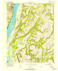 1954 Golconda1955 Print · USGSThe riverfront of the early fifties is preserved here, showing the navigational hub at Golconda and the massive Pryor Island. Genealogists can trace rural life through landmarks like Wagman Chapel, Joy Sch, and the isolated Duley Bluff Cem.3 unique versions available
 - 1954 Map of Shetlerville, 1955 Print
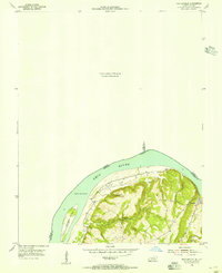 1954 Shetlerville1955 Print · USGSLivingston County, Kentucky, and Pope County, Illinois, meet at a sweeping bend in the river during the mid-fifties. Genealogists and local historians can trace the paths around Carrsville or locate Loves Cem and the winding Givens Foot Trail.
 - 1954 Map of Smithland, 1955 Print
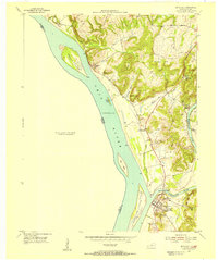 1954 Smithland1955 Print · USGSThe river confluence at Smithland in the mid-1950s remains a landscape rich in Civil War history and family heritage. Researchers can trace the Historical Hospital (Civil War), find the Silver Mine, and locate ancestral burials at Cowper Cem.
 - 1954 Map of Little Cypress, 1956 Print
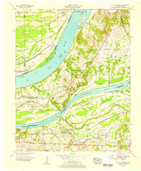 1954 Little Cypress1956 Print · USGSThe confluence of the great rivers in Western Kentucky and Southern Illinois is captured here in the mid-1950s. Trace family roots and local industry at Kincaid Mounds, the community of Possum Trot, and along the tracks of the ILLINOIS CENTRAL.
 - 1958 Map of Little Cypress, 1959 Print
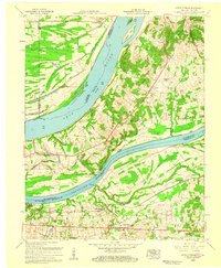 1958 Little Cypress1959 Print · USGSLivingston and Marshall Counties meet at the river forks in the late fifties, showing a landscape shaped by the Ohio River and Tennessee River. You can trace family roots at Vaughn Chapel or Oak Grove Cem and locate the rail lines through Little Cypress.2 unique versions available
 - 1959 Map of Herod, 1960 Print
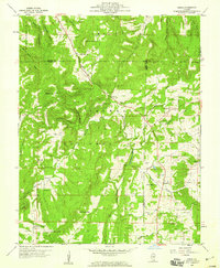 1959 Herod1960 Print · USGSSouthern Illinois in the late fifties is captured here at the intersection of industry and the Shawnee National Forest. Researchers can trace old family names at Wallace Cem, locate forgotten sites like Empire Mine, or find rural landmarks such as One Horse Gap.3 unique versions available
 - 1959 Map of Equality, 1960 Print
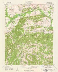 1959 Equality1960 Print · USGSSouthern Illinois during the late fifties reveals a landscape of transition between the industrial river valleys and the wooded heights of the Shawnee National Forest. Researchers can locate deep-rooted community sites like Equality, the Salt Wells, and remote locations such as One Horse Gap.2 unique versions available
 - 1959 Map of Shetlerville, 1960 Print
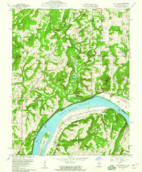 1959 Shetlerville1960 Print · USGSThe riverfront and timberlands of the Ohio Valley are captured here in the late fifties, showing the interplay of the Ohio River and the Shawnee National Forest. Researchers can locate old family burial sites like Twitchell Cem and trace the legacy of mining at the Baker Mine and Parkinson Mine.3 unique versions available
Showing maps 1-25 of 115
Top cities of Pope County
Frequently asked questions
- What are the different types of historical maps available for Pope County?
- What is the oldest map of Pope County?
- Where can I purchase historical maps of Pope County for my home or office?
- Where can I download high-res historical maps of Pope County?
- Are there historical topographic maps available for Pope County?
- Is there historical aerial imagery available for Pope County?
- Where are historical maps of Pope County sourced from?