1940s Maps of Tazewell County, Illinois
Explore 4 historic maps of Tazewell County from the 1940s. These maps offer a rare glimpse into what life looked like during the 1940s — showing old roads, neighborhoods, homes, and landmarks that have changed or disappeared over time.
Whether you're researching your family's past, planning a metal detecting trip, or studying how Tazewell County's landscape evolved across the 1940s, these high-resolution maps are a powerful tool for exploring the history of this region.
- Focus on a specific era: All maps on this page are from the 1940s, giving you a focused view of this time period.
- See what’s changed: Compare century-old streets, trails, and buildings to today's modern landscape using overlays and satellite layers.
- Research with precision: Use these maps for genealogy, historical research, land use analysis, or educational projects.
- View, download, or print: Maps are fully viewable online in high resolution, and can be downloaded or printed for your own records.
Start exploring Tazewell County's history through authentic maps from the 1940s. This is your window into the past.
Tazewell County, IL maps
(4)- 1942 Map of Delavan
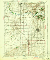 1942 Delavan1942 Print · USGSTazewell County's fertile plains are captured in the early 1940s, showing a landscape defined by busy rail junctions and a dense grid of country schoolhouses. Researchers can trace family roots through landmarks like St Lukes Ch, South Pekin, and rural schools such as Oak Hill Sch.3 unique versions available
 - 1948 Map of Glasford, 1965 Print
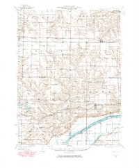 1948 Glasford1965 Print · USGSThe Illinois River valley near Glasford is captured here during the post-war era, showing a landscape defined by river commerce and coal extraction. Genealogists can locate dozens of country schools and churches, such as Graham Chapel, Blue Sch, and the Lightbody Mine.
 - 1949 Map of Peoria East, 1966 Print
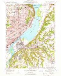 1949 Peoria East1966 Print · USGSMid-century Peoria and the Illinois River shoreline show a thriving industrial and rail landscape during a period of significant growth. Genealogists and historians can locate dozens of neighborhood schools like Bradley University and Woodrow Wilson Sch, alongside the rail yards of the Illinois Terminal.5 unique versions available
 - 1949 Map of Peoria West, 1967 Print
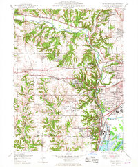 1949 Peoria West1967 Print · USGSPeoria and its western suburbs show a mix of industrial riverfront and expanding residential tracts just after the war. Local historians can trace the footprint of the Peoria Municipal Airport, the State Hospital Farm, and family-named schools like Calvin Coolidge Sch.3 unique versions available
End of results
Showing maps 1-4 of 4
Top cities of Tazewell County
- Pekin historical maps
- East Peoria historical maps
- Groveland historical maps
- Morton historical maps
- Washington historical maps
- Creve Coeur historical maps
See more
Frequently asked questions
- What are the different types of historical maps available for Tazewell County?
- What is the oldest map of Tazewell County?
- Where can I purchase historical maps of Tazewell County for my home or office?
- Where can I download high-res historical maps of Tazewell County?
- Are there historical topographic maps available for Tazewell County?
- Is there historical aerial imagery available for Tazewell County?
- Where are historical maps of Tazewell County sourced from?