Old Maps of Tazewell County, Illinois for Hiking & Exploration
Hike through history with 150 historic maps of Tazewell County. Explore old trails, ghost towns, and forgotten backroads — perfect for outdoor adventurers and local explorers.
- Rediscover forgotten places: Map out old mining camps, roads, and footpaths that no longer exist on modern maps.
- Layer with modern tools: Combine with LiDAR or satellite views to plan hikes through historical terrain.
- Made for exploration: Popular among hikers, overlanders, and local history lovers.
Use these maps to find adventure and explore the hidden past of Tazewell County.
Tazewell County, IL maps
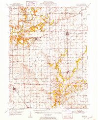
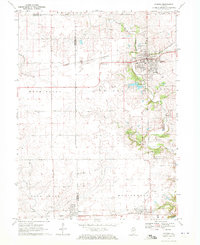
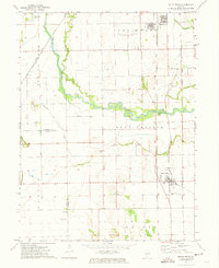
(150)- 1905 Map of Peoria
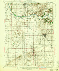
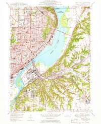
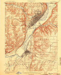 1905 Peoria1905 Print · USGSPeoria and Pekin at the turn of the century are revealed here as major industrial hubs defined by the Illinois River. Researchers can trace the early rail network and locate landmarks like Orchard Mines, the Insane Asylum, and the Poor Farm.4 unique versions available
 - 1927 Map of Peoria, 1955 Print
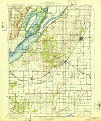
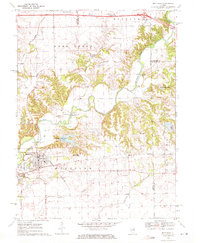
 1927 Peoria1955 Print · USGSPeoria and the Illinois River valley are shown here during the mid-1930s, capturing a critical era of rail expansion and industrial growth. Genealogists and researchers can trace local landmarks like the State Hospital, Orchard Mines, and the Poor Farm.
 - 1928 Map of Mackinaw, 1954 Print
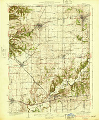
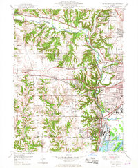
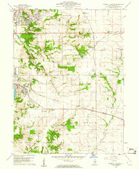
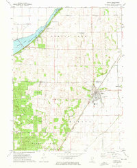
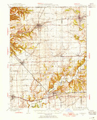 1928 Mackinaw1954 Print · USGSTazewell and Woodford Counties thrived as a major rail hub in the late twenties, balancing rich farmland with bustling rail towns. Genealogists can trace family roots through dozens of district schools like Science Hill Sch and settlements including Morton, Deer Creek, and Allentown.
 - 1929 Map of Manito, 1972 Print
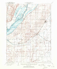 1929 Manito1972 Print · USGSMason and Fulton counties in the late 1920s reveal a landscape of deep river bottoms and newly drained prairie. Researchers can trace family history through a dense network of country schools and churches like Coon Sch and Macedonia Ch, or locate the path of the Chicago and Illinois Midland railway.
 - 1930 Map of Glasford
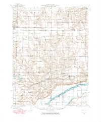
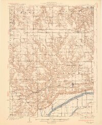 1930 Glasford1930 Print · USGSCentral Illinois river towns and upland prairie farms thrive in the late twenties between the Illinois River and Hanna City. Researchers can trace old coal operations at Baxter Mine or locate family roots at Penn Ridge Ch and Union Cemetery.3 unique versions available
 - 1932 Map of Mackinaw
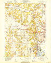
 1932 Mackinaw1932 Print · USGSTazewell and Woodford counties are captured here in the early 1930s, showing a landscape tightly organized by rail lines and rural schoolhouses. Genealogists can trace family footprints across dozens of local districts like Cottonwood Sch or visit the Mennonite Ch and the Mackinaw Sanitarium.2 unique versions available
 - 1932 Map of Manito
 1932 Manito1932 Print · USGSThe Illinois River valley in the early 1930s showcases a landscape of intricate drainage ditches and river-bottom hunting clubs near Manito. Researchers can trace rural lineages through dozens of named sites like Eureka Sch, Ebenezer Ch, and Wessling Cem.3 unique versions available
 - 1942 Map of Delavan
 1942 Delavan1942 Print · USGSTazewell County's fertile plains are captured in the early 1940s, showing a landscape defined by busy rail junctions and a dense grid of country schoolhouses. Researchers can trace family roots through landmarks like St Lukes Ch, South Pekin, and rural schools such as Oak Hill Sch.3 unique versions available
 - 1948 Map of Glasford, 1965 Print
 1948 Glasford1965 Print · USGSThe Illinois River valley near Glasford is captured here during the post-war era, showing a landscape defined by river commerce and coal extraction. Genealogists can locate dozens of country schools and churches, such as Graham Chapel, Blue Sch, and the Lightbody Mine.
 - 1949 Map of Peoria East, 1966 Print
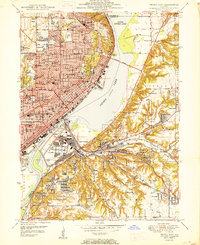
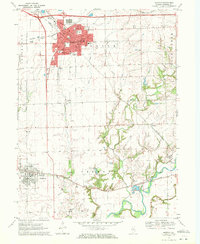
 1949 Peoria East1966 Print · USGSMid-century Peoria and the Illinois River shoreline show a thriving industrial and rail landscape during a period of significant growth. Genealogists and historians can locate dozens of neighborhood schools like Bradley University and Woodrow Wilson Sch, alongside the rail yards of the Illinois Terminal.5 unique versions available
 - 1949 Map of Peoria West, 1967 Print
 1949 Peoria West1967 Print · USGSPeoria and its western suburbs show a mix of industrial riverfront and expanding residential tracts just after the war. Local historians can trace the footprint of the Peoria Municipal Airport, the State Hospital Farm, and family-named schools like Calvin Coolidge Sch.3 unique versions available
 - 1950 Map of Peoria West
 1950 Peoria West1950 Print · USGSMid-century Peoria is a bustling rail and river hub at the height of its industrial era. Genealogists and historians can trace the foundations of local communities through landmarks like the Peoria State Hospital, Golden Acres, and the Peoria Municipal Airport.
 - 1950 Map of Peoria East
 1950 Peoria East1950 Print · USGSPeoria and the Illinois River valley are shown here just after the war, at a peak of industrial and urban density. Genealogists and local historians can trace hundreds of family and community landmarks, from Springdale Cemetery to the neighborhoods of Creve Coeur and Peoria Heights.
 - 1951 Map of Minier, 1952 Print
 1951 Minier1952 Print · USGSTazewell and Logan Counties thrive as a rail-and-river agricultural hub during the mid-twentieth century. Family historians can trace local roots through numerous country landmarks like Mennonite Cem, the settlement at Mindale, and Hittle Grove Cem.3 unique versions available
 - 1958 Map of Peoria, 1969 Print
 1958 Peoria1969 Print · USGSCentral Illinois thrived as a hub of education and transport during the late sixties, as the new interstate system began to reshape the prairie. Genealogists and historians can trace local landmarks like Springdale Cem, Bradley University, and the sprawling grounds of Chanute AFB.4 unique versions available
 - 1960 Map of Marquette Heights, 1961 Print
 1960 Marquette Heights1961 Print · USGSTazewell County undergoes a shift toward suburban expansion at the start of the sixties, even as the rural character of its townships remains largely intact. Researchers can trace family history through sites like the Brush Hill Sch, Glendale Memorial Cemetery, and the County Home.3 unique versions available
 - 1960 Map of Pekin, 1961 Print
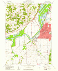 1960 Pekin1961 Print · USGSThe riverfront industry and rail networks of the Illinois valley are on full display in this mid-century survey of the Pekin area. Researchers can trace family history through sites like Lakeside Cemetery or locate vanished landmarks like the Drive-in Theater and Orchard Mines.3 unique versions available
 - 1961 Map of Peoria
 1961 Peoria1961 Print · USGSCentral Illinois thrived at the intersection of river trade and rail power during the late fifties. Genealogists and local historians can trace the rail networks of the Illinois Central and Wabash, alongside landmarks like Chanute AFB and Weldon Springs State Park.
 - 1963 Map of Peoria
 1963 Peoria1963 Print · USGSCentral Illinois thrived as a rail and highway crossroads during the early sixties, centered on the bustling Illinois River valley. Genealogists and historians can trace the mid-century layout of Peoria, locate the grounds of Chanute Air Force Base, and follow historic lines like the Toledo Peoria and Western Railway.
 - 1970 Map of Washington, 1972 Print
 1970 Washington1972 Print · USGSTazewell County's expansion is clearly visible in the early seventies as the residential edges of WASHINGTON and MORTON begin to spread across the Illinois prairie. Researchers can trace family history through numerous rural burial sites like Guth Cem and Herstein Cem or locate local landmarks like the Smitty Landing Strip.2 unique versions available
 - 1970 Map of Eureka, 1972 Print
 1970 Eureka1972 Print · USGSWoodford and Tazewell counties are shown in the early seventies as established rail and college communities. Trace local family roots through Hartman Cem and Mt Zion Cem or follow the rails of the Toledo Peoria and Western.2 unique versions available
 - 1970 Map of Mackinaw, 1972 Print
 1970 Mackinaw1972 Print · USGSTazewell County's rural heartland is documented here in the early seventies, centered on the Penn Central rail corridor and the winding Mackinaw River. Genealogists and historians can locate the Oak Knoll Sanatorium, old family burials like Stumbaugh Cem, and the small settlement of Lilly.2 unique versions available
 - 1970 Map of Morton, 1972 Print
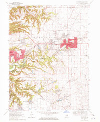
 1970 Morton1972 Print · USGSTazewell County in the early seventies shows the expansion of Morton alongside its long-standing rail networks. Local historians can trace old community landmarks from Allentown to rural burial sites like Buckeye Cem and Walnut Cem.2 unique versions available
 - 1971 Map of Manito, 1973 Print
 1971 Manito1973 Print · USGSIn the early seventies, the central Illinois prairie around Manito was a landscape of managed waterways and state timberlands. Trace family ties and local rail history through the Chicago and Illinois Midland tracks and sites like St Frederick Cem and Forest City.2 unique versions available
 - 1971 Map of South Pekin, 1973 Print
 1971 South Pekin1973 Print · USGSCentral Illinois farming and rail life are preserved here in the early seventies, centered on the villages of South Pekin and Green Valley. Genealogists and historians can trace family roots at Old Sand Prairie Cem or locate old rural landmarks like Union Ch and The Mound.2 unique versions available
Showing maps 1-25 of 150
Top cities of Tazewell County
- Pekin historical maps
- East Peoria historical maps
- Groveland historical maps
- Morton historical maps
- Washington historical maps
- Creve Coeur historical maps
See more
Frequently asked questions
- What are the different types of historical maps available for Tazewell County?
- What is the oldest map of Tazewell County?
- Where can I purchase historical maps of Tazewell County for my home or office?
- Where can I download high-res historical maps of Tazewell County?
- Are there historical topographic maps available for Tazewell County?
- Is there historical aerial imagery available for Tazewell County?
- Where are historical maps of Tazewell County sourced from?